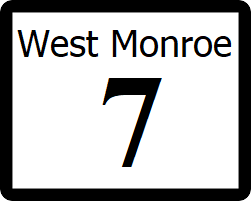
West Monroe State Highway 7: Difference between revisions
Jump to navigation
Jump to search
No edit summary |
|||
| (13 intermediate revisions by the same user not shown) | |||
| Line 1: | Line 1: | ||
[[File:WM-7.png|right|300px]] | |||
{{Infobox road | {{Infobox road | ||
|length_mi=394 | |||
|length_mi= | |||
|length_ref= | |length_ref= | ||
| | |formed=1912 | ||
|direction_a=West | |direction_a=West | ||
|terminus_a= [[File:WM-1.png|25px|link=West Monroe State Highway 1]] in [[Willmington]] | |||
|junction={{plainlist| | |||
*[[File:I-5.svg|25px|link=Interstate 25]] | |||
}} | |||
|direction_b=East | |direction_b=East | ||
| | |terminus_b=[[File:WM-50.png|25px|link=West Monroe State Highway 50]] in [[Lamar, West Monroe|Lamar]] | ||
| | |||
}} | }} | ||
'''State Highway 7''' ('''SH 7''') is a highway that runs from [[Ibican Route 2]] in [[Willmington]] to [[West Monroe State Highway 50|SH 50]] in [[Lamar, West Monroe|Lamar]] in southeast West Monroe. | '''State Highway 7''' ('''SH 7''') is a highway that runs from [[Ibican Route 2]] in [[Willmington]] to [[West Monroe State Highway 50|SH 50]] in [[Lamar, West Monroe|Lamar]] in southeast West Monroe. | ||
==Major intersections== | ==Major intersections== | ||
{ | {| class=wikitable | ||
|- | |||
| | ! style="text-align:center; vertical-align:bottom;"| '''County''' | ||
| | ! style="text-align:center; vertical-align:bottom;"| '''Location''' | ||
| | ! style="text-align:center; vertical-align:bottom;"| '''Destination''' | ||
| | |- | ||
| rowspan="10" | [[Freemont County, West Monroe|Freemont County]] | |||
| rowspan="2" | [[Westside Village, West Monroe|Westide Village]] | |||
| | | [[File:WM-1.png|25px|link=West Monroe State Highway 1]] - [[Commerce Park, West Monroe|Commerce Park]], [[Willmington]] | ||
|- | |||
| [[File:UR-64.png|25px|link=West Monroe Urban Road 64]] - [[Scottsbluff, West Monroe|Scottsbluff]], [[Willmington]] | |||
| | |- | ||
| [[Ralston, West Monroe|Ralston]] | |||
| [[File:I-10.svg|25px|link=Interstate 10]] - [[Rhone]], [[Orange, West Monroe|Orange]] | |||
| | |- | ||
| | | rowspan="7" | [[Willmington]] | ||
| [[File:US 2.svg|25px|link=Ibican Route 2]][[File:UR-1.png|25px|link=West Monroe Urban Road 1]] Independence Avenue - [[Scottsbluff, West Monroe|Scottsbluff]], [[Ferris, West Monroe|Ferris]] | |||
|- | |||
| | | [[File:I-25.svg|25px|link=Interstate 25]] - [[Toledo, West Monroe|Toledo]], [[Youngstown, West Monroe|Youngstown]] | ||
| | |- | ||
| | | [[File:WM-54.png|25px|link=West Monroe State Highway 54]] - [[Shelby, West Monroe|Shelby]] | ||
| | |- | ||
| | | [[File:I-610.svg|25px|link=Interstate 610 (West Monroe)]] - [[Carrington, West Monroe|Carrington]], [[Bishop, West Monroe|Bishop]] | ||
|- | |||
| [[File:RR-67.png|25px|link=West Monroe Rural Road 67]] - [[Collins, West Monroe|Collins]] | |||
| | |- | ||
| [[Cooper River]] | |||
|- | |||
| | | [[File:WM-111.png|25px|link=West Monroe State Highway 111]] - [[Willmington Carter International Airport]] | ||
| | |- | ||
| | | rowspan="3" | [[Shelby County, West Monroe|Shelby County]] | ||
| rowspan="3" | [[Appleton, West Monroe|Appleton]] | |||
| [[File:LP-55.png|25px|link=West Monroe State Loop 55]][[File:WMB-7A.png|25px]] to [[File:WM-105.png|25px|link=West Monroe State Highway 105]] - [[Shelby, West Monroe|Shelby]]; Begin concurrency with Loop 55. | |||
| | |- | ||
| | | [[File:WM-116.png|25px|link=West Monroe State Highway 116]][[File:WMB-105D.png|25px|link=West Monroe State Highway 105#Business Routes]] - [[Union Grove, West Monroe|Union Grove]] | ||
| | |- | ||
| [[File:LP-55.png|25px|link=West Monroe State Loop 55]][[File:WMB-7A.png|25px]] to [[File:WM-105.png|25px|link=West Monroe State Highway 105]] - [[Shelby, West Monroe|Shelby]]; End concurrency with Loop 55. | |||
|- | |||
| | | rowspan="2" | [[Panamor County, West Monroe|Panamor County]] | ||
| | | rowspan="2" | [[Bellevue, West Monroe|Bellevue]] | ||
| | | [[File:RR-31.png|25px|link=West Monroe Rural Road 31]][[File:RR-75.png|25px|link=West Monroe Rural Road 75]] - [[Howard, West Monroe|Howard]] | ||
|- | |||
| [[File:WM-106.png|25px|link=West Monroe State Highway 106]] south to [[Union Grove, West Monroe|Union Grove]], north to [[Kimberly, West Monroe|Kimberly]] | |||
| | |- | ||
| | | [[Victoria County, West Monroe|Victoria County]] | ||
| | | [[Preston, West Monroe|Preston]] | ||
| [[File:WM-24.png|25px|link=West Monroe State Highway 24]] - south to [[Langdon, West Monroe|Langdon]], [[Austin, West Monroe|Austin]]; north to [[Arlington, West Monroe|Arlington]] | |||
|- | |||
| | | rowspan="2" | [[Trinity County, West Monroe|Trinity County]] | ||
| rowspan="2" | [[Stafford, West Monroe|Stafford]] | |||
| [[File:WM-34.png|25px|link=West Monroe State Highway 34]] west to [[Arlington, West Monroe|Arlington]] | |||
| | |- | ||
| | | [[File:WM-75.png|25px|link=West Monroe State Highway 75]] south to [[Victoria, West Monroe|Victoria]]; north to [[Ashland, West Monroe|Ashland]], [[Whitehall, West Monroe|Whitehall]] | ||
| | |- | ||
| [[Anderson County, West Monroe|Anderson County]] | |||
| [[Baldwin, West Monroe|Baldwin]] | |||
| | | [[File:WM-148.png|25px|link=West Monroe State Highway 148]] south to [[Victoria, West Monroe|Victoria]]; north to [[Stanwood, West Monroe|Stanwood]] | ||
| | |- | ||
| | | [[Wood County, West Monroe|Wood County]] | ||
| [[Lamar, West Monroe|Lamar]] | |||
| [[File:WM-50.png|25px|link=West Monroe State Highway 50]] south to [[Victoria, West Monroe|Victoria]]; north to [[Proctor, West Monroe|Proctor]] | |||
|} | |||
==See also== | ==See also== | ||
* [[List of state highways in West Monroe]] | * [[List of state highways in West Monroe]] | ||
[[Category:State highways in West Mornoe| | [[Category:State highways in West Mornoe|007]] | ||
Latest revision as of 19:41, 29 November 2023
| Route information | |
|---|---|
| Length | 394 mi (634 km) |
| Existed | 1912–present |
| Major junctions | |
| West end | |
| East end | |
State Highway 7 (SH 7) is a highway that runs from Ibican Route 2 in Willmington to SH 50 in Lamar in southeast West Monroe.
Major intersections
| County | Location | Destination |
|---|---|---|
| Freemont County | Westide Village | |
| Ralston | ||
| Willmington | ||
| Cooper River | ||
| Shelby County | Appleton | |
| Panamor County | Bellevue | |
| Victoria County | Preston | |
| Trinity County | Stafford | |
| Anderson County | Baldwin | |
| Wood County | Lamar |
