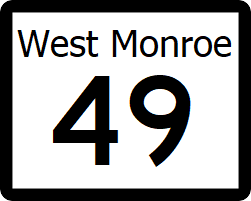
West Monroe State Highway 49: Difference between revisions
Jump to navigation
Jump to search
(Created page with "right|300px {{Infobox road |length_mi=146 |length_ref= |formed=1935 |direction_a=South |terminus_a= [[File:WM-24.png|25px|link=West Monroe State Highway 24]...") |
|||
| (One intermediate revision by the same user not shown) | |||
| Line 22: | Line 22: | ||
! style="text-align:center; vertical-align:bottom;"| '''Destination''' | ! style="text-align:center; vertical-align:bottom;"| '''Destination''' | ||
|- | |- | ||
| [[Fayette County, West Monroe|Fayette]] | | rowspan="2" | [[Wilkinson County, West Monroe|Wilkinson]] | ||
| rowspan="2" | [[Glass, West Monroe|Glass]] | |||
| [[File:WM-2.png|25px|link=West Monroe State Highway 2]][[File:WM-6.png|25px|link=West Monroe State Highway 6]] - [[Brownwood, West Monroe|Brownwood]], [[Carlton, West Monroe|Carlton]], [[Talpa, West Monroe|Talpa]] | |||
|- | |||
| [[File:WM-55.png|25px|link=West Monroe State Highway 55]] - [[Cleveland, West Monroe|Cleveland]] | |||
|- | |||
| rowspan="4" | [[Wilkinson County, West Monroe|Wilkinson]] | |||
| | |||
| [[File:RR-28.png|25px|link=West Monroe Rural Road 28]] - [[Brookesmith, West Monroe|Brookesmith]] | |||
|- | |||
| rowspan="3" | [[Denton, West Monroe|Denton]] | |||
| [[File:I-30.svg|25px|link=Interstate 30]] - [[Rhone, West Monroe|Rhone]], [[Toledo, West Monroe|Toledo]] | |||
|- | |||
| [[File:RR-46.png|25px|link=West Monroe Rural Road 46]] - [[Big Spring, West Monroe|Big Spring]] | |||
|- | |||
| [[File:WM-28.png|25px|link=West Monroe State Highway 28]][[File:WM-31.png|25px|link=West Monroe State Highway 31]] - [[Parma, West Monroe|Parma]], [[Cleveland, West Monroe|Cleveland]], [[Leesville, West Monroe|Leesville]], [[St. Lawrence, West Monroe|St. Lawrence]] | |||
|- | |||
| rowspan="2" | [[Fayette County, West Monroe|Fayette]] | |||
| | |||
| [[File:RR-53.png|25px|link=West Monroe Rural Road 53]] - [[Parma, West Monroe|Parma]], [[Fayetteville, West Monroe|Fayetteville]] | |||
|- | |||
| [[Holgate, West Monroe|Holgate]] | | [[Holgate, West Monroe|Holgate]] | ||
| [[File:WM-24.png|25px|link=West Monroe State Highway 24]] - [[Marion, West Monroe|Marion]], [[Fayetteville, West Monroe|Fayetteville]] | | [[File:WM-24.png|25px|link=West Monroe State Highway 24]] - [[Marion, West Monroe|Marion]], [[Fayetteville, West Monroe|Fayetteville]] | ||
| Line 50: | Line 70: | ||
* [[List of state highways in West Monroe]] | * [[List of state highways in West Monroe]] | ||
[[Category:State highways in West Mornoe| | [[Category:State highways in West Mornoe|049]] | ||
Latest revision as of 06:29, 2 July 2024
| Route information | |
|---|---|
| Length | 146 mi (235 km) |
| Existed | 1935–present |
| Major junctions | |
| South end | |
| North end | |
State Highway 49 (SH 49) is a minor north-south highway, half of which is within Weaver National Forest.
Major intersections
| County | Location | Destination |
|---|---|---|
| Wilkinson | Glass | |
| Wilkinson | ||
| Denton | ||
| Fayette | ||
| Holgate | ||
| Edward | ||
| Midvale | ||
| Washington | ||
| Houston | ||
| Prattsville |
