Scheduled Maintenance
The wiki will be going down for routine maintenance on Wednesday, July 17th, 2024, at approximately 1:00 PM Central Time (13:00) or 11:00 Pacific Time. The site may be inaccessible during this time and the database will be locked from editing. We expect the maintenance to take about one hour. We strongly encourage joining our Discord for updates.
West Monroe State Highway 7: Difference between revisions
Jump to navigation
Jump to search
No edit summary |
|||
| (12 intermediate revisions by the same user not shown) | |||
| Line 1: | Line 1: | ||
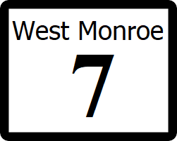
[[File:WM-7.png|right|300px]] | |||
{{Infobox road | {{Infobox road | ||
|length_mi=394 | |||
|length_mi= | |||
|length_ref= | |length_ref= | ||
| | |formed=1912 | ||
|direction_a=West | |direction_a=West | ||
|terminus_a= [[File:WM-1.png|25px|link=West Monroe State Highway 1]] in [[Willmington]] | |||
|junction={{plainlist| | |||
*[[File:I-5.svg|25px|link=Interstate 25]] | |||
}} | |||
|direction_b=East | |direction_b=East | ||
| | |terminus_b=[[File:WM-50.png|25px|link=West Monroe State Highway 50]] in [[Lamar, West Monroe|Lamar]] | ||
| | |||
}} | }} | ||
'''State Highway 7''' ('''SH 7''') is a highway that runs from [[Ibican Route 2]] in [[Willmington]] to [[West Monroe State Highway 50|SH 50]] in [[Lamar, West Monroe|Lamar]] in southeast West Monroe. | '''State Highway 7''' ('''SH 7''') is a highway that runs from [[Ibican Route 2]] in [[Willmington]] to [[West Monroe State Highway 50|SH 50]] in [[Lamar, West Monroe|Lamar]] in southeast West Monroe. | ||
==Major intersections== | ==Major intersections== | ||
{ | {| class=wikitable | ||
|- | |||
| | ! style="text-align:center; vertical-align:bottom;"| '''County''' | ||
| | ! style="text-align:center; vertical-align:bottom;"| '''Location''' | ||
| | ! style="text-align:center; vertical-align:bottom;"| '''Destination''' | ||
| | |- | ||
| rowspan="10" | [[Freemont County, West Monroe|Freemont County]] | |||
| rowspan="2" | [[Westside Village, West Monroe|Westide Village]] | |||
| | | [[File:WM-1.png|25px|link=West Monroe State Highway 1]] - [[Commerce Park, West Monroe|Commerce Park]], [[Willmington]] | ||
|- | |||
| [[File:UR-64.png|25px|link=West Monroe Urban Road 64]] - [[Scottsbluff, West Monroe|Scottsbluff]], [[Willmington]] | |||
| | |- | ||
| [[Ralston, West Monroe|Ralston]] | |||
| [[File:I-10.svg|25px|link=Interstate 10]] - [[Rhone]], [[Orange, West Monroe|Orange]] | |||
| | |- | ||
| | | rowspan="7" | [[Willmington]] | ||
| [[File:US 2.svg|25px|link=Ibican Route 2]][[File:UR-1.png|25px|link=West Monroe Urban Road 1]] Independence Avenue - [[Scottsbluff, West Monroe|Scottsbluff]], [[Ferris, West Monroe|Ferris]] | |||
|- | |||
| | | [[File:I-25.svg|25px|link=Interstate 25]] - [[Toledo, West Monroe|Toledo]], [[Youngstown, West Monroe|Youngstown]] | ||
| | |- | ||
| | | [[File:WM-54.png|25px|link=West Monroe State Highway 54]] - [[Shelby, West Monroe|Shelby]] | ||
| | |- | ||
| | | [[File:I-610.svg|25px|link=Interstate 610 (West Monroe)]] - [[Carrington, West Monroe|Carrington]], [[Bishop, West Monroe|Bishop]] | ||
|- | |||
| [[File:RR-67.png|25px|link=West Monroe Rural Road 67]] - [[Collins, West Monroe|Collins]] | |||
| | |- | ||
| [[Cooper River]] | |||
|- | |||
| | | [[File:WM-111.png|25px|link=West Monroe State Highway 111]] - [[Willmington Carter International Airport]] | ||
| | |- | ||
| | | rowspan="3" | [[Shelby County, West Monroe|Shelby County]] | ||
| rowspan="3" | [[Appleton, West Monroe|Appleton]] | |||
| [[File:LP-55.png|25px|link=West Monroe State Loop 55]][[File:WMB-7A.png|25px]] to [[File:WM-105.png|25px|link=West Monroe State Highway 105]] - [[Shelby, West Monroe|Shelby]]; Begin concurrency with Loop 55. | |||
| | |- | ||
| | | [[File:WM-116.png|25px|link=West Monroe State Highway 116]][[File:WMB-105D.png|25px|link=West Monroe State Highway 105#Business Routes]] - [[Union Grove, West Monroe|Union Grove]] | ||
| | |- | ||
| [[File:LP-55.png|25px|link=West Monroe State Loop 55]][[File:WMB-7A.png|25px]] to [[File:WM-105.png|25px|link=West Monroe State Highway 105]] - [[Shelby, West Monroe|Shelby]]; End concurrency with Loop 55. | |||
|- | |||
| | | rowspan="2" | [[Panamor County, West Monroe|Panamor County]] | ||
| | | rowspan="2" | [[Bellevue, West Monroe|Bellevue]] | ||
| | | [[File:RR-31.png|25px|link=West Monroe Rural Road 31]][[File:RR-75.png|25px|link=West Monroe Rural Road 75]] - [[Howard, West Monroe|Howard]] | ||
|- | |||
| [[File:WM-106.png|25px|link=West Monroe State Highway 106]] south to [[Union Grove, West Monroe|Union Grove]], north to [[Kimberly, West Monroe|Kimberly]] | |||
| | |- | ||
| | | [[Victoria County, West Monroe|Victoria County]] | ||
| | | [[Preston, West Monroe|Preston]] | ||
| [[File:WM-24.png|25px|link=West Monroe State Highway 24]] - south to [[Langdon, West Monroe|Langdon]], [[Austin, West Monroe|Austin]]; north to [[Arlington, West Monroe|Arlington]] | |||
|- | |||
| | | rowspan="2" | [[Trinity County, West Monroe|Trinity County]] | ||
| | | rowspan="2" | [[Stafford, West Monroe|Stafford]] | ||
| [[File:WM-34.png|25px|link=West Monroe State Highway 34]] west to [[Arlington, West Monroe|Arlington]] | |||
|- | |||
| | | [[File:WM-75.png|25px|link=West Monroe State Highway 75]] south to [[Victoria, West Monroe|Victoria]]; north to [[Ashland, West Monroe|Ashland]], [[Whitehall, West Monroe|Whitehall]] | ||
| | |- | ||
| | | [[Anderson County, West Monroe|Anderson County]] | ||
| [[Baldwin, West Monroe|Baldwin]] | |||
| [[File:WM-148.png|25px|link=West Monroe State Highway 148]] south to [[Victoria, West Monroe|Victoria]]; north to [[Stanwood, West Monroe|Stanwood]] | |||
| | |- | ||
| | | [[Wood County, West Monroe|Wood County]] | ||
| | | [[Lamar, West Monroe|Lamar]] | ||
| [[File:WM-50.png|25px|link=West Monroe State Highway 50]] south to [[Victoria, West Monroe|Victoria]]; north to [[Proctor, West Monroe|Proctor]] | |||
|} | |||
==See also== | ==See also== | ||
* [[List of state highways in West Monroe]] | * [[List of state highways in West Monroe]] | ||
[[Category:State highways in West Mornoe| | [[Category:State highways in West Mornoe|007]] | ||
Latest revision as of 19:41, 29 November 2023

| Route information | |
|---|---|
| Length | 394 mi (634 km) |
| Existed | 1912–present |
| Major junctions | |
| West end | |
| East end | |
State Highway 7 (SH 7) is a highway that runs from Ibican Route 2 in Willmington to SH 50 in Lamar in southeast West Monroe.
Major intersections
| County | Location | Destination |
|---|---|---|
| Freemont County | Westide Village | |
| Ralston | ||
| Willmington | ||
| Cooper River | ||
| Shelby County | Appleton | |
| Panamor County | Bellevue | |
| Victoria County | Preston | |
| Trinity County | Stafford | |
| Anderson County | Baldwin | |
| Wood County | Lamar |