Geography of Blechingia: Difference between revisions
Jump to navigation
Jump to search
No edit summary |
No edit summary |
||
| Line 2: | Line 2: | ||
| name = Blechingia | | name = Blechingia | ||
| image name = | | image name = | ||
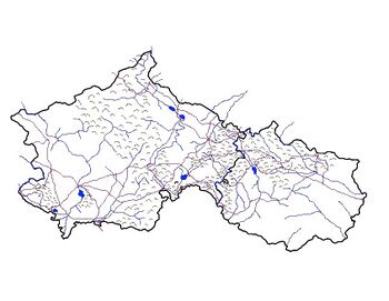
File:Map of Blechingia and its neighbor Lyonheimer .jpg | |||
| image size = | | image size = | ||
| image caption = | | image caption = | ||
Revision as of 15:50, 7 March 2021
 | |
| Continent | Thrismari |
|---|---|
| Area | |
| • Total | 1,022,058 km2 (394,619 sq mi) |
| Borders | Lyonheimer, Medovia, South Eisennau |
| Highest point | Mt. Adian 4,838.4 m (15,874 ft) |
| Lowest point | Slob Theas -2 m (-6.5 ft) |
| Longest river | River McKenna |
| Largest lake | Heilagulvath |
| Climate | Diverse: Ranges from Tagia in the south most along the coast. To Temperate |
| Natural Hazards | tsunamis; volcanoes; earthquake activity around Ice Sea, forest fires, permafost in southern Étaín |