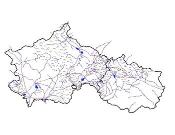
Geography of Blechingia
Jump to navigation
Jump to search
 | |
| Continent | Thrismari |
|---|---|
| Area | |
| • Total | 1,022,058 km2 (394,619 sq mi) |
| Coastline | 1,870 km (1,160 mi) |
| Borders | Lyonheimer, Medovia, South Eisennau |
| Highest point | Mt. Adian 4,838.4 m (15,874 ft) |
| Lowest point | Slob Theas -2 m (-6.5 ft) |
| Longest river | River McKenna |
| Largest lake | Heilagulvath |
| Climate | Diverse: Ranges from Tundra in the extreme southern islands, To tagia in the south mostly along the coast. To temperate broadleaf forest for the large vast majority, To temperte steppe in the western and northern parts, To alpine tundra and montane forest mostly in the mountainous regions. |
| Terrain | Vast central plain, Interior Highlands and low mountains in Southwest,mountains and valleys in the mid-south, coastal flatland near Ice Sea and Strait of Lir, rugged, volcanic topography in Étaín. |
| Natural Resources | coal, copper, lead, molybdenum, phosphates, rare earth elements, uranium, bauxite, gold, iron, mercury, nickel, potash, silver, tungsten, zinc, petroleum, natural gas, timber, arable land |
| Natural Hazards | tsunamis; volcanoes; earthquake activity around Ice Sea, forest fires, permafost in southern Étaín |