Tethale
Kingdom of Tethale Akynaela Tyffaela | |
|---|---|
|
Flag | |
| Motto: Land of the Sun and Moon Land of the Sun and Moon | |
| Anthem: Song of Tethale | |
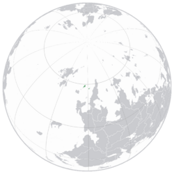
 Location of Tethale in dark green | |
| Capital and largest city | Swli |
| Official languages | Tethik |
| Ethnic groups (2019) | (79.1%)Tethik (16.8%)Fenik (4.1%) Other |
| Religion (2019) | (96.3%) Llanyseemp (1.8%) Samiism |
| Demonym(s) | Tethik |
| Government | Unitary Parliamentary Semi-Constitutional Monarchy |
• Monarch | Vacant |
| Legislature | Council |
| House of Nobles | |
| Establishment | |
• Founding of Tethale | 961 AD |
| Area | |
• Total | 15,616 km2 (6,029 sq mi) |
| Population | |
• 2019 census | 651256 |
• Density | 21/km2 (54.4/sq mi) |
| GDP (PPP) | estimate |
• Total | 5,443,737,600 ACU |
• Per capita | 16,600 ACU |
| GDP (nominal) | estimate |
• Total | 3,976,569,136 ACU |
• Per capita | 6,106 ACU |
| Gini (2020) | 33.2 medium |
| HDI (2018) | high |
| Currency | Nune (TNN) |
| Time zone | UTC-8 (TST) |
| Driving side | left |
| Calling code | +79 |
| Internet TLD | .Te |
Tethale (/tɛθɛil/), Known in Tethik as Tyffaela (/təθaila/) is an island nation located in northwest Thuadia, within the Tethik Sea in the Paisi Ocean. The territory of Tethale spans over 600 islands, covering over 15,500 square kilometers (6000 sq mi). The mainland of Tethale is situated between two tectonic plates, causing the existence of many volcanoes over the island. The three largest cities in Tethale are Swli, Naelwtaela and Iwgynosia. Swli Is the capital of Tethale and the largest city. Only 8.9% of the population live in the capital.
Tethale is one of the least populous countries in Anteria, with over 600,000 citizens, and has a density of around 41 people per square kilometer, with the population spread relatively evenly throughout the islands.
Tethale has been inhabited for thousands of years, since around 4000 years. The tribes that ended up on the islands migrated from the Aleni Peninsula and Northern Kiyortza, first reaching the Iwgyna Islands, before getting to Mainland Tethale. Record of the ancient Tethik Peoples and Fenik Peoples have been lost to time, as stories were told orally, without a writing system. The first record of the people come from an source, who's creator has not been identified, found on the Aleni Peninsula in the 5th Century AD, which talked about their farming next to volcanoes.
Etymology
The name "Tyffaela" is derived from the Old Tethik word, "Tyffkala", which roughly translates to "Tethik land" (Tyffka meaning Tethik, and ala meaning land). The Tethiks were one of the many tribes that lived in Northern Kiyortza, who migrated to the Tethik Isles in antiquity. The earliest appearance of the word used to refer to Tethale as a whole was in the 6th century AD, where it reffered to the many warlord states on the main Tethik Island. The word changed over time to eventually end at "Tyffaela", which translates in the same way as "Tyffkala".
The word was anglicised for use in Common around the 17th century, in order to make the word more simple to spell and speak. The word went from being uniformly spelled and pronounced as "Tyffaela" (/təθaila/), to being written and pronounced as "Tethale" (/tɛθɛil/). This writing is used in international documents, with the Tethik version of the name beside it.
History
Geography
Climate
The climate of Tethale is influenced by it's position in the Paisi Ocean and it's relatively high latitude. Tethale mostly has a temperate maritime climate, with temperature in the majority of Tethale not going under -5°C in winter, and going up to around 27°C in summer. Other parts of Tethale are considered a subpolar maritime climate, and a subpolar climate respectively. The days in the country are often calm, and the nights could be considered cool. The coldest months are December and January, while June and July are the warmest. Rainfall is quite common throughout the year.
