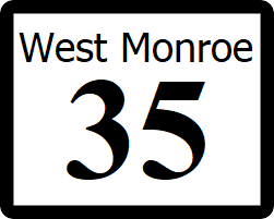
West Monroe State Highway 35
| Route information | |
|---|---|
| Length | 29 mi (47 km) |
| Existed | 1914–present |
| Major junctions | |
| West end | |
| East end | |
State Highway 35 (SH 35), also known as the West Freeway is a freeway that runs East-West through the western suburbs of Rhone, connecting it to the cities of Nina and Port Wells. SH 35 is a major freeway and essential branch of the Rhone freeway network, with 400,000 commuters daily at its busiest street, between loop 15 and Interstate 410. SH 35 also provides a number of downtown exits and a connection to the airport.
Exit List
All of SH 35 is located within King County, and all exits are unnumbered. Some murmurs within the West Monroe Department of Transportation have risen, suggesting the aignment of an interstate spur route (Most likely I-510) to the route, which would grant it greater federal highway funding. This happening would see the exits number in the interstate millage system.
| Location | Milage | Destination | Notes |
|---|---|---|---|
| Port Wells | 0.0 | Western Terminus, Traffic Light surface intersection | |
| 0.8 | Broadway Avenue - Downtown Port Wells | Westbound exit and eastbound entrance only | |
| 2.1 | Main Street | ||
| 3.0 | Preston Street | ||
| 4.5 | Baker Drive - Capital Community College Port Wells | ||
| 5.4 | Weir Road | ||
| 7.2 | Edgebrook Boulevard | ||
| 8.1 | Lordes Street | ||
| Nina | 8.9 | Fairhaven Drive | Eastbound exit and westbound entrance only |
| 9.5 | Stack Interchange | ||
| 11.2 | Portage Parkway | ||
| 12.1 | Jones Street | ||
| 12.9 | Railroad Avenue | Eastbound exit and westbound entrance only | |
| 13.5 | Jones Street | ||
| 14.4 | Commercial Park Drive | ||
| 15.7 | Crestmont Street | ||
| 17.3 | Belmark Lane | ||
| 18.6 | Vasser Street | ||
| 19.5 | Stack Interchange | ||
| 20.3 | Toledo Avenue | ||
| 21.5 | Raymond Street | ||
| Rhone | 22.8 | Airport Boulevard - Rhone International Airport | Direct Westbound to southbound connector |
| 24.3 | Mayfield Avenue | ||
| 25.1 | Westchester Road | ||
| 25.9 | Memorial Parkway | ||
| 26.7 | Russell Drive | ||
| 27.4 | Tindall Avenue | ||
| 28.2 | Mykawa Road | ||
| 29.1 | Kirby Drive | ||
| 30.0 | Turner Street | ||
| 30.9 | Rennenburg Street | Eastbound exit and westbound entrance only | |
| 31.4 | Main Street | ||
| 32.1 | Stack Interchange | ||
| 32.4 | Merchant Street | Eastbound exit and westbound entrance only | |
| 32.9 | Eastbound exit and westbound entrance only, direct Connectors | ||
| 33.8 | Eastbound exit and westbound entrance only, direct Connectors | ||
| 32.9 | End of SH 35, routing continues as IR-64 |
