|
| Length | 75 mi (121 km) |
|---|
| Existed | 1985–present |
|---|
|
| | |
|---|
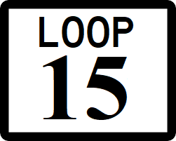
West Monroe State Loop 15, or The Beltway is a 76-mile-long (122 km) beltway around the Rhone metropolitan area. The Loop is built to Interstate Highway standards.
Major intersections
| County
|
Location
|
Destination
|
| Mason
|
Marlow
|
 - South Rhone, Gatlinburg. Rhone International Airport - South Rhone, Gatlinburg. Rhone International Airport
|
 - Rhone, Gatlinburg. Camp Atwater - Rhone, Gatlinburg. Camp Atwater
|
 - Gatlinburg - Gatlinburg
|
 - Kingsland, Gatlinburg - Kingsland, Gatlinburg
|
| Champion
|
 - Anderson, Elkheart - Anderson, Elkheart
|
 - Rhone, Willmington - Rhone, Willmington
|
| King
|
Cambridge
|
 - Kingsland, Millhome - Kingsland, Millhome
|
 - South Rhone - South Rhone
|
 - Kingsland, Elkheart - Kingsland, Elkheart
|
 - Champion - Champion
|
 - Holstein - Holstein
|
| Menard
|
 - Rhone, Leesville - Rhone, Leesville
|
| Wilkinson
|
|
 - Goland Park - Goland Park
|
| Gordan
|
 - Rhone, Denton - Rhone, Denton
|
| Allison
|
 - Rhone, Youngstown - Rhone, Youngstown
|
 - Goland Park, Cleveland, AFB Halliburton - Goland Park, Cleveland, AFB Halliburton
|
| Cisco
|
 - Castor, May - Castor, May
|
| Belton
|
 - Rhone, Cleveland - Rhone, Cleveland
|
| Kennedy
|
Norwood
|
 - Feltzburg, Amity - Feltzburg, Amity
|
 - Lynwood, Holtz - Lynwood, Holtz
|
| King
|
|
 - Rhone, Barton - Rhone, Barton
|
|
|
 - Holtz, Orlando, Fort Carter - Holtz, Orlando, Fort Carter
|
|
|
 to to  - Holtz, Fort Carter - Holtz, Fort Carter
|
| Port Wells
|

|
| Nina
|
 - Port Wells, Rhone - Port Wells, Rhone
|
 - Port Wells, Rhone - Port Wells, Rhone
|
| Rhone
|
 - Kinnley, Port of Rhone - Kinnley, Port of Rhone
|
|
|
 - Kinnley, South Rhone - Kinnley, South Rhone
|
| Mason
|
Anderson
|
 - Marlow - Marlow
|
 - Seabrook, Kinnley - Seabrook, Kinnley
|
 - Seabrook, Kinnley - Seabrook, Kinnley
|
See also
