Mahayala
Jump to navigation
Jump to search
State of Mahayala མ་ཧ་ཡ་ལ་ཀྲོའུ (Nyachzon) Maha Ya Trou | |
|---|---|
| Anthem: བཀྲ་ཤིས་ལུང་གི་གླུ་དབྱངས། Tra Shi Lung Gi Lu Yang Anthem of the Propitious Dragon | |
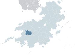
 Mahayala (dark green) in Kylaris | |
| Capital and largest city | Dharma |
| Official languages | Nyachzon, Shangean |
| Recognised regional languages | Yangzom, Sangpo, Lhakpa, Gyal |
| Demonym(s) | Mahayalan |
| Government | Unitary parliamentary semi-constitutional monarchy |
• King | Rabgyal Trengwa |
• Ugyen | Rabyang Aukatsang |
| Legislature | National Council |
| National Assembly | |
| House of Representatives | |
| History of Mahayala | |
| 1 March 1935 | |
| 1963–1975 | |
| 8 October 1975 | |
| 20 September 1982 | |
| Area | |
• Total | 704,547.94 km2 (272,027.48 sq mi) |
• Water (%) | 0.455 |
| Population | |
• 2016 census | 20,342,000 |
• Density | 28.87/km2 (74.8/sq mi) |
| GDP (PPP) | 2018 estimate |
• Total | $478.19 billion |
• Per capita | $8,099 |
| GDP (nominal) | 2018 estimate |
• Total | $199.7 billion |
• Per capita | $2,023 |
| Gini (2015) | 32.5 medium |
| HDI (2022) | 0.697 medium |
| Currency | Mahayalan bhuti (MBH) |
| Time zone | UTC-1 |
| Date format | YYYY-MM-DD |
| Driving side | left |
| Calling code | +32 |
| ISO 3166 code | MY |
| Internet TLD | .my |
Mahayala (མ་ཧ་ཡ་ལ་ཀྲ Maha Ya) officially State of Mahayala (མ་ཧ་ཡ་ལ་ཀྲོའུ། Maha Ya Trou) is a landlocked country in Coius bordering Shangea to the south and Ansan to the west.
TBA

