Mahayala
Jump to navigation
Jump to search
State of Mahayala | |
|---|---|
| Anthem: བཀྲ་ཤིས་ལུང་གི་གླུ་དབྱངས། Tra Shi Lung Gi Lu Yang Anthem of the Propitious Dragon | |
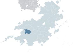
 Mahayala (dark green) in Kylaris | |
| Capital and largest city | Dharma |
| Official languages | Nyachzon, Shangean |
| Recognised regional languages | Yangzom, Sangpo, Lhakpa, Gyal |
| Demonym(s) | Mahayalan |
| Government | Unitary parliamentary semi-constitutional monarchy |
• King | Rabgyal Trengwa |
• Ugyen | Rabyang Aukatsang |
| Legislature | National Council |
| National Assembly | |
| House of Representatives | |
| History of Mahayala | |
| 1 March 1935 | |
| 1963–1975 | |
| 8 October 1975 | |
| 20 September 1982 | |
| Area | |
• Total | 704,547.94 km2 (272,027.48 sq mi) |
• Water (%) | 0.455 |
| Population | |
• 2016 census | 20,342,000 |
• Density | 28.87/km2 (74.8/sq mi) |
| GDP (PPP) | 2018 estimate |
• Total | $478.19 billion |
• Per capita | $8,099 |
| GDP (nominal) | 2018 estimate |
• Total | $199.7 billion |
• Per capita | $2,023 |
| Gini (2015) | 32.5 medium |
| HDI (2022) | 0.697 medium |
| Currency | Mahayalan bhuti (MBH) |
| Time zone | UTC-1 |
| Date format | YYYY-MM-DD |
| Driving side | left |
| Calling code | +32 |
| ISO 3166 code | MY |
| Internet TLD | .my |
Mahayala (མ་ཧ་ཡ་ལ་ཀྲ; Maha Ya) officially State of Mahayala (མ་ཧ་ཡ་ལ་ཀྲོའུ; Maha Ya Trou) is a landlocked country in Coius bordering Shangea to the south and Ansan to the west. Situated in the Western Shaleghos, Mahayala is notable for its biodiversity, including alpine and subtropical climates, as well as being a host to Tselha, the highest peak in Coius and X highest on Kylaris. Dharma is the nation's capital and the largest city. Mahayala is a multi-ethnic, multi-lingual, multi-religious and multi-cultural state, with Nyachzon and Shangean as the official languages.
Etymology
The name Mahayala is believed to be a combination of the Lhakpa words mah "between" and yalan "mountain" or "peak".

