User:Bigmoney/Sandbox18: Difference between revisions
m (Blanked the page) Tag: Blanking |
mNo edit summary |
||
| Line 1: | Line 1: | ||
{{Infobox country | |||
|micronation = <!--yes if a micronation--> | |||
|conventional_long_name = Kingdom of Kitaubani | |||
|native_name = ''Fanjakan'i Kitaubani'' ({{wp|Malagasy_language|Malagasy}})<br/>''Ufalme wa Kituopwanireza'' ({{wp|Swahili_language|KiUngwana}}) | |||
|common_name = Kitaubani | |||
|status = <!--Status of country, especially useful for micronations--> | |||
|image_flag = Kitaubanflag.png | |||
|alt_flag = <!--alt text for flag (text shown when pointer hovers over flag)--> | |||
|flag_border = <!--set to no to disable border around the flag--> | |||
|image_flag2 = <!--e.g. Second-flag of country.svg--> | |||
|alt_flag2 = <!--alt text for second flag--> | |||
|flag2_border = <!--set to no to disable border around the flag--> | |||
|image_coat = File:Coat of arms of Kitaubani.png | |||
|alt_coat = <!--alt text for coat of arms--> | |||
|symbol_type = <!--emblem, seal, etc (if not a coat of arms)--> | |||
|national_motto = ''Umoja katika Utofauti'' ({{wp|Swahili_language|KiUngwana}}) | |||
|englishmotto = Unity in Diversity | |||
|national_anthem = ''"Alfarma"''<br><small>"Majesty"</small><br>[[File:MediaPlayer.png|link=https://www.youtube.com/watch?v=8357OFGO-bM|210px]] | |||
|royal_anthem = <!--in inverted commas and wikilinked if link exists--> | |||
|other_symbol_type = <!--Use if a further symbol exists, e.g. hymn--> | |||
|other_symbol = | |||
|image_map = Kitaubaniglobe.png | |||
|loctext = [[Bahia]] | |||
|alt_map = <!--alt text for map--> | |||
|map_caption = Kitaubani (dark green) within the [[Congress of Bahian States]] (light green) in Bahia | |||
|image_map_size = 300px | |||
|image_map2 = <!--Another map, if required--> | |||
|alt_map2 = <!--alt text for second map--> | |||
|map_caption2 = <!--Caption to place below second map--> | |||
|image_map2_size = <!--Map size in number of pixels--> | |||
|capital = Kwamuimepe | |||
|coordinates = <!-- Coordinates for capital, using {{tl|coord}} --> | |||
|largest_city = Gashi | |||
|largest_settlement_type = city | |||
|largest_settlement = <!--Name of largest settlement--> | |||
|official_languages = {{wp|Malagasy_language|Malagasy}}, {{wp|Swahili_language|KiUngwana}} | |||
|national_languages = <!--Country/territory-wide languages recognised but not necessarily in country/territory-wide law, etc--> | |||
|regional_languages = <!--Languages recognised or associated with particular regions within the country/territory--> | |||
|languages_type = <!--Use to specify a further type of language, if not official, national or regional--> | |||
|languages = <!--Languages of the further type--> | |||
|languages_sub = <!--Is this further type of language a sub-item of the previous non-sub type? ("yes" or "no")--> | |||
|languages2_type = <!--Another further type of language--> | |||
|languages2 = <!--Languages of this second further type--> | |||
|languages2_sub = <!--Is the second alternative type of languages a sub-item of the previous non-sub type? ("yes" or "no")--> | |||
|ethnic_groups = {{Collapsible list | |||
|titlestyle = background:transparent;text-align:left;font-weight:normal;font-size:100%; | |||
|title = | 35% {{wp|Hausa}} | 22% {{wp|Bamileke}} | 15% {{wp|Tamasheq}} | 7% {{wp|Anlo}} | 5% {{wp|Swahili_people|WaUngwana}} | 16% [[Kitaubani#Ethnicity|Other]] }} | |||
|ethnic_groups_year = 2023 | |||
|ethnic_groups_ref = <!--(for any ref/s to associate with ethnic groups data)--> | |||
|religion = | |||
{{Collapsible list | |||
|titlestyle = background:transparent;text-align:left;font-weight:normal;font-size:100%; | |||
|title = | 38% Aladura faiths | 23% [[Irfan]] | 19% {{wp|Roman_Catholicism|Solarian Catholicism}} | 9% Animism | 11% [[Kitaubani#Religion|Other]] }} | |||
|religion_year = 2023 | |||
|religion_ref = <!--(for any ref/s to associate with religion data)--> | |||
|demonym = Kitauban | |||
|government_type = {{wp|Unitary_state|Unitary}} {{wp|constitutional monarchy}} | |||
|leader_title1 = Queen | |||
|leader_name1 = Medare I | |||
|leader_title2 = Premier | |||
|leader_name2 = Balarabe Zango | |||
|leader_title14 = <!--(up to 14 distinct leaders may be included)--> | |||
|leader_name14 = | |||
|legislature = <!--Name of the country/territory's governing body, e.g. "Parliament", "Congress", etc--> | |||
|upper_house = <!--Name of governing body's upper house, if given (e.g. "Senate")--> | |||
|lower_house = <!--Name of governing body's lower house, if given (e.g. "Chamber of Deputies")--> | |||
|sovereignty_type = | |||
|sovereignty_note = | |||
|established_event1 = <!--First key event in history of country/territory's status or formation--> | |||
|established_date1 = <!--Date of first key event--> | |||
|established_event2 = <!--Second key event--> | |||
|established_date2 = <!--Date of second key event--> | |||
|established_event13 = <!--(up to 13 distinct events may be included)--> | |||
|established_date13 = | |||
|area_rank = | |||
|area = <!--Major area size (in [[Template:convert]] either km2 or sqmi first)--> | |||
|area_km2 = 259,786.24 | |||
|area_sq_mi = 100,303.99 | |||
|area_footnote = <!--Optional footnote for area--> | |||
|percent_water = | |||
|area_label = <!--Label under "Area" (default is "Total")--> | |||
|area_label2 = <!--Label below area_label (optional)--> | |||
|area_data2 = <!--Text after area_label2 (optional)--> | |||
|population_estimate = 21,974,231 | |||
|population_estimate_rank = | |||
|population_estimate_year = 2023 | |||
|population_census = | |||
|population_census_year = | |||
|population_density_km2 = | |||
|population_density_sq_mi = | |||
|population_density_rank = | |||
|nummembers = <!--An alternative to population for micronation--> | |||
|GDP_PPP = {{increase}} $371,210,684,283 | |||
|GDP_PPP_rank = 37<sup>th</sup> | |||
|GDP_PPP_year = 2023 | |||
|GDP_PPP_per_capita = {{increase}} $16,893 | |||
|GDP_PPP_per_capita_rank = 40<sup>th</sup> | |||
|GDP_nominal = {{increase}} $143,667,522,278 | |||
|GDP_nominal_rank = 51<sup>st</sup> | |||
|GDP_nominal_year = 2023 | |||
|GDP_nominal_per_capita = {{increase}} $6,538 | |||
|GDP_nominal_per_capita_rank = 58<sup>th</sup> | |||
|Gini = <!--(Gini measure of income inequality; input number only; valid values are between 0 and 100)--> | |||
|Gini_ref = <!--(for any ref/s to associate with Gini number)--> | |||
|Gini_rank = | |||
|Gini_year = | |||
|HDI_year = <!-- Please use the year to which the data refers, not the publication year--> | |||
|HDI = <!--(Human Development Index; input number only; valid values are between 0 and 1)--> | |||
|HDI_change = <!--increase/decrease/steady; rank change from previous year--> | |||
|HDI_rank = | |||
|HDI_ref = <!--(for any ref/s to associate with HDI number)--> | |||
|currency = Kitauban wuri (₩) | |||
|currency_code = KTW | |||
|time_zone = ''Kardjiba Island: +4'' | |||
|utc_offset = +3 (BST)<br/> | |||
|time_zone_DST = <!--Link to DST (Daylight Saving Time) used, otherwise leave empty--> | |||
|utc_offset_DST = <!--in the form "+N", where N is number of hours offset--> | |||
|DST_note = <!--Optional note regarding DST use--> | |||
|antipodes = <!--Place/s exactly on the opposite side of the world to country/territory--> | |||
|date_format = <!--all-numeric date format and era, such as [[Common Era|CE]], [[Anno Domini|AD]], [[Hijri year|AH]], etc.; e.g. {{abbr|yyyy|year}}-{{abbr|mm|month}}-{{abbr|dd|day}} ([[Anno Domini|AD]]) --> | |||
|drives_on = right | |||
|cctld = .kt | |||
|iso3166code = <!--ISO code only; no extra text. Use to override default from common_name parameter above; omit using "omit".--> | |||
|calling_code = +27 | |||
|patron_saint = <!--Use patron_saints for multiple--> | |||
|image_map3 = <!--Optional third map position, e.g. for use with reference to footnotes below it--> | |||
|alt_map3 = <!--alt text for third map position--> | |||
|footnote_a = <!--For any footnote <sup>a</sup> used above--> | |||
|footnote_b = <!--For any footnote <sup>b</sup> used above--> | |||
|footnote_h = <!--For any footnote <sup>h</sup> used above--> | |||
|footnotes = <!--For any generic non-numbered footnotes--> | |||
}} | |||
'''Kitaubani''', known officially as the '''Kingdom of Kitaubani''', is a sovereign state located XXX. The current population of XX people is spread across XX square kilometers, making Kitaubani one of the more moderately-dense nations in Bahia at 84 persons per square kilometer. | |||
The islands presently known as Kitaubani were inhabited since ancient times by numerous groups, such as the Hausa and the Tamasheq. These groups frequently associated with one another and with their cohorts on the Bahian mainland through a cross-channel trade network. City-states were beginning to form on the coasts, which interfaced with the more nomadic groups in the hinterlands through trade, diplomatic marriage and warfare. These patterns of interaction were interrupted in the early [[Hourege|Houregic Period]]. In the mid-eleventh century CE, an {{wp|Swahili_people|Ungwana}} ruler known as Mataka fled warfare in his home in modern-day [[Maucha]]. Mataka's arrival in Kitaubani presaged many of his followers', which included a significant merchant caste that soon dominated the city of Gashi. For around a century, Gashi operated indistinctly from other coastal Kitauban city-states. By the end of the twelfth century, however, Gashi's Ungwana rulers had begun attacking neighboring city-states, either to annex them or force them into tributary status. This eventually transformed into the elite of Gashi holding at least nominal control of most of the Kitauban islands by the 1500s. To this day, Mataka's initial takeover of the village of Gashi is seen as the direct predecessor of the modern Kitauban state, and Mataka himself is considered in the popular consciousness as the first ''mfalme'', or Ungwana ruler of Kitaubani. | |||
Presently, the Kingdom of Kitaubani is ruled as a constitutional monarchy under the guiding principle of parliamentary sovereignty. The government retains moderately low corruption and high transparency scores. It is a member of the [[Congress of Bahian States]], the [[Community of Nations]], the [[Council for Mutual Development]] and the [[International Forum for Developing States]]. Kitaubani maintains one of the stronger economies in Bahia, benefitting from a growth in urban manufacturing and its influence in the global shipping industry. Its nominal Gross Domestic Product (GDP) is the largest per capita in Bahia. | |||
==Etymology== | |||
The name ''Kitaubani'' likely derives from a KiUngwana phrase, though it has been altered to fit Hausa language phonology. Following the Bahian consolidation during the Houregic Age, an expedition led by ''mfalme'' Mataka, landed on the shores of Kitaubani at the site of modern-day Gashi. Mataka had fled his homeland of modern-day Maucha both to escape violence at home and to re-establish his wealth through new economic holdings. After a long journey fraught with adverse conditions, conflicts with local authorities, and other innumerable hardships, was the island of Kitaubani: according to popular folklore, in his relief at completing his journey, Matake proclaimed the site ''kituo wa pwani'', or the Coast of Respite. As Mataka carries an almost-mythified status in Kitauban consciousness as one of the first kings of the island, this story has persisted and grown to be the most popular folk etymology for the name of the country. The name ''Kitaubani'' can apply both to the country and to the larger island within the country; the latter is frequently termed "Kitaubani Island" or "the Isle of Kitaubani" to avoid confusion. | |||
==History== | |||
As an island, Kitaubani was settled by prehistoric humans later than mainland Bahia. | |||
===Pre-Houregic Period=== | |||
===Arrival of Mataka=== | |||
===Second Gashi Period=== | |||
===Protectorate=== | |||
===Independent Kitaubani=== | |||
The late 1950s and early-mid 1960s saw increasing frustration with Yatasu's continued rule. With other Bahian nations decolonizing into (at least nominal) republics, sentiment was high for the establishment of a republic in Kitaubani. Disillusioned with the continued suspension of the Constitution's promulgation and buoyed by international support, protests began calling for anything from the promulgation of a new Constitution to the abolition of the monarchy entirely. During this time, the Royal Police and Royal Army intelligence agenices conducted small-scale, targeted purges of both ethnic separatist and Councilist dissidents; the Kitauban Dirty War weakened public and international support for Yatasu, though it is arguable whether or not he had lost control of these security forces by the end of his absolutist reign. Wishing to retain life and livelihood, Katasu bowed to the pressure from both domestic and international sources (namely from the United Bahian Republic) and accepted a much more ceremonial role, leaving open the door for the political parties kept much in limbo to step forward into fully legitimate politics. The first Premier was a moderate Pan-Bahian and social democrat named Danjimma Ringim, who then executed numerous policies designed to placate radical sentiment and disarm potential Councilist sympathies. This led to a gradual restabilization of Kitaubani's political scene over the ensuing decades, thanks largely to the support of business elites from several different minority ethnic groups lending much-needed political capital to Ringim's reforms in the interest of keeping the peace. Yatasu, not wishing to tip the boat and recognizing the bad public image he already had, reluctantly acquiesced to many of the political changes solidfying the supremacy of the parliamentarian system in Kitauban politics. The death of Yatasu in 1972 was in hindsight remembered as the final transition point from "old Kitaubani" to "new Kitaubani." | |||
==Geography== | |||
===Climate=== | |||
A combination of prevailing trade winds to the south and the central highlands of Kitaubani Island have shaped the nation's climate. The south experiences nearly sub-tropical precipitation, though retains average temperatures well within the temperate zone thanks to the island's latitude and the moderating effects of the ocean. The north of the island lies within a rain shadow created by the central highlands, creating more arid and variable conditions. Kardjiba Island experiences a similar arid-temperate climate to the north of Kitaubani Island. | |||
As Kitaubani lies on two islands, the country is home to numerous endemic species and variants not found elsewhere in the world. | |||
===Administrative divisions=== | |||
Kitaubani is subdivided into 22 departments, further subdivided into districts. These districts are centered around a significant autonomous settlement with a city council, with the remaining territory divided into wards overseen by municipal, village, or rural councils. The departments of Kitaubani were drawn for the most recent time in 1970, designed to roughly correspond to equal population size per district. Due to substantial industrialization and urbanization in the intervening decades, however, there now exists a substantial population disparity between rural and more urbanized departments. | |||
==Demographics== | |||
===Ethnicity=== | |||
===Language=== | |||
Hausa and KiUngwana, through their historical prominence, have retained their positions as dual ''linguae francae'' across the island. Some students elect to learn XXX as a foreign language, though for many decades this was discouraged due to political reasons. | |||
===Education=== | |||
===Religion=== | |||
[[File:130415-Eglise_de_Faravohitra.jpg|thumb|220px|right|St. Engelbert's Church in Kaduna]] | |||
Owing to Kitaubani's long history as a multicultural state and prolonged historical contact with overseas groups, the modern-day religious makeup of the country is widely varied, with no one religion holding a majority. According to the Kitauban Decennial Census, the largest group of adherents belong to the Aladura faiths. ''Aladura'' is a broad term covering a wide variety of faiths that syncretize traditional faiths with elements of Sotirianity, most notably Solarian Catholicism. This term embodies religious groups formed during and after the colonial period, as well as the Philipites, an autocephalous sect in partial communion with the Solarian Church that predates the arrival of colonial missionaries by several centuries. As a result of this varied background, the Aladura faith is highly decentralized; some groups are in full communion with the Solarian Church, while others hold such different beliefs that they are considered heterodox by mainstream, non-Bahian Sotirians. As of 2020, around 8.4 million Kitaubans self-identify as affiliated with some form of Aladura. | |||
==Government== | |||
Kitaubani is a {{wp|unitary_state|unitary}} {{wp|constitutional monarchy}}, governed under its 1969 Constitution. The head of state is Queen Medare I. Under the Kitauban Constitution, the monarch holds mostly symbolic power. Most real executive authority lies with the parliamentary head of government, a title often translated as Premier. Currently, the Premier is Balarabe Zango of the Progressive Bahian Front. The Premier is elected from the ranks of Kitaubani's parliament, the National Assembly. Under the principle of {{wp|parliamentary sovereignty}}, the legitimacy of the Kitauban government is meant to derive from the citizenry through voting for representatives in the parliament. | |||
==Economy== | |||
[[File:Lafarge cement factory in Ewekoro Ogun state -Nigeria.jpg|thumb|220px|left|A cement factory in X Department, Kardjiba]] | |||
Kitaubani is often categorized as an {{wp|developing economy|lower-middle-income}} nation. Through a burgeoning industrial sector and nascent services sector, along with footholds in the global shipping industry, the nation has maintained one of the stronger economies in Bahia. Kitaubani holds the highest Gross Domestic Product (GDP) per capita both nominally and in terms of {{wp|Purchasing Power Parity}} (PPP) in Bahia. Decades of relative political stability and peaceful transfers of power have helped encourage steady economic growth. | |||
Major industries in Kitaubani include manufacturing, agriculture, shipping, and, increasingly, tourism. Shipping, especially in providing crews for international vessels and through {{wp|flag of convenience|flags of convenience}}, generates significant revenue and employs a large number of Kitaubans. Kitauban shipping crews and other foreign workers provide a significant influx of foreign capital through {{wp|remittance|remittances}}. | |||
===Transportation=== | |||
Kitaubani's transport network is diverse, with numerous methods available connecting settlements, the islands, and the country itself to the outside world. Compared to other Bahian nations, the Kitauban rail network is relatively robust, including both intercity service, freight transport, and in Kwamuimepe and Gashi, limited urban light rail. | |||
{{Gallery | |||
|title= | |||
|width=200 |height=140 | |||
|align=center | |||
|footer= | |||
|mode=nolines | |||
|File:Train Movement at oshodi stations rushing hour of the day Photo Taken by Mr Olusola D, Ayibiowu.jpg | |||
|alt1= | |||
| A passenger rail service bound for Kwamuimepe in central Kitaubani | |||
|File:Fokker 100 de IRS Airlines estacionados en Lagos Nigeri.JPG | |||
|alt2= | |||
| Airliners at Kwamuimepe Airport | |||
|File:Ghetto, Lagos, Nigeria, 12-15-16h20m56s237.png | |||
|alt3= | |||
| A collection of minibuses outside a train station in suburban Gashi | |||
|File:ILORIN_TRAIN_STATION.jpg | |||
|alt4= | |||
|A suburban Kitauban highway | |||
|File:The Liberian-flagged Shell Oil Tanker "Solena" at Gothenburg, 1998.jpg | |||
|alt5= | |||
|A Kitauban-flagged oil tanker underway | |||
|File:Marwa elchazly- Alexandria Tramway 03.jpg | |||
|alt6= | |||
|A tram on the Kwamuimepe Light Rail network | |||
}} | |||
==Culture== | |||
Revision as of 21:56, 23 March 2024
Kingdom of Kitaubani | |
|---|---|
 Flag
 Coat of arms
| |
Anthem: "Alfarma" "Majesty" | |
 Kitaubani (dark green) within the Congress of Bahian States (light green) in Bahia | |
| Location | Bahia |
| Capital | Kwamuimepe |
| Largest city | Gashi |
| Official languages | Malagasy, KiUngwana |
| Ethnic groups (2023) | |
| Religion (2023) | List
|
| Demonym(s) | Kitauban |
| Government | Unitary constitutional monarchy |
• Queen | Medare I |
• Premier | Balarabe Zango |
| Area | |
• | 259,786.24 km2 (100,304.03 sq mi) |
| Population | |
• 2023 estimate | 21,974,231 |
| GDP (PPP) | 2023 estimate |
• Total | |
• Per capita | |
| GDP (nominal) | 2023 estimate |
• Total | |
• Per capita | |
| Currency | Kitauban wuri (₩) (KTW) |
| Time zone | UTC+3 (BST) (Kardjiba Island: +4) |
| Driving side | right |
| Calling code | +27 |
| Internet TLD | .kt |
Kitaubani, known officially as the Kingdom of Kitaubani, is a sovereign state located XXX. The current population of XX people is spread across XX square kilometers, making Kitaubani one of the more moderately-dense nations in Bahia at 84 persons per square kilometer.
The islands presently known as Kitaubani were inhabited since ancient times by numerous groups, such as the Hausa and the Tamasheq. These groups frequently associated with one another and with their cohorts on the Bahian mainland through a cross-channel trade network. City-states were beginning to form on the coasts, which interfaced with the more nomadic groups in the hinterlands through trade, diplomatic marriage and warfare. These patterns of interaction were interrupted in the early Houregic Period. In the mid-eleventh century CE, an Ungwana ruler known as Mataka fled warfare in his home in modern-day Maucha. Mataka's arrival in Kitaubani presaged many of his followers', which included a significant merchant caste that soon dominated the city of Gashi. For around a century, Gashi operated indistinctly from other coastal Kitauban city-states. By the end of the twelfth century, however, Gashi's Ungwana rulers had begun attacking neighboring city-states, either to annex them or force them into tributary status. This eventually transformed into the elite of Gashi holding at least nominal control of most of the Kitauban islands by the 1500s. To this day, Mataka's initial takeover of the village of Gashi is seen as the direct predecessor of the modern Kitauban state, and Mataka himself is considered in the popular consciousness as the first mfalme, or Ungwana ruler of Kitaubani.
Presently, the Kingdom of Kitaubani is ruled as a constitutional monarchy under the guiding principle of parliamentary sovereignty. The government retains moderately low corruption and high transparency scores. It is a member of the Congress of Bahian States, the Community of Nations, the Council for Mutual Development and the International Forum for Developing States. Kitaubani maintains one of the stronger economies in Bahia, benefitting from a growth in urban manufacturing and its influence in the global shipping industry. Its nominal Gross Domestic Product (GDP) is the largest per capita in Bahia.
Etymology
The name Kitaubani likely derives from a KiUngwana phrase, though it has been altered to fit Hausa language phonology. Following the Bahian consolidation during the Houregic Age, an expedition led by mfalme Mataka, landed on the shores of Kitaubani at the site of modern-day Gashi. Mataka had fled his homeland of modern-day Maucha both to escape violence at home and to re-establish his wealth through new economic holdings. After a long journey fraught with adverse conditions, conflicts with local authorities, and other innumerable hardships, was the island of Kitaubani: according to popular folklore, in his relief at completing his journey, Matake proclaimed the site kituo wa pwani, or the Coast of Respite. As Mataka carries an almost-mythified status in Kitauban consciousness as one of the first kings of the island, this story has persisted and grown to be the most popular folk etymology for the name of the country. The name Kitaubani can apply both to the country and to the larger island within the country; the latter is frequently termed "Kitaubani Island" or "the Isle of Kitaubani" to avoid confusion.
History
As an island, Kitaubani was settled by prehistoric humans later than mainland Bahia.
Pre-Houregic Period
Arrival of Mataka
Second Gashi Period
Protectorate
Independent Kitaubani
The late 1950s and early-mid 1960s saw increasing frustration with Yatasu's continued rule. With other Bahian nations decolonizing into (at least nominal) republics, sentiment was high for the establishment of a republic in Kitaubani. Disillusioned with the continued suspension of the Constitution's promulgation and buoyed by international support, protests began calling for anything from the promulgation of a new Constitution to the abolition of the monarchy entirely. During this time, the Royal Police and Royal Army intelligence agenices conducted small-scale, targeted purges of both ethnic separatist and Councilist dissidents; the Kitauban Dirty War weakened public and international support for Yatasu, though it is arguable whether or not he had lost control of these security forces by the end of his absolutist reign. Wishing to retain life and livelihood, Katasu bowed to the pressure from both domestic and international sources (namely from the United Bahian Republic) and accepted a much more ceremonial role, leaving open the door for the political parties kept much in limbo to step forward into fully legitimate politics. The first Premier was a moderate Pan-Bahian and social democrat named Danjimma Ringim, who then executed numerous policies designed to placate radical sentiment and disarm potential Councilist sympathies. This led to a gradual restabilization of Kitaubani's political scene over the ensuing decades, thanks largely to the support of business elites from several different minority ethnic groups lending much-needed political capital to Ringim's reforms in the interest of keeping the peace. Yatasu, not wishing to tip the boat and recognizing the bad public image he already had, reluctantly acquiesced to many of the political changes solidfying the supremacy of the parliamentarian system in Kitauban politics. The death of Yatasu in 1972 was in hindsight remembered as the final transition point from "old Kitaubani" to "new Kitaubani."
Geography
Climate
A combination of prevailing trade winds to the south and the central highlands of Kitaubani Island have shaped the nation's climate. The south experiences nearly sub-tropical precipitation, though retains average temperatures well within the temperate zone thanks to the island's latitude and the moderating effects of the ocean. The north of the island lies within a rain shadow created by the central highlands, creating more arid and variable conditions. Kardjiba Island experiences a similar arid-temperate climate to the north of Kitaubani Island.
As Kitaubani lies on two islands, the country is home to numerous endemic species and variants not found elsewhere in the world.
Administrative divisions
Kitaubani is subdivided into 22 departments, further subdivided into districts. These districts are centered around a significant autonomous settlement with a city council, with the remaining territory divided into wards overseen by municipal, village, or rural councils. The departments of Kitaubani were drawn for the most recent time in 1970, designed to roughly correspond to equal population size per district. Due to substantial industrialization and urbanization in the intervening decades, however, there now exists a substantial population disparity between rural and more urbanized departments.
Demographics
Ethnicity
Language
Hausa and KiUngwana, through their historical prominence, have retained their positions as dual linguae francae across the island. Some students elect to learn XXX as a foreign language, though for many decades this was discouraged due to political reasons.
Education
Religion

Owing to Kitaubani's long history as a multicultural state and prolonged historical contact with overseas groups, the modern-day religious makeup of the country is widely varied, with no one religion holding a majority. According to the Kitauban Decennial Census, the largest group of adherents belong to the Aladura faiths. Aladura is a broad term covering a wide variety of faiths that syncretize traditional faiths with elements of Sotirianity, most notably Solarian Catholicism. This term embodies religious groups formed during and after the colonial period, as well as the Philipites, an autocephalous sect in partial communion with the Solarian Church that predates the arrival of colonial missionaries by several centuries. As a result of this varied background, the Aladura faith is highly decentralized; some groups are in full communion with the Solarian Church, while others hold such different beliefs that they are considered heterodox by mainstream, non-Bahian Sotirians. As of 2020, around 8.4 million Kitaubans self-identify as affiliated with some form of Aladura.
Government
Kitaubani is a unitary constitutional monarchy, governed under its 1969 Constitution. The head of state is Queen Medare I. Under the Kitauban Constitution, the monarch holds mostly symbolic power. Most real executive authority lies with the parliamentary head of government, a title often translated as Premier. Currently, the Premier is Balarabe Zango of the Progressive Bahian Front. The Premier is elected from the ranks of Kitaubani's parliament, the National Assembly. Under the principle of parliamentary sovereignty, the legitimacy of the Kitauban government is meant to derive from the citizenry through voting for representatives in the parliament.
Economy

Kitaubani is often categorized as an lower-middle-income nation. Through a burgeoning industrial sector and nascent services sector, along with footholds in the global shipping industry, the nation has maintained one of the stronger economies in Bahia. Kitaubani holds the highest Gross Domestic Product (GDP) per capita both nominally and in terms of Purchasing Power Parity (PPP) in Bahia. Decades of relative political stability and peaceful transfers of power have helped encourage steady economic growth.
Major industries in Kitaubani include manufacturing, agriculture, shipping, and, increasingly, tourism. Shipping, especially in providing crews for international vessels and through flags of convenience, generates significant revenue and employs a large number of Kitaubans. Kitauban shipping crews and other foreign workers provide a significant influx of foreign capital through remittances.
Transportation
Kitaubani's transport network is diverse, with numerous methods available connecting settlements, the islands, and the country itself to the outside world. Compared to other Bahian nations, the Kitauban rail network is relatively robust, including both intercity service, freight transport, and in Kwamuimepe and Gashi, limited urban light rail.

A passenger rail service bound for Kwamuimepe in central Kitaubani

Airliners at Kwamuimepe Airport
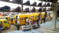
A collection of minibuses outside a train station in suburban Gashi
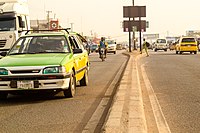
A suburban Kitauban highway

A Kitauban-flagged oil tanker underway

A tram on the Kwamuimepe Light Rail network


