Category:Maps
Jump to navigation
Jump to search
This category and its subcategories are for articles and media related to maps and cartography.
Subcategories
This category has the following 2 subcategories, out of 2 total.
M
- Maps of Orioni (12 F)
Media in category "Maps"
The following 13 files are in this category, out of 13 total.
- Brigg.png 1,200 × 1,293; 873 KB
- Early human migrations on Eurth.png 1,071 × 1,260; 197 KB
- Eurth edition of Risk.png 4,000 × 1,876; 828 KB
- Eurth-map-for-children.jpg 4,000 × 2,014; 571 KB
- Historical map of Orioni.jpg 2,000 × 1,816; 377 KB
- Koppen climate classification map of Orioni.png 2,000 × 1,816; 64 KB
- Map-of-Hakenium.png 362 × 328; 62 KB
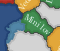
- Map-of-Minilov-in-Euclea.PNG 500 × 440; 4 KB
- Map-of-minilov-kylaris.PNG 522 × 448; 68 KB
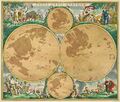
- Portolan map of Eurth.jpg 2,283 × 1,940; 665 KB
- Sanar System.png 1,920 × 1,280; 1.71 MB
- SSI Eurth.png 1,599 × 832; 354 KB
- Tectonic plates of Eurth.png 4,000 × 2,000; 1.14 MB


