Category:Maps (Eurth)
Jump to navigation
Jump to search


Default blank base map of Eurth.
Subcategories
This category has the following 3 subcategories, out of 3 total.
A
M
- Maps of Orioni (12 F)
- Maps of Qubdi (13 F)
Pages in category "Maps (Eurth)"
The following 4 pages are in this category, out of 4 total.
Media in category "Maps (Eurth)"
The following 200 files are in this category, out of 283 total.
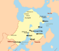
(previous page) (next page) Administrative regions of Kirvina.png 1,217 × 841; 328 KB
 Ahrana from space.png 1,551 × 1,917; 3.58 MB
 Ahrana Map .png 786 × 721; 367 KB
 Amarillo in the United Republic.png 980 × 1,181; 127 KB
 Anatea on Globe.png 1,927 × 1,927; 282 KB
 ANCAO FirstLetter.png 4,000 × 2,000; 641 KB
 Ancient Koto Map.png 615 × 549; 78 KB
 Argis Great Lakes.jpeg 1,979 × 1,484; 385 KB
 Ashington sphere.png 1,239 × 1,239; 98 KB
 Astaria sphere.png 1,239 × 1,239; 170 KB
 ATLAS MAP LABELS.png 896 × 740; 255 KB
 Auriel-Islands-Locator-Map.png 3,178 × 3,832; 576 KB
 Aurora city map.png 2,000 × 2,000; 267 KB
 Azano-Marenesian migrations.png 2,000 × 1,000; 173 KB
 Bergenaria in Europa.png 553 × 595; 111 KB
 Burkini Triangle.png 1,580 × 1,119; 144 KB
 Cashar Rally routes.png 1,440 × 802; 566 KB
 Climate map of Tamurin.png 328 × 320; 4 KB
 Climate of Eurth.png 4,000 × 2,000; 849 KB
 County Map of Littland.png 1,912 × 1,818; 40 KB
 Dniester partition 1949.png 2,000 × 1,498; 551 KB
 Dukedom of Low and High Tata Map.png 1,920 × 2,560; 302 KB
 Dukedom of Moskovo.png 1,920 × 2,560; 301 KB
 Dukedom of Peterburi.png 1,920 × 2,560; 302 KB
 Dukedom of Thralhaven.png 1,920 × 2,560; 301 KB
 Early human migrations on Eurth.png 1,071 × 1,260; 197 KB
 Esonice Köppen classification map.png 1,739 × 1,183; 220 KB
 Eurth edition of Risk.png 4,000 × 1,876; 828 KB
 Eurth-map-for-children.jpg 4,000 × 2,014; 571 KB
 EurthVision 2024 map.png 4,000 × 2,000; 254 KB
 FEDCOM MAP BOLDTXT.png 1,563 × 733; 16 KB
 Fina outline map.jpg 1,111 × 731; 71 KB
 Flaxzar prewar map.png 499 × 509; 205 KB
 Garindina location map.png 700 × 700; 50 KB
 General Map of Littland.png 2,580 × 2,191; 57 KB
 Geographic names of the Esonian archipelago.png 2,163 × 1,345; 350 KB
 Geographical map of Anatea.jpg 6,500 × 4,500; 1.15 MB
 Geography of Gotneska.jpg 828 × 1,124; 412 KB
 Grand Duchy of Elde Map.png 1,920 × 2,560; 302 KB
 Great Xio Location.png 2,002 × 2,002; 251 KB
 Greater Thalassan Co-Prosperity Sphere.png 708 × 700; 5 KB
 Greaterzaxar.png 890 × 653; 447 KB
 Havenburg.png 1,800 × 1,200; 505 KB
 Highways of kertosono1.png 2,000 × 2,902; 557 KB
 Historical map of Orioni.jpg 2,000 × 1,816; 377 KB
 Hodrea projection2.png 1,239 × 1,239; 217 KB
 Ionio Map City.png 2,000 × 1,880; 334 KB
 Jutpandi within Nuragara.png 1,024 × 816; 55 KB
 Kaldana.png 173 × 424; 115 KB
 Kaseka map.png 1,057 × 745; 122 KB
 Kingdom of Ahran Map.png 1,920 × 2,560; 298 KB
 Kingdom of Lockiee.png 1,920 × 2,560; 312 KB
 Kingdom of Tatani.png 1,920 × 2,560; 301 KB
 Kingdom of Uppsund Map.png 1,920 × 2,560; 300 KB
 Kingdom of Xara.png 1,920 × 2,560; 300 KB
 KonalaniMap.png 1,159 × 991; 183 KB
 Koppen climate classification map of Mekabiri.png 684 × 734; 214 KB
 Koppen climate classification map of Orioni.png 2,000 × 1,816; 64 KB
 Kotowari City map wiki.png 1,240 × 847; 61 KB
 Kotowari City Map.png 510 × 436; 56 KB
 Kotowari Provincial Map.png 1,416 × 848; 64 KB
 Kotowari Relief.png 462 × 478; 62 KB
 Kotowari Wikipedia Map.png 446 × 414; 44 KB
 Littland BravoRegional.png 1,338 × 1,471; 212 KB
 Location of Alharu on Eurth.png 2,000 × 1,007; 22 KB
 Location of Andalla.png 919 × 919; 91 KB
 Location of Antargis on Eurth.png 2,000 × 1,007; 21 KB
 Location of Apuni.png 919 × 919; 90 KB
 Location of Argis on Eurth.png 2,000 × 1,007; 22 KB
 Location of Aurelia on Eurth.png 2,000 × 1,007; 22 KB
 Location of Ayubi.png 919 × 919; 90 KB
 Location of Bainbridge Islands.png 919 × 919; 88 KB
 Location of Burkini.png 919 × 919; 89 KB
 Location of Damak Var.png 919 × 919; 93 KB
 Location of Deltannia.png 919 × 919; 100 KB
 Location of Europa on Eurth.png 2,000 × 1,007; 22 KB
 Location of Grenesia.png 3,373 × 1,532; 255 KB
 Location of Ide Jima.png 919 × 919; 96 KB
 Location of Kotowari.png 919 × 919; 96 KB
 Location of Manamana.png 919 × 919; 94 KB
 Location of Marenesia on Eurth.png 2,000 × 1,007; 21 KB
 Location of Mekabiri.png 919 × 919; 91 KB
 Location of Miiros.png 919 × 919; 94 KB
 Location of Mito on Eurth.png 934 × 919; 138 KB
 Location of Niederoestereich.png 919 × 919; 91 KB
 Location of Pecario.png 919 × 919; 93 KB
 Location of Rohini.png 919 × 919; 96 KB
 Location of Roqoo.png 1,375 × 1,375; 92 KB
 Location of San Ba.png 919 × 919; 96 KB
 Location of Tagmatium.png 902 × 903; 30 KB
 Location of Tamurin.png 919 × 919; 96 KB
 Location of Thalassa on Eurth.png 2,000 × 1,007; 22 KB
 Location of Velaheria.png 919 × 919; 54 KB
 Location of Volsci.png 919 × 919; 95 KB
 Location of Yien.png 919 × 919; 49 KB
 Location of Zekistan.png 919 × 919; 96 KB
 Lushanthan Empire Map Extent.png 867 × 552; 131 KB
 Mahana Koppen Map.png 797 × 853; 81 KB
 Mahana Wiki Map New.png 791 × 786; 148 KB
 Mahana Wikipedia Provincial Map.png 996 × 847; 35 KB
 Mahana-EOS.png 1,273 × 635; 171 KB
 Major Mahanan speaking populations.png 1,222 × 773; 23 KB
 MalskiaGlobe.png 1,002 × 1,002; 164 KB
 Map of Abantium.png 393 × 231; 37 KB
 Map of Acadia.png 805 × 405; 88 KB
 Map of Adaptus.png 755 × 771; 330 KB
 Map of Afropa.png 1,017 × 763; 376 KB
 Map of Andalla.png 2,081 × 2,969; 320 KB
 Map of Aroma.png 367 × 339; 16 KB
 Map of Austurgothia.png 463 × 496; 108 KB
 Map of Ayubi.png 2,000 × 2,000; 183 KB
 Map of Bahiristan.png 834 × 624; 19 KB
 Map of Bainbridge Islands archipelago.png 798 × 409; 290 KB
 Map of Bainbridge Islands.png 2,000 × 2,000; 286 KB
 Map of Burania.png 301 × 281; 9 KB
 Map of Cashar.png 480 × 335; 18 KB
 Map of Ceris.png 475 × 289; 155 KB
 Map of classical migrations on Eurth.png 2,000 × 1,000; 114 KB
 Map of Cristina.png 316 × 280; 109 KB
 Map of cultures in Mahana.png 491 × 381; 48 KB
 Map of Côte de Fourrure.png 617 × 368; 287 KB
 Map of Damak Var.png 2,000 × 2,000; 167 KB
 Map of Deltannia.png 2,000 × 2,000; 145 KB
 Map of Dniester.png 246 × 237; 31 KB
 Map of Dolchland.png 2,048 × 1,535; 379 KB
 Map of early modern migrations on Eurth.png 2,000 × 1,000; 132 KB
 Map of East Gotnii.png 1,143 × 634; 202 KB
 Map of Euandria.png 136 × 161; 12 KB
 Map of Eurth during the Bronze Age.png 2,000 × 1,000; 27 KB
 Map of Eurth in 1000 BCE.png 2,000 × 1,000; 61 KB
 Map of Eurth in 1000 CE.png 2,000 × 1,000; 21 KB
 Map of Eurth in 1500 CE.png 2,000 × 1,000; 21 KB
 Map of Eurth in 1800 CE.png 2,000 × 1,000; 21 KB
 Map of Eurth in 1900 CE.png 2,000 × 1,000; 21 KB
 Map of Eurth in 1950 CE.png 2,000 × 1,000; 21 KB
 Map of Eurth in 50 BCE.png 2,000 × 1,000; 27 KB
 Map of Eurth in 500 BCE.png 2,000 × 1,000; 28 KB
 Map of Eurth in 500 CE.png 2,000 × 1,000; 21 KB
 Map of Eurth.png 2,000 × 1,000; 18 KB
 Map of GIN.png 2,000 × 1,000; 20 KB
 Map of Giokto.png 365 × 179; 14 KB
 Map of Girkmand.png 270 × 224; 15 KB
 Map of Gotneska.png 492 × 529; 432 KB
 Map of Great Anglia.png 531 × 427; 30 KB
 Map of Great Xio.png 3,000 × 3,563; 613 KB
 Map of Ide Jima.png 2,000 × 2,000; 153 KB
 Map of Iwenland.png 802 × 345; 50 KB
 Map of Járnger Ðr Province.png 602 × 642; 149 KB
 Map of Kotowari.png 444 × 388; 87 KB
 Map of Lysia.png 738 × 648; 413 KB
 Map of Magnus.png 494 × 224; 40 KB
 Map of Manamana.png 421 × 298; 34 KB
 Map of Mekabiri.png 2,000 × 2,000; 145 KB
 Map of Memopotamia.png 317 × 264; 2 KB
 Map of Mevraq.png 620 × 552; 117 KB
 Map of Miiros.png 2,000 × 2,000; 137 KB
 Map of Montedica.png 277 × 198; 13 KB
 Map of Nanaviit.jpg 828 × 574; 328 KB
 Map of Niederoestereich.png 2,000 × 2,000; 159 KB
 Map of Noble Nykia.png 577 × 304; 80 KB
 Map of Norrium.png 519 × 246; 54 KB
 Map of Occident.png 317 × 335; 3 KB
 Map of Orient.png 500 × 778; 128 KB
 Map of Pecario.png 558 × 302; 33 KB
 Map of post-classical migrations on Eurth.png 2,000 × 1,000; 140 KB
 Map of prehistoric migrations on Eurth.png 2,000 × 1,000; 39 KB
 Map of Qubdi.png 424 × 397; 63 KB
 Map of Red Iberos.png 383 × 376; 73 KB
 Map of Rohini.png 500 × 300; 35 KB
 Map of Safiloa.png 1,560 × 1,275; 3.06 MB
 Map of San Ba.png 301 × 171; 58 KB
 Map of San Castellino.png 686 × 690; 38 KB
 Map of Sporsia.png 218 × 252; 30 KB
 Map of SSI.png 1,600 × 1,200; 51 KB
 Map of Suverina.png 602 × 514; 56 KB
 Map of Tal Shiar.png 277 × 207; 21 KB
 Map of Tamurin.png 2,000 × 2,000; 191 KB
 Map of the Aayan Empire.png 471 × 542; 93 KB
 Map of the Anglian War.png 2,000 × 1,000; 177 KB
 Map of the Duchy of Ansbrück.PNG 1,644 × 882; 433 KB
 Map of the Hexanese.png 239 × 262; 22 KB
 Map of the Long War.png 498 × 444; 73 KB
 Map of the Pearl Road.png 983 × 706; 27 KB
 Map of the Three Kingdoms.png 775 × 650; 48 KB
 Map of the Yellow Empire in 1550 CE.png 2,505 × 1,255; 1.75 MB
 Map of the Éinauna Grasslands.png 615 × 493; 119 KB
 Map of Thelarike.png 160 × 161; 1 KB
 Map of Thubani.png 317 × 330; 14 KB
 Map of Variota.png 420 × 376; 36 KB
 Map of Velaheria.png 2,000 × 2,000; 75 KB
 Map of Velaherian provinces.png 2,000 × 2,000; 56 KB
 Map of Vetok.png 381 × 248; 11 KB
 Map of Volsci.png 791 × 419; 48 KB
 Map of Wajoka.png 308 × 524; 75 KB
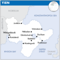 Map of Yien.png 2,000 × 2,000; 86 KB
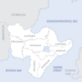 Map of Yienite provinces.png 2,000 × 2,000; 58 KB
 Map of Youtabonia.png 297 × 354; 18 KB
 Map of Yuropa.png 295 × 281; 20 KB
 Map of Zekistan.png 708 × 707; 109 KB
 Map-of-Mahdah.jpg 251 × 208; 23 KB


&filefrom=Map-of-Vanarambaion.png#mw-category-media)