File:Political map of ceris.jpg
Jump to navigation
Jump to search

Size of this preview: 800 × 444 pixels. Other resolution: 2,135 × 1,185 pixels.
Original file (2,135 × 1,185 pixels, file size: 593 KB, MIME type: image/jpeg)
Summary
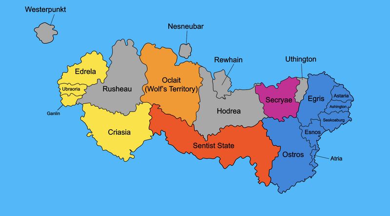
A political map of Ceris. Blue = North Adlantic Union Purple = Aligned with Tagmatium Yellow = West Ceris Federation Orange/Red = Aligned with Sentism Grey = Unaligned States
File history
Click on a date/time to view the file as it appeared at that time.
| Date/Time | Thumbnail | Dimensions | User | Comment | |
|---|---|---|---|---|---|
| current | 17:22, 13 February 2022 | | 2,135 × 1,185 (593 KB) | Seylos (talk | contribs) | A political map of Ceris. Blue = North Adlantic Union Purple = Aligned with Tagmatium Yellow = West Ceris Federation Orange/Red = Aligned with Sentism Grey = Unaligned States |
You cannot overwrite this file.
File usage
The following 2 pages use this file: