Hartridge (Freedonia)
Hartridge | |
|---|---|
City-County | |
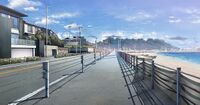
From Top to bottom: Hartridge CBD (Downtown Hartridge), Spring Canal Neighborhood, Spring Canal Neighborhood during a rainstorm, Lake Hannah Recreational Area during the day, Lake Hannah Recreational Area during the night, Hartridge Botanical Gardens,Hartridge Greenbelt Park, Hartridge Central High School, Hartridge University campus, Residential street in the Flowerland Neighborhood, M1 Freeway in Hartridge, Lakeshore Neighborhood | |
| Nickname(s): Spring City, Garden City, City of Opportunity | |
| Country | Freedonia |
| Region | South Sutherland Region |
| Founded by | Cornell Hartridge |
| Government | |
| • Mayor | George Wright (PDP) |
| Area | |
| • City-County | 520 sq mi (1,300 km2) |
| • Land | 434 sq mi (1,120 km2) |
| • Water | 86 sq mi (220 km2) |
| • Urban | 110 sq mi (300 km2) |
| • Rural | 324 sq mi (840 km2) |
| Elevation | 390 ft (120 m) |
| Population (2015)770,000 people live in the Hartridge Metropolitan Area | |
| • City-County | 263,000 |
| • Density | 2,391/sq mi (923/km2) |
| Population Density based on City Land Area | |
| Demonym | Hartridgeain |
| Time zone | Freedonia Time |
Hartridge also known as Hartridge City is the largest city and capital of Southland. It is the nation's largest city. Hartridge is known for its natural beauty, lake shore, beach shore, mountain, and forest views. Hartridge University is located in the city. Hartridge has a population as of the 2022 census, of 618,000 people living in the Municipality. 1.7 million people live in the Metropolitan Area of Hartridge. Hartridge is located on an narrow area between Lake Hannah and the (Hartridge Bay) Toyana Ocean. With the Spring Canal connecting the two bodies of water.
History
Geography
The City County of Hartridge is the smallest county by land area in Southland. Located between Lake Hannah, Hartridge Bay which opens up to the Cantalle Ocean, and the Southerland Mountains. The city rapidly rises from sea level to 120-220 feet in elevation. In some places on the north and south ends of the city, hills reach elevations of 560 to 980 feet.
Lake Hannah is the largest lake in Freedonia at 182 square miles. Of which 48 square miles of the lake is owned by the Hartridge Municipality. The Municipality also faces Hartridge Bay which is 690 square miles in area. The Municipality owns 114 square miles of the bay. The remaining area is divided between the greenbelt and the urban area. The Urban Area is 290 square miles. 18 miles east to west in length. And 16.12 miles north to south in width.
Outside of this area to the north is the Hartridge Greenbelt Park, at 128 square miles. It is mountainous and heavily forested. The greenbelt is home to the tallest mountain in the city at 2,300 feet in height. Most hills and mountains in the greenbelt are between 1,800 and 2,300 feet.
In 1973 the Spring Canal was completed, connecting Lake Hannah and Hartridge Bay. The Area prior to this was well known for flooding during heavy rainfall as well as flooding from Lake Hannah overflowing it's banks. The area as a result was left as a natural flood plain, dividing the northern and southern parts of the city. The Area was raised from a elevation of 29 feet to 63 feet during the 1980's. The area during the 1990's was developed into a mixed use area of high density commerical and housing.
Uptown and Downtown Hartridge was built along the new lands. The Central Business District is located along the banks of Spring Canal and the Bayshore. The city is still at risk of flooding, though not to the extent prior to 1973.
Climate
Hartridge has a mild Oceanic Continental Climate. The city experiences plenty of rainfall evenly distributed throughout the year. Warm to mild temperatures are common. The city receives on average 52 inches of rainfall each year. With 160 days of precipitation recorded on average each year. With a summer wet season lasting from December to March. As a result of sitting between two bodies of water, the temperatures are milder and conditions are humid throughout most of the year than the surrounding suburbs and rural areas.
A record high of 93°F was recorded on January 18, 1998 at the height of a 7 day stretch of 86°F+ temperatures. A record low of 6°F was recorded on July 5, 2003. The wettest month was January of 1992 with 16 inches recorded. The driest month was March of 2018 with 1 inch of rainfall. The wettest year was 1934 with 100 inches of rainfall recorded. The driest year was 2016 with 28 inches of rainfall.
Heatwaves are considered when temperatures reach or exceed 86°F in the city for 3 days or more. A coldwave or cold snap is declared when temperatures are 10°F degrees below the average high temperature for 2 days or more. Snow is common, happening every winter, 21 days per year, 42 inches of snow are reported on average each year. The heaviest snowfall dropped 20 inches of snow in July of 1993. The most snow recorded in a year was 75 inches in 1993. The least amount of snow recorded was in 2020 at 9 inches.
| Climate data for Downtown Hartridge, North Region, Freedonia, 1991–2020 normals, extremes 1944–present | |||||||||||||
|---|---|---|---|---|---|---|---|---|---|---|---|---|---|
| Month | Jan | Feb | Mar | Apr | May | Jun | Jul | Aug | Sep | Oct | Nov | Dec | Year |
| Record high °F (°C) | 106 (41) |
107 (42) |
102 (39) |
97 (36) |
93 (34) |
86 (30) |
81 (27) |
83 (28) |
88 (31) |
95 (35) |
101 (38) |
104 (40) |
107 (42) |
| Average high °F (°C) | 77 (25) |
77 (25) |
74 (23) |
70 (21) |
67 (19) |
64 (18) |
62 (17) |
62 (17) |
64 (18) |
68 (20) |
72 (22) |
75 (24) |
69 (21) |
| Average low °F (°C) | 63 (17) |
62 (17) |
59 (15) |
55 (13) |
52 (11) |
48 (9) |
45 (7) |
45 (7) |
47 (8) |
50 (10) |
55 (13) |
58 (14) |
53 (12) |
| Record low °F (°C) | 50 (10) |
49 (9) |
45 (7) |
42 (6) |
37 (3) |
33 (1) |
29 (−2) |
27 (−3) |
32 (0) |
38 (3) |
44 (7) |
48 (9) |
27 (−3) |
| Average precipitation inches (mm) | 4.71 (120) |
4.53 (115) |
3.28 (83) |
2.27 (58) |
2.78 (71) |
2.56 (65) |
2.23 (57) |
2.28 (58) |
2.53 (64) |
2.33 (59) |
3.38 (86) |
4.26 (108) |
37.14 (944) |
| Average precipitation days (≥ 0.01 in) | 15 | 14 | 12 | 10 | 10 | 9 | 10 | 9 | 10 | 11 | 12 | 14 | 136 |
| Source: Freedonia Weather Service | |||||||||||||
Parks and Gardens
Demographics
| Historical population | ||
|---|---|---|
| Year | Pop. | ±% |
| 1830 | 900 | — |
| 1840 | 2,000 | +122.2% |
| 1850 | 3,000 | +50.0% |
| 1878 | 12,000 | +300.0% |
| 1882 | 18,000 | +50.0% |
| 1910 | 36,000 | +100.0% |
| 1920 | 48,000 | +33.3% |
| 1930 | 68,000 | +41.7% |
| 1932 | 70,000 | +2.9% |
| 1939 | 78,000 | +11.4% |
| 1958 | 122,000 | +56.4% |
| 1978 | 207,000 | +69.7% |
| 1992 | 260,000 | +25.6% |
| 2002 | 303,000 | +16.5% |
| 2015 | 368,000 | +21.5% |


