Prosperity Hills
| Prosperity Hills | |
|---|---|
Oretai Osaiqa | |
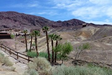
 The former Arka Silver Mine | |
| Highest point | |
| Elevation | 1,701 metres (5,581 ft) |
| Geography | |
| Location | Rezat, Trellin |
The Prosperity Hills (Trellinese: Oretai Osaiqa) are a mountain range in southwest Rezat, in Trellin. Bounded in the west by the Petakha and in the east by the floodplain of the Etsakha, the Prosperity Hills are the source of several minor rivers, including the Etsakha's tributary the Buloth and the Mozpolirqi, a tributary of the Petakha. Silver was discovered in the mountains in 1849, and in the next few decades became a cause for large-scale immigration to the region in the Rezati Silver Rush.
History
During the Rezati Silver Rush, the richly argentiferous but otherwise infertile Parched Hills (Oretai Pekkig) were renamed the Prosperity Hills in tribute to the wealth they brought hundreds and possibly thousands of migrants. Numerous mines were established in the region between 1849 and 1886, Trellin's longest silver or gold rush, including the Arka Silver Mine and the city of Kalku. The importance of the region to the Rezati economy led to Halith, a new city, being elevated to the status of provincial capital. Severe floods along the Etsakha and Buloth subsequently saw Halith's destruction, though the city retained its title as provincial capital when rebuilt on more solid ground.
Silver mining declined in the region from 1882 and was only a minor contributor to the provincial economy by 1890 as surface finds dried up. Sites such as Arka Mine became depopulated ghost towns in the wake of the silver rush, although some were revitalised as tourist sites in the late 20th century. Mining of subsurface deposits was renewed in the 1970s in some locations and continues today.