Kilalurak
This article is incomplete because it is pending further input from participants, or it is a work-in-progress by one author. Please comment on this article's talk page to share your input, comments and questions. Note: To contribute to this article, you may need to seek help from the author(s) of this page. |
Kilalurak Monarchy ᑭᓚᓗᕋᒃ
(Kilalurian) | |
|---|---|
| Motto: '"ᓄᕙᒨᒃ, ᒉᕉ, ᓇᕘ ᐊᒃᒃᒥᒨᓛᓈᔾ!" To be Free, To be Great, We Will Not Fall! | |
| Anthem: Praise, for us and all. | |
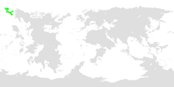 Kilalurak highlighted in green. | |
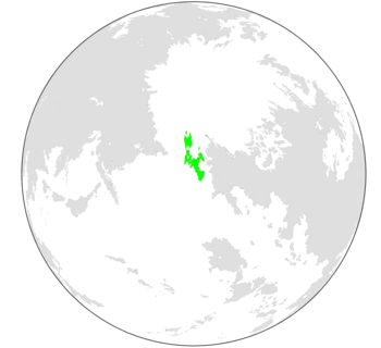 Kilalurak as seen on a globe. | |
| Capital and largest city | Mianuuva (ᒥᐊᓅᕙ) |
| Official languages | Kilalurian, Zhenian |
| Recognised national languages | Muuvaguiikkian, South Kilalurian |
| Ethnic groups (2014) |
|
| Religion | See Religion in Kilalurak |
| Demonym(s) | Kilalurian |
| Government | Federal Constitutional Elective Monarchy |
• Nanuuk | Miikijukk J. Ukpak |
| Establishment | |
• First settlers arrive in Kilalurak | 2500 BC |
• Kilalurak establishes borders | 344 AD |
• Zhenians arrive in Kilalurak, Kilalurian civil war begins | 1520-1921 AD |
• Tuktuu treaty signed | 1929 AD |
| Area | |
• | 439,959.92 km2 (169,869.47 sq mi) |
• Water (%) | 6.7% |
| Population | |
• 2020 estimate | 724,974 |
• 2019 census | 723,531 |
| GDP (PPP) | 2016 estimate |
• Total | $2.706 billion |
• Per capita | $60,911 |
| Gini (2015) | 22.1 low |
| HDI (2018) | 0.5512 medium |
| Currency | Kilalurian Sivinik (ᙟ) (KLV) |
| Time zone | UTC-11:00, -10:00 |
| Date format | dd-mm-yyyy |
| Driving side | right |
| Calling code | +474 |
| ISO 3166 code | KL |
| Internet TLD | .kl, .kila, .klrak, .krk |
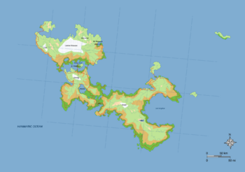
Kilalurak (Kilalurian: ᑭᓚᓗᕋᒃ), also known as Kilalurak Monarchy (Kilalurian: ᑭᓚᓗᕋᒃ ᒧᓇᕐᒃᑮ) is a Federal Elective Monarchy consisting of 9 provinces across 6 separate islands and land-masses, as well as 4 metropolitan areas. Kilalurak is located in northwest Veharia, and spans across 439,959.92 km2 of land over both North and South Kilalurak, Kisil Island, and other Provinces of Kilalurak. Kilalurak is, at this moment, the largest island nation on Earth. Kilalurak is situated next to the Kilalurak Passage, the Suukk Strait separates the North and South Kilalurian Islands, and the Kisil Strait separates Kisil Island and North Kilalurak.
Traces of human influence on Kilalurak go back roughly 21,000 years when humans crossed the Bersius land bridge from northeastern Tarsis to northwestern Veharia. Early settlers on Kilalurak named the islands after the shape of the western coastal mountains on the North Kilalurak Island which resemble a large whale, which, when translated into Kilalurian, comes out as "Kila-(large/great) -lurak (whale). During its early days, the recognizable mountains served as a landmark for passing travelers. After the land bridge connecting Tarsis and Veharia sunk into the ocean, Kilalurak was primarily a fishing and whaling settlement, its waters being home to several rare/endangered whales and other marine life native to the arctic waters. Traces of Kilalurian peoples have been found as far east as modern-day Florencia and as far south as mid-Veharia. Its first king, Liikamuungui Siinnguiung (Kilalurian: ᓖᑲᒨᖑᐃ ᓰᓐᖑᐃᐅᖕ), declared the first borders of Kilalurak. These borders remain the same to this day.
During the early 1500's, Zhenian ships arrived on the North Kilalurian shore. Zhenians, introducing Kilalurian natives to their religion, cultures, weapons, etc., settled mostly on Kisil Island, using it as a port for passing Zhenian ships. This port later turned into a whaling industry. Zhenians also settled on the North and South Kilalurak, as well as other small islands such as Piik Island, Isle of Suukk, and other small southern islands. This further introduced Zhenian customs to Kilalurian natives. This sparked conflict between the North and South Kilalurian islands, North Kilalurians wanting to accept the new culture, and South Kilalurians strongly opposing these new customs. These conflicts got worse as more Zhenian immigrants arrived and settled on South Kilalurak. Just one year after the Zhenians arrived in Kilalurak, South Kilalurak seceded from Kilalurak, starting its own nation, South Kilalurak. Its new king, Najiim Nauja, ordered that all South Kilalurians kill every non-Kilalurian residing within South Kilalurak. This included half-Kilalurians, as well as Women and Children. This massacre is known as The Great Zhenian Slaughter, or The South Kilalurian Massacre. On January 12th, 1921, the Kilalurian Civil War began. This lasted for almost 10 years, the Tuktuu Treaty being signed on November 30th, 1929, reuniting North and South Kilalurak one again. Evidence of this war can still be seen today, examples include some South Kilalurian schools not accepting any foreign students, small businesses not allowing non-Kilalurians, and some jobs not hiring non-Kilalurians. Evidence of The Great Zhenian Slaughter is also censored from South Kilalurian internet.
Now, Kilalurak is home to almost 725,000 residents across 4 separate islands. Its capital, Mianuuva, is home to around 223,000, and its second largest town, Subek, is home to just over 120,000.
Etymology
The word Kilalurak comes from the Kilalurian words of "Kila", which translates to great/large, and "Lurak", which means whale. It is believed that the name comes from the large coastal mountains along the coast of eastern North Kilalurak, which have the appearance of a portrait view of a large whale. The two words, "Kila" and "Lurak" were combined into one word at an unknown time, but records show it was some time between 100 BC and 344 AD. This was likely for ease of writing or saying. While the word "Kila" still remains as a commonly used word (although pronounced differently), the word "Lurak" is now seen as outdated and is used rarely in casual conversation. The word "Kkin" is now used in its place.
The name Kila lurak has been found in the logs of passing ships for multiple centuries before the first arrival of the Zhenians, the earliest records of the islands themselves being first recorded on an unknown date in 983 C.E., and the earliest records of the romanized version of Kila lurak was first discovered in the log of a passing merchant in the year 1486.
History
Main Article: History of Kilalurak
The oldest evidence of human presence on Kilalurak was discovered in Kkuuijlannu Cave off the coast of North Kilalurak. The evidence in question was cave paintings indicating polar bears, whales, and mountains, human teeth, and a small sculpture of a human carved out of a walrus' tusk. The teeth and sculpture have since been put on display in the National Kilalurian Museum of History and Sciences in Mianuuva. Cave tours of the Kkuuijlannu Cave have the cave paintings on display for the paying public. Since this time, Kilalurak has been involved in little tribulations or conflicts with other nations.
First settlers arrive, early Kilalurian life
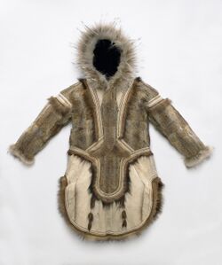
Around 20,000-23,000 years ago, settlers arrived on the west coast of Kilalurak, naming the island for its unique coastal mountains. The islands were primarily used as a landmark for passing travelers before the Bersius land bridge sank. Early settlers were likely fishermen and whalers, as well as hunters and shepherds. People who could not do these jobs created large fur coats, crafted Risilii (a small, intricate, and likely ornate craft, typically made from hardened animal leather or paper), or sculpted ornate sculptures from walrus tusk or rock. Seeking warmer temperatures, people traveled from the west coast of North Kilalurak to the East coast where the climate is warmer.
At the same time, settlements also sprang up on the Suukk Strait, the Siksilakk Nuuvmuuk peninsula, and the Isle of Suukk. It is also believed that the first settlement on South Kilalurak was inhabited during this time. As the population of Kilalurak steadily increased, travelers settled on the sparse habitable zones along the coast of Kilalurak, making it to the very eastern end of Kilalurak by the year 1 AC. The population of Kilalurak at this time was at least 500 and the most 1,000. Traveling Kilalurians traveled beyond modern-day Kilalurak and into northern Veharia. These settlers reached as far as modern-day Florencia before their path became unknown. Piik Island was also inhabited at this time, as well as the Kisil and Southern Islands.
Kilalurak becomes a monarchy
In the year 342 AD, Liikamuungui Siinnguiung, a fisherman from Kilaava, South Kilalurak, had started to walk from settlement to settlement, announcing his idea for a "leader to lead all people". This journey lasted for 6 months, his followers also being encouraged to spread the word on their own. Siinnguiung traveled on the back of a muskox, and delivered gifts along with his words to the establishments he visited. The gifts given included clothing, seeds for crops, and small sculptures, believed to carry the soul of the person who crafted it.
Siinnguiung's plan eventually worked, his supporters considering him to be the "Great Nanuuk", the word traditionally being a religious figure said to resemble a large, spiritual polar bear or a person who is the "polar bear master", controlling all polar bears in the world. After gaining national recognition, Siinnguiung gave orders and speeches by sending his followers to spread the word to all of Kilalurak. One of Siinnguiung's first orders was to set the borders of Kilalurak, which remain the same to present day. Siinnguiung also invented and produced an early version the Kilalurian Sivinik, known then as the "Sivnu Lukarajuk" or "Sivnu Bead", Sivnu being the name of Siinnguiung's domesticated muskox, his prized companion.
Siinnguiung is also said to have built a port town by himself, carved 10,000 sculptures in 1 day, and other outrageous claims. When Siinnguiung died in 365 AD, one of his followers, Jaak Naujii, became the second Nanuuk, carrying on the tradition of bringing his word to the land via travelling by muskox. The tradition of travelling across Kilalurak to spread word of a governor campaign stays true to this day, most campaigners traveling by muskox or horseback, their followers cheering them on as they pass by.
Zhenians arrive
Kisil Island
Most Zhenians settled on the eastern shore of Kisil Island, their settlement, Subek, being primarily used as a dock for passing Zhenian ships. After the Kilalurian Civil War, the Tuktuu Treaty ceded Kisil Island to Zhenia. As a result, population on Kisil Island, primarily Subek, skyrocketed.
After the end of The Second Great War, Zhenia, having lost the war, ceded Kisil Island back to Kilalurak. Kisil Island's citizens regained Kilalurian citizenship and the territory was once again counted as that of Kilalurak. 10 years after The Second Great War, Kisil Island gained Provincial status, it becoming the seventh province out of eight.
Kisil Island still holds the second most populated city in Kilalurak, the population of the island being at around 124,000. Kisil Island is also home to one of the most northernmost cities in the world, Niksaluk.
Civil War
Main Article: Kilalurian Civil War
After the first Zhenians began to inhabit and settle on Kilalurian lands, their cultures and customs began to leak into daily Kilalurian life. As the numbers of Zhenian and half-Zhenian populations rose in both North Kilalurak and South Kilalurak, opinions of these new ways of life began to circulate. While most North Kilalurians tended to accept the change in culture, Tensions between North and South Islands began after most South Kilalurians revolted the idea. After 10 months of increasing tensions, The current Nanuuk of Kilalurak at the time, Asiñal Tuktuu, formally announced and asked the Kilalurian people to accept the Zhenians into their towns and homes peacefully, and that the country of Kilalurak would accept any Zhenian settlers wanting to live within their country. This further angered South Kilalurian traditionalists. On December 18th, 1520, Najiim Nauja, South Kilalurian governor and Kilalurian traditionalist, declared that South Kilalurak was to secede from the nation of Kilalurak as a whole.
After seceding, Nauja went dormant for one month, not communicating with anyone outside of his wife, Laiika Nauja. This caused outrage within the South Kilalurian populace, and crowds swiftly began to form outside of Nauja's home in Iñuk, South Kilalurak, thinking that he had abandoned the people. On January 18th, 1521, Nauja emerged on his home's balcony and was greeted with thrown items and insults. Nauja declared the plan to remove all Zhenians and half Zhenians from South Kilalurak, and that all Kilalurian men and women help participate in removing them. This order stayed in place for 5 days before Nauja, being unsatisfied with the amount of Zhenians successfully removed, ordered that all Kilalurians within able to kill all Zhenians on sight. This included half-Zhenians, women and children. 2 days later, exactly one year after the first Zhenian ships arrived, Tuktuu declared war against South Kilalurak. Nauja's plan of removal was unsuccessful, only 312 Zhenians of the approximated 800 living in South Kilalurak were successfully removed by South Kilalurian forces, the rest of them fleeing uninjured to North Kilalurak and the Isle of Suukk.
On November 1st, 1529, Nauja was killed by an unnamed North Kilalurian soldier. The next day, South Kilalurak was successfully annexed by North Kilalurak. On November 30th, 1529, the Tuktuu Treaty was signed by Tuktuu and Nauja's second-in-command, Kilil Iskiluk. This reunited North and South Kilalurak. The Tuktuu treaty also ceded Kisil Island to Zhenia. The anti-foreigner policy after the Treaty of Tuktuu resulted in higher concentration of foreigners (mostly Zhenians) on Kisil Island, a trend that continues to this day. Subek would grow to be the second-largest city in the nation, all while it becomes a stopping point for Zhenians traversing the Hanmaric Ocean.
Effects of this civil war are seen to this day, as some Kilalurian traditionalists do not allow non-Kilalurian to enter their businesses or to enter schools. See Racism in Kilalurak.
WWI
WWII
Geography
Kilalurak is situated between the Hanmaric Ocean and the Arctic ocean, its two straits and the Kilalurak Passage being an often used trade route. The entirety of the North island is within the Arctic Circle, while the South island is just south of it.
Kilalurak is one of the largest Island Nations in the world, and it spans over 439,959.92 km2. Kilalurak has 5 islands not under their own administrative district; including the lightly populated Piik Island, Numka Island, Southern Islands, and Pakloruk Island. Kilalurak also embodies 4 other islands who are considered their own province, and 1 province which is connected to mainland Veharia. Lakes and glaciers cover roughly 13.5% of Kilalurak territory, and vegetation only grows on roughly 26.89% of the land owned by Kilalurak.

Kilalurak's closest neighboring landmass is Veharia, it's second closest landmass being northeastern Tarsis. While being closer to Veharia in proximity, during the early 1500's to early 1600's, Kilalurak had most influence from regions within Tarsis rather than Veharia, and was considered as part of Tarsis as late as the early 1700's. Kilalurak's coastlines are known to have steep cliffs, sea stacks up to 50 meters in height, and most commonly fjords, which are seen often along Kilalurak's rocky shores. Kilalurak is home to at least 5 major glaciers, and as many as 20 more smaller glaciers scattered across Kisil Island, North Kilalurak and Muuvaguiikk. Kilalurak's largest glacier, Liakñuk Kilasuuk, named after Nanuuk Lakk Liakñuk, takes up around 30-40% of North Kilalurak's total landmass.
While not on a geological fault, Kilalurak is home to 15 extinct volcanoes, 2 dormant volcanoes, and 3 active volcanoes. The most recent eruption of any volcano on Kilalurak was in 1999 during the 1999 Nuuqininging Volcanic Eruption, which effected most of North Kilalurian settlements, including capital city Mianuuva, as well as northern parts of South Kilalurak. While not expected to erupt any time soon, Mt. Mianuuva, the neighboring volcano of Kilalurak's most populated city, is in an active state, and has been seen bellowing smoke. Records show that the last time Mt. Mianuuva erupted was in 1504, in which drawings and sketches depicting what happened were enscribed on murals and written about in journals. While records vary, it is approximated that 31 were injured and 4 died.
There are an approximated 41 major rivers spanning throughout Kilalurak, and can be seen at List of Kilalurak Rivers. Kilalurak's coast is home to most settlements and cities, the interior regions of Kilalurak, also known as the Kilalurak Bluffs, being taken up by harsh climates mostly unsuitable for life. Land here is covered in rocky cliffs, ice, and glaciers. Kilalurak's largest settlement is Mianuuva, followed in a close second by Subek on Kisil Island, followed by Iñuk, South Kilalurak, and Sut Paturik, Isle of Suukk. The town of Niksaluk is Kilalurak's most northern settlement, located on Kisil Island. Kilalurak is also home to the northernmost capital city in the world, Mianuuva. Kilalurak takes pride in its environmental program, in which it is listed as the 9th most environmentally friendly country in the world according to a study done in 2013.
Landscape
Lukmal Falls in South Kilalurak.
Mianuuvan Mountains reflecting into Valisik Bay.
Climate
The coasts of North Kilalurak are subarctic, as well as the majority of South Kilalurak, and situated on the very south coast of South Kilalurak are subpolar oceanic climates. The majority of North Kilalurak is taken up with tundra climates, as well as Kisil Island and Muuvaguiikk. Within North Kilalurak's inland, there are sprinkles of ice cap climate, and Kisil Island is 30-40% ice cap climate. The climate within Kilalurak varies dramatically, with the south and east coasts generally being warmer, wetter, and windier, and the east and north coasts being colder and more inhumane. The highest recorded temperature on Kilalurak was in 1977 when the town of Lukmal reached 33.3°C (91.94°F). The lowest recorded temperature was in Niksaluk, Kisil Island, where the temperature reached a low of -43.9°C (-47.02°F) in December of 1933.
| Climate data for Takpul National Airport | |||||||||||||
|---|---|---|---|---|---|---|---|---|---|---|---|---|---|
| Month | Jan | Feb | Mar | Apr | May | Jun | Jul | Aug | Sep | Oct | Nov | Dec | Year |
| Record high °F | 21.6 | 27 | 30 | 31.4 | 35.6 | 47.1 | 58.9 | 60.1 | 46.2 | 42.2 | 27.4 | 19.9 | 60.1 |
| Mean maximum °F | 16.8 | 24 | 25.7 | 26.1 | 28.7 | 34.78 | 50.1 | 52.2 | 33.3 | 29.2 | 19.9 | 9.7 | 52.2 |
| Mean minimum °F | −9.2 | −1.0 | 7.7 | 12.1 | 12.9 | 23.1 | 33.9 | 39.9 | 27 | 14.4 | −2.6 | −10.1 | −10.6 |
| Record low °F | −9.2 | −1.0 | 7.7 | 12.1 | 12.9 | 23.1 | 33.9 | 39.9 | 27 | 14.4 | −2.6 | −10.1 | −10.6 |
| Record high °C | −5.8 | −3 | −1 | −0.3 | 2.0 | 8.4 | 14.9 | 15.6 | 7.9 | 5.7 | −2.6 | −6.7 | 15.6 |
| Record low °C | −22.9 | −18.3 | −13.5 | −11.1 | −10.6 | −4.9 | 1.1 | 4.4 | −3 | −9.8 | −19.2 | −23.4 | −23.7 |
Plants

While Kilalurak's plant life only covers roughly 27% of its landmass, it is host to many exotic and endangered plants and fungi. It is classified as a nation within the Boreal Kingdom. Most of the inland parts of the island are barren of any vegetation due to the high snow levels of the region. Along the coasts of the region, grass and trees grow freely, the grass being grazed by livestock and the trees used as lumber. The trees growing in Kilalurak vary, the majority of which are Birch trees and Aspen trees, as well as rowan trees, willow trees, common juniper trees, as well as other small subspecies and communities of vegetation.
Fungi, particularly Basidiomycota, grows commonly throughout the southern regions of Kilalurak, as well as Lichen, and other fungi. Currently there are just over 770 different fungal species inhabiting Kilalurak, the most northern fungi growing in parts of Kisil Island.
Records show that at one point in time, trees and other plant life grew on up to 45% of land on Kilalurak, and is quoted as being "The forest of the north" by famous poet Lukas Laovale in 1810. The forest regions in Kilalurak have subsided dramatically due to deforestation and other human influences. The trees were mainly exploited for lumber, firewood, and building materials. This, as well as disrupting the ecosystem, displaced and, in some cases, brought extinction to species native to Kilalurak.
Since 1950, environmental campaigns to replant forests have gone underway and brought back 10% of the lost forests. The trees grown are mainly birch trees and common juniper trees, those being the easiest trees to replant within the region. Although these campaigns were successful, it has not grown the amount of trees back which were lost. Soil erosion is also a severe issue within the lands of Kilalurak, which influences 1/3 of Kilalurian soil. This influences the stability and reliability of agriculture and crops throughout Kilalurak, most notably southern to southeastern Kilalurak, as well as Mianuuva and other regions around that area.
Animals
Main Article: Wildlife in Kilalurak
Currently, there are only 4 mammals known to be indigenous to Kilalurak. These animals are the arctic fox, which most likely walked across the frozen sea from Veharia to Kilalurak during the last ice age, the muskox, who's path to Kilalurak is likely the same as the arctic fox, as well as the barren-ground caribou and the polar bear. There are currently no wild or free-living amphibians or reptiles residing in Kilalurak. Birds such as the Veharian Kestrel, Veharia Goose, and other birds do not live in Kilalurak, but visit annually during breeding season.
Animals living in Kilalurak are chickens, Kilalurian sheep, Kilalurian Horses, yak, cattle, goats, and the Kilalurian sheepdog, all descendants of animals brought by Zhenia. Wild mammals include mice, mink, rabbits, and reindeer. Marine life in Kilalurak includes walrus', seals, whales, and other fish.
There are 1,130 species of insects living on Kilalurak, which is comparatively low as opposed to the million to 2 million species living in more southern regions. Kilalurak has had no mosquitoes since 1865.
Fish living in the harbors of Kilalurak are diverse in species and large in population. fishing is an important Kilalurian industry, accounting for most famous Kilalurian dishes and cuisines. Birds such as the seagull fly near the south Kilalurian coast, and puffins nest on the coasts of rocky beaches. Whale watching is an important industry in Kilalurak, as well as whaling and other scientific whale hunts.
Environmental Issues
The most prevalent issue in Kilalurian environments is the warming of temperatures. This, along with other reasons, is causing the rapid melting of Kilalurian glaciers. The most notable example of this issue is the Valing Cap or just Valing. This glacier existed up until 1977, the year in which the Valing Cap completely melted. Other glaciers have shrunk significantly in recent times, the second most notable example being the "Liakñuk Kilasuukk" glacier, the largest in the country. The glacier, now restricted to many kilometers inland, once touched the Hanmaric Ocean.
The second most difficult issue is the deforestation of the few large forests in Kilalurak. While the forests are recovering the deforestations in Kilalurak, the large number of vegetation lost is largely unrecoverable, as well as the multiple extinct species whose home was the forests mentioned.
Politics and Government
Kilalurak is a federal constitutional elective monarchy. The head of state is known as the Nanuuk, a term used for "bear master" in ancient Kilalurian religions. As of 2020, the Nanuuk of Kilalurak is Miikijukk Jiivisivik Ukpak, the former governor of the Isle of Suukk. The Nanuuk is elected to a 10-20 year term by and from among the nine leaders of the Kilalurian Provinces. After one of the nine provincial leaders wins the title of Nanuuk, their old position as governor is resigned to someone else. After the term has ended, the former Nanuuk is required to not work any other jobs and to retire. The position of Nanuuk was held by Lupluk Makmuluk until 2012, in which he retired from his position.
Current Nanuuk Ukpak has been in office for 8 years, his 15th anniversary being on February 20th, 2020. The Nanuuk's power has decreased in range of power due to a change in the constitution in 1956, but still remains as the most powerful role in Kilalurian Politics.
Administrative Divisions
Kilalurak is a federation of eight provinces and one federal territory. These are divided into 5 regions, one province being on Kisil Island, one province and one federal state on North Kilalurak, one province being on the Isle of Suukk, one province being on Muuvaguiikk, and four provinces being on South Kilalurak. Each state is then divided into the smaller divisions called Naquk.
Governance in the states falls within local government voted on by the people, federal territories being governed by the Nanuuk themselves. Each state has a unicameral Kilalurian State Assembly whose members are picked and elected from single-member constituencies, the seats of which are appointed directly from the Nanuuk. State governments are controlled by the governor who are state assembly workers from either party in the assembly. In each state, the governor is usually required to be a native Kilalurian, but after Min Chong-Su, a native Zhenian, won the seat of governor of the Namavu province in 1978, as well as the current governor of Kisil Island, Han Chong-Ho, also a native Zhenian, views on such requirements have been debated. The elections for governor are held usually at the same time as the election for the national leader, but they may also happen if a current governor retires due to age or health problems.
Law and Law Enforcement
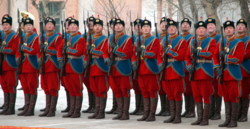
Each province within Kilalurak owns their own standing police force, usually composed of 20-50 men. The largest police force is the Mianuuvan Police Force, composed of 49 men as of April 2020. The smallest police force is the Muuvaguiikkian Police Force with just 13 police officers.
While police force is not regularly exercised, the main job of police officers are traffic stops and check-ups. Police officers are required to know CPR, first aid, and how to identify multiple diseases and symptoms. In most states the police force works in the same building as hospitals and urgent care buildings. On July 16th of every year, there is a National Parade of Kilalurian Police and Military, known more commonly as "Siksik day" (lit. safety day). The parade is to recognize the police force as well as the defense force working for Kilalurak.
In some states, there are corruption claims against the police force, mainly in reference to the 2005 killings of 25 sleigh dogs in Nauja, South Kilalurak. The deputy of the Nauja police force refused to believe the event even happened, refusing to look at evidence. Since this event, the Nauja and Piik Island police forces have been accused of the unnecessary killings of 5 other domesticated pets, unnecessary traffic stops, and rude manners. See Corruption in Kilalurian Police.
Military
Main Article: Military in Kilalurak
At the current moment, Kilalurak has no standing army, the Kilalurian Conscription program being disbanded in 1950. Kilalurak does however have a Kilalurian Coast Guard, as well as a Kilalurian Air Defense, both of whom maintain the Kilalurian Crisis Response Unit who are to support peacekeeping missions with other nations. The Kilalurian Crisis Response Unit, also known as the KICRU, also responds to natural disasters in nearby and allied nations, and is notable to have a very quick response time.
The Kilalurian Conscription, KICO, was created in 1911 in response to growing tension throughout Veharia. KICO was barely used during that time, their main use being to support Zhenian troops on Kisil Island with warm clothes and food. KICO was created in collaboration between Nanuuk Muvkui Kaluku and governor of Isle of Suukk Lalakul Vasuka.
Kilalurak currently has ~2,400 military personnel, taking pride in their elite training program.
Foreign Relations
Main article: Foreign Relations of Kilalurak.
Economy & Infrastructure
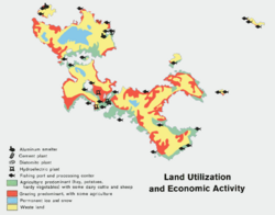
Up until the mid-20th century, Kilalurak was an exceedingly poor country. As of 2020, Kilalurak is one of the most developed countries in the world after a strong economic boom in 1951. Kilalurak has been rated 4th place for the highest quality of life in the world, and in 2020 Kilalurak was named among the top 10 most economically green counties in the world. Kilalurak's GDP per capita sits at a comfortable $60,911 USD. About 75 percent of total primary energy supply in Kilalurak is taken from domestically produced renewable energy sources, mainly through use of abundant hydroelectic and some geothermal power. Kilalurak also has one of the highest unemployment rates in the world, a problem which sprouted due to the 2000 and 2004 financial crisis'.
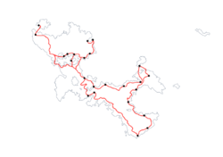
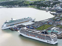
In the past, Kilalurak's economy depended on fisheries and whaling. While still mostly true today, tourism has taken the lead for economic growth, especially whale watching and road trip-like tours of Kilalurak's Roundabout Road, a stretch of road which wraps around Kilalurak's borders, stopping by all of Kilalurak's most populous and famous cities. Kilalurak is also one of many destinations visited by international cruise lines, Iñuk and Mianuuva being the most commonly visited ports with an average of 144 cruise liners visiting each year. On average, Kilalurak hosts over 1.7 million unique visitors annually, which is more than three times the native Kilalurian population.
Kilalurak is ranked at the 26th position in the 2016 index of Economic Freedom, among the freest in the world. According to the 2018 Index, Kilalurak is estimated to be the 13th most innovative country in the world.
Agriculture
Agriculture, especially animal farming, is an important part if Kilalurak's history and economy, making up about 19% of Kilalurak's workforce. One of Kilalurak's leading exports, fish, are caught along the many coasts of Kilalurak. The fish caught include salmon, sheefish, and glass eels. Zhenia and other Tarsan regions are Kilalurak's top buyers, Zhenia in particular importing most of Kilalurak's filets. Livestock farming, particularly sheep (for wool, meat. A more traditional livestock animal) and cattle (a newer animal is Kilalurak's history, used mainly for meat and cow milk), are the primary animals used in livestock farming, but poultry and pigs are also farmed on Kilalurak, although less prevalently. Although the extremely cool climate and slim growing seasons, Kilalurak is home to several food crops, most commonly potatoes, turnips, carrots, cabbage, cauliflower, etc. Other crops not usually able to grow during this season are grown in greenhouses powered by Kilalurak's hydroelectric power sources. Cocoa has also been grown using these methods, but not at a commercial scale. To support livestock farms, fodder crops, including grain, wheat, barley, and other materials are grown in farms. Grass is most commonly used as food for livestock, often being grazed in large, open pastures.
Kilalurak's cold climate has advantages, including the lack of insects and other crop-ruining animals. This, along with other reasons, causes pesticides to rarely be used, and, along with the long daylight hours and general lack of pollution, grass grows quickly, allowing for more livestock animals and easier grazing habits.
The first recorded agricultural farms dates back to roughly around when Kilalurak's first settlers arrived, most likely growing potatoes and keeping muskoxen for livestock and fur. These patters remained roughly the same until the early 1500's when Zhenians arrived, along with their farming techniques, animals, and seeds for food. At that time, every animals was strategically used in combination with their skills, sheep being able to graze outside during winter months and used for their wool, cattle being able to be kept inside for milk. Cattle was also eaten.
Energy
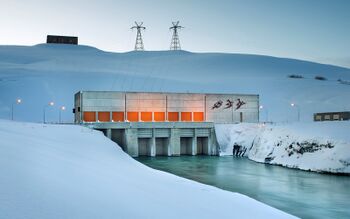
Kilalurak takes advantage of the many fjords riddling its coastlines, its primary source of power being hydroelectric power. Despite the cool weather, some rivers used in hydroelectric dams come from the nearby ocean, thus being salt water and unable to freeze. There are currently 5 hydroelectric dams in Kilalurak, the majority of which being in the Iñuk region, south of Lake Añisiluk due the abundance of rivers sprouting from glaciers.
Wind power and geothermal power is also used in Kilalurak, although not used often. Geothermal power generators are located near Mt. Mianuuva and Nuuqininging regions due the prevalent volcanoes. The largest wind farm in Kilalurak is located on the Siksilakk Nuuvmuuk, with a total of 527 wind turbines.
Kilalurak prides itself on its clean energy index: relying almost entirely from environmentally clean wind and hydro power. Because of Kilalurak's small populace, it one of the largest per capita importers of oil in the world. Kilalurak consumes 21,385 barrels per day (B/d) of oil as of the year 2016. Kilalurak is not one of the highest consumers of oil in the world as the power needed is not necessary, oil being used mainly for gasoline and other production of materials such as asphalt.
Transport
Main article: Transport in Kilalurak. See also: Airports in Kilalurak.
The modes of transport within Kilalurak has greatly increased in quality since the mid-20th century. Jasnuvik Company is the primary leader of this expansion, working hand in hand with Kilalurak's 5 Nanuuks since the economic boom. Transport in Kilalurak is largely obstructed and governed by Kilalurak's sparse population and rugged terrain. Little to no roads or railways reach into the Kilalurak Bluffs, the terrain being largely unusable and the result not worth the effort. The principle mode of transportation is by road. There is a large and ambitious railway stretching and connecting Kilalurak together, its construction being completed in 2011. There are also many bus services which are used nearly as often as personal cars. Transportation between two long-distance cities, for example Iñuk and Subek, can be done either by railway or by domestic flight. The only way of reaching the main island of Kilalurak is by flight or by sea. The majority of transportation infrastructure is located within Mianuuvan province and Kisil Island province, South Kilalurak province being in third place, the three of these areas home to nearly 2/3 of Kilalurak's population. More ambitious transportation projects are destined to occur in the near future, most probably including more highways within the islands.
Kilalurak's rail system encompasses 8,385km of total railroad tracks, not including the 346km of light rail tracks in the Mianuuvan province. Kilalurak's rail system is one of the most ambitious rail projects of all time, construction starting in 1975 and being completed in 2011. The rail system, known colloquially as "Namtivit Pusji" or "Caribou Railroad", connects nearly all populated cities within Kilalurak, as well as passing over the Suukk and Kisil Strait. The railroad was constructed and overseen by Jasnuvik Company. Mianuuva is also home to a light rail line known as "Kaknupalivik Mianuuvan". This railroad reaches all throughout the capital district and has 21 stops. Subek, while having no light rail system, has planned on building as such. These plans have not yet been achieved.
Kilalurak has 14,385km of road expanding across all nine of Kilalurak's provinces, only 7,295km of these roads being paved. All of these roads are publicly administered, and 90% of these roads were constructed and over viewed by Jasnuvik Company. Organized road building began in 1933 and has exponentially increased in size and production speed since 1951. 47.89% of Kilalurian road transport is by public transport and 53.21% of road transport is by personal vehicles.
Kilalurak is home to 100 airports, 4 of which are internationally recognized, serving 2.1 million customers via both domestic and international flight. Kilalurak's two largest airports are the Takpul National Airport in Mianuuva and the Iñuksinigvik Airport in Iñuk, South Kilalurak, both being the most well known for international travel and are subsequently some of the busiest spots in all of Kilalurak by number of flights and number of passengers. Kulak Air, (Kilalurian:"ᑯᓚᒃ ᕗᓂᖕᑯ") the nations flag carrier, is the national airline company and the only global airliner company originating and operating out of Kilalurak. Domestic flights dominate most of Kilalurian airspace, most commonly being used to fly from city to city or across bodies of water. Domestic flights are also used for sightseeing and tourism known as "Air Tourism".
Water transport is one of the cheapest and most widely used way of transporting non-human products, although ferries and other human transport boats are also just as important. Kilalurak is home to the northernmost harbor in the world located on Kisil Island in Subek, the second most populated city in Kilalurak. The Suukk Strait and Kilalurak Passage are popular trade routes, most particularly when transporting to Florencia's northern coast. Kilalurak is home to nine major harbor cities. Situated between the southern Hanmaric Ocean and north Hanmaric Ocean, Kilalurak is a popular and well used as a harbor and stopping point for passing traders.
Tourism
Tourism has been Kilalurak's leading industry since 1999, accounting for most of Kilalurak's economy as it is today. The most popular tourism attraction within Kilalurak is whale-watching, famous for its quantity of whales during mating season (March-July). Kilalurak is also famous for its unique and big holidays, the most popular parade being the Iknitit Race, or the Iknitit Nanuuk Race, visitors coming from around the globe to watch or participate in the event. Kilalurak is also known for its unique and flowing landscapes, as well as its species and people. The nation has also been host to several international sporting events, the last one being in 2009.
Healthcare

Main article: Healthcare in Kilalurak
Kilalurak has a universal healthcare system that is administered in part by the Nanuuk and the Minister of Health and is paid mostly by taxes (73%) and service fees (37%). Besides the capital city Mianuuva, as well as Sut Paturik and Subek, private hospitals are extremely rare, but private insurance is common.
Kilalurak ranks 14th place in health care expenditures as a percentage of GDP and 18th in spending per capita. Kilalurak's health care system is one of the best preforming and effective systems in the world as ranked by the World Health Care System (WHCS). Careers in the healthcare field rank as one of the most picked fields by Kilalurian students. As a result, there are 4.1 doctors per 10,000 people and 17.1 nurses per 10,000 people.
As ranked by the WHCS, Kilalurians are among the healthiest individuals in the world, with 78.5% of citizens reporting of good health in a 2018 survey. Kilalurak has one of the lowest obesity problems in the world, its citizens generally being skinny. As a result of this, Kilalurak is ranked 2nd to last place in obesity percentage per 1,000 people. Kilalurak is well known for its health campaigns and other advertisements for well being. As a result from abortion laws, infant morality is one of the lowest in the world, babies who risk the life of its mother or the child itself being terminated early by law. The number of smokers in Kilalurak rank slightly above average, a growing issue in Kilalurian health and daily life, a factor likely to take a toll on Kilalurak's current life expectancy of 80 years old, the 5th highest in the world. Also a result of abortion laws, Kilalurak has a high concentration of children with down syndrome, one of the highest in the world.
Due to its generally clean methods of energy and sparse population, Kilalurak's low level of pollution has great effects on Kilalurian life expectancy. Also thanks to general environmental awareness by Kilalurian citizens, Kilalurak has less toxic materials in its atmosphere than mostly any other developed country in the world.
Education and Science
Main article: Education in Kilalurak

The Ministry of Education and Science has full control over the Education system as well as policies and material that all schools use in Kilalurak. Schools with under 50 students, as well as kindergartens and preschools are administered by the Naquk or County in which it lies. Home schooling in Kilalurak is generally looked down upon by the national government, however; if the parent or guardian has a degree in teaching, the Ministry of Education and Science may grant the parent a teaching certificate upon application. Although being taught at home, children being home-schooled must still adhere to governmental education requirements and material.
Preschools, also known as Aska Kanior just simply Askas, is an optional school for children aged 5. The Aska Kani schools last for 3 years, the grade levels being known as Askas Lusta, Askas Sklustu, and Askas Sklusgani respectively. Mandatory school begins at age 7. Playschools, also known as Kani Gapul, were created in 2000 for children with working parents. The age range for these schools are 3-15, parents with children under 3 having mandatory leave from work.
Mandatory education, or Runggunatanlis, starts at age 7 and ends at age 15, comprising of 9 separate grade levels and 2 different school levels. A typical school year lasts for 9 months, starting on July 9th and completing on April 10th. The minimum number of school days in Kilalurak are 195, being increased from the 150 days in 1950. All public schools must have madatory lessons on Wuism, Vayonism, and Langism, typically being combined into one class known as Luksut, although exemption from this class may be achieved if an application is filed to the Ministry of Education and Science. The first school in the mandatory school system is ulugani with grade levels 1-6, followed by uluninus with grade levels 7-9. Optional collages known as ulupanggul are often taken by uluninus graduates. ulupanggul schools have 47 separate fields to graduate with, the full list of fields being at Fields of Education in Kilalurak. One individual may graduate with a maximum of 4 fields, qualifying for jobs within said field. Optional schools known as uluguktu take place after school and are available to students of all schools. uluguktu schools are for physical education and working out. uluguktu schools are to be made mandatory in coming years due to a change in material in education requirements in 2020. All schools in Kilalurak are mixed-sex schools.
An assessment in 2019 shows that 87% of Kilalurian citizens have an education, with 89% of said citizens graduating from uluninus schools and 60% graduating from ulupanggul. The average GPA of Kilalurian citizens is 3.5, or 117 in Kilalurian GPA calculations. Kilalurak's education system is considered to be excellent by the Board of Education.
With the exception of a few institutes, nationwide exams take place in all schools on the first week of October and the last week of March. There is also another test taken at varying times throughout the year. The test on the first week of October is known as the "Function and Brain Skill Level and Memory Test" or "FABSLAM" (ᓗᓐᓚᔅᑕ ᒋᑦ ᓂᒃᑕᑦᑭᕈ ᐃᓇᒐ ᑭᓐᑐ ᒋᑦ ᑐᒐᒃᓴᖕᒐ ᑲᖕᒍ) is to test the student on their reasoning, guessing, and memory, using international material used in several other countries. The test on the last week of March is known as the "School Material and Memory Test" or "kani sikta git tugaksangga" (KSGT). This test is the question the students on school material taught during the schools year. The "Inter-year Ulupanggal Test" or "gintari nil ulupanggal kanggu" (GNUK) is a test taken slowly throughout the school year in preparation for ulupanggal. There is also a test known as the "Tilin", known formally as "taksil lu nil" which is known for its difficulty and takes place at the end of grade 6 and 9. It covers all material taught during the past levels, the grade 9 Tilin being world renown for its extreme difficulty and is considered the "most difficult test in Veharia". The test dates back to 1900 when the test was created by Ritu Kivsiñut who also created most of school material and introduced the concept of school as a whole. The requirement of the Tilin has been under consideration many times, but has ultimately remained part of the required testing.
Demographics
According to the 2019 estimate, 500,639 people currently live in Kilalurak, and with a population density of 1.13 per km2, Kilalurak's population is very sparse. Due to early colonization, population on North Kilalurak is larger than any other Kilalurian region, even if most of the land on North Kilalurak is mostly uninhabitable. Its capital, Mianuuva, is settled at the juncture of habitable and uninhabitable land, a rare find in the northern regions of Kilalurak. Kilalurak's second largest city, Subek, Is nestled on a slim streak of vegetation off the western coast of Kisil Island. Its neighboring town, Niksaluk, is around 8 kilometers away from Subek, and defies all odds by being settled inside of a tundra climate. Most of the population of South Kilalurak is nestled at a river delta on the western coast of mid-South Kilalurak in region called "Iñuk". Iñuk is home to roughly 30% of South Kilalurak's population.
Kilalurak's population has had a steady incline for most of Kilalurak's history, pregnancy being seen as a slight taboo and a feat of dedication. The pattern of growth increased in the early 1500's due to oncoming Zhenian immigrants, raising the incline of birth rates per year as well as immigrants per year. These raised population rates slowed during the late 1900's returning close to as it was before Zhenian influences interfered, the population growing ~1,000-3,000 per year. This pattern has remained mostly the same to this day. Kisil Island is currently the home of the largest minority in Kilalurak, having approximately 81,000 Zhenians living in its capital Subek. Along with the largest Zhenian population, Subek is also home to the largest Little Zhenia in the nation. Sut Paturik, the capital of Suukk, is known as the "capital of Vayonism" in Kilalurak, and also holds the largest Oyan population. Placing in third and fourth for population respectively, Kapukan and Florencian minorities live mostly inside of the Capital Region.
Currently, women make up 47% of the population while men make up 53%. The average woman's life expectancy is 81 and men's 80. The average person living in Kilalurak lives to 80.5 years, making it one of the longest living countries in the world.
Ethnicity
In a census done in 2019, roughly 65% of Kilalurak's population claims to be Kilalurian, 27% claim to be of Zhenian origins, and 9% believe themselves to be otherwise. In another poll done in 2000, only 6% of Kilalurians have less than 5% Zhenian DNA. Before Kilalurak's initial industrialization in the early 1500s, The people of Kilalurak were broadly tribals. This term includes multiple subdivisions, most commonly hunters and seamstress'. Of the Native Kilalurians; around 55% can trace their ancestors to one of these two tribal jobs. A notable outlier of these common pasts are the Muuvaguiikkian people, living on the Muuvaguiikk Peninsula. These people are likely descendants of ancient Kilalurian nomads. Kilalurian nomads likely reached as far as modern day Florencia, who dissolved into one of the native tribes of Florencia known as Saklavluk or Native Florencians.
Another exception are Piik Islandic, likely descendants of early settlement attempts ~20,000 years ago. The now endangered ethnicity likely rooted from the same people who initially settled on North Kilalurak, but split off and became isolated in their own right. Piik island was resettled by Kilalurians before 0 AD, breeding with native Piik Islanders nearly to extinction. Today, there are only 5 Piik Islandic communities still alive today, with an approximated 63 people, less of which speak the native Piik Islandic Language.
After Zhenians arrived in the early 14th century, pure or near pure Kilalurian families began to decrease exponentially due to Zhenians breeding with Kilalurians. Zhenians also brought along diseases; including small pox, measles, and other deadly infections. Although not to the same extent as other diseases (likely the result of a rudimentary "social distancing" due to Kilalurian religious customs). Although not as bad, diseases still took out swaths of native peoples, likely wiping out up to 30% of Kilalurians. In a study in 2019, these diseases have proven to have marked Kilalurian's immune system, maybe even down to their genetic makeup.
Today, only small villages on the interior of Kilalurak have been mostly unaffected by Zhenian interbreeding, but notable outliers include the current Nanuuk Miikijukk Ukpak, being born in Sut Paturik with only 3.5% Zhenian DNA.
Language
Main Article: Kilalurian Language
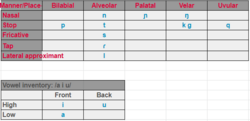
The main official language of Kilalurak is Kilalurian. Kilalurian is a language isolate, a language with no other known linguistic relationships. Kilalurian is one of the very few language isolates with over 500,000 speakers. Kilalurian is largely an unchanging language, not altering much from Old Kilalurian, a now extinct language. Kilalurian has many borrowed words from Zhenian and Elyrian, including the word for "cow" being "su" (ᓱ), deriving mainly from the Zhenian translation; "so". Kilalurian grammar follows SOV (subject object verb). The puristic tendencies of Kilalurian is to a large degree a result of conscious language planning.
Kilalurian Sign Language or KSL was considered a recognized minority language in 2005. Kilalurian and Zhenian are required school subjects in all public schools, and Elyrian is widely understood to a small degree. Zhenian is spoken by Zhenian families (the largest minority group in Kilalurak).
As opposed to other naming customs, Kilalurians often refer to each other by their last names if not accustomed to them yet. Middle names are a generally new concept brought by Auroran immigrants in the 19th century, and has since become a relatively common naming custom. Ones last name usually derives from the first syllable of their father's last name and the second syllable of their mother's last name, example: If ones father's last name was Kvijul and mother's last name was Igspuru, the child's last name would be Kvispu.
Religion
Largest Cities
Largest cities or towns in Kilalurak
2019 census | |||||||||
|---|---|---|---|---|---|---|---|---|---|
| Rank | Province-level division | Pop. | |||||||
 Mianuuva  Subek |
1 | Mianuuva | Mianuuvan | 223,582 |  Iñuk  Sut Paturik | ||||
| 2 | Subek | Kisil Island | 120,133 | ||||||
| 3 | Iñuk | South Kilalurak | 53,543 | ||||||
| 4 | Sut Paturik | Isle of Suukk | 30,004 | ||||||
| 5 | Irakumak | Mianuuvan | 10,995 | ||||||
| 6 | Kakisak | Nauja | 6,112 | ||||||
| 7 | Tiñuk | North Kilalurak | 3,532 | ||||||
| 8 | Pikra | North Kilalurak | 3,103 | ||||||
| 9 | Numajuk | North Kilalurak | 2,963 | ||||||
| 10 | Quiñuk | South Kilalurak | 1,103 | ||||||


