The Mawusi
This article is incomplete because it is pending further input from participants, or it is a work-in-progress by one author. Please comment on this article's talk page to share your input, comments and questions. Note: To contribute to this article, you may need to seek help from the author(s) of this page. |
Democratic Republic of The Mawusi République Démocratique du Mouéoussi (Midrasian) Jamhuri ya Kidemokrasia ya Mawusi (Watuwakuu) | |
|---|---|
 Flag
 Coat of arms
| |
| Motto: "Force, prospérité, persévérance" "Strength, prosperity, perseverance" | |
 | |
| Capital | Bruneville |
| Largest | Port Loyal |
| Official languages | Midrasian |
| Recognised national languages | Watuwakuu |
| Ethnic groups (2017) | 65% Black 20% Gamis 9% East Majulan 5% White 1% Other |
| Demonym(s) | Mawuese |
| Government | Federal Dominant Party Socialist Semi-Presidential Republic |
| Oliver Habib | |
| Valiant Hamadi | |
| Léon Kitwana | |
| Legislature | Parliament |
| Federal Council | |
| The House | |
| Area | |
• Total | 1,321,195 km2 (510,116 sq mi) |
| Population | |
• 2018 estimate | 65,094,866 |
| GDP (PPP) | 2018 estimate |
• Total | 641,9 Billion US$ |
• Per capita | 9,862 US$ |
| GDP (nominal) | 2018 estimate |
• Total | 406,8 Billion US$ |
• Per capita | 6,250 US$ |
| Gini (2017) | medium |
| HDI (2017) | medium |
| Currency | Mawuese Loynere (MWŁ) 1 USD = 80.7 MOŁ |
| Date format | dd/mm/yyyy |
| Driving side | right |
| ISO 3166 code | MAW |
| Internet TLD | .mw |
 | |
The Mawusi, officially the Democratic Republic of the Mawusi is a sovereign state whose territory is located in the Continent of Majula. The Mawusi has a total area of 1,321,195 square kilometres and a population of 65,094,866 (as of January 2017). The Mawusi is located almost entirely in the Brune tropical forest. The biggest river that flows in the nation is the Brune River. The capital city is Bruneville, whereas the biggest and most populous city is Port Loyal, located in the delta of the Brune River. Other important urban areas of the country includes Nambabi, Etonmere, Bangoli, and Satshamba.
For the longest time, The Mawusi was the crib of many kingdoms and empires. However, the modern state of The Mawusi had its origins in the Midrasian colonization of the region during early 17th Century until the late 20th Century, forming after the Majulan Territory of Bruneays aqcuired the Berbier Corridor after its independence. The country became independent in 1958, following the Black River War, but imerged in a civil war man years later that lasted until the end of the 20th Century. It was only in 2005 when the country held it's first ever democratic elections, and changed it's official name from Central Majulan Republic to a more local and cultural name, The Mawusi.
The Mawusi is many times referred as the "Majulan giant" due to its big population and economy. With approximatelly 65 million people, the country is the most populous in the continent, and nineth in Aeia. The country has a diverse array of ethnic groups, with the biggest ones being the Maziwa, Visiwa, Kaskazini, and Majikusini peoples, all part of the Watuakuu population in The Mawusi, and Gamis. Religion wise, the country is divided among Alydians, who live mainly in southern regions of the country, and Israds, who live in the north, closest to the Arabekh channel. Minority religions still can be found among ethnic minorities across the country.
History
Geography
Climate
Biodiversity
Demographics
Ethnicities
Religion
Languages
Government & Politics
Law
Armed forces
Crime and law enforcement
International relations
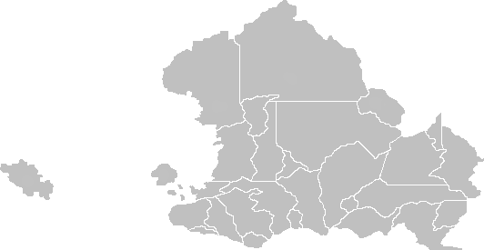
Sub-divisions
Economy
Infrastucture
Education
Health
Energy
Transportation
Media and communication
Culture
Music
Television and Cinema
Sports
Celebrations and Holidays
Administrative divisions
The Republic of The Mawusi is divided into 26 states and two city-provinces of Bruneville and Port Loyal. The provinces are subdivided into districts which are divided into territories.