Lübbenau Mountains: Difference between revisions
No edit summary |
|||
| (4 intermediate revisions by 2 users not shown) | |||
| Line 102: | Line 102: | ||
The Lübbenau Mountains provide lowland [[Lyonheimer]] and [[Kingdom of Blechingia|Blechingia]] with drinking water, irrigation,hydroelectric power. | The Lübbenau Mountains provide lowland [[Lyonheimer]] and [[Kingdom of Blechingia|Blechingia]] with drinking water, irrigation,hydroelectric power. | ||
Major rivers of the region include the | Major rivers of the region include the | ||
* [[River Andoma]] | |||
** [[River Baren]] | |||
* [[River Aedratic]] | |||
==Climate== | ==Climate== | ||
==Largest cities== | ==Largest cities== | ||
==History== | |||
The first Humans to inhabent the region. | |||
During the early years of the 20th Century [[Kimgdom of Blechingia|Blechingia]] and [[Lyonheimer]] fought in the [[Great War|Great War]] which saw great conflict in the mountains, with the Southern Front taking part here | |||
==Image Collection== | ==Image Collection== | ||
Latest revision as of 16:11, 2 September 2021
| Lübbenau Mountains | |
|---|---|
| Felsőerdő Hegy (Hungarian) Lübbænu (Götaish) | |
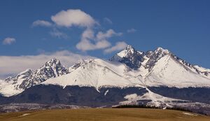 Lübbenau Mountains, on the border of Lyonheimer and Blechingia | |
| Highest point | |
| Peak | Mount Varsaves |
| Elevation | 5,281 m (17,326 ft) |
| Naming | |
| Etymology | named by Blechingian explorers |
| Native name | Lübbænu, Felsőerdő Hegy |
| Pronunciation | lu-ben-ew |
| Geography | |
| Location | Blechingia, Lyonheimer and Medovia |
| Geology | |
| Age of rock | 463 Million years |
| Climbing | |
| First ascent | 1643, by Uves Hidegkuti |
| Easiest route | through the Blechingi-Lyonheimer southern border |
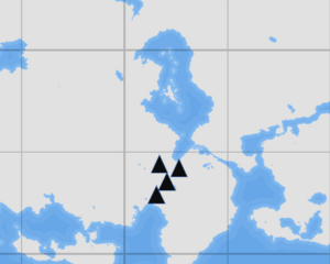
The Lübbenau is a large mountain range in southern Thrismari, that stretches from southern Lyonheimer to Medovia. The range acts as a natural border between Lyonheimer, Blechingia and Medovia.
The highest point is 5,281m, which is Mount Varsaves on the border of Lyonheimer and Medovia.First scaled by mountaineerer Uves Hidegkuti in 1643, Mount Varsaves is a tourist location that brave mountaineerers attempt to scale each year.
Highest Mountains
| Name | Height | Name | Height | Name | Height |
|---|---|---|---|---|---|
| Mount Varsaves | 5,281 m (17,326 ft) | 4,102 m (13,458 ft) | 4,102 m (13,458 ft) | ||
| Wolfsberg | 4,409 m (14,465 ft) | 4,206 m (13,799 ft) | 4,078 m (13,379 ft) | ||
| 4,545 m (14,911 ft) | 4,199 m (13,776 ft) | 4,063 m (13,330 ft) | |||
| 4,533 m (14,872 ft) | 4,193 m (13,757 ft) |
Lakes and Rivers
The Lübbenau Mountains provide lowland Lyonheimer and Blechingia with drinking water, irrigation,hydroelectric power.
Major rivers of the region include the
Climate
Largest cities
History
The first Humans to inhabent the region.
During the early years of the 20th Century Blechingia and Lyonheimer fought in the Great War which saw great conflict in the mountains, with the Southern Front taking part here
Image Collection
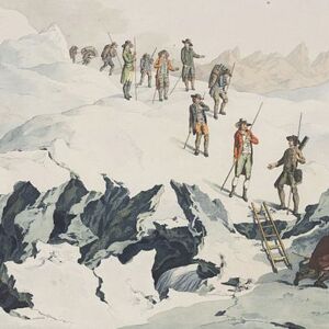 Uves Hidegkuti's climb, 1643
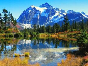 Lake Aedratic,located on the border of Blechingia & Lyonheimer
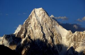 Mount Varsaves, tallest mountain in Lübbenau Mountain range
- ↑ "4000 m Peaks of the Alps". Bielefeldt.de. July 6, 2010. Retrieved August 9, 2012.
