Maucha: Difference between revisions
No edit summary |
|||
| (3 intermediate revisions by the same user not shown) | |||
| Line 87: | Line 87: | ||
|area_label2 = <!-- label below area_label (optional) --> | |area_label2 = <!-- label below area_label (optional) --> | ||
|area_dabodyalign = <!-- text after area_label2 (optional) --> | |area_dabodyalign = <!-- text after area_label2 (optional) --> | ||
|population_estimate = | |population_estimate = 43,955,202 | ||
|population_estimate_rank = | |population_estimate_rank = | ||
|population_estimate_year = 2020 | |population_estimate_year = 2020 | ||
|population_census = | |population_census = | ||
|population_census_year = | |population_census_year = | ||
|population_density_km2 = | |population_density_km2 = 105 | ||
|population_density_sq_mi = | |population_density_sq_mi = | ||
|population_density_rank = | |population_density_rank = | ||
|GDP_PPP = $ | |GDP_PPP = $142,766,496,096 | ||
|GDP_PPP_rank = 46th | |GDP_PPP_rank = 46th | ||
|GDP_PPP_year = 2020 | |GDP_PPP_year = 2020 | ||
|GDP_PPP_per_capita = $3,248 | |GDP_PPP_per_capita = $3,248 | ||
|GDP_PPP_per_capita_rank = 56th | |GDP_PPP_per_capita_rank = 56th | ||
|GDP_nominal = $ | |GDP_nominal = $99,602,487,732 | ||
|GDP_nominal_rank = 53th | |GDP_nominal_rank = 53th | ||
|GDP_nominal_year = 2020 | |GDP_nominal_year = 2020 | ||
| Line 258: | Line 258: | ||
| city_1 = Nambabi | div_1 = Kolisi State{{!}}Kolisi | pop_1 = 3,902,424| img_1 = Johannesburg.jpeg | | city_1 = Nambabi | div_1 = Kolisi State{{!}}Kolisi | pop_1 = 3,902,424| img_1 = Johannesburg.jpeg | ||
| city_2 = Kanyabahayadha | div_2 = Federal District (Maucha){{!}}Federal District | pop_2 = 2,756,782 | img_2 = Brazzaville.jpeg | | city_2 = Kanyabahayadha | div_2 = Federal District (Maucha){{!}}Federal District | pop_2 = 2,756,782 | img_2 = Brazzaville.jpeg | ||
| city_3 = Garastadt | div_3 = Kolisi State{{!}}Kolisi | pop_3 = 1,593,949 | | | city_3 = Garastadt | div_3 = Kolisi State{{!}}Kolisi | pop_3 = 1,593,949 | img_3 = Abidjan-Cote-Ivoire.jpeg | ||
| city_4 = Usambara | div_4 = Kolisi State{{!}}Kolisi | pop_4 = 1,510,746 | img_4 = Un aperçu de la ville de conakry.jpg | | city_4 = Usambara | div_4 = Kolisi State{{!}}Kolisi | pop_4 = 1,510,746 | img_4 = Un aperçu de la ville de conakry.jpg | ||
| city_5 = Bomtili | div_5 = Mabalane State{{!}}Mabalane | pop_5 = 1,278,152 | | city_5 = Bomtili | div_5 = Mabalane State{{!}}Mabalane | pop_5 = 1,278,152 | ||
| city_6 = Bangoli | div_6 = Kikomakoma State{{!}}Kikomakoma| pop_6 = | | city_6 = Bangoli | div_6 = Kikomakoma State{{!}}Kikomakoma| pop_6 = 1,174,013 | ||
| city_7 = Indwengwe | div_7 = Indwengwe State{{!}}Indwengwe | pop_7 = | | city_7 = Indwengwe | div_7 = Indwengwe State{{!}}Indwengwe | pop_7 = 1,021,357 | ||
| city_8 = Ibabitema | div_8 = Mauchan State of Ibabochia{{!}}Ibabochia | pop_8 = | | city_8 = Ibabitema | div_8 = Mauchan State of Ibabochia{{!}}Ibabochia | pop_8 = 873,781 | ||
| city_9 = Port Zimmermann| div_9 = Onikuste State{{!}}Onikuste | pop_9 = 583,776 | | city_9 = Port Zimmermann| div_9 = Onikuste State{{!}}Onikuste | pop_9 = 583,776 | ||
| city_10 = Amasufer | div_10 = Madzi State{{!}}Madzi | pop_10 = 536,979 | | city_10 = Amasufer | div_10 = Madzi State{{!}}Madzi | pop_10 = 536,979 | ||
| Line 301: | Line 301: | ||
4. [[image:Kaanyahadha.png|border|30px]] [[Kanyabahayadha|Kanyabahayadha]]<br /> | 4. [[image:Kaanyahadha.png|border|30px]] [[Kanyabahayadha|Kanyabahayadha]]<br /> | ||
5. [[image:YalansaFlag2.png|border|30px]] [[Yalansa State|Yalansa]]<br /> | 5. [[image:YalansaFlag2.png|border|30px]] [[Yalansa State|Yalansa]]<br /> | ||
6. [[Watisa State|Watisa]]<br /> | 6. [[image:WatisaFlag.png|border|30px]] [[Watisa State|Watisa]]<br /> | ||
7. [[Untere Feda State|Untere Feda]]<br /> | 7. [[Untere Feda State|Untere Feda]]<br /> | ||
8. [[image:Rect17472.png|border|30px]] [[Obere Feda State|Obere Feda]]<br /> | 8. [[image:Rect17472.png|border|30px]] [[Obere Feda State|Obere Feda]]<br /> | ||
9. [[Kikomakoma State|Kikomakoma]]<br /> | 9. [[image:FlagKikomakoma.png|border|30px]] [[Kikomakoma State|Kikomakoma]]<br /> | ||
10. [[Nyekundu State|Nyekundu]]<br /> | 10. [[Nyekundu State|Nyekundu]]<br /> | ||
11. [[Red Nation]] | 11. [[Red Nation]] | ||
Latest revision as of 02:25, 2 August 2023
Democratic Republic of Maucha | |
|---|---|
| Motto: "Für die Menschen aus dem Land des Silbers" (For the poeple from the land of silver) | |
| Anthem: "Mäusch, Land unseres Volkes" (Estmerish: Maucha, Land of Our People") | |
 | |
| Capital | Kanyabahayadha |
| Largest | Nambabi |
| Official languages | Weranic |
| Recognised national languages | Watuajua Sisulu |
| Recognised regional languages | |
| Demonym(s) | Mauchian |
| Government | Federative presidential republic |
• President | Werner Okonkwo |
• Vice President | Mavo Holomisa |
• President of Senate | Kalere Odili |
• President of the Chamber | Issa Mbadinuju |
| Legislature | National Congress |
| Senate | |
| House of Deputies | |
| Formation | |
• Independence from Werania | 1950 |
• Join the United Bahian Republic | 1960 |
• Independence from the United Bahian Republic | 1969 |
| Area | |
• | 419,033 km2 (161,790 sq mi) |
| Population | |
• 2020 estimate | 43,955,202 |
• Density | 105/km2 (271.9/sq mi) |
| GDP (PPP) | 2020 estimate |
• Total | $142,766,496,096 (46th) |
• Per capita | $3,248 (56th) |
| GDP (nominal) | 2020 estimate |
• Total | $99,602,487,732 (53th) |
• Per capita | $2,266 (51st) |
| Gini (2020) | 42.4 medium |
| HDI (2020) | 0.601 medium |
| Currency | Mauchian Fedha (M₣) (MWF) |
| Calling code | +255 |
| ISO 3166 code | MWI |
| Internet TLD | .mw |
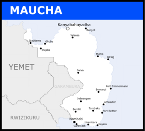
Maucha (Weranian: Mäusch, Watuajua: Mwisho, Sisulu: Mwisho), officially the Democratic Republic of Maucha (Weranian: Demokratische Republik Mäusch, Watuajua: Jamhuri ya Kidemokrasia ya Mwisho, Sisulu: Iriphabliki yaseMwisho Ekhululekile), is a sovereign state whose territory is in northeastern Coius. Maucha is the easternmost country in the western hemisphere, occupying a total area of 419,033 km² on the eastern coast of the subcontinent of Bahia. It borders Yemet and Garambura to the west. Maucha has territorial disputes over the Ibabochia region with Yemet and the Kulo State. Maucha is the third most populated country in Bahia with a population of 30,955,202 (as of January 2020). The capital of the country is Kanyabahayadha, located at the delta of the Fedha river on the northern coast of the country. The metropolitan region of Nambabi is the largest urban area of the country as well as the biggest city in Bahia.
After independence from Werania, the Eastern Bahian Republic fell into a civil crisis, as minorities started to revolt against the ethnic government. When the capital of the newly formed Republic of East Bahia was changed from Kanyabahayadha to Nambabi, the northern provinces rebelled and started a resistance movement against the current government. East Bahia eventually came to join the United Bahian Republic in 1960, alongside Rwizikuru. In 1961, a mass killing of Watuajuan protestors in Bangoli resulted in the implosion of the current government, that slowly collapsed until culminating in the suicide of the President in 1964. After the reinstitution of a democratic government, the new president attempted to unite all Eastern-Bahian people by claiming certain territories from both Yemet and Rwizikuru, including a big portion of nowadays Garambura. The rise in tension between the Bahia nations led to complete dissolution of the United Bahian Republic in 1969. Following the East Bahia’s independence from the UBR, the country’s official name changed to Maucha, and a federative presidential republic was adopted from then on.
Maucha is considered one of the most developed countries in Bahia nowadays. Maucha has the second highest GDP nominal per capita in Bahia, as well as the third biggest economy. The mining industry is the most prominent in the country, with silver mines accounting for over 40% of Maucha’s natural reserves. Given the country’s flat geography, overmanning, and the growing dependency on the extraction of silver, other industries such as aviation, pharmaceuticals, and clothing and textiles have been gaining notoriety. In terms of crops, the arid climate of most of the country allows for the plantation of soy, wheat, and corn, while the tropical south sees crops such as tropical fruits and root vegetables. Maucha is a member of the Community of Nations, and a founding member of the Congress of Bahia States. In terms of population, Maucha is the fourth biggest in Bahia with about 31 million people. The country is not very urban, with over 60% of the population living in five cities; four of which are in Maucha.
Etymology
Linguists believe that the current name Maucha (Weranian: Mäusch) is a transliteration of the native Watuajua word "Mwisho", which means "the latter" or "the end". Linguists and historians believe that the term originated from the locals' perception of Maucha's geographic position by the coast and the limits of the land and the ocean as the edge of the world; in theory, those people believed that their land was the the boundary of their known world.
The current name was adopted officially in 1969 after Maucha's secession from the United Bahian Republic. Prior to that, the nation underwent the name of the East Bahia since its independence from Werania, in 1950. During colonial times, however, the country was named Silberküste, which literally translates from Weranian to "Silver Coast", an allusion to the metal heavily commercialized by the Watuajuans before and during colonization.
History
Antiquity
Modern Kingdoms
The fall of the Chisomo Dynasty of the Kingdom of Sena in 1653 marked the establishment of the Njinji-Susulu Confederacy and its hegemony in the territories south of the Iwoye River. The Confederacy succeeded in expanding their territory north of modern-day Maucha but found resistance from the Onikhuma Kingdom, another well-settled local kingdom. From the beginning of the 18th century up to 1786, both the Onikhuma Kingdom and Njinji-Sisulu Confederacy fought a series of battles in what became known as the XXXX War. Ultimately, the Onikhuma Kingdom was subjugated by Mabuti I and became a part of the Confederacy. Despite the growing conflicts down in the Gonda Delta against the Gaullicans, the Confederacy kept on pushing their forces up to the Watuajuan coast.
By the end of the 18th century, the Watuajuan Confederation had become an extremely well-organized and well-developed State, with many international merchants arriving for their abundant silver. The Watuajuan Confederation dominated the delta of the Fedha River and extended its area to the northernmost part of modern-day’s Maucha’s panhandle. Such wealth and stability attracted Weranian missions, who looked forward to commercializing silver with the Watuajuan. In 1809, the Battle of Yalansa put the Njinji-Sisulu Confederacy on the edge after an easy victory from the Watuajuan forces. After a few years of backing off, the Njinji-Sisulu came back for a new attempt, this time succeeding and taking over the cities of Yalansa in 1829, and Bangoli in 1832, and exposing the Watuajuan capital city of Kanyabahayadha to the invaders. Noticing the clear disadvantage, the Watuajuan signed the Military Contract of 1835, which allowed the Weranian military to have jurisdiction over the Watuajuan land. This allowed Weranians to assist in the Watuajuan resistance against the Njinji-Sisulu and push back the invasion by reconquesting Bangoli in 1838 and Yalansa in 1840.
The Watuajuan Confederation kept on pushing the Njinji-Sisulu Confederacy back south, as they slowly took over their territory. By 1861, all former Kingdoms under the Njini-Sisulu north of the Iwoye River were freed and admitted into the Watuajuan Confederacy. In 1865, Nambabi was surrounded and sieged. The Sisulu Capital finally succumbed in 1869. The Watuajuan Confederacy, then renamed the Mwisho Empire, remained independent until 1876 when it became an official colony of Werania.
Colony of Silberküste
Eastern Bahian Republic (1950-1960)
1950 -Onele Nombembe, from Nambabi of Sisulu origins, known for his involvement with ultra-Bahian and anti-Deitsmen guerillas, reach power.
-Immediately, his policies start reflecting racial segregation against Watuajuans and Deitsmen.
-The capital of Maucha moves from Nambabi to Kanyabahayadha.
-Resistance is installed in the north of Maucha, who do not agree with the policies imposed by Nombembe. At the same time, Nombembe forces begin to be more stern on resistance. 1951
-Throughout 1951, a series of localized protests in the North (mostly in K.yadha) intensified the tensions between Watuajuans and the government.
-Political movements throughout the center and north of Maucha start rising against Nombembe. More expressively, the Undivided Mauchan Movent (UMB), led by Levi Badru, becomes the main resistance to Nombembe. 1952
-Protests throughout the country led to more prisoners, injured, and dead as Nombembe became more strict.
-Political opposition became prohibited and all political opposition was ordered to be dissolved at the expense of imprisonment.
Mauchan Civil War
1952 -Protests throughout the country led to more prisoners, injured, and dead as Nombembe became more strict.
-Political opposition became prohibited and all political opposition was ordered to be dissolved at the expense of imprisonment.
-The resistance was armed and a civil war began as they responded to the government forces.
-At the end of 1952, Nombembe ordered troops to bomb the government palace in K.yadha in an attempt of assassinating Badru. Damage is caused in the city, and more civilians are lost. Nombembe starts to lose support in the south, where peace-forward groups start to protest against Nombembe's government.
1953
-More resitance milita organized and cities in the south of Maucha, up to this point dominated by the Liberation Army of Maucha (BA) start coming in control of the UMB.
-Protests in Nambabi increase, and disobedience starts happening among Nombembe troops and allies.
-When the governmental palace of Nambabi gets seiged, Nombembe is captured and executed by the guerilla.
-The UMB promotes Badru as the new leader, and the general Mauchan populations supports it.
Mauchan Peace
1954 -On January 1st, the capital is returned to K.yadha
-Badru brings a more stable and universal way of governing Maucha, and both Sisulu and Watuajuan people become generally happy with the government.
1954 - 1960
-This period is known as the Mauchan peace.
-Badru and the UMB remain in power for the remainder of this period, with some, but peaceful opposition. 1960
-Badru brings Maucha into the UBR, given his ideals of a pan-Bahian nation. He believed that the UBR could bring all people of Bahia together in a strong nation.
United Bahian Republic (1960-1969)
1960 -Badru brings Maucha into the UBR, given his ideals of a pan-Bahian nation. He believed that the UBR could bring all people of Bahia together in a strong nation.
1962 -Badru decides to open the country for elections, and Thebeyame Lasaro, born in Bomtili, aligned with ???? (opposition party), rises to power and pushes for a more Maucha-forward policies.
-Lasaro pushes for territorial disputes with Rwizikuru and Yemet, and starts claiming influence over such regions. 1963
-Lasaro views Rwizikuru's exit of the UBR as a loss of wanted territory, and instead of getting into a conflict with Rwizikuru, Lasaro focus in the instability of Yemet and the threat of losing Ibabochia. 1966
-Badru is reelected but dies 7 months after being elected. His VP leads the nation in the mean time.
-By the end of the year, a new election takes place, and Lasaro rises to power once more. 1967
-Lasaro's term begin officially in Jan 1st. 1968
-With the death of Oronge in Yemet, the threat of its neighbor threathend Maucha, and the government started to organize itself military with a fear of a possible Yemeti strong pouncing. 1969
-Yemet, a bigger country with a bigger military force, seceedes from the UBR and commence the Ibabochia War in 1969.
Democratic Republic of Maucha
Ibabochian War
Geography
Climate
Biodiversity
Demographics
Largest cities in Maucha
2020 Census | |||||||||
|---|---|---|---|---|---|---|---|---|---|
| Rank | Maucha | Pop. | |||||||
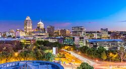
 Nambabi  Kanyabahayadha |
1 | Nambabi | Kolisi | 3,902,424 |  Garastadt  Usambara | ||||
| 2 | Kanyabahayadha | Federal District | 2,756,782 | ||||||
| 3 | Garastadt | Kolisi | 1,593,949 | ||||||
| 4 | Usambara | Kolisi | 1,510,746 | ||||||
| 5 | Bomtili | Mabalane | 1,278,152 | ||||||
| 6 | Bangoli | Kikomakoma | 1,174,013 | ||||||
| 7 | Indwengwe | Indwengwe | 1,021,357 | ||||||
| 8 | Ibabitema | Ibabochia | 873,781 | ||||||
| 9 | Port Zimmermann | Onikuste | 583,776 | ||||||
| 10 | Amasufer | Madzi | 536,979 | ||||||
Ethnicities
Religion
Languages
Education
Government & Politics
Foreign relations
Military
Administrative Divisions
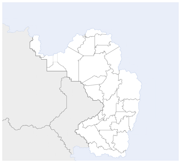
According to Mauchan Constitution of 1971, the federation is formed by 24 states, one [[Wikipedia:Autonomous administrative division |autonomous region]], one federal district, and one federal territory. The federal territory of Harara is the only administrative division that does not govern itself, as the federal government has total sovereignty over it. The Mauchan States have a great degree of freedom, though most of the judicial process is determined and enforced by the federal government. The Autonomous State of the Red Nation is the only administrative division in Maucha with higher judicial freedom. Currently, the State of Ibabochia is the only federal State undergoing the process of becoming an Autonomous State, but this issue has shown to be controversial as it depends directly on the outcomes in the Yemeti conflict. Nambabi and Garastadt together have applied for statehood in 2018 and the elevation of the megalopolis into a State is still under discussion in the National Congress.
The states are divided into 5 unoficial regions determined by merely geographical similarity. No government is responsible for the management of the regions and the functionality of it is for mere statistical purposes, as well as making it easy to share federal funds with the administrative divisions.
Each State is further down divided into municipalities that usually consists of one city as being the seat of the municipality. The municipalities are governed by mayors and unicameral legislatures which are all elected by the population every 4 years. There are a total of #### municipalities in Maucha. Similar to the 5 federal regions, the states are also further divided into meso-regions, which are formed by municipalities based on solely geographic similarities.
|
Sociopolitics
Economy
Maucha is the second strongest economy in Bahia, only behind Garambura. Maucha has the second highest nominal GDP per capita in Bahia, at $2,266, and the third highest total nominal GDP, at $70,144,487,732. In terms of total GDP PPP and GDP PPP per capita, Maucha ranks second as well, at $3,248 and $100,542,496,096 respectively. The constant state of political stability in the country, allied with the right political policies to promote investment has led Maucha to have one of the fastest growing economies in Bahia, being now considered an emerging economy. The Mauchan currency is the Fedha, and is often considered to be one of the most stable Bahian currencies.
The development of Maucha’s economy has allowed a rapid growth of the tertiary sector of the economy, with most of the population being employed in services. The secondary sector of the economy has also been gaining notoriety, since Maucha’s extensive territory and political/economic stability attracts many manufacturers to build factories that supply to the general area of northern Coius. The primary sector of the economy is still the one that generates the most profit, as the majority of the economy still depends on it. In terms of agriculture, staple crops such as soy, wheat, and corn are dominant in the arid areas of Maucha, while root vegetables, cocoa, sugar cane, and other tropical fruits are dominant in the tropical Mauchan south. Generally, the biggest Mauchan companies are Ostbahische Fluggesellschaft or OBF (aviation), Mäusches Bergbau-und Extraktionsunternehmen or MB&E (Mining), Mtel (Telecommunications), Gepard MAG (automobilistic), Ostbank, Mäushce Bank, Ila Bank and Panbahisch Bank (banking), and Jabavu Pharma AG (pharmaceutical).
The busiest cargo port of Maucha is the port of Nambabi, located within the city of Nambabi, followed by the port of Silver, in Kanyabahayadha, and the port of Garastadt, in Garastadt. The Trans-Bahian railway goes through Maucha, and connects the country to other neighboring nations. Alongside the Trans-Bahian railway, Maucha counts with the Trans-Mauchan Railway, which connects Ibabochia to Nambabi going alongside the coastal cities of the country.
Mining
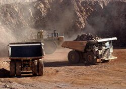
Since pre-colonial times, mining has been an important economic activity in Maucha, especially in the central-north regions of the country. From the ancient Watuajuan people to the Weranian colonizers, the exploitation of silver has been substantial for the nation’s economic success. Maucha ranks in the top 5 world exporters of silver, and the Mauchan company MB&E is the biggest mining company in Bahia. MB&E, being the country’s largest mining corporation, is shared between the federal government and the public, with the shares being 49% and 51% respectively. The Fedha River Basin region alone is responsible for mining over 75% of Maucha’s total silver reserves. The biggest silver mine in Maucha is the Jabari mine, in the state of Obere Feda, with a probable silver reserve of 478.7Moz. The Jabari mine has been owned by MB&E since 2001.
Other metals mined in Maucha includes copper, cobalt, and gold. In addition to that, precious rocks are also mined in Maucha. The biggest precious rocks reserves in Maucha are aquamarine, diamond, topaz, and tourmaline. Despite the richness of Maucha’s soil and the wealth generated by the mining of precious stones, a lot of concern has been raised in regards to the human rights and working conditions of the mine workers. Many have claimed seeing child labor and slave-almost conditions being implemented in mines across Maucha. Another common concern is the workload, that has been seen to surpass 16 daily hours. Since the beginning of the 2000s, these concerns have been brought to light and have been slowly addressed by the federal government, who is currently working on passing a series of laws protecting the working rights of mine workers. The project is called Mine Work Regulative Laws and is in current process of voting in the National Congress.
Tourism
Infrastucture
Health
Energy
Transportation
Media and communication
Culture
Music
Television and Cinema
Sports
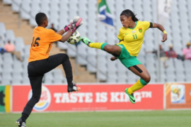
Association football is the most played sport in Maucha, with the Mauchan top flight league being the most watched in Bahia. Internationally, the Mauchan men’s national football team is the one with the most IFF World Cup appearances in Bahia, having reached as far as the round of 16 during the 20XX edition, hosted at ?????. The women’s national football team has also never missed a World Cup, and they are also currently ranked the best in Bahia. The 2021 IFF women World Cup was hosted in Maucha, increasing the view of the sport thorough the country, and also opening space for more investments in the women’s modality.
Volleyball and Basketball come second and third, respectively, as the most watched sports in Maucha. Maucha usually ranks among the best in Bahia, and tend to be of good competition to other excelling Coian nations. However, Maucha excels in track & field sports, with gold medals being won in multiple modalities such as marathon, 100m, and others. Nceba Jezile is Maucha’s biggest gold medalist, having won 4 gold medals in 100m sprint modality.
E-sports is also a growing field in Maucha. The performance of Mtel Lion City in the 2021 Avatar World Cup in Dezevau brought the attention to the modality, and many sponsors saw the market as promising. Maucha is currently a powerhouse of Avatar in Coius, while other games are still in the process of receiving more attention. The current Mauchan Avatar Ace Division is set to add four new debutant teams for the upcoming 2022 season going from 10 to 14 teams.


