Mount Kovdor
| Mount Kovdor | |
|---|---|
| Kovudoru-san (Namorese) Montze[ya] Kovdor (Luziycan) | |
 Mount Kovdor | |
| Highest point | |
| Elevation | 550 m (1,800 ft) |
| Geography | |
| Location | Template:Country data Geadland Högherhus, Eskraulund |
Mount Kovdor (Namorese: Ковудору-сан; Otekian Luziycan: Montzeya Kovdor; Standard Luziycan: Montze Kovdor, Geadish: Βϊεργ KȢδορ) is a mountain located in the tripoint between Namor, Geadland and Luziyca. At a height of 550 meters, it is the highest point in Namor's Txotai region. The mountain marks the northernmost end of the Luziyca-Namor border. It is also the westernmost point in Namor.
The peak of Mount Kovdor marks the exact location of the tripoint, indicated by three boundary markers on each side. There are no border crossings on or near the mountain, therefore it is illegal to cross the borders there. Travel to the mountain is allowed from the Namorese side, although one can only observe the tripoint from a safe distance. Travel from the mountain is also allowed from the Luziycan side, and they can go up to the tripoint, although they cannot go around it due to security reasons. Travel to the mountain is allowed from all three sides; one can go up to the tripoint on the Luziycan side, one can only observe the tripoint from a safe distance on the Namorese side.
History
Mount Kovdor has been documented since ancient times, when it marked the boundary between Oteki County and the rest of the Duchy of York. When Oteki was sold to Antelopian Namor, the Namorese referred to the mountain as "Frontier Mountain (Бенчин-сан)" to show that it marked the new Namorese-York border, although the local Otekian population continued to call it Mount Kovdor.
Otekian rebellion
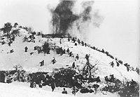
Part of Mount Kovdor was taken over by rebels belonging to the self-proclaimed Second Republic of Oteki during the Otekian rebellion in Txotai. It remained under insurgent control after most of Txotai, including Kusef, capitulated to Namorese forces, and became the scene of sporadic cross-border fighting between Otekian separatist insurgents and the Namorese Liberation Army. Due to the absence of a clearly demarcated border, separatists were able to receive aid from East Luziyca and the OGIE from Frontiersburg through Mount Kovdor.
NLA forces redoubled efforts at taking control of Mount Kovdor starting NMR 2317. After three weeks of intense fighting, Namorese forces regained control of their side of the mountain peak, represented symbolically by the replacing with the Republic of Oteki boundary marker with the pre-rebellion PRN marker. Afterwards, things became a bit quieter, although there were reports of continued clashes between Namorese and separatist militants as well as between Namorese and East Luziycan troops, especially during the Third Namo-Luziycan War.
Tripoint
Tense relations between Namor and Luziyca meant that there was no way for the two countries to share one boundary marker; as a result, there is a boundary marker on each side to show which side of the tripoint belongs to which country.
The tripoint is not a border crossing, so it is illegal for one to cross from one country to another; however, depending on which side of the border one is on, it is possible to approach the tripoint without entering the pavilion. On the Namorese side, visitors may observe the tripoint from a safe distance of 10 meters and no closer. On the Luziycan side, visitors may enter the pavilion, but they cannot enter Namor or Geadland (i.e. if both of their feet are not on the Luziycan side, they are violating the law: if one is on the Luziycan side, but another in a different country, it is technically illegal, but is tolerated by authorities), unless if they have permission from the border guards of the country. On the Geadish side, visitors can only access the area with a guide, and cannot cross into other into another country's territory without permission from that country's border guards.
Barrier-Free Zone
Between where the tripoint lies and where the northern end of the Namo-Luziycan Barrier begins, there is a "barrier-free zone" that runs across the sides of Mount Kovdor. The zone, which is 400 meters in length, is the only place in the entire Namo-Luziycan border that is not covered by the Namo-Luziycan barrier. Theoretically, it is easier to cross the border unauthorized at the barrier-free zone given that there is no wall, but to compensate for this there are guard towers on both sides of the border to prevent illegal crossings.
The borders between Geadland and its neighbours have fence for most of their respective lengths. Mount Kovdor is the only part of the Geadish-Namorese border that is not fenced and one of two parts of the Geadish-Luziycan border (the other point is in Westerholm International Peace Park). However, there is a fence around the vicinity of the tripoint area, with a single guarded gate.
- Tripoint.png
The tripoint on the peak of Mount Kovdor.
- Tripointsign.png
A sign on the Namorese side of the border warning visitors against traveling closer than 10 meters to the tripoint
- Restareamountkovdor.jpg
Rest area for visitors in Namorese side of Mount Kovdor
References
There are a number of references to Mt. Kovdor.
The mountain is considered the "father mountain" of the Otekian people and is featured in numerous poems, songs and chants. Hymni Oteki makes an implicit reference to Mount Kovdor when it referred to Oteki as the "Land of the Mountain, and the river."
