Category:Maps (Eurth)
Redirect page
Redirect to:
Subcategories
This category has the following 3 subcategories, out of 3 total.
A
M
- Maps of Orioni (12 F)
- Maps of Qubdi (13 F)
Pages in category "Maps (Eurth)"
The following 4 pages are in this category, out of 4 total.
Media in category "Maps (Eurth)"
The following 83 files are in this category, out of 283 total.
(previous page) (next page) Map-of-Vanarambaion.png 600 × 220; 40 KB
 Mapebrary438904383.png 414 × 414; 57 KB
 MapofKertosono.png 2,000 × 2,889; 740 KB
 Members of the Assembled Nations.png 2,000 × 1,000; 252 KB
 Namdatka Borders and Rivers Miki Wap.png 1,109 × 862; 122 KB
 New Lysia Map.png 441 × 414; 155 KB
 Numero Dos.png 1,056 × 625; 219 KB
 Numero eight.png 1,058 × 627; 219 KB
 Numero Eleven.png 1,060 × 630; 220 KB
 Numero five.png 1,060 × 629; 219 KB
 Numero four.png 1,057 × 625; 218 KB
 Numero nine.png 1,060 × 625; 218 KB
 Numero seven.png 1,056 × 623; 217 KB
 Numero six.png 1,058 × 627; 218 KB
 Numero Ten.png 1,057 × 627; 220 KB
 Numero thirteen.png 1,057 × 629; 219 KB
 Numero Tres.png 1,054 × 626; 216 KB
 Numero Twelve.png 1,055 × 630; 219 KB
 Numero Uno.png 1,057 × 623; 217 KB
 OARC Map.png 475 × 409; 38 KB
 Ocean currents of Eurth.png 2,000 × 1,000; 173 KB
 Oceans of Eurth.png 4,000 × 2,000; 1.5 MB
 Official Flag of Greater Zaxar.png 987 × 602; 52 KB
 Ortho Map of Schennland.png 2,325 × 2,325; 741 KB
 Orthographic Map of Eurth with the United Republic highlighted.png 912 × 912; 194 KB
 Physicalsalvia.png 411 × 313; 126 KB
 Pirate Map.png 1,300 × 833; 54 KB
 Porto Greco Map.png 1,000 × 1,010; 160 KB
 Portolan map of Eurth.jpg 2,283 × 1,940; 665 KB
 Province 1.png 658 × 561; 69 KB
 Province 2.png 660 × 562; 70 KB
 Province 3.png 661 × 559; 69 KB
 Province 4.png 662 × 562; 70 KB
 Province 5.png 660 × 559; 70 KB
 Province 6.png 660 × 563; 70 KB
 Province 7.png 661 × 561; 70 KB
 Province Map of Ebrary.png 544 × 379; 57 KB
 Provincial Map Mekabiri.png 721 × 853; 145 KB
 Pulezh PR location.png 2,748 × 1,693; 64 KB
 Regional map of Anatea.jpg 6,500 × 4,500; 1.22 MB
 Renolion Map.png 585 × 441; 35 KB
 RhavaEurth2.png 2,732 × 2,048; 1.2 MB
 RhavaGlobe.png 2,732 × 2,048; 1,011 KB
 Rinava Argis Map.png 824 × 412; 6 KB
 River dolphin extent.png 587 × 492; 15 KB
 River Shannon- Gotneska.png 783 × 658; 477 KB
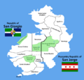 Saint George Island.png 2,600 × 2,500; 253 KB
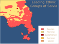 Salvia ethnic.png 1,003 × 756; 98 KB
 Salvia map.png 600 × 608; 139 KB
 Salvia.png 664 × 664; 126 KB
 Salviaprovinces.png 1,412 × 1,685; 205 KB
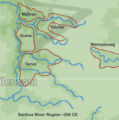 Sarthus River Region 200CE.png 573 × 576; 196 KB
 SawbraniaGlobe.png 1,002 × 1,002; 162 KB
 Screenshot 2022-01-30 204703.png 449 × 399; 62 KB
 Screenshot 2022-02-06 200354.png 429 × 484; 45 KB
 Screenshot 2022-02-14 200246.png 509 × 561; 106 KB
 Seylos satellite.png 2,000 × 2,000; 1.91 MB
 SeylosMaps.png 1,202 × 850; 209 KB
 Simplified cultural map of esonice.png 1,632 × 1,562; 223 KB
 SSI Eurth.png 1,599 × 832; 354 KB
 SSI Thalassa.png 670 × 670; 87 KB
 States Map of the United Republic NO LABELS.png 3,178 × 3,832; 590 KB
 Stedoria Globe1.png 1,002 × 1,002; 181 KB
 Stylish Map of Littland 2022.png 3,000 × 3,000; 1.13 MB
 Tagmatine migration.png 737 × 552; 62 KB
 TagmatiumKoppenMap.png 815 × 851; 165 KB
 Tectonic plates of Eurth.png 4,000 × 2,000; 1.14 MB
 Thalassan Tigers.png 650 × 460; 3 KB
 Themes of Mito.svg 424 × 437; 36 KB
 ThransaltzGlobe.png 1,002 × 1,002; 204 KB
 Thubten Dispute.png 497 × 586; 64 KB
 Topographic map of Esonice.png 2,059 × 1,823; 453 KB
 Trident member Map.png 698 × 352; 84 KB
 UENA map.png 2,000 × 1,000; 89 KB
 Ulfheimr location.png 1,247 × 567; 451 KB
 Verde blockade.png 600 × 200; 37 KB
 Verdenspladsen.png 2,981 × 2,674; 2.41 MB
 Wampanoag Empire.png 473 × 557; 204 KB
 Xiohane Climate Map.png 1,822 × 2,293; 148 KB
 Zaxar Culture Map Clipart.png 400 × 288; 15 KB
 Zaxar Region Biome Map.png 779 × 652; 104 KB
 Zaxar States Map 1.0.jpg 851 × 658; 194 KB
 Zaxar Wiki Map.png 754 × 709; 147 KB


&oldid=444819&fileuntil=Map-of-Vanarambaion.png#mw-category-media)