Kashubia: Difference between revisions
No edit summary |
No edit summary |
||
| Line 9: | Line 9: | ||
|symbol_type = Emblem | |symbol_type = Emblem | ||
|national_motto = ''[[Síla, Svoboda, Solidarita]]''<br/><small>"Strength, Freedom, Unity"</small> | |national_motto = ''[[Síla, Svoboda, Solidarita]]''<br/><small>"Strength, Freedom, Unity"</small> | ||
|national_anthem = [https://www.youtube.com/watch?v=oyO056Ab-sQ&ab_channel=AlifefortheCzar To The Allegiant Ones] | |national_anthem = [https://www.youtube.com/watch?v=oyO056Ab-sQ&ab_channel=AlifefortheCzar | ||
K těm Allegiantům <br/> To The Allegiant Ones] | |||
|image_map = Kashubia map small.png | |image_map = Kashubia map small.png | ||
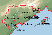
|map_caption = Topographical relief map with major cities. | |map_caption = Topographical relief map with major cities. | ||
Revision as of 00:38, 5 January 2021
This article is incomplete because it is pending further input from participants, or it is a work-in-progress by one author. Please comment on this article's talk page to share your input, comments and questions. Note: To contribute to this article, you may need to seek help from the author(s) of this page. |
Republic of Kaszuby Republika Kaszuby Республика Кашубия Kasuhbia | |
|---|---|
Motto: Síla, Svoboda, Solidarita "Strength, Freedom, Unity" | |
Anthem: [https://www.youtube.com/watch?v=oyO056Ab-sQ&ab_channel=AlifefortheCzar
K těm Allegiantům To The Allegiant Ones] | |
 Topographical relief map with major cities. | |
| Capital and largest city | Kralovice |
| Ethnic groups (1931) | Kashubian 67.7% Czech 10.6% |
| Demonym(s) | Kashubian |
| Government | Unitary parliamentary republic (1919–1930) Unitary presidential constitutional republic (1919–1931) |
| Antonin Jaskowski | |
| Sovereign State | |
• Independence | 1918 |
• Constitution | 1918 |
| Area | |
• Total Land | 265,171.42 km2 (102,383.26 sq mi)does not include inland lakes |
• Water (%) | 13.41% |
| Population | |
• 2020 census | 14,861,348 |
• Density | [convert: invalid number] |
| GDP (PPP) | 2020 estimate |
• Total | $408.465 billion |
• Per capita | $27,599 |
| Currency | Koruna (KOR) |
| Time zone | UTC-1 (Menghean Southwestern Time) |
| Date format | yyyy-mm-dd; CE(AD) |
| Driving side | right |
| Calling code | +25 |
Kaszubya (/Ka-shU-bya/ in English), also known as Kashubia is a sovereign nation in central-coastal Kylaris. It is bordered by Vedmed to the north; Amathia to the east; Tengaria to the south, and Yavorstrana to the west. Kashubia's capital and largest city, Kralovice, is situated on the eastern shores of Lake Mareaspero. Though possessing a unique language and culture, Kashubia was a part of the Empire of Tengaria until its fall following the Great War (Kylaris), after which Kashubia gained its independence. It has a population of 14.8 billion, and an economy centered around agriculture, manufacturing, and mining.
Eytomology
n/a
History
First Settlements
Settlement in the area called Kashubia for the last 1,000 years started by the end of the Glacial Stage, some 13,000 years ago. Archeological traces have been found of various cultures during the Stone and Bronze Age, Baltic peoples, Germanic peoples during the Iron Age and, in the Dark Ages, West Slavic tribes and Vikings. Starting in the 10th century, early Kashubian rulers united the region.
As part of the Grand Principality
Kaszuby was a client-state of the Grand Principality of Tengaria.
Iconclast Wars
DEFENESTRATION GANG
Revolution and Independence
During the Great War, almost one hundred thousand Kashubians fought as part of the Kasuhbian Legion against the Empire. In a large part thanks to their efforts during the war, Kaszuby was able to break free of Imperial reign and establish itself as an independent state for the first time since its partition by the Kingdom of Vihoslavia and the Empire.
Kashubian Legion
Czechs! On Trains! In Siberia!
Republic of Kazubya
The Republic is Kaszubya's modern-day state.
Geography
Steppe
Mareaspero Coast
Black Mountains
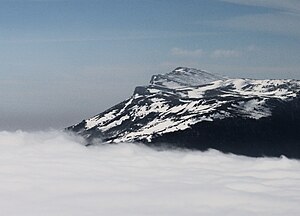
The Black Mountains dominate Kaszuby's northern and western frontiers. The mountains, named for the slate and obsidian that dominate their slopes, are both naturally hazardous and resource rich. The primary range forms an arc throughout Central and southeastern Patrium. Roughly 1,500 km (932 mi) long, the range stretches from the XXX, to Kaszuby's eastern frontier, and down to the southern Patriumonic coast. The highest range within the Carpathians is known as the Tatra mountains in northern Kaszuby, where the highest peaks exceed 2,600 m (8,530 ft).
Zelenamoriya Foothills
Lake Sivash
Geology
Land use
Climate
Government
Constitution and Law
Administrative divisions
Politics
Foreign Relations
Military
Economy
Agriculture
Manufacturing
Mining
Energy
Culture
who gives a flying fuck


