User:Geordinia/sandbox12: Difference between revisions
(Replaced content with "Category:Rajyaghar {{Infobox subdivision type | name = Union States and Federal Territories | map = RajyagharStateMap.png | category...") Tag: Replaced |
No edit summary |
||
| Line 13: | Line 13: | ||
{{Politics of Rajyaghar}} | {{Politics of Rajyaghar}} | ||
== List of Administrative | The '''Administrative Divisions of Rajyaghar''' are the administrative subdivisions of the Kingdom. These divisions are composed of a heirarchy of different federal levels ranging from regions to communes. The principal functionary administrative divisions of the Kingdom are the federal units comprised of 11 Union States, 2 Federal Territories and 1 Autonomous Princely State. | ||
Since independence, despite being a constitutional federation the Kingdom has a highly centralised form of government with the majority of major policy decisions being decided and enforced by the [[Cabinet of Rajyaghar|Ashta Pradhan]] and [[Shahee Sansad]]. After the introduction of the Saṅghīya Constitution following the Niralan Seccession, more power was distributed to the Union States and Federal Territories and special constitutional provisions were granted to Nivasasthan transforming it into a semi-autonomous federal unit under the designation of "Autonomous Princely State". | |||
The Union States and the Princely State of Nivasasthan are based on the historical Madhyarajyas with their monarchical heads of state retaining their status but as ceremonial heads of federal states titled ''"Rajakumars"''. The Federal Districts are governed differently with the ''Panditrao'' (High Priest) in [[Bishnupur]] and ''the Governor'' in [[Kinadica]]. | |||
==Federal Hierarchy== | |||
{{Tree chart/start}} | |||
{{Tree chart|}} | |||
{{Tree chart| | | FED | FED=[[List of sovereign states of Kylaris|'''National''']]<br>([[Rajyaghar]])}} | |||
{{Tree chart| | | |!| | | | | }} | |||
{{Tree chart| | | PRO | PRO=[[Administrative divisions of Rajyaghar#Regions|'''Regions''']]<br>(e.g. [[The Core]])}} | |||
{{Tree chart| | | |!| | | | | }} | |||
{{Tree chart| | | DIV | DIV=[[Administrative divisions of Rajyaghar#Federal Units|'''Federal Units''']]<br>(e.g. [[Sanyukt]])}} | |||
{{Tree chart| | | |!| | | | | }} | |||
{{Tree chart| | | DIS | DIS=[[Administrative divisions of Rajyaghar#Provinces|'''Provinces''']]<br>(e.g. Uttarīyatoch)}} | |||
{{Tree chart| | | |!| | | | | }} | |||
{{Tree chart| | | SUB | SUB={{wp|Electoral district|'''Districts'''}}<br>(e.g. Sanyukt's 3rd District)}} | |||
{{Tree chart| | | |!| | | | | }} | |||
{{Tree chart| | |Block| Block={{wp|Township|'''Commune'''}}<br>(Rural Villages and City Boroughs)}} | |||
{{Tree chart|}} | |||
{{Tree chart/end}} | |||
==Federal Subdivisions== | |||
===Regions=== | |||
Peninsular States | |||
The Core | |||
Outer Rim States | |||
The South | |||
===Union States and Federal Territories=== | |||
{| class="wikitable sortable mw-collapsible" border="1" style="font-size:90%" | {| class="wikitable sortable mw-collapsible" border="1" style="font-size:90%" | ||
! Type | ! Type | ||
| Line 41: | Line 75: | ||
| 3,160,018 | | 3,160,018 | ||
| align="center" | 31 | | align="center" | 31 | ||
| XX<br>''Panditrao'' | |||
| XX | |||
|[[File:Bishnupur Map.jpg|105px]] | |||
|- | |||
| bgcolor="darkgray" | Federal Territory | |||
| [[Kinadica]] | |||
| The Core | |||
| [[Kinadica]] | |||
| 6,724,100 | |||
| align="center" | 67 | |||
| Rajiv Sirasikar<br>''the Governor'' | |||
| Panditrao XX | | Panditrao XX | ||
|[[File:Bishnupur Map.jpg|105px]] | |||
|- | |||
| bgcolor="lightgray" | Princely State | |||
| [[Nivasasthan]] | |||
| The South | |||
| [[Kinadica]] | |||
| 6,724,100 | |||
| align="center" | 67 | |||
| Rajiv Sirasikar<br>''the Governor'' | |||
| Panditrao XX | | Panditrao XX | ||
|[[File:Bishnupur Map.jpg|105px]] | |[[File:Bishnupur Map.jpg|105px]] | ||
Latest revision as of 20:41, 14 July 2023
| Union States and Federal Territories | |
|---|---|
 | |
| Category | Federated State |
| Location | |
| Number | 11 Union States 2 Federal Territories 1 Autonomous Princely State |
| Government | State government |
| Subdivisions | Province, District, Commune |
 |
|---|
| This article is part of a series on the politics and government of Rajyaghar |
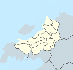
The Administrative Divisions of Rajyaghar are the administrative subdivisions of the Kingdom. These divisions are composed of a heirarchy of different federal levels ranging from regions to communes. The principal functionary administrative divisions of the Kingdom are the federal units comprised of 11 Union States, 2 Federal Territories and 1 Autonomous Princely State.
Since independence, despite being a constitutional federation the Kingdom has a highly centralised form of government with the majority of major policy decisions being decided and enforced by the Ashta Pradhan and Shahee Sansad. After the introduction of the Saṅghīya Constitution following the Niralan Seccession, more power was distributed to the Union States and Federal Territories and special constitutional provisions were granted to Nivasasthan transforming it into a semi-autonomous federal unit under the designation of "Autonomous Princely State".
The Union States and the Princely State of Nivasasthan are based on the historical Madhyarajyas with their monarchical heads of state retaining their status but as ceremonial heads of federal states titled "Rajakumars". The Federal Districts are governed differently with the Panditrao (High Priest) in Bishnupur and the Governor in Kinadica.
Federal Hierarchy
| National (Rajyaghar) | |||||||||||||||||
| Regions (e.g. The Core) | |||||||||||||||||
| Federal Units (e.g. Sanyukt) | |||||||||||||||||
| Provinces (e.g. Uttarīyatoch) | |||||||||||||||||
| Districts (e.g. Sanyukt's 3rd District) | |||||||||||||||||
| Commune (Rural Villages and City Boroughs) | |||||||||||||||||
Federal Subdivisions
Regions
Peninsular States The Core Outer Rim States The South
Union States and Federal Territories
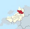
| Type | Name | Region | Capital | Population | Seats in Shahee Sansad |
Rajakumar | First Minister | Location |
|---|---|---|---|---|---|---|---|---|
| Union State | Sanyukt | The Core | Kentola | 9,690,722 | 96 | Shivaji Rajana | Goivand Baria | 
|
| Federal Territory | Bishnupur | The Core | Bishnupur | 3,160,018 | 31 | XX Panditrao |
XX | 
|
| Federal Territory | Kinadica | The Core | Kinadica | 6,724,100 | 67 | Rajiv Sirasikar the Governor |
Panditrao XX | 
|
| Princely State | Nivasasthan | The South | Kinadica | 6,724,100 | 67 | Rajiv Sirasikar the Governor |
Panditrao XX | 
|