User:Lyonsland/sandbox3: Difference between revisions
Jump to navigation
Jump to search
(Blanked the page) Tag: Blanking |
No edit summary |
||
| Line 1: | Line 1: | ||
[[Category:Hennehouwe]][[Category:Cities (Kylaris)]]{{Infobox settlement | |||
|name = s'Holle | |||
|official_name = | |||
|native_name = | |||
|settlement_type = {{wp|Capital city}} and [[Hennehouwe#Administrative divisions|city region]] | |||
|image_skyline = {{Photomontage|position=center | |||
| photo1a = Skyline_Rotterdam_from_Schiebroek_cropped.jpg | |||
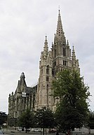
| photo2a = Bxl,_Eglise_Notre-Dame_de_Laeken-2.jpg | |||
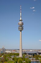
| photo2b = Olympiaturm,_Múnich,_Alemania_2012-04-28,_DD_20.JPG | |||
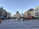
| photo3a = De_Brouckèreplein_Brussel_juli_2021.jpg | |||
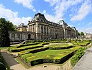
| photo3b = Royal_Palace_in_Brussels.JPG | |||
| photo4a = Cinquantenaire_Park_panorama.jpg | |||
| size = 270 | |||
| spacing = 2 | |||
| color = #FFFFFF | |||
| border = 0}} | |||
|image_alt = | |||
|image_caption = From top down, left to right: the city skyline, [[s'Holle#Religion|St. Charles Cathedral]], the [[s'Holle#Media|s'Holle Broadcasting Tower]], [[s'Holle#Economy|Elsenplein]] {{wp|central square}}, the ''[[s'Holle#Politics|Senaatsgebouw]]'', and [[s'Holle#Geography|Cornelissen Park]] | |||
|image_flag = Sholle_flag.png | |||
|flag_size = 125px | |||
|flag_alt = | |||
|image_seal = | |||
|seal_alt = | |||
|image_shield = Sholle Coat of Arms.png | |||
|shield_alt = | |||
|etymology = | |||
|nickname = ''The Home of Hennehouwe'', | |||
|anthem = | |||
|motto = | |||
|image_map = {{Location map|Hennehouwe | |||
|alt = | |||
|lat_deg = 22.1 | |||
|lon_deg = 28.2 | |||
|position = bottom | |||
|label = s'Holle | |||
|caption = | |||
|width = 300 | |||
}} | |||
|map_alt = | |||
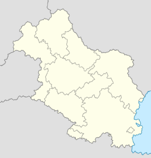
|map_caption = Location within Hennehouwe | |||
|coordinates = <!-- {{coord|latitude|longitude|type:city|display=inline,title}} --> | |||
|coor_pinpoint = | |||
|coordinates_footnotes = | |||
|subdivision_type = Country | |||
|subdivision_name = {{flag|Hennehouwe}} | |||
|subdivision_type1 = Region | |||
|subdivision_name1 = s'Holle | |||
|subdivision_type2 = | |||
|subdivision_name2 = | |||
|subdivision_type3 = | |||
|subdivision_name3 = | |||
|established_title = | |||
|established_date = | |||
|founder = | |||
|seat_type = | |||
|seat = | |||
|government_footnotes = | |||
|government_type = {{wp|Parliamentary system|parliamentary}} {{wp|Constituent state|region}} within a {{wp|federation|federal}} {{wp|republic}} | |||
|governing_body = [[s'Holle#Politics|s'Holle City Assembly]] | |||
|leader_title = {{nowrap|[[Mayor–Governor of s'Holle|Mayor–Governor]]}} | |||
|leader_name = [[Marijne Tijhoff]] | |||
|leader_party = [[Socialist Labour Party (Hennehouwe)|SAP]] | |||
|leader_title1 = Governing parties | |||
|leader_name1 = [[Socialist Labour Party (Hennehouwe)|SAP]], [[Progressive Democratic Party (Hennehouwe)|VDP]] and [[Green Party (Hennehouwe)|Groen]] | |||
|leader_title2 = [[Senate of Hennehouwe|First Chamber]] seats | |||
|leader_name2 = 7 (of 60) | |||
|leader_title3 = [[Senate of Hennehouwe|Second Chamber]] seats | |||
|leader_name3 = 21 (of 180) | |||
|leader_title4 = | |||
|leader_name4 = | |||
|total_type = Region | |||
|unit_pref = Metric | |||
<!-- ALL fields with measurements have automatic unit conversion --> | |||
<!-- for references: use <ref> tags --> | |||
|area_footnotes = | |||
|area_urban_footnotes = <!-- <ref> </ref> --> | |||
|area_rural_footnotes = <!-- <ref> </ref> --> | |||
|area_metro_footnotes = <!-- <ref> </ref> --> | |||
|area_note = | |||
|area_water_percent = | |||
|area_rank = | |||
|area_blank1_title = | |||
<!-- square kilometers --> | |||
|area_total_km2 = 432 | |||
|area_land_km2 = | |||
|area_water_km2 = | |||
|area_urban_km2 = | |||
|area_rural_km2 = | |||
|area_metro_km2 = 1,803 | |||
|area_blank1_km2 = | |||
|length_km = | |||
|width_km = | |||
|dimensions_footnotes = | |||
|elevation_footnotes = | |||
|elevation_m = | |||
|population_footnotes = | |||
|population_as_of = | |||
|population_density_km2 = auto | |||
|population_note = | |||
|population_total = 1,413,551 | |||
|population_urban = | |||
|population_metro = 2,741,380 | |||
|population_demonym = s'Holler | |||
|population_rank = 1st ([[Hennehouwe]]) | |||
|timezone1 = Euclean Standard Time | |||
|utc_offset1 = +0 | |||
|timezone1_DST = | |||
|utc_offset1_DST = | |||
|postal_code_type = {{wp|Postal code|Postal code(s)}} | |||
|postal_code = {{wp|Postal code|SH}}, {{wp|Postal code|SHA}}, {{wp|Postal code|SHB}}, {{wp|Postal code|SHD}}, {{wp|Postal code|SHE}}, {{wp|Postal code|SHM}}, {{wp|Postal code|SHP}}, {{wp|Postal code|SHR}}, {{wp|Postal code|SHS}}, {{wp|Postal code|SHV}}, {{wp|Postal code|SHX}}, {{wp|Postal code|SO}}, {{wp|Postal code|Y}}, {{wp|Postal code|YS}}, | |||
|area_code_type = | |||
|area_code = | |||
|area_codes = <!-- for multiple area codes --> | |||
|iso_code = | |||
|website = {{URL|sholle.hh}} | |||
|module = | |||
|footnotes = | |||
|blank_name_sec1 = Official languages | |||
|blank_info_sec1 = {{plainlist| | |||
*{{wp|Dutch_language|Hennish}}}} | |||
}} | |||
Revision as of 12:41, 15 March 2022
s'Holle | |
|---|---|
From top down, left to right: the city skyline, St. Charles Cathedral, the s'Holle Broadcasting Tower, Elsenplein central square, the Senaatsgebouw, and Cornelissen Park | |
|
Coat of arms of s'Holle Coat of arms | |
| Nickname: The Home of Hennehouwe, | |
Location within Hennehouwe | |
| Country | |
| Region | s'Holle |
| Government | |
| • Type | parliamentary region within a federal republic |
| • Body | s'Holle City Assembly |
| • Mayor–Governor | Marijne Tijhoff (SAP) |
| • Governing parties | SAP, VDP and Groen |
| • First Chamber seats | 7 (of 60) |
| • Second Chamber seats | 21 (of 180) |
| Area | |
| • Region | 432 km2 (167 sq mi) |
| • Metro | 1,803 km2 (696 sq mi) |
| Population | |
| • Region | 1,413,551 |
| • Rank | 1st (Hennehouwe) |
| • Density | 3,300/km2 (8,500/sq mi) |
| • Metro | 2,741,380 |
| Demonym | s'Holler |
| Time zone | UTC+0 (Euclean Standard Time) |
| Postal code(s) | |
| Official languages | |
| Website | sholle |

