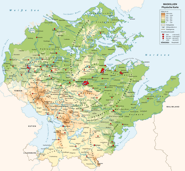
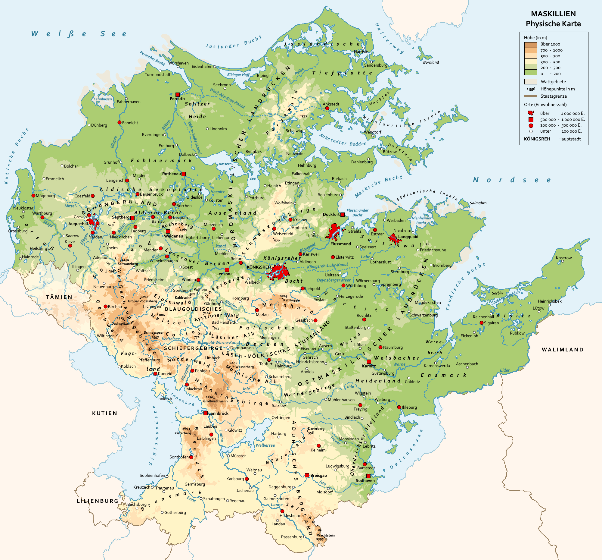
File:General topographic map of Mascylla.png
Jump to navigation
Jump to search
Size of this preview: 645 × 599 pixels. Other resolution: 2,000 × 1,858 pixels.
Original file (2,000 × 1,858 pixels, file size: 804 KB, MIME type: image/png)
File history
Click on a date/time to view the file as it appeared at that time.
| Date/Time | Thumbnail | Dimensions | User | Comment | |
|---|---|---|---|---|---|
| current | 00:31, 10 January 2023 | | 2,000 × 1,858 (804 KB) | Concleror (talk | contribs) | |
| 21:25, 4 January 2023 |  | 2,000 × 1,858 (799 KB) | Concleror (talk | contribs) | ||
| 21:18, 4 January 2023 |  | 2,000 × 1,858 (799 KB) | Concleror (talk | contribs) | ||
| 21:12, 4 January 2023 | 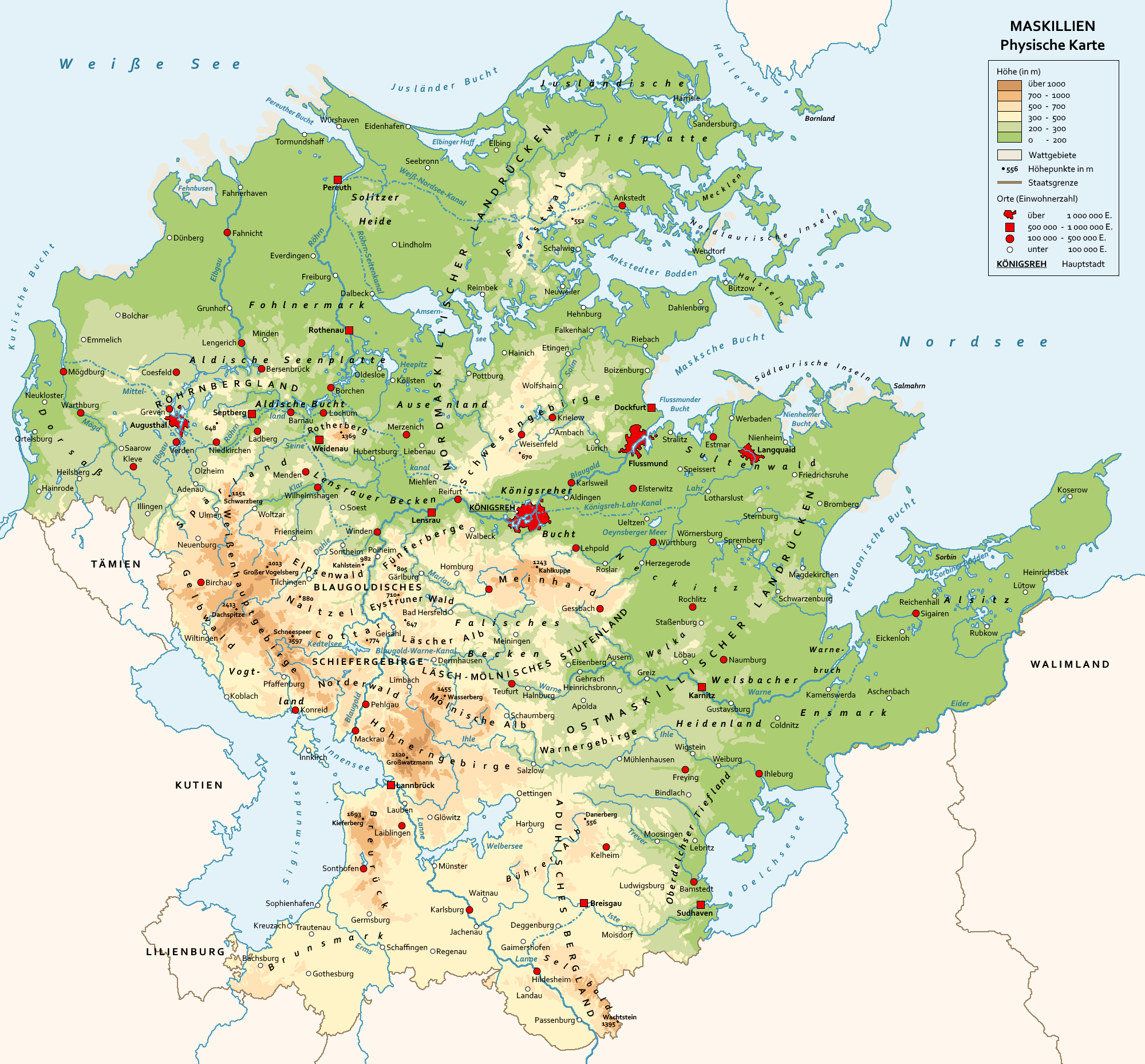 | 2,000 × 1,858 (799 KB) | Concleror (talk | contribs) |
You cannot overwrite this file.
File usage
The following page uses this file: