Category:Mascylla
Jump to navigation
Jump to search
Pages and files containing "Mascylla" are linked here.
Pages in category "Mascylla"
The following 102 pages are in this category, out of 102 total.
A
B
C
E
F
H
K
L
M
- MAOA
- Mascane
- Mascylla
- Mascyllary Air Force
- Mascyllary Army
- Mascyllary colonial empire
- Mascyllary Karning
- Mascyllary Kingdom
- Mascyllary Navy
- Mascyllary people
- Mascyllary Revolution of 1847
- Template:Mascyllary Royal Family
- Mascyllary Soviet Republic
- Template:Mascyllatopics
- Maskillea Airlines
- Media of Mascylla
- Meilke – Geeint in Mord und Schwur
- Monarchy of Mascylla
S
Media in category "Mascylla"
The following 24 files are in this category, out of 24 total.
- Arms of Mascylla.png 933 × 1,076; 549 KB
- Blank space for iiwiki.png 1,000 × 1,000; 267 bytes
- Coat of arms of Augusthal.png 906 × 1,690; 910 KB
- Coat of arms of Flussmund.png 1,549 × 1,200; 987 KB
- Coat of arms of Königsreh.png 2,320 × 1,993; 2.9 MB
- Composition of the Mascyllary Reichssenat, 2022.png 1,757 × 886; 171 KB
- Dorothea I of Mascylla in 2016 (cropped).png 659 × 882; 670 KB
- Flag of Augusthal.png 2,000 × 1,300; 537 KB
- Flag of the Duchy of Engelbart-Maining und Saanberg.png 1,280 × 853; 596 bytes
- Flag of the Duchy of Welsbach-Gehrach.png 1,280 × 853; 242 KB
- Flag of the Grand Duchy of Amretz-Heinrichsbronn-Amsern.png 1,280 × 853; 492 bytes
- Flag of the Grand Duchy of Langquaid.png 1,280 × 853; 594 bytes
- Flag of the Mascyllary Post.png 1,600 × 900; 80 KB
- Flag of the Principality of Würthburg.png 1,280 × 853; 594 bytes
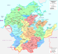
- General map of Mascylla (2022).png 2,096 × 1,948; 750 KB
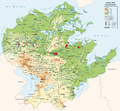
- General topographic map of Mascylla.png 2,000 × 1,858; 804 KB
- Location map of the Kingdom of Adwhin.png 2,096 × 1,948; 82 KB
- Location map of the Kingdom of Aldia.png 2,096 × 1,948; 83 KB
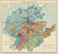
- Map of Mascylla before the War of the Five Kings (Heep).png 2,265 × 2,100; 4.2 MB
- Map of the Elbgau Confederation 1789.png 2,096 × 1,948; 80 KB
- Map of the War of the Five Kings.png 2,096 × 1,948; 81 KB
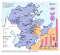
- Mascyllary Kingdom economic map.png 2,425 × 2,200; 837 KB
- PRM map.png 2,096 × 1,948; 79 KB
- Standard of the Mascyllary Kingdom (1793).png 2,000 × 1,300; 590 KB
