Samripe Mountain Range: Difference between revisions
Jump to navigation
Jump to search
(Created page with "{{Infobox mountain | name = Samripe Mountains | other_name = साम्रिपे हिमालहरू (Mahanan) | etymology = named by...") |
Lyooonheimer (talk | contribs) No edit summary |
||
| Line 1: | Line 1: | ||
{{Infobox mountain | {{Infobox mountain | ||
| name = Samripe Mountains | | name = Samripe Mountains | ||
| other_name = साम्रिपे हिमालहरू ([[Mahanan]]) | | other_name = साम्रिपे हिमालहरू ([[Mahanan]]) <br> ས་མོ་རི་བོ། ([https://en.wikipedia.org/wiki/Tibetan_script Carelitan]) | ||
| etymology = | | etymology = "Mother's Peak of the World" | ||
| native_name = | | native_name = | ||
| native_name_lang = | | native_name_lang = | ||
| photo = [[File: | | photo = [[File:OIP (1).jpg|300px]] | ||
| photo_size = | | photo_size = | ||
| photo_alt = | | photo_alt = | ||
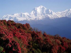
| photo_caption = | | photo_caption = The Samripe Mountains from the east camp of the peak [[X92]] | ||
| map = | | map = | ||
| map_image = [[File:Screenshot | | map_image = [[File:Screenshot 2022-01-03 153948.png|300px]] | ||
| map_alt = | | map_alt = | ||
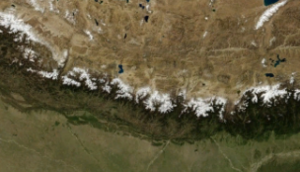
| map_caption = | | map_caption = Satellite image of the mountains. | ||
| map_relief = | | map_relief = | ||
| map_size = | | map_size = | ||
| location = [[ | | location = [[Mahana]], [[Orient]] | ||
| label = | | label = | ||
| label_position = | | label_position = | ||
| highest = [[Mount | | highest = [[Mount Monjara]] | ||
| elevation_m = | | elevation_m = 7,963 | ||
| elevation_ft = | | elevation_ft = | ||
| elevation_ref = | | elevation_ref = | ||
| Line 34: | Line 34: | ||
| translation = | | translation = | ||
| language = | | language = | ||
| pronunciation = | | pronunciation = sam-ree-pay | ||
| range = | | range = | ||
| coordinates = | | coordinates = | ||
| Line 40: | Line 40: | ||
| topo = | | topo = | ||
| type = | | type = | ||
| age = | | age = 79 Million years | ||
| geology = | | geology = | ||
| volcanic_arc = | | volcanic_arc = | ||
| Line 47: | Line 47: | ||
| volcanic_arc/belt = | | volcanic_arc/belt = | ||
| last_eruption = | | last_eruption = | ||
| first_ascent = | | first_ascent = | ||
| easiest_route = | | easiest_route = | ||
| normal_route = | | normal_route = | ||
| access = | | access = | ||
| Line 54: | Line 54: | ||
| embedded = | | embedded = | ||
}} | }} | ||
The '''Samripe Mountain Range''', or '''Samripes''' ([[Mahanan]]: साम्रिपे हिमालहरू, [https://en.wikipedia.org/wiki/Tibetan_script Carelitan]: ས་མོ་རི་བོ། | IPA: sæmɹipeɪ) are a large mountain range in [[Mahana]] that seperates the [[Careleon Plateau]] from the lowland areas of [[Mahana]]. | |||
Revision as of 15:58, 3 January 2022
| Samripe Mountains | |
|---|---|
| साम्रिपे हिमालहरू (Mahanan) ས་མོ་རི་བོ། (Carelitan) | |
 The Samripe Mountains from the east camp of the peak X92 | |
| Highest point | |
| Peak | Mount Monjara |
| Elevation | 7,963 m (26,125 ft) |
| Naming | |
| Etymology | "Mother's Peak of the World" |
| Pronunciation | sam-ree-pay |
| Geography | |
| Location | Mahana, Orient |
| Geology | |
| Age of rock | 79 Million years |
The Samripe Mountain Range, or Samripes (Mahanan: साम्रिपे हिमालहरू, Carelitan: ས་མོ་རི་བོ། | IPA: sæmɹipeɪ) are a large mountain range in Mahana that seperates the Careleon Plateau from the lowland areas of Mahana.
