Kestutia: Difference between revisions
Jump to navigation
Jump to search
(Created page with "{{WIP}} {{Region icon Kylaris}} {{Infobox settlement | name = Kestutia | native_name = ''Kestutija'' | official_name = State of Kes...") |
mNo edit summary |
||
| Line 27: | Line 27: | ||
| leader_name = tbd | | leader_name = tbd | ||
| governing_body = [[Saeimas of Kestutia|Saeimas]] | | governing_body = [[Saeimas of Kestutia|Saeimas]] | ||
| area_total_km2 = | | area_total_km2 = 38,939.21 | ||
| area_land_km2 = | | area_land_km2 = | ||
| area_water_km2 = | | area_water_km2 = | ||
| area_rank = | | area_rank = 11th | ||
| elevation_max_m = | | elevation_max_m = | ||
| elevation_max_point = | | elevation_max_point = | ||
Revision as of 11:38, 24 March 2022
This article is incomplete because it is pending further input from participants, or it is a work-in-progress by one author. Please comment on this article's talk page to share your input, comments and questions. Note: To contribute to this article, you may need to seek help from the author(s) of this page. |
Kestutia
Kestutija | |
|---|---|
| State of Kestutia Kestutijos valstija | |
| Nickname: The tbd State | |
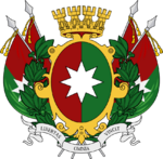
| Motto(s): Florebo quocumque ferar (Solarian) (I will flourish wherever I am brought) | |
| Location of Kestutia in Aucuria Location of Kestutia in Aucuria | |
| Country | |
| Capital and largest city | Naujoji Šilokrautė |
| Government | |
| • Body | Saeimas |
| • Governor | tbd |
| Area | |
| • Total | 38,939.21 km2 (15,034.51 sq mi) |
| • Rank | 11th |
| Population (2014) | |
| • Total | 1,668,940 |
| • Rank | 8th |
| • Density | 43/km2 (110/sq mi) |
| Demonym | Kestutian |
| Postal code | KE |
| ISO 3166 code | AK-KE |
Kestutia (Ruttish: Kestutija) is one of the nineteen states of the Aucurian Republic. Located along the country's northern coast, it is bordered by the states of New Ruttland, Chucisaca, Chanchamaya, and Magdaliete. Its capital and largest city is Naujoji Šilokrautė.
[history]
[current economics, demographics, politics, etc.]
History
[any precolonial stuff]
[colonial period]
[postcolonial history]

