Alcantara: Difference between revisions
mNo edit summary |
|||
| Line 134: | Line 134: | ||
==Geography== | ==Geography== | ||
<gallery mode=packed heights=120px> | |||
File:Cabo Ortegal (Spain).jpg|Cape del Cartiño | |||
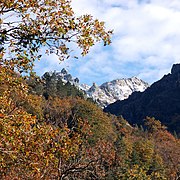
File:Geres1.jpg|Pico de Santiago in Serra Das Cobras, natural limit between Morroseta and [[Costa de Ouro]] | |||
File:Paisaje de prados de siega en Cantabria (España). Monte (Riotuerto), Barrio de Idiopuerta.jpg|Farms in the Comarca da Xalla | |||
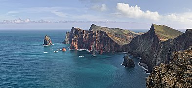
File:Ponta de São Lourenço north north east.jpg|Ponta de Ortegal, southernmost point of Morroseta and Costa de Ouro | |||
File:Two curious cows (Bos taurus), Pico Island, Azores, Portugal (PPL1-Corrected) julesvernex2.jpg|Rural landscape on Antilla, Costa de Ouro | |||
</gallery> | |||
===Climate=== | ===Climate=== | ||
Revision as of 02:13, 22 December 2020
Morrosetan Republic República Morroseta (Morrosetan and Costense) | |
|---|---|
Coat of Arms
| |
| Motto: "Máis aló" (Morrosetan) "Further Beyond" | |
| Capital | A Gracia |
| Official languages | Morrosetan |
| Recognised regional languages | Costense |
| Demonym(s) | Morrosetan |
| Government | Unitary semi-presidential republic |
| Manuel Fraga Touriño | |
| Isabel Saldanha Tamborindeguy | |
| Legislature | Parliament of Morroseta |
| Senate | |
| Chamber of Deputies | |
| Population | |
• 2019 estimate | 2,708,339 |
• 2017 census | 2,174,231 |
• Density | 1,143/km2 (2,960.4/sq mi) |
| GDP (PPP) | 2019 estimate |
• Total | $84,541 billion |
• Per capita | $31,450 |
| GDP (nominal) | 2019 estimate |
• Total | $67,550 billion |
• Per capita | $27,658 |
| Gini (2019) | 33.2 medium |
| HDI (2019) | very high |
| Currency | Escudo (ℰ) (ESC) |
| Date format | dd.mm.yyyy AD |
| Driving side | right |
| Calling code | +243 |
| Internet TLD | .mor |
Morroseta, officially the Morrosetan Republic (Morrosetan and Costense: República Morroseta), is a country located on the Astyrian continent of Teudallum. It borders Cassonne to the north, Monsa to the east and the _ Ocean on the east and south. Its capital city is A Gracia, which is also the most populous urban area. The territory of Morroseta also comprises the autonomous region of Costa de Ouro.
The territory in which is Morroseta today has been inhabited since, at least, 2500 BC, period in which Mosetos expanded settling near the cities of Cartiño and Piñedo. The place saw the development of these settlements that expanded from coastal towns dedicated to the fishing industry, to the first villages in valleys, where fertile lands provided a source of aliments. Mosetos held close contact with the _ at the other side of the Serra das Cobras, that divide Morroseta from mainland Costa de Ouro, and with the time developed authentic forms of self-government that later evolved into small kingdoms that disputed during several years the control of the land. Commercial ties with Exponential merchants served for the consolidation of the large adherence of the population to the Catholic faith and in 1011, Morroseta was founded by the Hesperidesian Kingdom Albandea founded its first harbour in the coast. However, it was going to be in 1261 when the first Morrosetan political unity was formed with the Treaties of A Gracia (Tratados da A Gracia), that united the several kingdoms and duchies of Morroseta into one solely unity under the control of A Gracia. During the early modern period, Morroseta was known as a small colonial power in the south of Teudallum, holding together with Monsa several colonies and profitable species routes.
Enlightenment brought important advances to the socio-political and scientific areas of life. During this period, Morroseta was home to well-known writers and thinkers. In 1741, a revolt and later revolution concluded with the first Constitution of Morroseta that included important limitations to the absolute power of the monarchs, ensured basic human rights and created one of the first modern constitutional monarchies of Astyria, that led to the creation of a legislative power. During most of the 18th and 19th century, Morroseta would live important transformations that concluded with the dismantle of the Morrosetan Overseas; large periods of economic troubles would provoke revolts and the creation of several short-lived republics that would not succeed in the unity of the territory. However, at the start of the 20th century, the country will be immersed in a true civil war between forces pro to keep the monarchy, forces that would push for a liberal republic and the forces of Touriño, who would later establish a conservative and largely confessional republic that will keep Morroseta and Costa de Ouro united under a repressive dictatorship until in 1966, the largest political forces of the country signed the return to a democratic regime. In 1977, the centre-left Partido Socialista Obreiro won for the first time, leading a long period of economic development. During the 90s and early 00s, the country would be governed by the centre-right Renovación Nacional, which led several privatisations and financial reforms.
Morroseta is today a semi-presidential republic, led by a President and a Prime Minister, both elected by universal suffrage for terms of 6 and 5 years approximately respectively. It counts with a developed and advanced economy heavily relied on the services and the industry, with contributions of the agriculture and stock-breeding. The country ranks high in economic freedom, democracy, press freedom and social progress. It is a member of several regional associations and keeps an active role on its influence sphere.
Politically and economically, the country has struggled to escape the immediate influence of its much larger neighbour, Cassonne, an undependable partner. Its foreign relations tend to look further afield out of necessity, leading Morroseta to develop close ties with Cadenza, Kelonna and Monsa, among others.
History
Establishment
Morroseta was founded in 1011 under the auspices of the Hesperidesian kingdom of Albandea, which established a harbour at Ad Gratiam Dei.
Geography
Pico de Santiago in Serra Das Cobras, natural limit between Morroseta and Costa de Ouro


