Kajapas: Difference between revisions
Jump to navigation
Jump to search
mNo edit summary |
mNo edit summary |
||
| Line 25: | Line 25: | ||
| leader_name = tbd | | leader_name = tbd | ||
| governing_body = [[Saeimas of Kajapas|Saeimas]] | | governing_body = [[Saeimas of Kajapas|Saeimas]] | ||
| area_total_km2 = | | area_total_km2 = 29,343.06 | ||
| area_land_km2 = | | area_land_km2 = | ||
| area_water_km2 = | | area_water_km2 = | ||
| area_rank = | | area_rank = 13th | ||
| elevation_max_m = | | elevation_max_m = | ||
| elevation_max_point = | | elevation_max_point = | ||
Revision as of 11:38, 24 March 2022
Kajapas
Kajapas | |
|---|---|
| State of Kajapas Kajapos valstija | |
| Nickname: The Citrus State | |
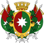
| Motto(s): Sic semper tyrannis (Solarian) (Thus always to tyrants) | |
| Location of Kajapas in Aucuria Location of Kajapas in Aucuria | |
| Country | |
| Capital and largest city | Velykopolė |
| Government | |
| • Body | Saeimas |
| • Governor | tbd |
| Area | |
| • Total | 29,343.06 km2 (11,329.42 sq mi) |
| • Rank | 13th |
| Population (2014) | |
| • Total | 2,107,888 |
| • Rank | 7th |
| • Density | 72/km2 (190/sq mi) |
| Demonym | Kajapan |
| Postal code | KJ |
| ISO 3166 code | AK-KJ |
Kajapas (Ruttish: Kajapas; Casimiran: Kijapa) is one of the nineteen states of the Aucurian Republic. The state consists of two parts, one located on the Aucurian mainland, bordered by Šventasis Silvestras & Suduva, and the other the island of Saint Casimir in the Arucian Sea. Its capital and largest city is Velykopolė.
[history]
[current economics, demographics, politics, etc.]
History
[any precolonial stuff]
[colonial period]
[postcolonial history]

