List of West Monroe Urban/Rural Roads 1-99: Difference between revisions
(→UR 16) |
(→UR 16) |
||
| Line 742: | Line 742: | ||
|terminus_b=[[File:WM-11.png|25px|link=West Monroe State Highway 11]] near [[May, West Monroe|May]] | |terminus_b=[[File:WM-11.png|25px|link=West Monroe State Highway 11]] near [[May, West Monroe|May]] | ||
}} | }} | ||
Urban Road 16 | Urban Road 16 serves the eastern part of the [[Rhone]] metro area, serving Mason, King, and Wilkinson Counties. | ||
{| class=wikitable | {| class=wikitable | ||
|- | |- | ||
| Line 802: | Line 802: | ||
| | | | ||
| [[File:WM-11.png|25px|link=West Monroe State Highway 11]] - [[May, West Monroe|May]], [[Brownwoood, West Monroe|Brownwood]] | | [[File:WM-11.png|25px|link=West Monroe State Highway 11]] - [[May, West Monroe|May]], [[Brownwoood, West Monroe|Brownwood]] | ||
|} | |||
==UR 17== | |||
[[File:UR-17.png|right|300px]] | |||
{{Infobox road | |||
|length_mi=32 | |||
|length_ref= | |||
|formed=1982 | |||
|direction_a=West | |||
|terminus_a= [[File:WM-1.png|25px|link=West Monroe State Highway 1]] in [[Bishop, West Monroe|Bishop]] | |||
|junction= | |||
|direction_b=East | |||
|terminus_b=[[File:I-410.svg|25px|link=Interstate 410 (West Monroe)]][[File:LP-111.png|25px|link=West Monroe State Loop 111]] in [[Freemont, West Monroe|Freemont]] | |||
}} | |||
Urban Road 17 runs along the south bank of the [[Cooper River]] through the cities of Bishop and Willmington | |||
{| class=wikitable | |||
|- | |||
! style="text-align:center; vertical-align:bottom;"| '''County''' | |||
! style="text-align:center; vertical-align:bottom;"| '''Location''' | |||
! style="text-align:center; vertical-align:bottom;"| '''Destination''' | |||
|- | |||
| rowspan="12" | [[Freemont County, West Monroe|Freemont]] | |||
| rowspan="6" | [[Bishop, West Monroe|Bishop]] | |||
| [[File:WM-1.png|25px|link=West Monroe State Highway 1]] - [[Westside Village, West Monroe|Westside Village]], [[Green Bay, West Monroe|Green Bay]] | |||
|- | |||
| [[File:UR-1.png|25px|link=West Monroe Urban Road 1]] - [[Willmington, West Monroe|Willmington]] | |||
|- | |||
| [[File:LP-190.png|25px|link=West Monroe State Loop 190]] - [[Willmington Navy Yard]] | |||
|- | |||
| [[File:I-10.svg|25px|link=Interstate 10]] - [[Willmington, West Monroe|Willmington]], [[Orange, West Monroe|Orange]] | |||
|- | |||
| [[File:US 2.svg|25px|link=Ibican Route 2]] - [[Ferris, West Monroe|Ferris]], [[Brookfield, West Monroe|Brookfield]] | |||
|- | |||
| [[File:WMS-421.png|25px|link=West Monroe Spur Highway 421]] - [[Ferris, West Monroe|Ferris]] | |||
|- | |||
| rowspan="4" | [[Willmington, West Monroe|Willmington]] | |||
| [[File:UR-67.png|25px|link=West Monroe Urban Road 67]] to [[File:WMS-45.png|25px|link=West Monroe Spur Highway 45]] - [[Collins, West Monroe|Collins]] | |||
|- | |||
| [[File:I-410.svg|25px|link=Interstate 410 (West Monroe)]][[File:LP-111.png|25px|link=West Monroe State Loop 111]] - [[Carrington, West Monroe|Carrington]], [[Bishop, West Monroe|Bishop]], [[Willmington Carter International Airport]] | |||
|} | |} | ||
{{clear}} | {{clear}} | ||
Revision as of 02:55, 26 July 2023
  West Monroe Rural Road and Urban Road markers | |
| Highway names | |
|---|---|
| Interstates | Interstate Highway X (IH-X, I-X) |
| Ibican Route: | Ibican Route X (IR X) |
| Loops: | Loop X |
| Spurs: | Spur X |
| Rural or Urban Roads: | Rural Road X (RR X) Urban Road X (UR X) |
| Park Roads: | Park Road X (PR X) |
Urban and Rural Roads in West Monroe are owned and maintained by the West Monroe Department of Transportation (WMDOT).
UR 1
| Route information | |
|---|---|
| Length | 41 mi (66 km) |
| Existed | 1934–present |
| Major junctions | |
| South end | |
| North end | |
| County | Location | Destination |
|---|---|---|
| Freemont | Bishop | |
| Cooper River | ||
| Willmington | ||
| East | ||
| West | ||
| Calahan | ||
| Chilton | ||
RR 2
| Route information | |
|---|---|
| Length | 25 mi (40 km) |
| Existed | 1934–present |
| Major junctions | |
| South end | |
| North end | |
Rural Road 2 was originally built to serve logging and agricultural interests in Hopkins County, but today is mostly used by people seeking recreation on Lake Hopkins.
| County | Location | Destination |
|---|---|---|
| Hopkins | ||
RR 3
| Route information | |
|---|---|
| Length | 22 mi (35 km) |
| Existed | 1934–present |
| Major junctions | |
| East end | |
| West end | |
Rural Road 3 serves the rural areas of central western Kennedy County, connection Addison with Lexington, in Archer County.
| County | Location | Destination |
|---|---|---|
| Archer | Lexington | |
| Kennedy | ||
| Amity River | ||
| Addison | ||
RR 4
| Route information | |
|---|---|
| Length | 42 mi (68 km) |
| Existed | 1934–1965 |
| Major junctions | |
| South end | |
| North end | |
Rural Road 4 formerly served as a connection between Glass, Denton, and Holgate. Its milage was transfered to SH 49 in 1965 to extend that highway south to Glass.
| County | Location | Destination |
|---|---|---|
| Wilinson | Glass | |
| Denton | ||
| Denton | ||
| Fayette | ||
| Holgate |
RR 5
| Route information | |
|---|---|
| Length | 53 mi (85 km) |
| Existed | 1934–present |
| Major junctions | |
| East end | |
| West end | |
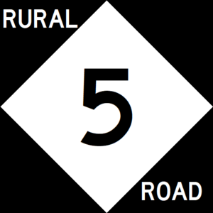
Rural Road 5 serves south Kennedy and central Wilkinson counties, and marks the northern end of the Rhone urban area.
| County | Location | Destination |
|---|---|---|
| Kennedy | ||
| Amity River | ||
| Lynwood | ||
| Wilkinson | Belton | |
| May | ||
| Brownwood | ||
| Talpa | ||
RR 6
| Route information | |
|---|---|
| Length | 36 mi (58 km) |
| Existed | 1934–present |
| Major junctions | |
| South end | |
| North end | |
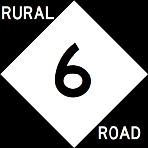
Rural Road 6 serves rural eastern Archer and Martin Counties, briefly crossing into Mitchell County to connect to Kettering.
| County | Location | Destination |
|---|---|---|
| Archer | ||
| Lexington | ||
| Martin | ||
| Mitchell | Kettering |
UR 7
| Route information | |
|---|---|
| Length | 53 mi (85 km) |
| Existed | 1971–present |
| Major junctions | |
| East end | |
| West end | |
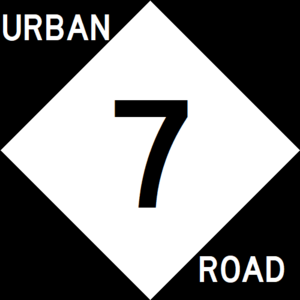
Urban Road 7 serves the cities of Abilene and Jasper in Brooks County. It uses the right-of-way of discontinued SH-10, which was replaced by Interstate 30, replacing Rural Road 7's orginial routing that is today Park Road 7.
| County | Location | Destination |
|---|---|---|
| Cameron | Mansfield | |
| Cooper River | ||
| Brooks | Abilene | |
| Lynwood | ||
RR 8
| Route information | |
|---|---|
| Length | 36 mi (58 km) |
| Existed | 1934–present |
| Major junctions | |
| South end | |
| North end | |
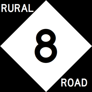
Rural Road 8 parallels Interstate 50 through Garden, Porter, and Oldham counties in the western part of the state.
| County | Location | Destination |
|---|---|---|
| Oldham | Sunrise | |
| Garden | Stanton | |
| Martin | ||
| McAlister |
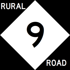
RR 9
| Route information | |
|---|---|
| Length | 62 mi (100 km) |
| Existed | 1934–present |
| Major junctions | |
| South end | |
| North end | |
Rural Road 9 serves rural central Albion and Johnson Counties, begining in Barton, and running north to the south gate of Hadrian Knob State Park.
| County | Location | Destination |
|---|---|---|
| Albion | Barton | |
| Cypress River | ||
| Johnson | Johnsonville | South |
| North | ||
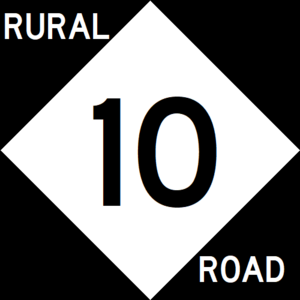
RR 10
| Route information | |
|---|---|
| Length | 49 mi (79 km) |
| Existed | 1934–present |
| Major junctions | |
| East end | |
| West end | |
Rural Road 10 connects the outer southern suburbs of Rhone with Willmingtons northeastern suburbs.
| County | Location | Destination |
|---|---|---|
| Mason | Gatlinburg | |
| Travis | Haven | Travis Bayou |
| Haven | ||
| Calahan | ||
| Shelby | Collins | |
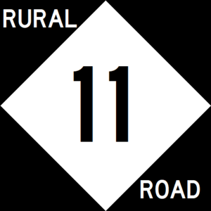
RR 11
| Route information | |
|---|---|
| Length | 25 mi (40 km) |
| Existed | 1934–1977 |
| Major junctions | |
| South end | |
| North end | |
Rural Road 11 formerly served as a connection between Glass and Cleveland. Its milage was transfered to SH 55 in 1977 to extend that highway south to Glass.
| County | Location | Destination |
|---|---|---|
| Wilkinson | Glass | |
| Brownwood | ||
| Cleveland |
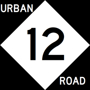
UR 12
| Route information | |
|---|---|
| Length | 49 mi (79 km) |
| Existed | 1971–present |
| Major junctions | |
| East end | |
| West end | |
Urban Road 7 northern Mason County
| County | Location | Destination |
|---|---|---|
| Brooks | ||
| Anderson | ||
| Marlow | ||
| Anderson | ||
| Travis | Elkheart | |
RR 13
| Route information | |
|---|---|
| Length | 23 mi (37 km) |
| Existed | 1934–present |
| Major junctions | |
| East end | |
| West end | |
Rural Road 5 serves south Kennedy and central Wilkinson counties, and marks the northern end of the Rhone urban area.
| County | Location | Destination |
|---|---|---|
| Archer | ||
| Garner Sound | ||
| Garner Village | ||
RR 14
| Route information | |
|---|---|
| Length | 35 mi (56 km) |
| Existed | 1934–present |
| Major junctions | |
| East end | |
| West end | |
Rural Road 14 serves mountainous central Hunt and Porter counties, running from a junction between Huntsville and Eustace Valley State Park to the West Gate of Valencia Mountains National Park.
| County | Location | Destination |
|---|---|---|
| Hunt | ||
| Porter | ||
| Valencia Mountains National Park |
RR 15
| Route information | |
|---|---|
| Length | 126 mi (203 km) |
| Existed | 1934–present |
| Major junctions | |
| South end | |
| North end | |
Rural Road 15 runs from the Willmington suburbs north through central West Monroe, and is the longest of the Urban/Rural Roads.
| County | Location | Destination |
|---|---|---|
| Shelby | Shelby | |
| Washington | ||
| Sherwood | ||
| Denton | Travis Bayou | |
| Mercury | ||
| Brookesmith | ||
| Fayette | fayetteville | |
UR 16
| Route information | |
|---|---|
| Length | 57 mi (92 km) |
| Existed | 1971–present |
| Major junctions | |
| South end | |
| North end | |
Urban Road 16 serves the eastern part of the Rhone metro area, serving Mason, King, and Wilkinson Counties.
| County | Location | Destination |
|---|---|---|
| Mason | Gatlinburg | |
| Marlow | ||
| King | Kingsland | |
| Rhone | ||
| Goland Park | ||
| Wilkinson | Allison | |
UR 17
| Route information | |
|---|---|
| Length | 32 mi (51 km) |
| Existed | 1982–present |
| Major junctions | |
| West end | |
| East end | |
Urban Road 17 runs along the south bank of the Cooper River through the cities of Bishop and Willmington
| County | Location | Destination |
|---|---|---|
| Freemont | Bishop | |
| Willmington | File:UR-67.png to | |
