Administrative divisions of Rajyaghar: Difference between revisions
m (→Map of the Union States: Added Sanyukti flag) |
No edit summary |
||
| Line 1: | Line 1: | ||
{{WIP}} {{Region icon Kylaris}} [[Category:Rajyaghar]] | {{WIP}} {{Region icon Kylaris}} [[Category:Rajyaghar]] | ||
Rajyaghar | {{Infobox subdivision type | ||
| name = Union States and Territories of Rajyaghar | |||
| map = RajyagharStateMap.png | |||
| category = {{wp|Federated state}} | |||
| territory = [[Rajyaghar|Kingdom of Rajyaghar]] | |||
| start_date = | |||
| current_number = 24 Union States, 3 Federal Territories | |||
| number_date = | |||
| government = {{wp|State government}} | |||
| subdivision = {{wp|Province}}, {{wp|Commune}} | |||
}} | |||
{{Politics of Rajyaghar}} | |||
The '''Union States and Federal Territories''' of [[Rajyaghar]] are the principal administrative divisions of the Kingdom. The Kingdom is a {{wp|federation}} of 6 National Regions split into 24 Union States and 3 Federal Territories. The Union States and Federal Territories are further subdivided into Provinces and Communes. | |||
===State | [Brief history]. The administrative divisions are based on the historical [[Madhyarajyas|middle kingdoms]] of Rajyaghar with all of them retaining their royal families which serve as ceremonial representatives of the Monarch in the Union States and are granted the titles of ''"Rajakumar of the Union State"''. The Federal Districts are governed differently and have different ceremonial representatives of the Monarch. In [[Bishnupur]] it is the High Priest and in [[Kinadica]] it is the Governor. | ||
==History== | |||
===Naratha Confederacy=== | |||
===Colonial Era=== | |||
==Union States and Federal Territories== | |||
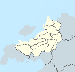
{{Rajyaghar labelled map|float=left}} | |||
===National Regions=== | |||
{{div col|colwidth=10em}} | |||
* {{flagicon image|RajyagharFlag.png}} The Core | |||
* {{flagicon image|RajyagharFlag.png}} The North | |||
* {{flagicon image|RajyagharFlag.png}} Eastern Bloc | |||
* {{flagicon image|RajyagharFlag.png}} Lowlands | |||
* {{flagicon image|RajyagharFlag.png}} Pavitra | |||
* {{flagicon image|RajyagharFlag.png}} Outer Rim | |||
{{div col end}} | |||
===Union States=== | |||
{{div col|colwidth=10em}} | |||
* {{flagicon image|RajyagharFlag.png}} [[Bhankari]] | |||
* {{flagicon image|ChanakFlag.png}} [[Chanak]] | |||
* {{flagicon image|DelarBewarFlag.png}} [[Dalar Bewar]] | |||
* {{flagicon image|DedhaFlag.png}} [[Dedha]] | |||
* {{flagicon image|RajyagharFlag.png}} [[Dharana]] | |||
* {{flagicon image|HarringhataFlag.png}} [[Harringhata]] | |||
* {{flagicon image|RajyagharFlag.png}} [[Jhanaghar]] | |||
* {{flagicon image|RajyagharFlag.png}} [[Kodur]] | |||
* {{flagicon image|LakhanaFlag.png}} [[Lakhana]] | |||
* {{flagicon image|MondariFlag.png}} [[Mondari]] | |||
* {{flagicon image|RajyagharFlag.png}} [[Nakhtrana]] | |||
* {{flagicon image|ParsaFlag.png}} [[Parsa]] | |||
* {{flagicon image|RajyagharFlag.png}} [[Pinjar]] | |||
* {{flagicon image|RajyagharFlag.png}} [[Rathankot]] | |||
* {{flagicon image|RajyagharFlag.png}} [[Raulia]] | |||
* {{flagicon image|SanyuktFlag.png}} [[Sanyukt]] | |||
* {{flagicon image|RajyagharFlag.png}} [[Sangam]] | |||
* {{flagicon image|RajyagharFlag.png}} [[Sanosra]] | |||
* {{flagicon image|RajyagharFlag.png}} [[Sasipur]] | |||
* {{flagicon image|RajyagharFlag.png}} [[Suti]] | |||
* {{flagicon image|RajyagharFlag.png}} [[Swarupnagar]] | |||
* {{flagicon image|RajyagharFlag.png}} [[Tarkhana]] | |||
* {{flagicon image|ZulmatFlag.png}} [[Zulmat]] | |||
{{div col end}} | |||
===Federal Districts=== | |||
{{div col|colwidth=8em}} | |||
* {{flagicon image|BishnupurFlag.png}} [[Bishnupur]] | |||
* {{flagicon image|KinadicaFlag.png}} [[Kinadica]] | |||
{{div col end}} | |||
==State Governance== | |||
Governance of the Union States is divided between the [[Central Union Government|federal]] and state governments. Each Union State has a legislature which, depending on the state, will either be {{wp|unicameral}} or {{wp|bicameral}}. In the majority of cases, the larger states have bicameral legislatures with the upper house having provincial representatives and the lower house having communal representatives. Following the {{wp|Westminster System|Northabbey model}}, the State Governments are led by First Ministers, who are members of the state legislature from the majority party. State elections are held every 5 years which, since 1995, have been at the same time as federal elections. | Governance of the Union States is divided between the [[Central Union Government|federal]] and state governments. Each Union State has a legislature which, depending on the state, will either be {{wp|unicameral}} or {{wp|bicameral}}. In the majority of cases, the larger states have bicameral legislatures with the upper house having provincial representatives and the lower house having communal representatives. Following the {{wp|Westminster System|Northabbey model}}, the State Governments are led by First Ministers, who are members of the state legislature from the majority party. State elections are held every 5 years which, since 1995, have been at the same time as federal elections. | ||
| Line 18: | Line 83: | ||
Since independence, the federal government has slowly reduced the powers granted to the state governments through legislating over previously un-prescribed duties, which combined with lack of development and federal intervention in state affairs, has led to increasing popularity of secession movements in the states of [[Tarkhana]], [[Sasipur]] and [[Pinjar]]. During ''the Emergency'', the 13th Amendment was transferred jurisdiction of the police from state governments to the federal government. | Since independence, the federal government has slowly reduced the powers granted to the state governments through legislating over previously un-prescribed duties, which combined with lack of development and federal intervention in state affairs, has led to increasing popularity of secession movements in the states of [[Tarkhana]], [[Sasipur]] and [[Pinjar]]. During ''the Emergency'', the 13th Amendment was transferred jurisdiction of the police from state governments to the federal government. | ||
{{Rajyaghar}} | {{Rajyaghar}} | ||
Revision as of 19:43, 20 April 2021
This article is incomplete because it is pending further input from participants, or it is a work-in-progress by one author. Please comment on this article's talk page to share your input, comments and questions. Note: To contribute to this article, you may need to seek help from the author(s) of this page. |
| Union States and Territories of Rajyaghar | |
|---|---|
 | |
| Category | Federated state |
| Location | Kingdom of Rajyaghar |
| Number | 24 Union States, 3 Federal Territories |
| Government | State government |
| Subdivisions | Province, Commune |
 |
|---|
| This article is part of a series on the politics and government of Rajyaghar |
The Union States and Federal Territories of Rajyaghar are the principal administrative divisions of the Kingdom. The Kingdom is a federation of 6 National Regions split into 24 Union States and 3 Federal Territories. The Union States and Federal Territories are further subdivided into Provinces and Communes.
[Brief history]. The administrative divisions are based on the historical middle kingdoms of Rajyaghar with all of them retaining their royal families which serve as ceremonial representatives of the Monarch in the Union States and are granted the titles of "Rajakumar of the Union State". The Federal Districts are governed differently and have different ceremonial representatives of the Monarch. In Bishnupur it is the High Priest and in Kinadica it is the Governor.
History
Naratha Confederacy
Colonial Era
Union States and Federal Territories
National Regions
 The Core
- The North
- Eastern Bloc
- Lowlands
- Pavitra
- Outer Rim
Union States
Federal Districts
State Governance
Governance of the Union States is divided between the federal and state governments. Each Union State has a legislature which, depending on the state, will either be unicameral or bicameral. In the majority of cases, the larger states have bicameral legislatures with the upper house having provincial representatives and the lower house having communal representatives. Following the Northabbey model, the State Governments are led by First Ministers, who are members of the state legislature from the majority party. State elections are held every 5 years which, since 1995, have been at the same time as federal elections.
Lower-level administration
Governance related to lower-level administration is further devolved from state governments to local authorities, including city councils and municipal councils. Whilst state governments hold jurisdiction over local authorities, since the passage of the 12th Amendment in 1965, the federal government can request the Monarch to suspend a state government and replace them with a Governor (executive) and Governor's Council (legislature).
The federal constitution outlines the following duties to be exercised by the state governments:
- Management of transportation and local infrastructure
- Provision of emergency services (excluding the police since 1965)
- Local planning and zoning
- Education outside of the national curriculum
- Any other duty not prescribed by law to be under the jurisdiction of the federal government
Since independence, the federal government has slowly reduced the powers granted to the state governments through legislating over previously un-prescribed duties, which combined with lack of development and federal intervention in state affairs, has led to increasing popularity of secession movements in the states of Tarkhana, Sasipur and Pinjar. During the Emergency, the 13th Amendment was transferred jurisdiction of the police from state governments to the federal government.
| History | | |
|---|---|---|
| Geography | ||
| Politics | ||
| Economy | ||
| Culture | ||