File:Map of the Yellow Empire in 1550 CE.png
Jump to navigation
Jump to search


Size of this preview: 800 × 401 pixels. Other resolution: 2,505 × 1,255 pixels.
Original file (2,505 × 1,255 pixels, file size: 1.75 MB, MIME type: image/png)
Summary
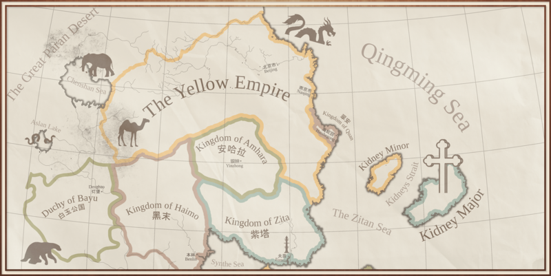
Map of the Yellow Empire, c. 1550 CE.
File history
Click on a date/time to view the file as it appeared at that time.
| Date/Time | Thumbnail | Dimensions | User | Comment | |
|---|---|---|---|---|---|
| current | 16:32, 4 July 2023 | | 2,505 × 1,255 (1.75 MB) | Orioni (talk | contribs) | Newer version shared by user Fulgistan on Discord. https://discord.com/channels/274678876242837505/309407963624505346/1124364025736732755 |
| 14:34, 29 December 2020 |  | 2,505 × 1,255 (1,002 KB) | Orioni (talk | contribs) | Map of the Yellow Empire, c. 1550 CE. Category:Eurth Category:Maps |
You cannot overwrite this file.
File usage
The following 2 pages use this file: