National Route 1
Jump to navigation
Jump to search

| Route information | |
|---|---|
| Length | Formatting error: invalid input when rounding mi (0 km) |
| Existed | 1920–present |
| Major junctions | |
| South end | |
| North end | |
| mi | km | |
|---|---|---|
| Pantera | tbd | tbd |
| Federal District | 10 | 16 |
| Cataldo | tbd | tbd |
| Calpurnia | tbd | tbd |
| Cumberland | tbd | tbd |
| Total | tbd | tbd |
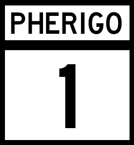
National Route 1 (NR 1) is a north-south major Pherigo National Highway in that runs the entire length of the country. Through Pantera, Cataldo, and Calpurnia, the route largely follows the coastlines of the Black Sea and Thomas Sound. Through Cumberland, the route runs through the interoir of the state, before ending at the state's north coast.
Major intersections
Pantera
| County | Location | Destination |
|---|---|---|
| Snider | Green Bay | Pherigo RiverReynosa-Green Bay International Bridge |
| Garfield | Bronson | |
| Orange | ||
| Stark | ||
| Pantera River | ||
| Nixon | Montgomery | |
| Rinnick River | ||
| Abbott | Stafford | |
| Warner | ||
| Wells | Gordon | |
| Lindon | Griffin | |
| Monroe | ||
Federal District
| County | Location | Destination |
|---|---|---|
| Charleston, Federal District | Colonial City Neighborhood | |
| Watefront District | Cumberland Avenue to | |
| Highland Park Neighborhood |
Cataldo
| County | Location | Destination |
|---|---|---|
| Tobin | Reston | |
| Warren River | ||
| Holmes | Bridgeport | |
| Ocean City | ||
| Otero | Surfside | |
| Stafford | ||
| Galloway | ||
| May Harbor | ||
| Jefferson River | ||
Calpurnia
| County | Location | Destination |
|---|---|---|
| Brent | Florence | |
| Bridgeport | ||
| Lewis | Colorado | |
| Smithville | ||
| Ybarra | Alvin | |
| Perry | Pellham | |
| Smithville | ||
| Stewart | Paige | |
| Sunset Village | ||
| Coleto River | ||
| Osage | Hampton | |
| Clearview | ||
| Oliver | Sargent | |
| Lovel | Hawkinsville | |
| Flores | Wadsworth | |
| Powell | ||
| Cannon | Crawford | |
| Bayside | ||
| Beake | Lavender | |
| Calpurnia River | ||
Cumberland
| County | Location | Destination |
|---|---|---|
| Nieves | Selma | |
| Geary | Pleasentville | |
| Riverside | ||
| Elkridge | ||
| Teller | Pasadena | |
| King | Gainesville | |
| Kingsville | ||
| Langdon | Arlington | |
| Rains | Park River | |
| Wimberly | ||
| Potter | McLeansville | |
| Burlington | ||
| Allensville | ||
| Cumberland River | ||
| Cumberland | Cumberland City | |
| Hampton | ||
| Palmer | St. George | |
| Portsmith | ||