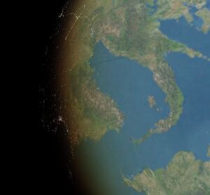
Titania Bay
Jump to navigation
Jump to search
| Titania Bay | |
|---|---|
 Satellite image of Titania Bay | |
| Location | Southwestern Euronia |
| Type | Bay |
| Part of | Cantalle Ocean |
| River sources | |
| Basin countries | |
| Max. depth | 7,686 m (25,217 ft) |
| Settlements | |
Titania Bay is a body of water bounded on the west by Alutiana, the north by Zamastan, Mayotte, and Auraine, and the east by Drambenburg. It connects to the Cantalle Ocean through the Strait of Alutia. The bay holds historical, economic, and cultural significance to the region, having been the cradle of power for many kingdoms and empires throughout history. The Drambenburgian and Mayottean kingdoms held control over the coastal regions of the bay and built major settlements and fortresses on islands and cliff faces throughout the region. Due to its geostrategic importance, the bay was contested in conflicts throughout history, most notably in the Fifty Years War and the World War.