Wassilia: Difference between revisions
No edit summary |
No edit summary |
||
| Line 31: | Line 31: | ||
|area_km2 = 589,306 | |area_km2 = 589,306 | ||
|area_label = Total | |area_label = Total | ||
|population_estimate = | |population_estimate = 30,913,910 | ||
|population_estimate_year = 2020 | |population_estimate_year = 2020 | ||
|population_density_km2 = | |population_density_km2 = 52.5 | ||
|population_density_sq_mi = | |population_density_sq_mi = 135.9 | ||
|GDP_nominal = $83.172 billion | |GDP_nominal = $83.172 billion | ||
|GDP_nominal_year = 2019 | |GDP_nominal_year = 2019 | ||
Revision as of 14:24, 11 July 2022
Federal Republic of Wassilia Republika Federalna Wassilia | |
|---|---|
| Capital | Tyonek |
| Largest city | Olszten |
| Official languages | Wassilian |
| Ethnic groups | 74% Wassilian 12% German 8% Other 6% Other |
| Demonym(s) | Wassilian |
| Government | Federal Republic |
| Legislature | Federal Assembly of Wassilia |
| Area | |
• Total | 589,306 km2 (227,532 sq mi) |
| Population | |
• 2020 estimate | 30,913,910 |
• Density | 52.5/km2 (136.0/sq mi) |
| GDP (nominal) | 2019 estimate |
• Total | $83.172 billion |
• Per capita | $15,646 |
| HDI (2019) | 0.805 very high |
| Currency | Oar |
| Date format | yyyy.mm.dd |
| Driving side | right |
| Calling code | +103 |
| Internet TLD | .wsl |
National Overview
The Federal Republic of Wassilia is located in the southeastern portion of Thrismari along the Sunadic Ocean. Wassilia has land borders to the north with Morrawia and to the west and northwest with Mygona. To the south Wassilia has a long border with Sacrofnia. To the east the entire nation has a water boundary with the Sunadic Ocean and the ____ Bay. The southern border is dominated by the Lubovow mountain range and is where the coldest temperatures are. The government of Wassilia is a democratically elected body with a legislative government known as the Federal Assembly. The leader of the Federal Assembly is the Prime Minister. Wassilia is divided into 7 provinces and 1 capital district which acts as a province as well.
Demographics
Wassilia has an estimated 34.5 million inhabitants with the large majority being native Wassilians. There is also a significant minority population of German population as well as Morrawians primarily located in the northern and northwestern portion of the country. Although Tyonek is the capital City and the cultural and historical hub of Wassilia, Olszten had surpassed in population. Olszten in the 20th century has become Wassilias most important trade and tourist hub sitting on the Sunadic coast.
Religion
By definition of the constitution, Wassilia is a secular nation specifying that there is no national religion. However, Catholicism is the dominant Religion practiced by Wassilians accounting for approximately 63% of the population. All regions with the exception of the Masovina province have a Catholic manjority. Masovina, in the northwest corner of the country is primarily Lutheran in conjunction with other Germanic peoples of the region. By and large though religion in Wassilia is declining as the fastest growing demographic in religion is agnosticism. The most religious provinces are the more rural Olawa and Polonia.
Geography
The total land area of Wassilia is 589,306 km2. This area lies between the latitudes -43 deg and -52 deg, N and longitudes of 1 deg and 16 degrees E. Wassilia does not have any overseas territories so the entirety of land area is contiguous. The largest city Olszten lies on the east coast of Wassilia with the capital city, Tyonek on the west shore of the ____ Bay. The two cities are quite different with Tyonek representing the older traditional city in design and architecture and Olszten very much representing Wassilia's modernity and becoming a true international city.
Waterways within Wassilia generally run to the north or the east depending on their source. Nearly all rivers from the Lubovow mountain range flow north and empty into the ____ Bay or to the northeast and flow into the Sunardic Ocean. The Zlockow River flowing from the western edge of the Lubovow Mountains to the ___ Bay is the traditional east/west divide of the nation. This divide can be seen in many ways be it Religiousness, Industry and Climate.
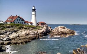
The coastal eastern half of Wassilia is known for its beautiful waterfront cities, small towns, and rocky shoreline. Much of the eastern coastline is made of rocky shore dotted with many lighthouses and fishing towns.
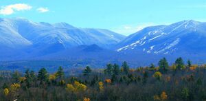
The coast becomes more mountainous as you head south toward Gydnow. Bayside is the coastal lowlands which is the most densely populated area of Wassilia consisting of the provinces of Grincel, Lodzsin, Tyonek, and Eastern Polonia. In the southern most province of Lubovow we have the Lubovow mountains which dominate the landscape here.
The land is very rugged with cities and towns separated by greater distance and largely along rivers flowing toward the bay. Moving westward the Provinces of Polonia and Szortinas are the breadbasket of Wassilia and provide much of the Agricultural needs for Wassilia. Western Polonia however is heavily forested with sparse population. Continuing north and west are the provinces of Masovina and Olawa which culturally are similar however Masovina is the much more populated and a large focus on industry while Olawa is more timber and agricultural.
Largest Cities in Wassilia
Wassilian 2020 Census | |||||||||
|---|---|---|---|---|---|---|---|---|---|
| Rank | Region | Pop. | |||||||
| 1 | Olszten | Grincel | 3,774,900 | ||||||
| 2 | Tyonek | Isorai | 3,575,300 | ||||||
| 3 | Eblaburg | Masovina | 1,654,200 | ||||||
| 4 | Sren | Hyast | 1,464,760 | ||||||
| 5 | Burzinai | Polva | 1,005,350 | ||||||
| 6 | Altapadys | Sortinas | 662,800 | ||||||
| 7 | Pilotin | Grincel | 656,881 | ||||||
| 8 | Glyeszko | Wynsoia | 605,800 | ||||||
| 9 | Opolo | Olawa | 563,550 | ||||||
| 10 | Skouvatis | Skille | 562,750 | ||||||
Climate
Wassilia has a humid continental climate (Köppen climate classification Dfb), with warm (although mostly not hot), humid summers. Winters are cold and snowy all over the country, and are mostly more severe in the southern mountainous region. The coastal lowland areas and bayfront are more temperate in the winter due to the warmer currents of the Sunardic Ocean and ___ Bay. Wassilia is mostly safe from tropical cyclones as the higher latitude weakens these systems to extratropical by the time they reach the Wassilian shoreline.


