Louise Mountains: Difference between revisions
(Created page with "{{Infobox mountain | photo= Willow_Flats_area_and_Teton_Range_in_Grand_Teton_National_Park.jpg | photo_caption= Summits of the Colelow Range in eastern Pahl | map_image =...") |
No edit summary |
||
| (One intermediate revision by the same user not shown) | |||
| Line 15: | Line 15: | ||
| coordinates= | | coordinates= | ||
}} | }} | ||
The '''Louise Mountains''', also known as the '''Louises''', are a major {{wp|mountain range}} in [[Euronia]] that runs for 4,102 kilometers () in a strait-line distance from northwest [[Mayotte]], the province of [[Titania (Province)|Titania]], to the southern tip of [[Alutiana]], defining the majority of the eastern border of [[Zamastan]]. The mountains define the eastern borders of the [[Administrative District (Zamastan)|provinces]] of [[Pahl]], [[Tregueux (Province)|Tregueux]], and [[Alenchon (Province)|Alenchon]]. Being the | The '''Louise Mountains''', also known as the '''Louises''', are a major {{wp|mountain range}} in [[Euronia]] that runs for 4,102 kilometers (2,549 mi) in a strait-line distance from northwest [[Mayotte]], the province of [[Titania (Province)|Titania]], to the southern tip of [[Alutiana]], defining the majority of the eastern border of [[Zamastan]]. The mountains define the eastern borders of the [[Administrative District (Zamastan)|provinces]] of [[Pahl]], [[Tregueux (Province)|Tregueux]], and [[Alenchon (Province)|Alenchon]]. Being the centralmost portion of the Southwest Euronian Cordillera, the Louise Mountains are distinct from the tectonically younger [[Zian Mountains]], which lie farther to its west, and the [[Lutharian Alps]] to its east. | ||
The Louise Mountains formed 80 million to 55 million years ago when the Lutharian plate began sliding underneath the Zian plate. The angle of subduction was shallow, resulting in a broad belt of mountains running down eastern Zamastan. Since then, further tectonic activity and erosion by glaciers have sculpted the Louises into dramatic peaks and valleys. At the end of the last ice age, humans began inhabiting the mountain range. After explorations of the range, natural resources such as minerals and fur drove the initial economic exploitation of the mountains, although the range itself never experienced a dense population. The mountains served as defining geographical boundaries for numerous states and empires throughout history, including the [[Paraboca]]n and [[Drambenburg]]ian kingdoms. | The Louise Mountains formed 80 million to 55 million years ago when the Lutharian plate began sliding underneath the Zian plate. The angle of subduction was shallow, resulting in a broad belt of mountains running down eastern Zamastan. Since then, further tectonic activity and erosion by glaciers have sculpted the Louises into dramatic peaks and valleys. At the end of the last ice age, humans began inhabiting the mountain range. After explorations of the range, natural resources such as minerals and fur drove the initial economic exploitation of the mountains, although the range itself never experienced a dense population. The mountains served as defining geographical boundaries for numerous states and empires throughout history, including the [[Paraboca]]n and [[Drambenburg]]ian kingdoms. | ||
Latest revision as of 23:07, 1 February 2023
| Louise Mountains | |
|---|---|
 Summits of the Colelow Range in eastern Pahl | |
| Highest point | |
| Peak | Mount Sandry |
| Elevation | 3,954 m (12,972 ft) |
| Dimensions | |
| Length | 4,102 km (2,549 mi) |
| Width | 212 km (132 mi) |
| Geography | |
| Countries | Zamastan, Mayotte, Alutiana |
| Geology | |
| Age of rock | Carboniferous |
| Type of rock | Metamorphic, igneous, sedimentary |
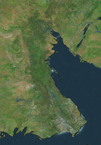
The Louise Mountains, also known as the Louises, are a major mountain range in Euronia that runs for 4,102 kilometers (2,549 mi) in a strait-line distance from northwest Mayotte, the province of Titania, to the southern tip of Alutiana, defining the majority of the eastern border of Zamastan. The mountains define the eastern borders of the provinces of Pahl, Tregueux, and Alenchon. Being the centralmost portion of the Southwest Euronian Cordillera, the Louise Mountains are distinct from the tectonically younger Zian Mountains, which lie farther to its west, and the Lutharian Alps to its east.
The Louise Mountains formed 80 million to 55 million years ago when the Lutharian plate began sliding underneath the Zian plate. The angle of subduction was shallow, resulting in a broad belt of mountains running down eastern Zamastan. Since then, further tectonic activity and erosion by glaciers have sculpted the Louises into dramatic peaks and valleys. At the end of the last ice age, humans began inhabiting the mountain range. After explorations of the range, natural resources such as minerals and fur drove the initial economic exploitation of the mountains, although the range itself never experienced a dense population. The mountains served as defining geographical boundaries for numerous states and empires throughout history, including the Parabocan and Drambenburgian kingdoms.
Of the 100 highest major peaks of the Louises, 79 (including the 30 highest) are located in Alutiana, ten in Pahl, six in Alenchon, three in Mayotte, and one each in Tregueux, Titania. The highest peak is Mount Sandry at 3,954 m (12,972 ft), along the border of Alutiana and Pahl. Public parks and forest lands protect much of the mountain range, and they are popular tourist destinations, especially for hiking, camping, mountaineering, fishing, hunting, mountain biking, snowmobiling, skiing, and snowboarding.
