Mahayala: Difference between revisions
No edit summary |
No edit summary |
||
| Line 23: | Line 23: | ||
|government_type = {{wp|unitary republic|Unitary}} {{wp|parliamentary system|parliamentary}} {{wp|semi-constitutional monarchy}} | |government_type = {{wp|unitary republic|Unitary}} {{wp|parliamentary system|parliamentary}} {{wp|semi-constitutional monarchy}} | ||
|leader_title1 = [[King of Mahayala|King]] | |leader_title1 = [[King of Mahayala|King]] | ||
|leader_name1 = [[ | |leader_name1 = [[Jamyang Trengwa]] | ||
|leader_title2 = [[Ugyen]] | |leader_title2 = [[Ugyen]] | ||
|leader_name2 = [[Rabyang Aukatsang]] | |leader_name2 = [[Rabyang Aukatsang]] | ||
Revision as of 10:30, 2 October 2023
Kingdom of Mahayala | |
|---|---|
| Anthem: བཀྲ་ཤིས་ལུང་གི་གླུ་དབྱངས། Tra Shi Lung Gi Lu Yang Anthem of the Propitious Dragon | |
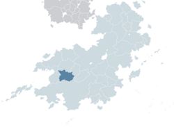
 Mahayala (dark green) in Kylaris | |
| Capital and largest city | Dharma |
| Official languages | Nyachzon, Shangean |
| Recognised regional languages | Yangzom, Sangpo, Lhakpa, Gyal |
| Demonym(s) | Mahayalan |
| Government | Unitary parliamentary semi-constitutional monarchy |
• King | Jamyang Trengwa |
• Ugyen | Rabyang Aukatsang |
| Legislature | National Council |
| National Assembly | |
| House of Representatives | |
| History of Mahayala | |
| 1 March 1935 | |
| 1963–1975 | |
| 8 October 1975 | |
| 20 September 1982 | |
| Area | |
• Total | 704,547.94 km2 (272,027.48 sq mi) |
• Water (%) | 0.455 |
| Population | |
• 2016 census | 20,342,000 |
• Density | 28.87/km2 (74.8/sq mi) |
| GDP (PPP) | 2018 estimate |
• Total | $478.19 billion |
• Per capita | $8,099 |
| GDP (nominal) | 2018 estimate |
• Total | $199.7 billion |
• Per capita | $2,023 |
| Gini (2015) | 32.5 medium |
| HDI (2022) | 0.697 medium |
| Currency | Mahayalan bhuti (MBH) |
| Time zone | UTC-1 |
| Date format | YYYY-MM-DD |
| Driving side | left |
| Calling code | +32 |
| ISO 3166 code | MY |
| Internet TLD | .my |
Mahayala (མ་ཧ་ཡ་ལ་; Gurung) officially Kingdom of Mahayala (མ་ཧ་ཡ་ལ་ཀྲོའུ; Gurung Gyal Khap) is a landlocked country in Coius bordering Shangea to the south and Ansan to the west. Situated in the Western Shaleghos, Mahayala is notable for its biodiversity, including alpine and subtropical climates, as well as being a host to Tselha, the highest peak in Coius and X highest on Kylaris. Dharma is the nation's capital and the largest city. Mahayala is a multi-ethnic, multi-lingual, multi-religious and multi-cultural state, with Nyachzon and Shangean as the official languages.
Etymology
The name Mahayala is believed to be a combination of the Lhakpa words mah "between" and yalan "mountain" or "peak". The official name of Mahayala in is Gurung in Nyachzon and Gǔlóng in Shangean.
History
Ancient Mahayala
Under Togoti and Shangean Rule
Unification and independence
Great War
In 1927, the Great War began. With the beginning of the Sakata Offensive in June 1932 and the major casualties it enflicted on Shangean troops, Shangea redeployed its forces to the primary front. On May 2, 1933, king Jamyang Tashi declared Mahayala's independence with the support of the Entente. As the Shangean forces were tied up in the war against Senria, Mahayala was not their main priority. Although officially the rebellion continued until 1935, the fighting ended already in the fall of 1934.
Civil War

The 1960s were problematic in many ways. In 1962, inflation soared due to the government's poor economic policies. The king did little to address the issue, despite holding ultimate power in the government. The breaking point came in late 1963 when rebellion erupted in the Shangean regions of the south. With Shangean support, the National Liberation Front began a guerrilla war against the central government forces. The insurgents quickly gained control of large parts of the rural south. They periodically besieged the capital, causing severe food shortages. The main supporters of the insurgents were primarily impoverished farmers. In 1964, as the civil war was in its early stages, another movement emerged in the south. The Red Resistance Movement aimed to overthrow the government and establish a socialist state. However, the movement received little support from other socialist countries and faced full-scale attacks from both sides of the civil war. The RRM collapsed in late 1969.
During the conflict, it was widely believed that there was no military solution. The government's significantly stronger forces would likely have defeated the rebels in open combat, but the guerrillas managed to avoid such confrontations and stuck to guerrilla tactics that the security forces could never effectively counter. The group's actions pushed the entire state into isolationism. The guerrilla war had initially been fought against the central government's security forces, but in 1971, the country's army became involved. The army received support from Senria, which provided them with assault rifles and trained officers.
In a 1970 Community of Nations statement, the guerrillas were defined as terrorists. In February of the following year, a peacekeeping operation was initiated. Both the ICD and CN human rights commissioners unsuccessfully appealed to the central government to agree to ceasefires. The civil war did not fully end until 1975 when, following the Coastal Crisis, the government declared a ceasefire. CN's peacekeeping operation in Mahayala concluded in January 1976.

