Zahedan
This article is incomplete because it is pending further input from participants, or it is a work-in-progress by one author. Please comment on this article's talk page to share your input, comments and questions. Note: To contribute to this article, you may need to seek help from the author(s) of this page. |
Zahedan زاهدان | |
|---|---|
| قلمرو سرمایه اتحادیه زاهدان Ettehād-ye Khetteh-Khelafah-ye Zâhedân Union Capital Territory of Zahedan | |
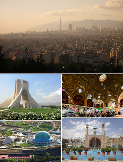 From the top clockwise: Panorama of Zahedan's skyline; Grand Bazaar; Shahid Feredyun Mazar; Nowruz Park; Inqelab Tower | |
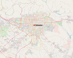
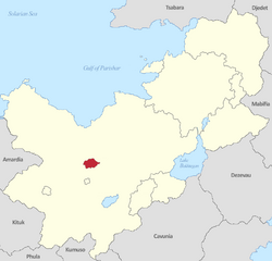 Location of the Zahedan UCT in Zorasan | |
 | |
| Country | |
| Union Territory | Federal Capital |
| Foundation | ~1123 BC As Sangavar |
| Districts | Expand
10 Districts |
| Government | |
| • Type | Mayor-council |
| • Body | Common Council |
| • Mayor | Nasser Khosroshahi |
| • Common Council Chairman | Adavazdar Rehbar |
| Area | |
| • Urban | 1,200 km2 (500 sq mi) |
| • Metro | 3,235 km2 (1,249 sq mi) |
| Elevation | 910 m (2,990 ft) |
| Population | |
| • Urban | 10,033,000 |
| • Metro | 17,998,378 |
| Demonym | Zahedani |
| Area code | (+98) 021 |
Zahedan (Pasdani: زاهدان; Zâhedân), officially the Union Capital Territory of Zahedan (قلمرو سرمایه اتحادیه زاهدان; Ettehād-ye Khetteh-Khelafāh-ye Zâhedân), is the capital and largest city of Zorasan. With a population of around 10 million in the city and 17 million in the larger metropolitan area of the Greater Union Territory, Zahedan is the most populous city in Zorasan and in Northern Coius and has the xx-largest metropolitan area in Coius overall. It is ranked XXth in the world by the population of its metropolitan area.
Zahedan has been a major settlement for over two millenia, being founded in 1123 BC by King Pishkar III as Sangavar. The city was renamed to Zahedan in 647 BC following the Devotion of Sangavar during the Rise of Irfan. The city would remain grow to become a prominent centre for commerce, culture and learning throughout ancient history, before emerging as one of the world's largest cities during the early middle ages. The city would suffer during the mid-20th century suffering attacks during the Great War, Solarian War and Pardarian Civil War. Following the unification of Pardaran in wake of the civil war in 1950, the city was rapidly rebuilt and modernised. The advent of industrialisation saw numerous waves of mass migrations and urban expansion, this led to Zahedan becoming of the one of the world's fastest growing cities throughout the 20th century. Arts, music, film, and cultural festivals were established towards the end of the 20th century and continue to be hosted by the city today. Infrastructure improvements have produced a complex transportation network in the city.
Today, the city is one of the largest in Coius and the world, it is the country's economic, political and economic hub, hosting several of the country's largest companies and industries. Zahedan is estimated to produce 18% of Zorasan's gross national product, and is considered to be a global city. In recent years, the city has begun to struggle with overdevelopment, water shortages and air pollution.
Etymology
Upon its founding, the city was initially refered to as Sangavar. Historians have regularly debated the origin of the name Sangavar, though a rising consensus is that the name was a constructed word produced by King Pishkar III, who sought a new capital to represent his person and reign. However, the name Zahedan (زاهدان; Zâhedân) was bestowed upon the city by the Irfanic Prophet Adavazdar in 648 BC, following the Devotion of Sangavar. The city's peaceful surrender and conversion to the Army of Adavazdar is widely accepted as being the origin for the name Zahedan, which derives from the plural of the Pasdani word "zâhid" (زاهد), meaning 'pious'.
History
Founding
Ancient and classical
Middle Ages
Early Modern
Modern
20th Century
Present
Geography
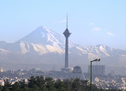
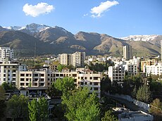
Zahedan is located at the near centre of Pardaran, in central-western Zorasan on the southern slopes of the Soban Mountains. To the south of Zahedan is the, to the south of Zahedan is the far-western reaches of the Dasth-e Aftab desert, though to the south-west of the city is the XX Steppe region. Owing to its location on the Pardarian Plateau, Zahedan rises on average 900m above sealevel, making it the highest city in the country.
Climate
Zahedan has a cold semi-arid climate (Köppen climate classification: BSk) with continental climate characteristics and a Solarian climate precipitation pattern. Zahedan's climate and precipitation is largely defined by its geographic location, with the towering Soban mountains to its north, the Dasht-e Aftab desert to the south-east and the XX Steppe region to the south-west. It can be generally described as mild in spring and autumn, hot and dry in summer, and cold and wet in winter. Due to the city's large area and location on the steps of the Soban mountains, there are significant differences in elevation across the various districts of the city. These differences are also notable in terms of weather, where the hilly northern districts are cooler than the southern flatter districts that approach the desert. The differences are most profound between Niavaran district in the north which sits at an elevation of 1,801 m (5,908 ft) above sea level, against Sattari district which rests just 911 m (2,988 ft) above sea-level in the south.
Between its founding and as late as the 14th century, Zahedan is bi-sected north-east to south-west by a small river that originated in the heights of the Soban mountains to the north. Known as the Pishkar River, it's widest point was only 10 meters and provided the city with a source of clean drinking water and sanitation, however, the city's growth during the 14th century eventually saw the river dry up. It is believed that the river bed was built over and its exact location is now lost.
Summer is long, hot, and dry with little rain, but relative humidity is generally low, making the heat tolerable. Average high temperatures are between 32 and 37 °C (90 and 99 °F), and it can occasionally drop to 14 °C (57 °F) in the mountainous north of the city at night. Most of the light annual precipitation occurs from late autumn to mid-spring, but no one month is particularly wet. The hottest month is July, with a mean minimum temperature of 26 °C (79 °F) and a mean maximum temperature of 34 °C (93 °F), and the coldest is January, with a mean minimum temperature of −5 °C (23 °F) and a mean maximum temperature of 1 °C (34 °F).

