Miersan Section of the Workers' International
Miersan Socialist Republic Mierska Socjalistyczna Republika | |
|---|---|
 Flag
Coat of arms
| |
| Motto: "Przerwij Łańcuchy!" "Break the Chains!" | |
| Anthem: Hymn Socjalistyczna Republika "Hymn of the Socialist Republic" | |
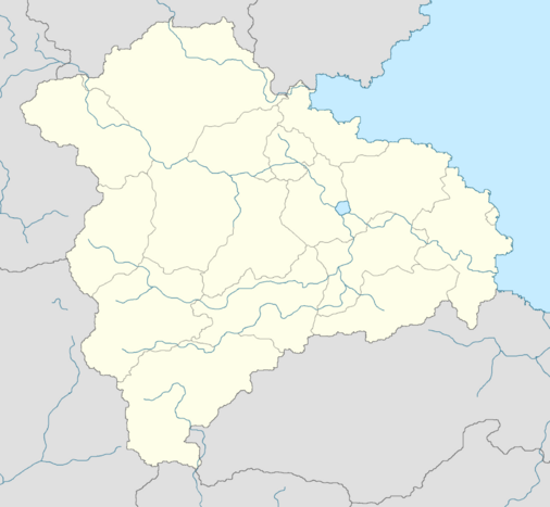
 Location of East Miersa (dark green) and claimed but uncontrolled territories (light green) in Euclea. | |
| Capital | Żobrodź (de jure) Dyńsk (de facto) |
| Largest city | Dyńsk |
| Official languages | Miersan |
| Recognised regional languages | Selórzan, Chrebian, Savader |
| Ethnic groups (2016) | Miersan (71.6%) Selórzan (11.2%) Chrebian (10.8%) Savader (2.2%) Other (4.2%) |
| Religion (2016) | Irreligious (54.2%) Catholicism (27.4%) Episemialism (11.8%) Other (6.6%) |
| Demonym(s) | East Miersan Miersan |
| Government | Federal socialist council republic |
• Premier | Anna Wlodarska |
| Legislature | People's Congress |
| Formation | |
| 1257 | |
| 1623 | |
| 1687 | |
| 1936 | |
| 1982 | |
| Area | |
• Total | 197,568 km2 (76,281 sq mi) |
| Population | |
• 2017 estimate | 21,740,000 |
• Density | 110.04/km2 (285.0/sq mi) |
| GDP (nominal) | 2015 estimate |
• Total | $562.718 billion |
• Per capita | $25,884 |
| Currency | East Miersan grosz (EMG) |
| Internet TLD | .miw |
The Miersan Socialist Republic (Miersan: Mierska Socjalistyczna Republika), also known as East Miersa (Miersan: Mierska Wschodnia), is a sovereign state in central Euclea, comprising the eastern portion of the historical nation of Miersa. It is bordered by Velzemia and Swetania to the north, by Aimilia and Gaullica to the east, and ??? to the south. To the west, it is bordered by West Miersa, though like its western counterpart, East Miersa claims to be the legitimate government of the entire Miersan basin. The country has an area of 197,568 km2 (76,281 sq mi) and a population of 21.7 million. According to the constitution, Żobrodź is the de jure capital, but Dyńsk is the de facto seat of government.
Miersa was first inhabited by the early Marolevs in the late classical period, as the Solarian Empire expanded into the Miersan hinterlands. Although not conquered by Solaria, the Solarians left a definite legacy in the region. The three first significant Miersan states were known as the Three Crowns, with East Miersa largely constituting Wybrzeże. It was united with Zachódnia and Firencja by Romuald the Bold in 1257. The subsequent Miersan Commonwealth became a significant power in central Euclea, at times rivalling neighbouring powers such as Sunrosia. In 1623, the Cesarz died without issue, leading to the Miersan Interregnum and the rise of the Miersan Republic. The Republic would be short-lived, with the monarchs of Gaullica and Narozalica both claiming the Miersan throne. The conclusion of the War of the Miersan Succession in 1638 put an end to the Interregnum, with land ceded to both Empires and the Duchy of Żobrodź buffer state created. In 1687 the First Miersan Revolt saw the final partition of the country. The eastern provinces became part of Gaullica, under which they developed into the industrial heartlands of Miersa.
Following the Great War, Miersa was largely under the occupation of Narozalica. Following Narozalican posturing and the outbreak of a major general strike, East Miersa was created as a part of the Godfredson Plan, and a CN-monitored DMZ was created. The nascent council republic became a strong ally to Swetania, and a rival to the Narozalican-bakced Miersan Federation. East Miersa experienced a post-war economic boom, allowing it to economically surpass the west. In 1979, East Miersa crossed the DMZ, resulting in the Miersan War. The interference of the Community of Nations led to the signing of the Treaty of San Alessandro in 1982, which attempted to normalise relations between the two states.
Today, East Miersa is a federal constitutionally socialist council republic, operating a socialist economy, with a nominal GDP per capita of $25,884. The current Premier is Anna Wlodarska. East Miersa is often considered a middle power in central Euclea, maintaining close ties to Swetania. It is a member of the Community of Nations, the International Council for Democracy and the Association for International Socialism.
Old Lore to Save
Administrative divisions
Since the national reunification of 1983, the Miersan Commonwealth has been divided into fourteen ordinary voivodeships, one free city, one sovereign military order and one personal domain of the Cesarz. Compared to other nations, the voivodeships maintain relatively little autonomy, the local governments only responsible minor matters, and each heavily reliant on the central government. Each voivodeship is led by a Voivode; a governor appointed directly by the Cesarz to maintain order over the region. The area and population size of each voivodeship varies greatly. Alongside the ordinary voivodeships, there is also the Free City of Dyńsk, which operates similarly, but is led instead by a Wielki Burmistrz, elected by and from the city's land-owning third estate, the burghers. The Free City has significantly greater autonomy than the other voivodeships, and is given the right to operate its own semi-elected sejmik. Additionally, there is the Sovereign Military Hospitaller Order of Saint Michael of the Północkraj, which is also granted a significant level of autonomy, and operates as a Alydian military order, able to elect its own Arcymistrz with the approval of the Cesarz. Lastly, there is the personal domain of the Cesarz, which is considered the personal property of the Cesarz in traditional law.
|
| Rank | Voivodeship | Pop. | Rank | Voivodeship | Pop. | ||||
|---|---|---|---|---|---|---|---|---|---|
 Żobrodź  Dyńsk |
1 | Żobrodź | Kraina Korony | 10,119,120 | 11 | Lunań | Małowaskie | 408,764 |  Łószcław  Krada |
| 2 | Dyńsk | Free City of Dyńsk | 3,312,542 | 12 | Tyskie | Czękanie | 381,465 | ||
| 3 | Łószcław | Chernow | 1,716,161 | 13 | Zanica | Czękanie | 312,316 | ||
| 4 | Krada | Święciżar | 1,180,024 | 14 | Lesznik | Chernow | 299,178 | ||
| 5 | Inonik | Dolny Szpons | 821,291 | 15 | Gormża | Narszczów | 282,089 | ||
| 6 | Gorgard | Północkraj | 791,218 | 16 | Gdawiec | Nadmorzem | 243,982 | ||
| 7 | Lugów | Zamkobrzeg | 702,309 | 17 | Tarcław | Święciżar | 239,281 | ||
| 8 | Czeławy | Wielkowaskie | 614,183 | 18 | Dąmyśl | Środek | 237,970 | ||
| 9 | Nowyburg | Zamkobrzeg | 435,291 | 19 | Gliwibin | Lówniak | 201,291 | ||
| 10 | Rydź | Nadmorzem | 421,289 | 20 | Zieruń | Górny Szpons | 198,880 | ||