User:Lyonsland/sandbox3
s'Holle | |
|---|---|
From top down, left to right: the city skyline, St. Charles Cathedral, the s'Holle Broadcasting Tower, Elsenplein central square, the Senaatsgebouw, and Cornelissen Park | |
|
Coat of arms of s'Holle Coat of arms | |
| Nickname: The Home of Hennehouwe | |
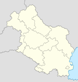
Location within Hennehouwe | |
| Country | |
| Region | s'Holle |
| Government | |
| • Body | s'Holle City Assembly |
| • Mayor–Governor | Marijne Tijhoff (SAP) |
| • Governing parties | SAP, VDP and Groen |
| • First Chamber seats | 7 (of 60) |
| • Second Chamber seats | 21 (of 180) |
| Area | |
| • Region | 432 km2 (167 sq mi) |
| • Metro | 1,803 km2 (696 sq mi) |
| Population | |
| • Region | 1,413,551 |
| • Rank | 1st (Hennehouwe) |
| • Density | 3,300/km2 (8,500/sq mi) |
| • Metro | 2,741,380 |
| Demonym | s'Holler |
| Time zone | UTC+0 (Euclean Standard Time) |
| Postal code(s) | |
| Official languages | |
| Website | sholle |
s'Holle is the capital and most populous city of Hennehouwe. The city proper has a population of 1,413,551 and a metro population of 2,741,380 as of the 2018 census. One of the ten constituent regions of Hennehouwe and one of only two to be perscribed as a city region, s'Holle is wholly surrounded by the region of Flamia, of which the city was historically part of. The city is situated upon the southern end of the River Hol, from which its name is derived.
The city's origins trace back to the 8th century, when the Verliquoian Empire established a fortified settlement on the banks of the River Hol. Its size and relevance within the region grew over time, soon becoming the centrepoint of Gaullican rule in Hennehouwe. s'Holle remained a loyal vassal to Gaullica in its infant centuries, including throughout the War of the Jeans and the dissolvement of the Verliquoian Empire, though its distinct identity as a Hennish city formed with the bestowment of the Duke of Hol by the Gaullican Empire in 1367. The city became the de facto capital of the Duchy of Flamia upon the Partition of Hennehouwe, at which points its prominence as a wider financial and cultural centre increased. Upon the Flamish victory in the Gilded Wars, s'Holle became the effective capital of the whole country, though it remained under vast Gaullican influence until the declaration of the Second Republic in 1855. The city was occupied by Functionalist Gaullica from 1927 until its liberation by Estmerish and Weranian forces in 1933, and was the site of the Treaty of s'Holle in 1934. The subsequent establishment of the Third Republic in 1935 affirmed s'Holle's role as the capital of a federal Hennehouwe, and formally separated the city from Flamia as its own entity with established borders.
As a city region, s'Holle's regional government and legislature has expanded powers that would otherwise be separately granted to regions and municipalities. s'Holle comprises of twelve districts, with limited autonomy over local affairs. The city region's executive is overseen by the Mayor–Governor, whilst the districts' executives are overseen by district mayors.
s'Holle is Hennehouwe's political, economic and judicial centre. The city is home to the Senaatsgebouw, the world's oldest functioning stock exchange in the s'Holle Stock Exchange, and the Palace of Justice. At a global level, s'Holle is ranked as a second-rate city by the World City Studies Institute and is located on the Coastal Corridor. The city is also the location for a number of international institutions, chief among them the International Court of Arbitration and Justice (CIAJ).


