Haddock Sea
Jump to navigation
Jump to search
| Haddock Sea | |
|---|---|
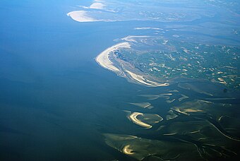
 The northern Geadish coast on the Haddock Sea | |
| Location | Between Geadland and Txotai to the south and Vyvland to the north |
| Type | Sea |
| Basin countries | Vyvland, Geadland, Namor, Luziyca (some definitions) |
| Max. width | 652km (405mi) |
| Islands | Leghel, Daydmion, Storholm, Kafren and others |
| Settlements | |
The Haddock Sea (Geadish: Üsemir, Luziycan: Piksha Mare, Swedish: Koljahav, Vyvlander: Hektsee) is a body of water between Vyvland, Luziyca, Txotai in Namor, and Geadland in Northwestern Esquarium. It is approximately 400 miles across at its narrowest point, from the port of Temsvaal in the Southwest province of Vyvland to near Arje on the Geadish island of Leghel. The sea has cultural significance on both sides as the area between Vyvland and the continent and, more broadly, the wider world. It is thus often referenced in Vyvlander culture as a boundary line or divider between Vyvland and foreign countries. The sea, due to its funnel-like undersea profile, is prone to flooding, with the most recent severe flood occurring in 1955.