Baghnala: Difference between revisions
Jump to navigation
Jump to search
No edit summary |
No edit summary |
||
| Line 61: | Line 61: | ||
|area_label2 = <!--Label below area_label (optional)--> | |area_label2 = <!--Label below area_label (optional)--> | ||
|area_data2 = <!--Text after area_label2 (optional)--> | |area_data2 = <!--Text after area_label2 (optional)--> | ||
|population_estimate = {{Increase}} | |population_estimate = {{Increase}} 68,400,000 | ||
|population_estimate_rank = TBD | |population_estimate_rank = TBD | ||
|population_estimate_year = 2022 | |population_estimate_year = 2022 | ||
|population_census = | |population_census = 67,842,149 | ||
|population_census_year = 2020 | |population_census_year = 2020 | ||
|population_density_km2 = | |population_density_km2 = 139.52 | ||
|population_density_sq_mi = | |population_density_sq_mi = | ||
|population_density_rank = | |population_density_rank = | ||
Revision as of 04:38, 29 September 2023
Republic of Baghnala Jmhwra Baghnala | |
|---|---|
|
Flag | |
Motto: TBD | |
Anthem: | |
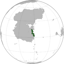
 Location of Narulia in Stratea | |
| Location | Gulf of Atily region of Stratea |
| Capital | Savak |
| Largest city | Dashigan |
| Official languages | not!persian |
| Recognised national languages | not!persian, not!zaza |
| Ethnic groups | By race:
|
| Religion |
|
| Demonym(s) | Baghnalan |
| Government | Unitary Semi-Presidential Republic |
• Prime Minister | TBD |
• President | TBD |
| Legislature | Parliament |
| TBD | |
| TBD | |
| Establishment | |
• TBDEVENT1 | TBDDATE1 |
• TBDEVENT2 | TBDDATE2 |
• TBDEVENT3 | TBDDATE3 |
| Area | |
• | 486,263 km2 (187,747 sq mi) |
| Population | |
• 2022 estimate | |
• 2020 census | 67,842,149 |
• Density | 139.52/km2 (361.4/sq mi) |
| GDP (PPP) | estimate |
• Total | ₭253.36 billion |
• Per capita | ₭4,108 (TBD) |
| HDI (2018) | high |
| Currency | Baghnalan Tomar (BAG) |
| Time zone | +TBD |
| Date format | dd-mm-yyyy |
| Driving side | left |
| Calling code | TBD |
| Internet TLD | .bg |
Baghnala, officially the Republic of Baghnala, is a country located in Stratea that covers an area of 486,263 km2 (187,747 sq mi).
