Zarare
This article is incomplete because it is pending further input from participants, or it is a work-in-progress by one author. Please comment on this article's talk page to share your input, comments and questions. Note: To contribute to this article, you may need to seek help from the author(s) of this page. |
Republic of Zarare Jamhuri Ya Zarare ৰিপাব্লিক অৱ জাৰাৰে | |
|---|---|
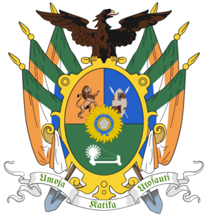
| Motto: "Umoja katika utofauti" "Unity in diversity" | |
| Anthem: "The Call of Zarare" | |
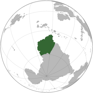
 Location of Zarare | |
| Capital | Georgetown |
| Largest city | Itheku |
| Official languages | Niagaran Kiswahili Hindustani |
| Recognised national languages | See Languages of Zarare |
| Ethnic groups (2020) |
|
| Religion (2020) |
|
| Demonym(s) | Zararian |
| Government | Federal parliamentary constitutional republic |
| NAME TBD | |
| TBD | |
| TBD | |
| TBD | |
| TBD | |
| Legislature | Parliament |
| National Council of States | |
| National Assembly | |
| Independence from Greater Niagara | |
• Dominion | 27 October 1948 |
• Republic | 1 May 1986 |
| Area | |
• Total | 3,321,058 km2 (1,282,268 sq mi) |
• Water (%) | 0.38% |
| Population | |
• 2022 estimate | 484,693,049 (2nd) |
• 2020 census | 484,293,180 |
• Density | 145.95/km2 (378.0/sq mi) |
| GDP (PPP) | 2020 estimate |
• Total | ₭10.06 trillion |
• Per capita | ₭20,772 |
| GDP (nominal) | 2020 estimate |
• Total | ₭4.42 trillion |
• Per capita | ₭9,124 |
| Gini (2020) | medium |
| HDI (2020) | high |
| Currency | Zararian pound (£) (ZRP) |
| Time zone | UTCx (+x) |
| Date format | dd-mm-yyy |
| Driving side | left |
| Calling code | +47 |
| ISO 3166 code | ZR |
| Internet TLD | .zr |
Zarare, officially the Republic of Zarare (RZR), is a country in Frigo. It is the TBD-largest country by area, the second-most populous country, and the most populous democracy in the world. Bounded by 4,122 kilometres (2,561 mi) of coastline that stretched along the Tenific and Depian Oceans. It shares land borders with Antarctica to the south; and Inglaterra to the east. It also shares a maritime border with Singosari to the north. The national capital is Georgetown, and the most populous city and largest financial center is Itheku. Zarare’s land is a megadiverse, with three biodiversity hotspots, unique biomes, plant and animal life. Its plains comprise 64.7% of its area. Zarare’s wildlife is supported among these plains, and elsewhere, in protected habitats. Zarare also has the most TBD World Heritage Sites in Frigo.
About 44% of the population are Indigenous Zararians. The remaining population consists of Frigo’s largest communities of Niagaran (White Zararians), Galians (Black Zararians), and multiracial (Coloured Zararians) ancestry. Zarare is a multiethnic society encompassing a wide variety of cultures, languages, and religions. Its pluralistic makeup is reflected in the constitution’s recognition of 3 official languages, the TBD-highest number in the world. According to the 2020 census, the four most spoken first languages are Niagaran (72.6%), Kiswahili (21.5 %), Hindustani (11.3%), and Chamgha (9.4%).
Zarare has been a federal republic since 1986, governed through a democratic parliamentary system. It is a pluralistic, multilingual and multi-ethnic society. As of 2023, Zarare is a middle power in international affairs; it maintains significant regional influence and is a member of both the Commonwealth and the TBD INTERGOVERNMENTAL FORUM. It is a developing country ranking TBDth on the human development index, the 2nd highest on the continent. It has been classified by the TBD INTERNATIONAL FINANCIAL INSTITUTION as a newly industrialised country and has the 5th-largest economy in the world. with an expanding middle class. It has a space programme which includes several planned or completed extraterrestrial missions. Since 1986, Zarare's nominal per capita income quadrupled from ₭2,103 annually to ₭9,124, and its literacy rate from 23.7% to 94%. It has substantially reduced its rate of poverty, though at the cost of increasing economic inequality. Among the socio-economic challenges Zarare faces are inequality, crime, and overpopulation.
Etymology
History
Prehistoric archaeology
Ancient Zarare
Medieval Zarare
Early modern Zarare
Modern Zarare
Geography
Climate
Biodiversity
Conservation issues
Demographics
Languages
Religion
Urbanization
One online database lists Zarare having more than 2,600 cities. The following are the ten largest cities and towns in Zarare.
Largest cities in Zarare
2020 census | |||||||||
|---|---|---|---|---|---|---|---|---|---|
| Rank | States and union territories | Pop. | Rank | States and union territories | Pop. | ||||
 Itheku  Georgetown |
1 | Itheku | Ndebeleland | 11,944,780 | 11 | TBD | Dakshinraj | 1,884,181 |  Udapura  Kimberly |
| 2 | Georgetown | Georgetown | 7,121,953 | 12 | Cacileyo | Malkialand | 1,642,838 | ||
| 3 | Udapura | Assamiya | 5,568,533 | 13 | TBD | TBD | 1,561,471 | ||
| 4 | Kimberly | Tswanaland | 4,826,931 | 14 | Uhando | Adhityaka | 1,253,017 | ||
| 5 | Ekhaya | Nataland | 4,081,776 | 15 | Shikhar | Shikhar | 1,166,283 | ||
| 6 | Clybourne | Talahati | 3,684,756 | 16 | Gonkekhet | Tswanaland | 982,244 | ||
| 7 | Kalakana | West Samudr | 3,363,882 | 17 | Mijarasee | Assamiya | 937,551 | ||
| 8 | Bandari | Assamiya | 2,771,352 | 18 | Newport | West Samudr | 900,770 | ||
| 9 | Prachehar | Sutherland | 2,492,745 | 19 | Vandobast | Ndebeleland | 896,145 | ||
| 10 | Salisbury | Etawahland | 2,231,320 | 20 | Alcapine | Alcapine | 867,300 | ||
Government and politics
Politics
Government
Administrative divisions
Law enforcement and crime
Foreign relations
Military
Economy
Industries
Tourism
Infrastructure
Roads
Rail
Energy
Science and technology
Transport
Water supply and sanitation


