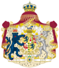
Outline of Mascylla
The following outline is provided as an overview of and topical guide to Mascylla.
Mascylla – sovereign country located on the northern extent of Erdara. It is bordered by the White Sea to the north, the Kyralov Sea to the north-east, Lake Delchse to the south-east, Tudonia to the south, Lilienburg and Lake Sigismund to the south-west, Juznia to the west, and Alriika and the North Sea to the north-west. With a population of over 39 million and an area of more 338,000 square kilometres (130,000 sq mi), it is the most populous and largest country in Erdara.
Mascylla was under the control of the Hesurian empire for hundreds of years and more centuries being fragmented into smaller states. Efforts to resist the rising kingdom of Adwhin eventually led to the expulsion of the Elbgau Confederation from its sphere of influence in the mid-18th century, ensuing into a bitter war. It ended with a victory on behalf of the Confederation, unifying the region and becoming a nation-state in 1793.

