Gagian Expressway System
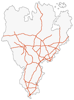
The Gagian Expressway System is a network of approximately 36,000 km of controlled-access highways that serves as Gagium's national road network. Partially inspired by the national highway system of Hrvada, the Gagian Expressway System was signed into law by Prime Minister Benoit Bouchard on 15 April 1961. Originally designed solely to connect major Gagian population centers, the Expressway System has since evolved into an integrated highway system that connects both major cities and small towns and extends across all the commonwealths of Gagium. The size of the Expressway system was nearly doubled between 1983 and 2000, following the Third Great War.
The highways of the Gagian Expressway System, designated by the letter 'E', are both funded and maintained by the national government. Gagian Expressways all conform to specific standards, mainly the provision of two lanes in each direction that conform to specific lane and shoulder widths. The standards dictating the numbering of these highways call for all expressways to be designated with a one to three digit number. 1 and 2 digit expressways serve as main routes designed to connect different metropolitan areas to each other, while 3 digit expressways serve as routes meant to carry local traffic in a single metropolitan or geographical area. In addition to this, many of the highways of the Gagian Expressway System are operated as toll routes in order to support their maintenance as well as encourage other means of transportation, such as via the SCG's high speed railway network.

