Lurona: Difference between revisions
Jump to navigation
Jump to search
(Created page with "{{Infobox country |conventional_long_name = Republic of Lurona |native_name = Repubblica di Lurona<br>Luronako Errepublika |common_name = Lurona |status =...") |
mNo edit summary |
||
| Line 105: | Line 105: | ||
[[Category:Stratea]] | [[Category:Stratea]] | ||
[[Category:Countries in Stratea]] | [[Category:Countries in Stratea]] | ||
[[Category: | [[Category:Lurona]] | ||
Revision as of 18:30, 28 January 2023
Republic of Lurona Repubblica di Lurona Luronako Errepublika | |
|---|---|
|
Flag | |
Motto: TBD | |
Anthem: | |
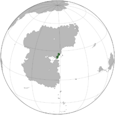
 Location of Lurona in Stratea | |
| Location | Gulf of Atily region of Stratea |
| Capital and largest city | Bellanera |
| Official languages | Caputian, not!basque |
| Recognised regional languages | not!georgian, not!dargwa |
| Ethnic groups | By race:
|
| Religion |
|
| Demonym(s) | Luronan |
| Government | Federal Semi-Presidential Parliamentary Republic |
• Prime Minister | Dacio Annunziato |
• President | Costanzo Capello |
| Legislature | Parliament |
| Establishment | |
• TBDEVENT1 | TBDDATE1 |
• TBDEVENT2 | TBDDATE2 |
• TBDEVENT3 | TBDDATE3 |
| Area | |
• | 219,349 km2 (84,691 sq mi) |
| Population | |
• 2022 estimate | |
• 2020 census | 15,211,800 |
• Density | 70.24/km2 (181.9/sq mi) |
| GDP (PPP) | estimate |
• Total | ₭319.45 billion |
• Per capita | ₭21,000 (TBD) |
| HDI (2018) | very high |
| Currency | Luronan Lira (LUR) |
| Time zone | +TBD |
| Date format | dd-mm-yyyy |
| Driving side | right |
| Calling code | TBD |
| Internet TLD | .mn |
Lurona, officially the Republic of Lurona (Caputian: Repubblica di Lurona, not!Basque: Luronako Errepublika), is a country located in the Gulf of Atily region of Stratea. Covering an area of 216,578 km2 (83,621 sq mi), Lurona shares a border with Senarwa to the west, Vadurzil to the northwest, Aghankir to the north, Luxchqiri to the northeast, Mantocia to the east, and the Gulf of Atily to the south.
