National Expressway (Zhenia)
| National Expressway 국가고속국도 | |
|---|---|
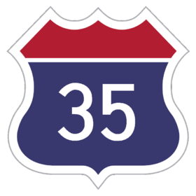
 Highway shield for the Expressway 35. | |
 | |
| System information | |
| Maintained by Zhenia Expressway Corporation | |
| Length | 70,611 km (43,876 mi) |
| Formed | 1955 |
| Highway names | |
| National Expressways | E##/E### |
| National Roads | R##/R### |
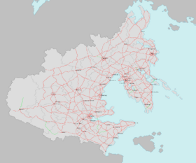
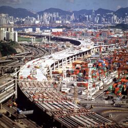
The National Expressway System (Zhenian: 국가고속국도) is a network of controlled-access highways that constitutes a part of the Zhenia National Road System in Zhenia, alongside the older National Road System. Although owned by Zhenia's Ministry of Territories and Transport, it is built and managed directly by the Zhenia Expressway Corporation (ZhenEx), a public company in which the government has a majority stake in. Extending throughout the entirety of Zhenia, it currently serves all Zhenian province-level administrative areas, with the latest connection being the addition of the Kim Shimin Memorial Bridge connecting the Haedong Special Administrative Region and Donghae South Province in 2010.
With its initial plans having been drawn out during the early days of the First Zhenian Republic, construction of the initial plan did not commence until 1933, with the first line winding through the Golden Arc completed in 1938 with the construction of other lines following suit. Although the project itself was halted, converted and even neglected during the later stages of the Second Great War and during the Second Zhenian Republic, it was re-initiated under one of the first administrative orders of the National Reconstruction Council spearheaded by Kim Shimin. The project was ultimately completed in 1987, with most of the nation's population centers and industrial areas linked by the road system to this day, although further extensions and expansions, as well as revamps, are still ongoing.
Although both construction and operation of all National Expressways was at the hands of the Zhenia Expressway Corporation, more recent projects have allowed for the investment of private capital in both the construction and operation process in roads with less demand through joint ventures with ZhenEx.
History
Initial planning and construction
Plans for a nationwide road system in Zhenia had surfaced in governmental documents as early as 1914, when the Ministry of Defense called for an efficient road system that would complement and partially substitute existing rail for transporting troops, equipment and resources across the nation. Such demands resulted in a three-phase plan by the Ministry of Land, Transport and Maritime Affairs - the first phase, to be completed by 1923, would improve existing road networks across the nation; the second phase, later materialized into the Zhenia National Road program, a plan initially intended to establish a nationwide connection for both urban and rural areas; and the third phase, a high-capacity controlled-access highway connecting areas with high demand, which later became the National Expressway system. While the National Road program was to precede the National Expressway system, priorities of the government had changed by 1930, when the National Road system was formally changed into a supplementary, national grid road network that provided road access to areas not served by the National Expressway.
Construction commenced by early 1933 by the construction of the Daedo-Jin-Nampo line - the eastern segment of the Golden Arc line - spearheading the initiation of other lines, mostly along the Golden Arc region. Most lines thought out during the earlier phases of the project, including those along the Golden Arc region, broke ground in the late 1930s. The Zhenian involvement in the Second Great War since 1937, however, halted almost all later phases of the plan as resources were re-prioritized to the war effort outside the nation. While some segments were converted into auxiliary airstrips during the course of the war, much of the partially constructed lanes, including those on the eastern coasts of the Danguk Peninsula, were intentionally torn down during the later phases of the war, in fear of the roads being used as invasion routes for Allied forces into the Zhenian heartland. Zhenia's defeat in the Second Great War, as well as the destruction from the years of war, left most sections of both already complete and under-construction routes deserted.
The Third Republic and beyond
Shortly after the Coup of 1955, Kim Shimin ordered the revival of the pre-war National Expressway plan, although with some changes: while the new network of highways would generally follow the notion of a true controlled access highway unlike the National Highway System, the specifically planned routes would differ from the decades-old initial plans and would adhere to the economic development plans of the Third Republic. The plans also shifted from some lines sharing roads with the existing National Highway System, to a dedicated controlled-access highway with higher speed designations, more lanes and reinforced asphalt. The plan issued at the time, since it had connected almost all major population and present/future economic centers with a grid of industrial-grade trunk roads while major population centers would be served by additional bypasses to lighten the load on traffic.
Following a nationwide construction effort, the first route, a part of the Trans Golden Arc Expressway and connecting Daedo and Hansan, was completed in 1959. It was then followed by the completion of multiple other routes mostly concentrated in the Danguk Peninsula and the Golden Arc region. Work in the relatively mountainous southwest and northeast, as well as the underdeveloped northwest, was relatively hindered but commenced amid the development of civil engineering technology and revisions in the Third Republic's economic development plans. The National Expressway 40, the first inland National Expressway route connecting Geonju and Shinhang, opened in 1971, further pushing forth connecting routes that linked the underdeveloped inland regions to the Golden Arc. While continuous additions are being made to this day, the project envisioned by the Third Republic was declared complete in 1987.
Extensions at work since the 1990s have been focused on lightening the load on existing trunk roads via lane additions and bypass routes also linking to less populated areas of the nation. While the existing grid plan has been maintained to this day since the Third Republic, branches have extended to less-accessible parts of the nation and integrated them into the expressway network. In 2010, the Kim Shimin Memorial Bridge, connecting Donghae South Province and the Haedong Islands, opened as a part of National Expressway 32, becoming the first-ever direct road connection between the Haedong Islands and the mainland, followed by the opening of the Bujeon Bridge, connecting the Haedong Islands and Gyeongjung Province.
Types of Expressways
Trunk Roads
Branch Roads
National Roads
Although not formally part of the National Expressway system, National Roads are the direct predecessors and augmenting roads of the National Expressway system. Although most segments have been built and remain to this day as limited-access roads, some roads in urban areas have been integrated into the urban network. National roads in some urban areas are also exempt to some of the regulations defining it as an urban road, including the restriction of pedestrian and bike usage of the road excluding certain circumstances, which has resulted in some segments being categorized as normal roads in accordance to revised regulations in 1990.
Regulations
Speed limits
Speed limits are rather strictly enforced in almost all National Expressway lanes, with the maximum and minimum speeds being around 130 km/h and 50 km/h respectively; in practice, however, ZhenEx approves up to 10% higher speeds than the maximum speed limit, taking into the possibility of technical errors in measurement into account. While minimum speed limits are generally enforced across the entire expressway system equally with the exception of passing lanes (in which the minimum speed limit is 90 km/h), maximum speed limits can vary by route; narrower, curved and winding routes generally have lower maximum speed limits than broader, straight routes. Minimum speed limits can be relaxed in congested traffic; maximum speed limits, however, cannot be relaxed under any circumstances.
Vehicle types and lane designation
Although the system has been simplified into three types of lanes now, all lanes of National Expressway routes were specifically designated to certain types of vehicles since the beginning. The first lane, known as the passing lane, is the left-most lane on the route and has a minimum speed limit of 90 km/h instead of the 50 km/h minimum speed limit enforced on all other lanes. Median bus lanes, although they are designated only in some sections, have priority over passing lanes and are positioned on the leftmost lane if they exist. The remaining lanes left of the median of the road are designated for small passenger cars and vans, while all remaining roads right of the median of the road are designated for minibuses, coaches, trucks, construction equipment, special vehicles and other low-speed vehicles.
As a controlled access expressway, motorcycles, mopeds, bicycles, pedestrians, three-wheeled vehicles and tractors are strictly prohibited from entering the National Expressway network due to safety reasons, although police and military vehicles are exempt from such restrictions. Construction vehicles, however, are allowed to access the National Expressway network both for construction/repair work on National Expressway routes and for passing; however, for the purpose of the latter, all vehicles must use the right-hand lanes designated for heavy vehicles under the lane designation scheme.
Numbering System and Nomenclature
Route Numbering System
National Expressways and Province-Level Highways are differentiated by the first character of their numbering scheme; National Expressways begin with the letter 'F' and thereby follow the format 'F##' or 'F###' (depending on the digit of the route number), while Province-Level Highways begin with the letter 'P' and follow a similar format. The expressway shields of National Expressways reflect such scheme; the shields of National Expressways are rectangular with a red bar on top, while Province-Level Highways have green rectangular shields with a yellow bar on top, indicating the type of expressway the driver is on.
Routes that run from north to south have a designation number that ends with odd numbers, while routes that run from east to west have designation numbers that end with even numbers; among such lanes, designation numbers ending with 5 or 0 are assigned to arterial trunk routes (Zhenian: 주간선 노선). The tenth place of such trunk routes are also assigned from north to south and east to west; for instance, National Expressway 15 runs along the eastern coasts of the Danguk Peninsula to the nation's northeastern border in Bukhae Province, being the easternmost north-south highway. The tenth place of supplementary core routes (Zhenian: 보조간선 노선) are assigned equal to the nearest core trunk route, while their designation numbers end with 1, 3, 5, 7 or 2, 4, 6, 8 depending on their general direction. The designation number of branch routes (Zhenian: 지선) feature an additional digit after the branch route it deviates from, also in accordance to the direction in which the branch route goes. The first digits of Ring Roads around the nation's Metropolitan Municipalities are assigned to match the digit of the municipality's postal code, usually resulting in the designation number being three digits.
The northern and eastern ends of each route are designated as starting points (Zhenian: 기점), while the southern and western ends are designated as the terminal point (Zhenian: 종점). The routes from starting points to terminal points, or southbound and westbound routes, are often called 'downbound routes' (Zhenian: 하행선), while eastbound and northbound routes are often called 'upbound routes' (Zhenian: 상행선).
Exit Numbering
Exits and junctions in all National Expressways follow an order-based scheme and consist of two parts: the first part consists of the expressway number, while the latter part can consist of up to three digits of numbers running from starting point to terminal point. For instance, if an exit is the 25th exit from the starting point of Expressway 10, the exit is designated 'Exit 10-25'. For this reason, junctions can be designated with two exit numbers; while both are accepted, the exit number of the route with the higher-priority number in accordance to the numbering scheme is prioritized.
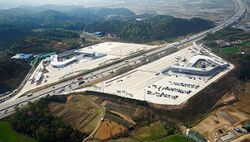
The exits towards service areas are assigned the nearest exit number with an 'H' on its end to distinguish it as an exit - for instance, a rest stop (between Exits 35-88 and 35-89) that is 2.1 kilometers from Exit 35-88 and 25.6 kilometers from Exit 35-89 would be designated '35-88H'. Rest stops, differentiated from service areas in that they are not included in the legal definition of 'service areas' and are regarded more as safety facilities to prevent accidents, are not assigned separate exit numbers; however, new safety regulations in 2009 have mandatory for all navigation devices to notify the driver of a rest stop within three kilometers.
Naming
Although all National Expressway routes, regardless of the order and time they were built, would be primarily and formally referred to the expressway designation number, they would also be assigned names to be used more commonly. Many earlier National Expressway routes were, with few exceptions, initially named with the syllables of their starting and terminal points; for instance, the Jeongju-Changan Expressway was initially named the 'Jeongan Expressway', taking each syllable from the terminal and starting points respectively. Unlike the numbering scheme, such names didn't necessarily need to follow the numbering scheme as long as the syllables of the starting and terminal points were included. Ring roads were named after the metropolitan municipality it was circling around, while branch roads were named after with the prefix '-branch' (Zhenian: -지선).
The rules in assigning such names have been revised in the late 1990s to allow for greater diversity and reduce the confusion caused by a limited number of syllables. Instead of taking each syllable from the starting and terminal points respectively, expressways can now include the full names of their starting and terminal points; for instance, the Jeongan Expressway from above can alternately be called the 'Jeongju-Changan Expressway'. Expressways can also be named after the key features of the route - for instance, the Trans Golden Arc Expressway gets its name from the fact that it traverses the Golden Arc from east to west.
Tolls
Unlike the provincial-level roads of the Zhenia National Highway system, all National Expressway roads are designated as toll roads, with toll gates in each entrance and exit for toll collection. Tolls are based on the distance traveled in the National Expressway network. One collects a ticket upon entering the network, which can be given to an attendant for processing or can be inserted into a machine with the fare upon exiting the expressway. The distance is calculated as the shortest distance between the two exit interchanges of the National Expressway.
The toll collection system used in National Expressways has modernized over the years; while toll collector machines have gradually replaced attendants in most exits by the early 2000s, Passer, an electronic toll collection (ETC) system using DSRC (dedicated short-range communication) to allow for wireless toll payment by the driver without having to physically stop at the toll gate, has been introduced to the entire network in 2010. While it requires vehicles to carry their own transponders linked to a payment method (usually a prepaid expressway card or any of the National-level transportation cards), it has helped in easing congestion near exits and reduce total travel time on the end of each driver.
A new system implementing open road tolling, a step further from the Passer system to eliminate the need for toll gates altogether and replace existing toll gates with overhead cameras and transponders, has been under experimentation in some segments since 2019 and is expected to be introduced to the National Expressway network by 2024.


