Kelenoa: Difference between revisions
m (removed Aeia category) |
|||
| (36 intermediate revisions by 3 users not shown) | |||
| Line 1: | Line 1: | ||
{{template:WIP}} | |||
{{Infobox country | {{Infobox country | ||
|conventional_long_name = Tribes of Kelenoa | |conventional_long_name = Tribes of Kelenoa | ||
| Line 5: | Line 6: | ||
|alt_flag = [[Flag]] | |alt_flag = [[Flag]] | ||
|image_coat = KeloniiII.png | |image_coat = KeloniiII.png | ||
|national_motto = ''" | |national_motto = ''"Hoʻohuiʻia me nā kaula a me nā pua"''<br><small>"United by thaws and flowers"</small><br> | ||
|national_anthem = ʻO ka mele a kā mākou poʻe<br><small>"Our People's Song"</small><br> | |national_anthem = ʻO ka mele a kā mākou poʻe<br><small>"Our People's Song"</small><br> | ||
[[File:MediaPlayer.png|link=https://www.youtube.com/watch?v=lqGZpnJCtdA|200px]] | [[File:MediaPlayer.png|link=https://www.youtube.com/watch?v=lqGZpnJCtdA|200px]] | ||
| Line 45: | Line 46: | ||
|area_sq_mi = 151,372 | |area_sq_mi = 151,372 | ||
|percent_water = 1.5% | |percent_water = 1.5% | ||
|population_estimate = | |population_estimate = 37,410,000 | ||
|population_estimate_year = 2019 | |population_estimate_year = 2019 | ||
|population_census = | |population_census = 37,374,011 | ||
|population_census_year = 2018 | |population_census_year = 2018 | ||
|GDP_PPP_local = | |GDP_PPP_local = | ||
| Line 58: | Line 59: | ||
|GDP_nominal = $322.9 billion (xnd) | |GDP_nominal = $322.9 billion (xnd) | ||
|GDP_nominal_year = 2018 | |GDP_nominal_year = 2018 | ||
|GDP_nominal_per_capita = $ | |GDP_nominal_per_capita = $13,551 (xth) | ||
|HDI = 0. | |HDI = 0.703 | ||
|HDI_year = 2017 | |HDI_year = 2017 | ||
|HDI_change = 0.700 | |HDI_change = 0.700 | ||
| Line 72: | Line 73: | ||
}} | }} | ||
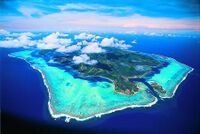
A collection of independent states and chiefdoms in the 9th century and later a confederacy in the 1670s emerged, gaining wealth and political importance with its exported goods and strategically important location. The arrival of Evandro Scire, an | '''Kelenoa''' ({{wp|Hawaiian language|Kawanakan}}: ''Kelenoʻa'' {{wp|Help:IPA/German|[keːˈleːno:ah]}}), officially the '''Tribes of Kelenoa''' ({{wp|Hawaiian language|Kawanakan}}: ''Nāʻohana ʻo Kelenoʻa'' {{wp|Help:IPA/German|[nāːˈohanaːo:keːˈleːno:ah]}}), is an {{wp|archipelagic state|archipelagic}} {{wp|Oceania|Oceanian}} country in eastern [[Savai]]. It comprises the main island of Komuele and its offshore islands, consisting of about 5,295 islands situated in [[Maonesia]], an {{wp|insular region}} of the western Jade Ocean. The archipelagio makes up the eastern tip of the Savaian continental shelf. Kelenoa includes [[Laina]] as a {{wp|dependent territory}}; the small archipelago continues as the [[Ajerrin|Welile Islands]] further south. The {{wp|Capital city|capital city}} of Kelenoa is [[Hapua]], while Pualeka is the most populous city, both situated on Komuele. Surrounded in essence by the x to the north, the x to the west, the Jade Ocean to the east and the x to the south, Kelenoa has no land borders but only shares maritime borders with most primarly x to the north, [[New Timeria]] and [[Kealakekua]] to the south-west and west respectively, and [[Ajerrin]] to the south. | ||
Kelenoa's location on the Jade Ring of Fire and close approximity to the {{wp|Equator|equator}} makes Kelenoa prone to {{wp|Earthquake|earthquakes}} and {{wp|Typhoon|typhoones}}, but also endows it with abundant natural resources and some of the world's greatest {{wp|Biodiversity|biodiversity}}. Kelenoa has an area of around 392,000 km² (145,000 sq mi), and, as of 2018, had a population of at least 49 million people. As of January 2018, it is the fourth-most populated country in Savai and the xth most populated country in the world. Multiple ethnicities and cultures are found throughout the islands. In prehistoric times, {{wp|Negrito}} were some of the archipelago's earliest inhabitants. They were followed by successive waves of {{wp|Austronesian peoples|Savaonesian peoples}}. Later, waves of {{wp|Polynesia|Seiranesians}} arrived, adding to the archipelago's diverse ethnic population. Exchanges with {{wp|Korean people|Songdangin}} and {{wp|Sundanese people|Seanesian}} nations occured, however the interactions and relations with the {{wp|native Hawaiians|Kawanakan}} remained the most crucial and impactful. Then, various competing maritime states were established under the rule of {{wp|Chiefdom|chiefs}} and {{wp|Petty kingdom|petty kings}}. | |||
A collection of independent states and chiefdoms in the 9th century and later a confederacy in the 1670s emerged, gaining wealth and political importance with its exported goods and strategically important location. The arrival of Evandro Scire, an Ardaiman explorer leading a fleet for Giozzara, in Vehale in 1725 marked the beginning of Asuran colonization, however the later colonisation process was very lingering, not making major land gains until as late as the 1820s. In 1730, Lhedwinic explorer Kristofer Bruntde arrived in Kelenoa, and later [[Lhedwin]] gained full control of the archipelago, slowly superseding Ardaima's position. Kelenoa as a whole became part of the [[Lhedwin|Lhedwinic colonial empire]] for only 20 years. This resulted in Asuran religions and languages failing to achieve significant influence. During this time, Hapua became a western hub of the trans-Jade trade connecting [[East Catai|Yidao]] and Savai with the Columbian using Hapua galleons. As the 19th century gave way to the 20th, during the height of the [[Great War (Aeia)|First Great War]], the Kelenoan Revolution quickly followed, which then spawned the short-lived Kelenoa Confederacy, followed by the bloody East Maonesian War against Lhedwin. The war, as well as the ensuing cholera epidemic, resulted in the deaths of thousands of combatants as well as tens of thousands of civilians. However, the war was won on side of the Kelenoan, gaining independence in the [[Great War (Aeia)#Aftermath|peace negotiations]] following the war in Lotric; the country was declared on January 4, 1900. [[Ardaima]] and [[Midrasia]] retained protection of the islands during the Interwar period, while Kelenoa industrialised and grew more stable. Since, it managed to surpass the turbulent times of the Second Great War and Cold War mostly neutral and stable. It cooperated on side of the [[Drago Entente#History of the Entente|Western Bloc]] and later the [[Commonwealth of Democratic Nations|CDN]] during global political and economical affairs of the latter 20th century. Just recently did Kelenoa begin to thrive economically, making it one of the fastest growing economies in the world. | |||
Kelenoa is considered to be a political {{wp|middle power}} and enjoys suffisticated economic growth and development. The country is considered to be an {{wp|Emerging market|emerging market}} and a {{wp|Newly industrialised country|newly industrialised country}} in the later stage, which has an economy transitioning from being based on {{wp|Self-sufficiency|self-sufficiency}} to one based more on export and foreign trade. It features a high {{wp|Human Development Index|standard of living}}, a large cultural and biological diversity, and a stable {{wp|Democracy|democratic}} system, being one of the least {{wp|Corruption|corrupt}} and most {{wp|Political freedom|politically free}} in the world. | Kelenoa is considered to be a political {{wp|middle power}} and enjoys suffisticated economic growth and development. The country is considered to be an {{wp|Emerging market|emerging market}} and a {{wp|Newly industrialised country|newly industrialised country}} in the later stage, which has an economy transitioning from being based on {{wp|Self-sufficiency|self-sufficiency}} to one based more on export and foreign trade. It features a high {{wp|Human Development Index|standard of living}}, a large cultural and biological diversity, and a stable {{wp|Democracy|democratic}} system, being one of the least {{wp|Corruption|corrupt}} and most {{wp|Political freedom|politically free}} in the world. | ||
| Line 105: | Line 108: | ||
The demarcation from Kelenoan prehistory to its classical period in the middle of what anthropologists refer to as Kelenoa's "Emergent Phase" (1st–15th centuries CE), which was characterized by newly emerging socio-cultural patterns, the initial development of large coastal settlements, greater social stratification and specialization, and the beginnings of local and international trade. By the 1300s, a number of the large coastal settlements had become progressive trading centers, and became the focal point of societal changes, ushering complex lifeways which characterized what historians called the "Barangic Phase" of early Kelenoan history, beginning from the 14th century through the arrival of Asuran colonizers and the beginning of Kelenoa's colonial period. The discovery of iron at around the 1st century CE created significant social and economic changes which allowed settlements to grow larger and develop new social patterns, characterized by social stratification and specialization. Some of these polities, particularly the coastal settlements at or near the mouths of large rivers, eventually developed substantial trade contacts with the early trading powers of [[Savai]] and [[Yidao|southeastern Yidao]], most importantly the Songdangin and [[Ajerrin#Pre-Chenoan Civilization|pre-Chenoan Ajerri]] kingdoms, the various dynasties of Qyred, and later, Seanesia. They also traded with Indragirian and Timerian kingdoms, and other Savaonesian islands. | The demarcation from Kelenoan prehistory to its classical period in the middle of what anthropologists refer to as Kelenoa's "Emergent Phase" (1st–15th centuries CE), which was characterized by newly emerging socio-cultural patterns, the initial development of large coastal settlements, greater social stratification and specialization, and the beginnings of local and international trade. By the 1300s, a number of the large coastal settlements had become progressive trading centers, and became the focal point of societal changes, ushering complex lifeways which characterized what historians called the "Barangic Phase" of early Kelenoan history, beginning from the 14th century through the arrival of Asuran colonizers and the beginning of Kelenoa's colonial period. The discovery of iron at around the 1st century CE created significant social and economic changes which allowed settlements to grow larger and develop new social patterns, characterized by social stratification and specialization. Some of these polities, particularly the coastal settlements at or near the mouths of large rivers, eventually developed substantial trade contacts with the early trading powers of [[Savai]] and [[Yidao|southeastern Yidao]], most importantly the Songdangin and [[Ajerrin#Pre-Chenoan Civilization|pre-Chenoan Ajerri]] kingdoms, the various dynasties of Qyred, and later, Seanesia. They also traded with Indragirian and Timerian kingdoms, and other Savaonesian islands. | ||
The later centuries saw the arrival and tried spreading of [[Irsad]] in the Kelenoan archipelago, however it lacked popularity for it to become significant, both religious, demographically, and politically. Other religions such as [[Taido]] and [[Cotrism]] also had little to no effect on the states and peoples, with the areas that were converted being isolated in the north of the islands. However, most notably Irsadic armies conducted {{wp|Slavery|slave-raids}} against the Maheane, alienating relations between both factions. In a matter of interregional politics, most states initially banned all foreign religions. Only the {{wp|Polynesian religions|Kawanakan religions}} across the Seira Sea had significant influence on Kelenoa's religions, with adaptations of most stories, legends, and characters. Politics also changed, when many chiefs grew more reliable on one another, due to resource supply or trade relations. Agreements (so called {{wp|Ancient Hawaii#Subsistence economy|''nāʻaelike''}}) and other contracts were signed, a for that time major leap in Kelenoan {{wp|Diplomacy|diplomacy}}. Relations improved greatly over the course of the next two centuries, finalizing with a confederacy ({{wp|Ancient Hawaii#chiefs|''kālepa''}}) founded in the 1670s. As a simple union made out of the representative chiefs of the member tribes, it served as Kelenoa's first unitary state. Though it showed ineffectiveness in actually governing the archiepalago due to its sparse population, the {{wp|Hawaiianize|Maheane identity}} was greatly strengthened in seeing the tribes as united and connected by relation. After fivety years of its existence, the nation was dissolved following calming foreign affairs. However, since [[ | The later centuries saw the arrival and tried spreading of [[Irsad]] in the Kelenoan archipelago, however it lacked popularity for it to become significant, both religious, demographically, and politically. Other religions such as [[Taido]] and [[Cotrism]] also had little to no effect on the states and peoples, with the areas that were converted being isolated in the north of the islands. However, most notably Irsadic armies conducted {{wp|Slavery|slave-raids}} against the Maheane, alienating relations between both factions. In a matter of interregional politics, most states initially banned all foreign religions. Only the {{wp|Polynesian religions|Kawanakan religions}} across the Seira Sea had significant influence on Kelenoa's religions, with adaptations of most stories, legends, and characters. Politics also changed, when many chiefs grew more reliable on one another, due to resource supply or trade relations. Agreements (so called {{wp|Ancient Hawaii#Subsistence economy|''nāʻaelike''}}) and other contracts were signed, a for that time major leap in Kelenoan {{wp|Diplomacy|diplomacy}}. Relations improved greatly over the course of the next two centuries, finalizing with a confederacy ({{wp|Ancient Hawaii#chiefs|''kālepa''}}) founded in the 1670s. As a simple union made out of the representative chiefs of the member tribes, it served as Kelenoa's first unitary state. Though it showed ineffectiveness in actually governing the archiepalago due to its sparse population, the {{wp|Hawaiianize|Maheane identity}} was greatly strengthened in seeing the tribes as united and connected by relation. After fivety years of its existence, the nation was dissolved following calming foreign affairs. However, since [[Ardaima]] began colonizing [[Songdang]] in the latter 1600 to early 1700s, the Kelenoan states had begun to increase their fleet sizes and further isolation. | ||
==== Cultural and social development ==== | ==== Cultural and social development ==== | ||
| Line 118: | Line 121: | ||
=== Colonial era === | === Colonial era === | ||
==== | ==== Ardaiman rule ==== | ||
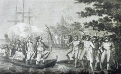
[[File:ArrivalofEvandroScire1725inKelenoa.png|240px|thumbnail|right| | [[File:ArrivalofEvandroScire1725inKelenoa.png|240px|thumbnail|right|Ardaiman explorer Evandro Scire landing at the shores of Vehale in 1725]] | ||
[[File:HoistingOfTheBanner1879.png|240px|thumbnail|right|"''The Hoisting of the Banner''" (1879) depicts the formal utilization of Kelenoa by Lhedwin]] | [[File:HoistingOfTheBanner1879.png|240px|thumbnail|right|"''The Hoisting of the Banner''" (1879) depicts the formal utilization of Kelenoa by Lhedwin]] | ||
In 1725, [[ | In 1725, [[Ardaima|Ardaiman]] explorer Evandro Scire's expedition arrived in Kelenoa, claimed the islands for Ardaima and was then killed at the Battle of Maikik. Colonization began with the landing of his expeditionary fleet in Vehale. After relocating to Peheva island and consolidating an alliance of Maheane allies, Ardaima soldiers and Arabekhan recruits, led by {{wp|Conquistadors|conquistators}} such as {{wp|Juan de Salcedo|Fabriano Scirozi}} who was inspired by his love for the beautiful princess of Eve-besieged Tonha, Kandarapa, the Ardaima-Songdangin coalition then {{wp|Miguel López de Legazpi|invaded the Kelenoan archpelago}}, liberated and incorporated Tondo. Under Ardaiman rule, they established northern Kelenoa as the colony of the [[Ardaiman Heritage Community|Ardaiman South Songdies]] (1740). They also defeated the chiefs in Vefeta. To counteract the colonisation of Kelenoa, the Maheane then conducted the Helekla War which was aimed against [[Ardaima]] and [[Songdang|Principality of Songdang]] and war was also waged against the chiefdoms of Waiteta and Hiloe (for the enslavement of neighbouring tribes). The Ardaiman considered their war with the Maheane one of national pride and colonial expansion. However, the war was prolonged and moved very little, continueing for nearly a century, with the Ardaiman only able to make other minor victories. Diseases and famine weakened both sides, with many areas entirely {{wp|Depopulation|depopulated}}. After a decade of fighting, Ardaima was able to hold only a number of sea ports and land strips along the North Komuelean coast. After that, Ardaima aspired to maintains the colonies it already had, making its role minor in [[Maonesia|Maonesian]] politics. | ||
==== Lhedwinic rule ==== | ==== Lhedwinic rule ==== | ||
After the war in the 1870s, and | After the war in the 1870s, and Ardaima distracted with attacking tribes along their colonies (and other {{wp|colonial power|colonial powers}} not in keen interest yet), [[Lhedwin]] began paying attention to the archipelago. Since it was enourmously weakened following the war with a low population and broken food supply, Lhedwinic colonisers had no difficulty annexing the archipelago. Blocking Ardaima and rushing through the islands, they were able to bring Kelenoa under colonial control, despite bloody fightings and constant revolts. By the early 1880s, Kelenoa belonged to Lhedwin. | ||
Lhedwinic rule eventually contributed significantly to bringing political unity to the fragmented states of the archipelago. During its time as a colony, Kelenoa was directly administered from [[Lhedwin#Politics|its capital]]. The {{wp|Manila galleons|Hapua galleons}}, one of the largest wooden ships ever built, were constructed in Kelenoa's habours. The Hapua galleons were accompanied with a large naval escort as it traveled to and from Hapua, across the Jade Ocean, and {{wp|Isolaprugna|Costapunente}}. The galleons sailed once or twice a year, between the 1880s and 1890s. The Hapua galleons brought with them goods, settlers and military reinforcements destined for Kelenoa, from [[Rennekka]] and [[East Catai|Yidao]]. The reverse voyage also brought [[Catai|Cataian]] commercial products and immigrants to the western side of the {{wp|New World}}. Trade introduced foodstuffs such as {{wp|Maize|maize}}, {{wp|Tomato|tomatoes}}, {{wp|Potato|potatoes}}, {{wp|Chilli pepper|chilli peppers}}, {{wp|chocolate}} and {{wp|Pineapple|pineapples}} from [[Nathair]] and [[Vidoria]]. Within Kelenoa, {{wp|Plantage|plantages}} were established. New towns were also created and [[Alydianism|Alydian]] missionaries tried to convert the population to [[Alydianism]], however the time (of the constitutency of the colony) for significant influence lacked. They also founded schools, a university, hospitals and churches which were built along the {{wp|Earthquake Baroque}} architectural style. To defend their settlements, the Lhedwinic constructed and manned a network of military fortresses (called "{{wp|Presidio|Goktelm}}") across the archipelago. The Lhedwinic also decreed the introduction of free public schooling in 1886. Slavery was also abolished. As a result of these policies the Kelenoan population increased exponentially; the Asuran population in the archipelago steadily grew although natives remained the majority. | Lhedwinic rule eventually contributed significantly to bringing political unity to the fragmented states of the archipelago. During its time as a colony, Kelenoa was directly administered from [[Lhedwin#Politics|its capital]]. The {{wp|Manila galleons|Hapua galleons}}, one of the largest wooden ships ever built, were constructed in Kelenoa's habours. The Hapua galleons were accompanied with a large naval escort as it traveled to and from Hapua, across the Jade Ocean, and {{wp|Isolaprugna|Costapunente}}. The galleons sailed once or twice a year, between the 1880s and 1890s. The Hapua galleons brought with them goods, settlers and military reinforcements destined for Kelenoa, from [[Rennekka]] and [[East Catai|Yidao]]. The reverse voyage also brought [[Catai|Cataian]] commercial products and immigrants to the western side of the {{wp|New World}}. Trade introduced foodstuffs such as {{wp|Maize|maize}}, {{wp|Tomato|tomatoes}}, {{wp|Potato|potatoes}}, {{wp|Chilli pepper|chilli peppers}}, {{wp|chocolate}} and {{wp|Pineapple|pineapples}} from [[Nathair]] and [[Vidoria]]. Within Kelenoa, {{wp|Plantage|plantages}} were established. New towns were also created and [[Alydianism|Alydian]] missionaries tried to convert the population to [[Alydianism]], however the time (of the constitutency of the colony) for significant influence lacked. They also founded schools, a university, hospitals and churches which were built along the {{wp|Earthquake Baroque}} architectural style. To defend their settlements, the Lhedwinic constructed and manned a network of military fortresses (called "{{wp|Presidio|Goktelm}}") across the archipelago. The Lhedwinic also decreed the introduction of free public schooling in 1886. Slavery was also abolished. As a result of these policies the Kelenoan population increased exponentially; the Asuran population in the archipelago steadily grew although natives remained the majority. | ||
| Line 137: | Line 140: | ||
[[File:Hula.png|170px|thumbnail|left|Though much of the native culture was surpressed, {{wp|Hula}} dance remained largely legal (1888)]] | [[File:Hula.png|170px|thumbnail|left|Though much of the native culture was surpressed, {{wp|Hula}} dance remained largely legal (1888)]] | ||
During its rule, Lhedwin also quelled various indigenous revolts. There were also several external military challenges from Songdangin and Timerian pirates, the | During its rule, Lhedwin also quelled various indigenous revolts. There were also several external military challenges from Songdangin and Timerian pirates, the Ardaiman, the Midrasian, the Sarporyvemnians and the Irsadic of Savai. Those challengers were fought off despite the hostile forces having encircled the Kelenoan archipelago in a crescent formed from Mayawi to Ajerrin. The resistance against Lhedwin did not immediately cease upon the conquest of the Savaonesian cities. Random native nobles and chiefs resisted Lhedwinic rule. The longest recorded native rebellion was that of chief Heweve which lasted a century. Kelenoa was maintained at a considerable cost during Lhedwinic rule. The long war against the Ardaimans from the north, in the 18th century, together with the intermittent conflict with the Irsadic in the South and combating Songdangin {{wp|Wokou|Haejeog}} piracy from the North nearly bankrupted the colonial treasury. | ||
In [[Asura]], the {{wp|Industrial Revolution}} spread from [[Aleia]] and [[Midrasia]] during the colonial period. The industrialization of Asura created great demands for raw materials from the colonies, bringing with it investment and wealth, although this was very unevenly distributed. [[Lhedwin]] had opened Kelenoa to this trade. Previously, the archipelago was seen as a trading post for international trade but in the nineteenth century it was developed both as a source of raw materials and as a market for manufactured goods. The economy of Kelenoa rose rapidly and its local industries developed to satisfy the rising demands of an industrializing Asura. A small flow of Asuran immigrants came with the opening of the [[Cherson Canal]], which cut the travel time between Asura and Kelenoa by half. Kelenoan nationalism began with an upsurge of patriotic sentiments and nationalistic ideals in 1800s Kelenoa that came as a consequence of Asuran political assimilation. New ideas about government and society, which the friars and colonial authorities found dangerous, quickly found their way into Kelenoa, and spread the ideals of the [[History of Midrasia|Midrasian]], [[UVSS|Vestric]] and other revolutions, including {{wp|nationalism}} and {{wp|liberalism}}. It served as the backbone for the first national revolution in Savai, the Kelenoan Revolution. | In [[Asura]], the {{wp|Industrial Revolution}} spread from [[Aleia]] and [[Midrasia]] during the colonial period. The industrialization of Asura created great demands for raw materials from the colonies, bringing with it investment and wealth, although this was very unevenly distributed. [[Lhedwin]] had opened Kelenoa to this trade. Previously, the archipelago was seen as a trading post for international trade but in the nineteenth century it was developed both as a source of raw materials and as a market for manufactured goods. The economy of Kelenoa rose rapidly and its local industries developed to satisfy the rising demands of an industrializing Asura. A small flow of Asuran immigrants came with the opening of the [[Cherson Canal]], which cut the travel time between Asura and Kelenoa by half. Kelenoan nationalism began with an upsurge of patriotic sentiments and nationalistic ideals in 1800s Kelenoa that came as a consequence of Asuran political assimilation. New ideas about government and society, which the friars and colonial authorities found dangerous, quickly found their way into Kelenoa, and spread the ideals of the [[History of Midrasia|Midrasian]], [[UVSS|Vestric]] and other revolutions, including {{wp|nationalism}} and {{wp|liberalism}}. It served as the backbone for the first national revolution in Savai, the Kelenoan Revolution. | ||
| Line 149: | Line 152: | ||
The Kelenoan Revolution began in August 1896, when the Lhedwinic authorities discovered the Ke kūʻokoʻa, an {{wp|Anti-imperialism|anti-colonial}} secret organization. The Ke kūʻokoʻa, led by Heweve's descendant Aphūe, was a liberationist movement whose goal was independence from the 16 years of colonial control from Lhedwin through armed revolt. The organization began to influence much of Kelenoa. During a mass gathering in [[Hapua]], the leaders of the Ke kūʻokoʻa organized themselves into a revolutionary government, named the newly established government "ʻO ka moku'āina kūʻokoʻa" ({{wp|Revolutionary government|"Free Republic"}}), and openly declared a nationwide armed revolution. Aphūe called for an attack on the capital city of Kristofshaven. This attack failed; however, the surrounding provinces began to revolt. In particular, rebels in Komuele led by chief Helveʻa and Akekeme (who were from two different factions of the Ke kūʻokoʻa) won major early victories. A power struggle among the revolutionaries led to Aphūe's death in 1898, with command shifting to Akekeme, who led the newly formed {{wp|revolutionary government}}. [[File:Akekeme.png|160px|thumbnail|left|Akekeme, local chief and later commander of the Ke kūʻokoʻa organization (1897)]]That year, the revolutionaries and the Lhedwinic signed the Pact of Oka-me leo, which temporarily reduced hostilities. Akekeme and other Kelenoan officers exiled themselves in New Hope in northern [[Ajerrin]]. However, the hostilities never completely ceased. | The Kelenoan Revolution began in August 1896, when the Lhedwinic authorities discovered the Ke kūʻokoʻa, an {{wp|Anti-imperialism|anti-colonial}} secret organization. The Ke kūʻokoʻa, led by Heweve's descendant Aphūe, was a liberationist movement whose goal was independence from the 16 years of colonial control from Lhedwin through armed revolt. The organization began to influence much of Kelenoa. During a mass gathering in [[Hapua]], the leaders of the Ke kūʻokoʻa organized themselves into a revolutionary government, named the newly established government "ʻO ka moku'āina kūʻokoʻa" ({{wp|Revolutionary government|"Free Republic"}}), and openly declared a nationwide armed revolution. Aphūe called for an attack on the capital city of Kristofshaven. This attack failed; however, the surrounding provinces began to revolt. In particular, rebels in Komuele led by chief Helveʻa and Akekeme (who were from two different factions of the Ke kūʻokoʻa) won major early victories. A power struggle among the revolutionaries led to Aphūe's death in 1898, with command shifting to Akekeme, who led the newly formed {{wp|revolutionary government}}. [[File:Akekeme.png|160px|thumbnail|left|Akekeme, local chief and later commander of the Ke kūʻokoʻa organization (1897)]]That year, the revolutionaries and the Lhedwinic signed the Pact of Oka-me leo, which temporarily reduced hostilities. Akekeme and other Kelenoan officers exiled themselves in New Hope in northern [[Ajerrin]]. However, the hostilities never completely ceased. | ||
However, | However, Ardaiman forces began attacking Lhedwinic forces from Songdang after the beginning of the [[Great War (Aeia)|Great War]]. On May 19, Akekeme, unofficially allied with Ardaima, returned to Kelenoa and resumed attacks against the Lhedwinic. By June, the rebels had gained control of nearly all of the archipelago, with the exception of Hapua. On June 12, Akekeme issued the {{wp|Sovereignity|declaration of independence}}, forming the Kelenoa Confederacy. Although this signified the end date of the revolution, neither Lhedwin nor Ardaima recognized Kelenoan independence yet. A {{wp|white peace}} was signed. | ||
The second conflict arose when the Kelenoa Confederacy objected to the terms of the {{wp|Treaty of Paris of 1898|Treaty of Sanjae}} under which Lhedwin maintained its, now autonomous, colony of Kelenoa, ending the short [[Kelenoa#Revolution and Kelenoa Confederacy (1896–1900)|Kelenoan Revolution]]. Fighting erupted between forces of Lhedwin and those of the Kelenoa Confederacy on February 4, 1896, in what became known as the 1896 Battle of Hapua. On June 2, 1896, the Kelenoa Confederacy officially declared war against Lhedwin. The war officially ended on July 2, 1899, with a victory for the confederacy. Much of the stationed military however kept fighting aginst both | The second conflict arose when the Kelenoa Confederacy objected to the terms of the {{wp|Treaty of Paris of 1898|Treaty of Sanjae}} under which Lhedwin maintained its, now autonomous, colony of Kelenoa, ending the short [[Kelenoa#Revolution and Kelenoa Confederacy (1896–1900)|Kelenoan Revolution]]. Fighting erupted between forces of Lhedwin and those of the Kelenoa Confederacy on February 4, 1896, in what became known as the 1896 Battle of Hapua. On June 2, 1896, the Kelenoa Confederacy officially declared war against Lhedwin. The war officially ended on July 2, 1899, with a victory for the confederacy. Much of the stationed military however kept fighting aginst both Ardaiman and Kelenoan troops, including the 2nd and 4th Army, continued hostilities in remote areas and islands, until their final defeat at the Battle of Nei kekea on June 15, 1899. The war resulted in the deaths of at least 200,000 Kelenoan civilians, mostly due to famine and disease. Some estimates for total civilian dead reach up to a million. In the [[Great War (Aeia)#Peace treaties|Lotric peace negotiations]] of 1900, the [[Great War (Aeia)|Grand Alliance]] recognized Kelenoan independence, with Lhedwin submitting to acknowledge its sovereignity. On January 4, 1900, Kelenoa was declared as an independent state. | ||
=== Post-Great War and occupation (1900–1915) === | === Post-Great War and occupation (1900–1915) === | ||
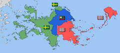
[[File:KelenoaMap1910s.png|240px|thumbnail|right|Occupation borders in Kelenoa in 1900 (red: [[Midrasia]], green: [[ | [[File:KelenoaMap1910s.png|240px|thumbnail|right|Occupation borders in Kelenoa in 1900 (red: [[Midrasia]], green: [[Ardaima]], blue: [[Newrey]])]] | ||
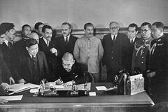
[[File:Matsuka.jpg|240px|thumbnail|right|Allied and Kelenoan officials signing the formal declaration of sovereignity of Kelenoa after more than a decade of post-Great War occupation in 1915]] | [[File:Matsuka.jpg|240px|thumbnail|right|Allied and Kelenoan officials signing the formal declaration of sovereignity of Kelenoa after more than a decade of post-Great War occupation in 1915]] | ||
In the first years of its independence, Kelenoa remained occupied by Grand Alliance forces. Due to its devastation and noticable depopulation during the [[Kelenoa#Revolution and Kelenoa Confederacy (1896-1900)|Kelenoan Revolution]] and [[Kelenoa#Revolution and Kelenoa Confederacy (1896-1900)|Pala War]], the three powers divided 'Kelenoa as a whole' into four occupation zones for administrative purposes, under [[ | In the first years of its independence, Kelenoa remained occupied by Grand Alliance forces. Due to its devastation and noticable depopulation during the [[Kelenoa#Revolution and Kelenoa Confederacy (1896-1900)|Kelenoan Revolution]] and [[Kelenoa#Revolution and Kelenoa Confederacy (1896-1900)|Pala War]], the three powers divided 'Kelenoa as a whole' into four occupation zones for administrative purposes, under [[Ardaima]], [[Newrey]] and [[Midrasia]] respectively; creating what became collectively known as "Allied-occupied Kelenoa" (Kawanakan: ''Pau nā paʻa Kelenoʻa''). This division was ratified at the [[Great War (Aeia)#Peace treaties|Lotric peace negotiations]] (January 1900). The three zones were as agreed established in the conference, and their implementation was executed in May 1900. | ||
During occupation, the country was heavily modernized and rebuilt; a road system and electricity were introduced. The powers also agreed on rebuilding agricultural areas devastated in the wars, which prohibited a looming famine. A functional judicial system however lacked, and police or other law enforcement forces were missing, since the occupants at home had trouble dealing with instability themselfs. However, the occupation sparked new radicalism among its inhabitants, and keen satisfaction with a completely independent state emerged. Finally, in 1915, the last troops left the archipelago, ending the Allied occupation. From Hapua, the government of and Allied officials declared Kelenoa independent; a third time since 1880. | During occupation, the country was heavily modernized and rebuilt; a road system and electricity were introduced. The powers also agreed on rebuilding agricultural areas devastated in the wars, which prohibited a looming famine. A functional judicial system however lacked, and police or other law enforcement forces were missing, since the occupants at home had trouble dealing with instability themselfs. However, the occupation sparked new radicalism among its inhabitants, and keen satisfaction with a completely independent state emerged. Finally, in 1915, the last troops left the archipelago, ending the Allied occupation. From Hapua, the government of and Allied officials declared Kelenoa independent; a third time since 1880. | ||
| Line 201: | Line 204: | ||
|Lolai and surrounding coral reefs | |Lolai and surrounding coral reefs | ||
}} | }} | ||
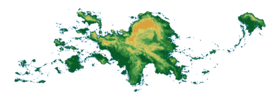
[[File:TopographyK.png|280px|thumbnail|right|Topographical and relief map of Kelenoa]] | |||
Kelenoa is an {{wp|island group|archipelago}} composed of about 5,295 islands with a total land area, including inland bodies of water, of 300,000 square kilometers (115,831 sq mi). The 36,289 kilometers (22,549 mi) of coastline makes it the country with the seventh {{wp|List of countries by length of coastline|longest coastline}} in the world. The {{wp|Exclusive economic zone}} of Kelenoa covers 2,263,816 km2 (874,064 sq mi). It is located between x° and x° E longitude and x° and x° N latitude and is bordered by the [[Jade Ocean]] to the east, the [[Banda Sea]] to the west, the [[Hanei Sea]] and the [[Songdangin Sea]] to the north, and the [[Seira Sea]] to the south. The peninsular on which [[Songdang]] is situated is located a few hundred kilometers northwest and [[Ajerrin]] is located directly to the south. The [[Mocuna Islands|Mocunas]] and [[Ainakaro]] are located to the west and [[Nyade]] is located to the far east of the islands. | Kelenoa is an {{wp|island group|archipelago}} composed of about 5,295 islands with a total land area, including inland bodies of water, of 300,000 square kilometers (115,831 sq mi). The 36,289 kilometers (22,549 mi) of coastline makes it the country with the seventh {{wp|List of countries by length of coastline|longest coastline}} in the world. The {{wp|Exclusive economic zone}} of Kelenoa covers 2,263,816 km2 (874,064 sq mi). It is located between x° and x° E longitude and x° and x° N latitude and is bordered by the [[Jade Ocean]] to the east, the [[Banda Sea]] to the west, the [[Hanei Sea]] and the [[Songdangin Sea]] to the north, and the [[Seira Sea]] to the south. The peninsular on which [[Songdang]] is situated is located a few hundred kilometers northwest and [[Ajerrin]] is located directly to the south. The [[Mocuna Islands|Mocunas]] and [[Ainakaro]] are located to the west and [[Nyade]] is located to the far east of the islands. | ||
Most of the mountainous islands are covered in {{wp|tropical rainforest}} and volcanic in origin. The highest mountain is Mount Waikapeni. It measures up to 2,954 meters (9,692 ft) above sea level and is located on the island of Komuele. The Galame Depth in the [[Kelenoʻa Trench]], which descends to a depth of 10,430 meters (34,220 ft), is the deepest point in the country and the {{wp|list of submarine topographical features|third deepest in the world}}. The trench is located in the Jade Ocean. The longest river is the Cameiea River in northern Komuele's highlands. Hapua Bay, upon the shore of which the capital city of Hapua lies, is connected to Lake Maikaʻi, the largest lake in | Most of the mountainous islands are covered in {{wp|tropical rainforest}} and volcanic in origin. The highest mountain is Mount Waikapeni. It measures up to 2,954 meters (9,692 ft) above sea level and is located on the island of Komuele. The Galame Depth in the [[Kelenoʻa Trench]], which descends to a depth of 10,430 meters (34,220 ft), is the deepest point in the country and the {{wp|list of submarine topographical features|third deepest in the world}}. The trench is located in the Jade Ocean. The longest river is the Cameiea River in northern Komuele's highlands. Hapua Bay, upon the shore of which the capital city of Hapua lies, is connected to Lake Maikaʻi, the largest lake in Kelenoa, by artifical canals. Despite its massive amount of islands and islets, only approximately 1,000 of its islands are populated, and fewer than one-half of these are larger than 2.5 square kilometers (1 sq mi). | ||
Situated on the western fringes of the Jade {{wp|Ring of Fire}}, Kelenoa experiences frequent seismic and volcanic activity. The Kalekai Plateau to the east in the Songdangin Sea is an undersea region active in {{wp|plate tectonics|tectonics}} {{wp|subduction}} processes. Around 20 {{wp|earthquake|earthquakes}} are registered daily, though most are too weak to be felt. The last major earthquake was the 1990 Vefeta earthquake. There are {{wp|List of active volcanoes|many active volcanoes}} such as the Waikapeni volcano and Mount Watengai. The eruption of Mount Watengai in June 1995 produced the second largest terrestrial eruption of the 20th century. Not all notable geographic features are so violent or destructive. A more serene legacy of the geological disturbances is the {{wp|Puerto Princesa Subterranean River|Ke Kamāliʻiwahine Kandarapa Subterranean River}}, the area represents a habitat for {{wp|Conservation biology|biodiversity conservation}}, the site also contains a full mountain-to-the-sea ecosystem and has some of the most important forests in Savai. Due to the {{wp|volcano|volcanic}} nature of the islands, mineral deposits are abundant. The country is estimated to have the second-largest titanium deposits after x and one of the largest aluminium deposits in the world. It is also rich in nickel, chromite, and zinc. Despite this, cultural customs, high population density, and environmental consciousness have resulted in these mineral resources remaining largely untapped. {{wp|Geothermal energy}} is a product of volcanic activity that Kelenoa has harnessed more successfully. Kelenoa is the world's second-biggest geothermal producer behind x, with 18% of the country's electricity needs being met by geothermal power. | Situated on the western fringes of the Jade {{wp|Ring of Fire}}, Kelenoa experiences frequent seismic and volcanic activity. The Kalekai Plateau to the east in the Songdangin Sea is an undersea region active in {{wp|plate tectonics|tectonics}} {{wp|subduction}} processes. Around 20 {{wp|earthquake|earthquakes}} are registered daily, though most are too weak to be felt. The last major earthquake was the 1990 Vefeta earthquake. There are {{wp|List of active volcanoes|many active volcanoes}} such as the Waikapeni volcano and Mount Watengai. The eruption of Mount Watengai in June 1995 produced the second largest terrestrial eruption of the 20th century. Not all notable geographic features are so violent or destructive. A more serene legacy of the geological disturbances is the {{wp|Puerto Princesa Subterranean River|Ke Kamāliʻiwahine Kandarapa Subterranean River}}, the area represents a habitat for {{wp|Conservation biology|biodiversity conservation}}, the site also contains a full mountain-to-the-sea ecosystem and has some of the most important forests in Savai. Due to the {{wp|volcano|volcanic}} nature of the islands, mineral deposits are abundant. The country is estimated to have the second-largest titanium deposits after x and one of the largest aluminium deposits in the world. It is also rich in nickel, chromite, and zinc. Despite this, cultural customs, high population density, and environmental consciousness have resulted in these mineral resources remaining largely untapped. {{wp|Geothermal energy}} is a product of volcanic activity that Kelenoa has harnessed more successfully. Kelenoa is the world's second-biggest geothermal producer behind x, with 18% of the country's electricity needs being met by geothermal power. | ||
| Line 350: | Line 355: | ||
== Politics == | == Politics == | ||
{{multiple image | |||
|align=right | |||
|image1= Mapeku.png | |||
|width1=124 | |||
|caption1= High Chief [[Kiala Mapeku]] | |||
|alt1= | |||
|width2=124 | |||
|caption2= Tribal Minister [[Hoku Kekoa]] | |||
|image2= Kekoa.png | |||
|alt2= | |||
}} | |||
Kelenoa has a democratic government in the form of a constitutional republic with a {{wp|presidential system}}. It is governed as a {{wp|federal state}} and {{wp|bicameralism|bicameral}}, {{wp|parliament|parliamentary}} [[Tribal republic|tribal republic]]. The High Chief functions as both {{wp|head of state}} and {{wp|head of government}} and is the {{wp|commander-in-chief}} of the armed forces. The high chief is elected by popular vote for a single six-year term, during which he or she appoints and presides over the {{wp|cabinet}}. The bicameral Tribal Assembly is composed of the Council of Chiefs, serving as the {{wp|upper house}}, with members elected to a six-year term, and the Council of Representatives, serving as the {{wp|lower house}}, with members elected to a three-year term. Senators are elected at large while the representatives are elected from both legislative districts and through sectoral representation. The judicial power is vested in the Supreme Court, composed of a Chief Justice as its presiding officer and fourteen {{wp|associate justice|associate justices}}, all of whom are appointed by the High Chief from nominations submitted by the Judicial Tribal Council. | |||
=== Foreign relations === | |||
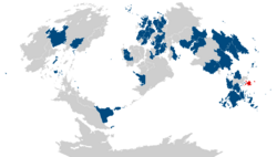
[[File:ForeignrelationsK.png|250px|thumb|right|Kelenoa (red) and nations with Kelenoan embassies and consulates (blue)]] | |||
Kelenoa's international relations are based on trade with other nations and the well-being of the 5 million overseas Kelenoans living outside the country. | |||
The country is an active participant in the Human Rights Council as well as in peacekeeping missions, particularly in [[Majula]]. In addition to membership in international organizations, Kelenoa is also a founding and active member of TRNE ([[The Treaty of Neighbors|Treaty of Neighbors]]), an organization designed to strengthen relations and promote economic and cultural growth among states in the Savai region. It has hosted several summits and is an active contributor to the direction and policies of the bloc. Kelenoa attaches great importance in its relations with Ajerrin, and has established significant cooperation with the country. It supported Midrasia during the [[Cold War (Aeia)]] and following wars and was a [[Major non-CDN ally|major non-CDN ally]]. Nanto, the biggest contributor of official development assistance to the country, is thought of as a friend. Although historical tensions between Kelenoa and Lhedwinic nations still exist on issues such as the plight of comfort women, much of the animosity inspired by memories of the Great War has faded. | |||
Relations with other nations are generally positive. Shared democratic values ease relations with Western and Asuran countries while similar economic concerns help in relations with other developing countries. Historical ties and cultural similarities also serve as a bridge in relations with Ardaima. Despite issues such as domestic abuse and war affecting overseas Kelenoan workers, relations with Middle Eastern countries are friendly as seen in the continuous employment of more than 0.5 million overseas Kelenoans living there. | |||
With communism no longer the threat it once was, once hostile relations in the 1950s between Kelenoa and the Vestric Commonwealth have improved greatly. Issues and concerns of expanding Vesperian influence, however, still encourage a degree of caution. Recent foreign policy has been mostly about economic relations with its Savaian and Yidao-Jade neighbors. | |||
=== Military === | |||
The Armed Forces of Kelenoa (AFK) are responsible for national security and consist of three branches: the Kelenoan Air Force, the Kelenoan Army, and the Kelenoan Navy (includes the Kelenoan Marine Corps). The Armed Forces of Kelenoa are a volunteer force. Civilian security is handled by the Kelenoan National Police under the Department of the Kelenoan Interior and Tribal Administration (DKITA). | |||
In the Autonomous Region in Irsadi Topkai, the largest separatist organization, the Topkaia National Liberation Front, is now engaging the government politically. Other more militant groups like the Topkai Irsadic Liberation Front, the communist New People's Army, and the Ala Seharya have previously kidnapped foreigners for ransom, particularly on the southern island of Topkai. Their presence decreased drastically due to successful security provided by the Kelenoan government. At 1.1 percent of GDP, Kelenoa spent less on its military forces than the regional average. As of 2014, the full military size was estimated to range around 120,000 including 20,000 further reserve troops. | |||
=== Administrative divisions === | |||
== Economy == | == Economy == | ||
The Kelenoan economy is the xth largest in the world, with an estimated 2018 {{wp|Gross Domestic Product|gross domestic product}} (nominal) of $ | |||
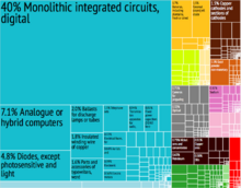
[[File:EconomyK.png|220px|thumb|right|A proportional representation of Kelenoa's exports, 2015]] | |||
The Kelenoan economy is the xth largest in the world, with an estimated 2018 {{wp|Gross Domestic Product|gross domestic product}} (nominal) of $322.9 billion. Primary exports include {{wp|semiconductors}} and electronic products, transport equipment, garments, {{wp|bauxite}} and {{wp|titanium}} products, {{wp|petroleum}} products, {{wp|coconut oil}}, and fruits. Major trading partners include Midrasia, Ardaima, tir Lhaeraidd, Songdang, the UVSS, Tyronova, Mascylla, Cuirpthe, Nanto, Ajerrin, and Indragiri. Its unit of {{wp|currency}} is the Kelenoan aphu (or AP). A {{wp|newly industrialized country}}, the Kelenoan economy has been transitioning from one based upon agriculture to an economy with more emphasis upon services and manufacturing. Of the country's total labor force of around 9.813 Million, the agricultural sector employs 30% of the labor force, and accounts for 14% of GDP. The industrial sector employs around 14% of the workforce and accounts for 30% of GDP. Meanwhile, the 47% of workers involved in the services sector are responsible for 56% of GDP. The {{wp|unemployment}} rate as of 14 December 2014, stands at 6.0%. Meanwhile, due to lower charges in basic necessities, the inflation rate eases to 3.7% in November. Gross international reserves as of October 2013 are $83.201 billion. The {{wp|Debt-to-GDP ratio}} continues to decline to 38.1% as of March 2014 from a record high of 78% in 2004. The country is a net importer but it is also a creditor nation. | |||
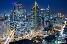
[[File:Hapua1.jpg|220px|thumb|right|Night skyline of the financial district of downtown Hapua]] | |||
After the Second Great War, Kelenoa was for a time regarded as the second wealthiest in Savai, next only to Nanto. In the 1960s its economic performance started being overtaken. The economy stagnated under the dictatorship of High Chief Haleakala as the regime spawned economic mismanagement and political volatility. The country suffered from slow economic growth and bouts of economic {{wp|recession}}. Only in the 1990s with a program of {{wp|economic liberalization}} did the economy begin to recover. | |||
The 1997 Savaian Financial Crisis affected the economy, resulting in a lingering decline of the value of the aphu and falls in the stock market. The extent it was affected initially was not as severe as that of some of its Savaian neighbors. This was largely due to the {{wp|fiscal conservatism}} of the government, partly as a result of decades of monitoring and fiscal supervision from the {{wp|International Monetary Fund}} (IMF), in comparison to the massive spending of its neighbors on the rapid acceleration of economic growth. There have been signs of progress since. In 2004, the economy experienced 6.4% GDP growth and 7.1% in 2007, its fastest pace of growth in three decades. Average annual GDP growth per capita for the period 1966–2007 still stands at 1.45% in comparison to an average of 5.96% for the East Savai and the Jade region as a whole. The daily income for 45% of the population of Kelenoa remains less than $2. | |||
The economy is heavily reliant upon {{wp|Remittance|remittances}} from overseas Kelenoans, which surpass {{wp|foreign direct investment}} as a source of foreign currency. {{wp|Remittance|Remittances}} peaked in 2010 at 10.4% of the national GDP, and were 8.6% in 2012 and in 2014, Kelenoa's total worth of foreign exchange remittances was US$28 billion. Regional development is uneven, with Pualeka – Metro Hapua in particular – gaining most of the new economic growth at the expense of the other regions, although the government has taken steps to distribute economic growth by promoting investment in other areas of the country. Despite constraints, service industries such as {{wp|tourism}} and {{wp|Outsourcing|business process outsourcing}} have been identified as areas with some of the best opportunities for growth for the country. | |||
INF includes the country in its list of the "Next Twenty" economies but Ajerrin and Seanesia have emerged as major economic competitors. The INF estimates that by the year 2050, it will be the 20th largest economy in the world. HSBC also projects the Kelenoan economy to become the 16th largest economy in the world, 5th largest economy in Savai and the largest economy in the East Savai region by 2050. Kelenoa is a member of the World Bank, the International Monetary Fund, the World Trade Organization (WTO), and the Savaian Development Bank which is headquartered in x. | |||
=== Transportation === | === Transportation === | ||
[[File:Expl.jpg|220px|thumb|right|The Pepe-Akekeme-Tarlay Expressway]] | |||
[[File:Hapuaairport.jpg|220px|thumb|right|Pehe Telmenak International Airport (PTIA) in Hapua]] | |||
Transportation infrastructure in Kelenoa is relatively underdeveloped. This is partly due to mountainous terrain and the scattered geography of the islands, but also the result of consistently low investment in infrastructure by successive governments. In 2013, about 3% of national GDP went towards infrastructure development—much lower than many of its neighbors. There are 216,387 kilometers (134,457 mi) of roads in Kelenoa, with only 61,093 kilometers (37,961 mi) of roads paved. | |||
Buses, {{wp|Jeepney|Jeepnāis}}, taxis, and motorized tricycles are commonly available in major cities and towns. In 2007, there were about 2.53 million registered motor vehicles with registrations increasing at an average annual rate of 4.55%. | |||
The Kelenoan Civil Aviation Department manages airports and implementation of policies regarding safe air travel with 85 public airports operational as of 2014. Pehe Telmenak International Airport (PTIA) serves the Greater Hapua Area together with Akekeme International Airport. Keleno'a Airlines, Savai's oldest commercial airline still operating under its original name, and Maonesair, the leading low-cost airline, are the major airlines serving most domestic and international destinations. | |||
Expressways and highways are mostly located on the island of Komuele including the Pan-Kelenoan Highway, connecting the islands of Komuele, Samar, Leitā, and Topukela, the North Komuele Expressway, South Komuele Expressway, and the Pepe–Akekeme–Tarlay Expressway. The Samar–Kristofa Link Expressway in Leitā will be the first expressway outside Komuele, to be finished by 2021. | |||
Rail transport in Kelenoa only plays a role in transporting passengers within Metro Hapua, the province of Lanuiti, and some parts of the Aopehu Region. {{wp|Freight transport}} was almost non-existent. As of 2017, the country had a {{wp|railway footprint}} of only 77 kilometers, which it had plans to expand to more than 320 kilometers by 2022. Metro Hapua is served by three rapid transit lines: Line 1, Line 2 and Line 3. The KNR South Commuter Line transports passengers between Metro Hapua and Lanuiti. Railway lines that are under-construction include the 4 km Line 2 East Extension Project (2020), the 22.8 km Line 7 (2020), the 25 km Line 9 (Metro Hapua Subway) (2025), and the 109 km KNR North-South Commuter Railway which is divided into several phases, with partial operations to begin in 2022. A multitude of other railway lines are planned. | |||
In the past, railways served major parts of Komuele, and railroad services were available on the islands of Samar and Lapai. Railways were also used for agricultural purposes, especially in {{wp|tobacco}} and {{wp|sugar cane}} production. A few transportation systems are under development: DOST-MIRDC and UP are implementing pre-feasibility studies on Automated Guideway Transit. | |||
As an archipelago, inter-island travel using watercraft is often necessary. The busiest seaports are Hapua, Pualeka, Lapai, Pheilehu, Ilolo, Henui, Ohanulu, and Tahite. 2GO Travel and Sulpicio Lines serve Hapua, with links to various cities and towns through passenger vessels. The 919-kilometer (571 mi) Strong Republic Nautical Highway (SRNH), an integrated set of highway segments and ferry routes covering 17 cities was established in 2003. The Honu River Ferry Service serves the major rivers in Metro Hapua, including the Honu River and Marikina River having numerous stops in Hapua, Makati, Kewele, Honu and Marikina. | |||
=== Science and technology === | === Science and technology === | ||
[[File:Ricel.jpg|160px|thumb|right|An IFRI researcher studying rubber DNA under ultraviolet light]] | |||
Kelenoa has pursued efforts to improve the field of science and technology. The Department of Kelenoan Science and Technology is the governing agency responsible for the development of coordination of science- and technology-related projects in Kelenoa. The National Scientist of Kelenoa award is given to individuals who have contributed to different fields of science in the country. | |||
Notable Kelenoan scientists include Maria Ohila, a food technologist famous for her formulated food products like {{wp|calamansi nip}}, {{wp|soyalac}} and the {{wp|banana ketchup}}, and Kai Peku, a physicist known for his method to analyze aateroid imagery with {{wp|spectroscopy}}. | |||
At least 51 World Intellectual Property Organization medals have been awarded to Kelenoan inventors. For example, inventor Magdalena Velelu's agricultural invention, the {{wp|turtle power tiller}}, won her the 1986 WIPO Inventor of the Year award and its use became widespread across Kelenoa, South Savai and Majula. In the field of medicine, notable figures include Ve Kemulo, a pediatrician whose pioneering work in pediatrics as an active medical practice spanned 8 decades, and Paulo Bora, a physician who was dubbed as "The Father of Nuclear Medicine in Kelenoa" for his contributions in the field of {{wp|nuclear medicine}}. | |||
Research organizations include the International Foodstuff Research Institute, an international independent research and training organization established in 1960 with headquarters in Hapua, focusing on the development of new food plant varieties and crop management techniques to help farmers in the country improve their lives. | |||
=== Communications === | === Communications === | ||
Kelenoa bought its first satellite in 1996. In 2016, Kelenoa's first {{wp|micro-satellite}}, Hivara-1, was launched aboard the Mascyllary [[MAOA|TS-3 spacecraft]]. | |||
Kelenoa has a sophisticated cellular phone industry and a high concentration of users. {{wp|Text messaging}} is a popular form of communication and, in 2007, the nation sent an average of one billion {{wp|SMS}} messages per day. Over four million mobile phone users also use their phones as virtual wallets, making it a leader among developing nations in providing financial transactions over cellular networks. The Kelephone Company commonly known as KPC is the leading {{wp|telecommunications}} provider. It is also one of the largest companies in the country. | |||
The National Telecommunications Commission is the agency responsible for the supervision, adjudication and control over all telecommunications services throughout the country. There are approximately 383 AM and 659 FM radio stations and 297 television and 873 cable television stations. On March 29, 1994, the country went live on the Internet via a 64 kbit/s connection from a router serviced by KPC to a {{wp|Sprint router}} in [[Ajerrin]]. Estimates for Internet penetration in Kelenoa vary widely ranging from a low of 2.5 million to a high of 10 million people. {{wp|Social media|Social networking}} and watching videos are among the most frequent Internet activities. The Kelenoan population is the world's sixth most popular internet user. | |||
=== Tourism === | === Tourism === | ||
The | [[File:Phip.jpg|220px|thumb|right|Limestone cliffs and island lagoons of Paleva]] | ||
The travel and tourism sector is a major contributor to the {{wp|economy}}, contributing 7.1% to the Kelenoan GDP in 2013 and providing 926,500 jobs or 4.2 percent of total employment. 2,433,428 international visitors arrived from January to June 2014 up by 2.22% in the same period in 2013. Mascylla, Midrasia, and Ardaima accounted for 58.78% while the remained of Asura accounted for 19.28% and Savai 10.64%. The Department of Tourism has responsibility for the management and promotion of the tourism sector. | |||
Kelenoa is also one of the favorite {{wp|retirement}} destinations for foreigners due to its warm climate all year round, beaches and low cost of living. | The country's rich biodiversity is one of the main tourist attractions with its beaches, mountains, rainforests, islands and diving spots among the most popular tourist destinations. As an archipelago consisting of about 5,200 islands, Kelenoa has numerous beaches, caves and other rock formations. Boracay has glaring white sand beaches and was named as the best island in the world by {{wp|Travel + Leisure}} in 2012. The {{wp|Banaue Rice Terraces}} in Meleā, the historic town of Vigape in Taikek, the {{wp|Chocolate Hills}} in Bohole, Akekeme's Paddle in Akekela and the Tubata's Reef in Vefeta are other highlights. Kelenoa is also one of the favorite {{wp|retirement}} destinations for foreigners due to its warm climate all year round, beaches and low cost of living. | ||
== Demographics == | == Demographics == | ||
[[File:PopulationdensityK.png|240px|thumb|right|Population density per province as of 2009 per square kilometer]] | |||
The population of Kelenoa was 37,374,011 in the official 2018 census. It increased from 1990 to 2008 by approximately 5 million, a 21% growth in that time frame. The first {{wp|official census}} in Kelenoa was carried out in 1890 and recorded a population of 2,567,685. | |||
The Kelenoan population will continue to increase throughout the 2010s and is projected to reach around | It is estimated that two-thirds of the population resides on the island of Komuele. The 3.21% population growth rate between 1995 and 2000 decreased to an estimated 1.95% for the 2005–2010 period, but remains a {{wp|contentious issue}}. The population's median age is 27.7 years with 60.9% aged from 15 to 64 years old. Life expectancy at birth is 72.4 years, 75.1 years for females and 73.9 years for males. Poverty incidence also significantly dropped to 15.6% in 2015 from 25.2% in 2012. Since the liberalization of Ajerri immigration laws in 1965, the number of people in Ajerrin having Kelenoan ancestry has grown substantially. In 2007 there were an estimated 2 million Kelenoans living overseas. The Kelenoan population will continue to increase throughout the 2010s and is projected to reach around 40 million by December 2022, based on projections made by the Department of People using the latest population census of 2018. | ||
=== Cities and urbanisation === | === Cities and urbanisation === | ||
Metro Pualeka is the most populous of the 3 defined metropolitan areas in Kelenoa and the 20th most populous in the world in 2018. Census data from 2015 showed it had a population of 3,577,253 comprising almost 13% of the national population. Including suburbs in the adjacent provinces of Greater Pualeka, the population is around 10,650,000. Hapua ranks as the second most populous city in the country at around 2.9 million people inhabiting it. Across the country, Kelenoa has a total urbanization rate of 51.2 percent. | |||
Metro Hapua's gross regional product was estimated as of 2009 to be A468.4 billion (at constant 1985 prices) and accounts for 33% of the nation's GDP. In 2011 Hapua ranked as the 28th wealthiest urban agglomeration in the world and the 4th in Savai. | |||
{{Largest cities | |||
| name = Largest cities of Kelenoa | |||
| country = Kelenoa | |||
| stat_ref = Kelenoan Department of the People | |||
| list_by_pop = | |||
| class = info | |||
| div_name = State | |||
| div_link = | |||
| city_1 = Pualeka | |||
| div_1 = Amaka | |||
| pop_1 = 3,577,253 | |||
| img_1 = | |||
| city_2 = Hapua | |||
| div_2 = Hapua | |||
| pop_2 = 2,981,022 | |||
| img_2 = | |||
| city_3 = Nagotui | |||
| div_3 = Hapua | |||
| pop_3 = 2,706,486 | |||
| img_3 = | |||
| city_4 = Tapeka | |||
| div_4 = Halue | |||
| pop_4 = 2,056,997 | |||
| img_4 = | |||
| city_5 = Kahitu | |||
| div_5= Hapua | |||
| pop_5 = 1,857,476 | |||
| img_5 = | |||
| city_6 = Ealohu | |||
| div_6= Fafita | |||
| pop_6 = 1,839,006 | |||
| img_6= | |||
| city_7 = Ahao | |||
| div_7= Amaka | |||
| pop_7 = 1,460,865 | |||
| img_7= | |||
| city_8 = Holone | |||
| div_8 = Vefeta | |||
| pop_8 = 947,248 | |||
| img_8= | |||
| city_9 = Tikamewa | |||
| div_9 = Tapku | |||
| pop_9 = 935,384 | |||
| img_9= | |||
| city_10 = Moloi | |||
| div_10 = Tapku | |||
| pop_10 = 902,669 | |||
| img_10= | |||
| city_11 = Kamahele | |||
| div_11 = Pokaipu | |||
| pop_11 = 792,111 | |||
| img_11= | |||
| city_12 = Memelewui | |||
| div_12 = Hapua | |||
| pop_12 = 724,503 | |||
| city_13 = Wolo | |||
| div_13 = Halue | |||
| pop_13 = 664,748 | |||
| city_14 = Vehana | |||
| div_14 = Aotena | |||
| pop_14 = 625,628 | |||
| city_15 = Rothnau | |||
| div_15 = Eystrun | |||
| pop_15 = 121,893 | |||
| city_16 = Krielow | |||
| div_16 = Kreschitien | |||
| pop_16 = 111,354 | |||
| city_17 = Seebronn | |||
| div_17 = Benschen | |||
| pop_17 = 110,335 | |||
| city_18 = Weidenau | |||
| div_18 = Doratheen | |||
| pop_18 = 105,014 | |||
| city_19 = Birchau | |||
| div_19 = Doratheen | |||
| pop_19 = 101,697 | |||
| city_20 = Ihleburg | |||
| div_20 = Falwig | |||
| pop_20 = 100,825 | |||
}} | |||
=== Ethnic groups === | === Ethnic groups === | ||
| Line 386: | Line 574: | ||
=== Languages === | === Languages === | ||
Data statistics list 126 individual languages in Kelenoa, 182 of which are living languages, while 4 no longer have any known speakers. Most native languages are part of the Kelenoan branch of the Oceanic Seiranesian languages, which is itself a branch of the Savaonesian language family. The only language not classified as an Savaonesian language are the various Lhedwinic-based creole varieties collectively called Malihini. | |||
Kawanakan is the official language of the country. Kawanakan is a standardized version of its ancient predecesors. Kawanakan is used in government, education, print, broadcast media, and business. Due to Kelenoa's history of complex interactions with many cultures all across the span of the whole world, as well as local influences, the Kelenoan language has the richest repertoire of incorporated foreign vocabulary used in everyday speech among the world's many dialects because Kelenoan has been enriched by languages as diverse as Newreyan, Fiorentine, Chalcian, Veleazan, Mashahith, Gheiravic, Arday, Midrasian, Lhedwinic, and Alemannic. Furthermore, in most towns, the local indigenous language are also spoken. The Kelenoan constitution provides for the promotion of Kawanakan. Lhedwinic, which was widely used as a lingua franca in the late nineteenth century, has since declined greatly in use, with it being a language of very little civil diaspora. A theory that the indigenous scripts of Ajerrin and Kelenoa are descended from an early form of the Chen script was presented at the 2010 meeting of the Toklai Linguistics Society. | |||
Languages not indigenous to the islands are also taught in select schools. Islamic schools in Komuele teach Modern Standard Gheiravic in their curriculum. Midrasian, Alemannic, Ashiharan, Songdangin, Giri, and other are taught with the help of foreign linguistic institutions. | |||
=== Religion === | === Religion === | ||
| Line 399: | Line 593: | ||
== Education == | == Education == | ||
[[File: | [[File:Unive.jpg|210px|thumbnail|right|The University of Kelenoa, the flagship constituent university located in the former Lhedwinic colonial courthouse]] | ||
Kelenoa has a simple {{wp|Literacy|literacy rate}} of 95.6%, with 95.1% for males and 96.1% for females. Kelenoa had a {{wp|Functional illiteracy|functional literacy}} rate of 86.45%, with 84.2% for males and 88.7% for females in 2008. Spending on education accounted for 16.11% in the national budget proposed for 2015. The Department of Kelenoan Education (DKE) lists 2,180 higher education institutions, 607 of which are public and 1,573 private. Classes start in June and end in March. The majority of colleges and universities follow a semester calendar from June to October and November to March. There are a number of foreign schools with study programs. A 6-year elementary, a 4-year junior high school and a 2-year senior high school education is mandatory of the K–12 educational program in 2013. | Kelenoa has a simple {{wp|Literacy|literacy rate}} of 95.6%, with 95.1% for males and 96.1% for females. Kelenoa had a {{wp|Functional illiteracy|functional literacy}} rate of 86.45%, with 84.2% for males and 88.7% for females in 2008. Spending on education accounted for 16.11% in the national budget proposed for 2015. The Department of Kelenoan Education (DKE) lists 2,180 higher education institutions, 607 of which are public and 1,573 private. Classes start in June and end in March. The majority of colleges and universities follow a semester calendar from June to October and November to March. There are a number of foreign schools with study programs. A 6-year elementary, a 4-year junior high school and a 2-year senior high school education is mandatory of the K–12 educational program in 2013. | ||
| Line 409: | Line 603: | ||
''Main article: Culture of Kelenoa'' | ''Main article: Culture of Kelenoa'' | ||
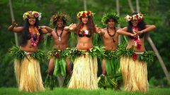
[[File: | [[File:HulaII.jpg|240px|thumbnail|right|Dancers of a ''ʻO ke kauwela'' occuring through early summer]] | ||
The aboriginal culture of Kelenoa, called the Maheane culture, is Seiranesian. Kelenoa represents the northernmost extension of the vast [[Seiranesian triangle]] of the west and central Jade Ocean. Early Maheane adapted the tropically based east Seiranesian culture in line with the challenges associated with a larger and more diverse environment, eventually developing their own distinctive culture. Social organisation was largely communal with families ({{wp|Whānau|''hana''}}), subtribes ({{wp|Hapū|''pūʻulu''}}) and tribes ({{wp|Iwi|''ohana''}}) ruled by a chief (''Aliʻi''), whose position was [[Tribal republic|subject to the community's approval]]. The | The aboriginal culture of Kelenoa, called the Maheane culture, is Seiranesian. Kelenoa represents the northernmost extension of the vast [[Seiranesian triangle]] of the west and central Jade Ocean. Early Maheane adapted the tropically based east Seiranesian culture in line with the challenges associated with a larger and more diverse environment, eventually developing their own distinctive culture. Social organisation was largely communal with families ({{wp|Whānau|''hana''}}), subtribes ({{wp|Hapū|''pūʻulu''}}) and tribes ({{wp|Iwi|''ohana''}}) ruled by a chief (''Aliʻi''), whose position was [[Tribal republic|subject to the community's approval]]. The Ardaiman and Lhedwinic immigrants brought aspects of their own culture to Kelenoa and also influenced Maheane culture, particularly with the introduction of Western literature, philosophy and education. However, Maheane still regard their allegiance to tribal groups as a vital part of {{wp|Cultural identity|their identity}}, and Maheane kinship roles resemble {{wp|Hawaiian kinship|those of other Seiranesian peoples}}. More recently [[Ajerrin|Ajerri]], [[Songdang|Songdangin]], [[Yidao|Yidaoan]] and other [[Asura|Asuran]] cultures have exerted influence on Kelenoa. Non-Maheane Polynesian cultures are also apparent, with large populations from other Seiranesian nations and areas found in the archipelago. | ||
While traditional Kelenoan culture remains as vestiges in modern Kelenoan society, there are re-enactments of the ceremonies and traditions throughout the islands. Some of these cultural influences, including the popularity (in greatly modified form) of lūʻau and hula, are strong enough to significantly affect wider [[Savai]]. Kelenoa's national symbols are influenced by natural, historical, and Maheane sources. The {{wp|Cyathea dealbata|silver fern}}, {{wp|stingray}}, {{wp|turtle|sea turtle}}, {{wp|katamaran}}, {{wp|paddle}}, and other are emblems appearing on many insignia and general uniforms. Certain items of popular culture thought to be unique to Kelenoa are called "Kelenoana". | While traditional Kelenoan culture remains as vestiges in modern Kelenoan society, there are re-enactments of the ceremonies and traditions throughout the islands. Some of these cultural influences, including the popularity (in greatly modified form) of lūʻau and hula, are strong enough to significantly affect wider [[Savai]]. Kelenoa's national symbols are influenced by natural, historical, and Maheane sources. The {{wp|Cyathea dealbata|silver fern}}, {{wp|stingray}}, {{wp|turtle|sea turtle}}, {{wp|katamaran}}, {{wp|paddle}}, and other are emblems appearing on many insignia and general uniforms. Certain items of popular culture thought to be unique to Kelenoa are called "Kelenoana". | ||
| Line 419: | Line 612: | ||
=== Architecture === | === Architecture === | ||
[[File:Maginam.jpg|220px|thumbnail|right|Traditional Seiranesian ropework on a roof support]] | |||
The architecture of Kelenoa is characterised by openness, with the design mirroring the culture and life of the Maheane people who inhabit the Kelenoan islands. Architectural concepts are incorporated into Kelenoan proverbs, {{wp|oratory}} and {{wp|metaphor|metaphors}}, as well as linking to other art forms in Kelenoa, such as boat building and {{wp|tatooing}}. The spaces outside and inside of traditional Maheane architecture are part of cultural form, ceremony and ritual. ''Noho'' is the Kawanakan word for all types of houses, from small to large. In general, traditional Kelenoan architecture is characterized by an oval or circular shape, with wooden posts holding up a domed roof. There are no walls. The base of the architecture is a skeleton frame. Before Asuran arrival and the availability of Western materials, a Kelenoan noho did not use any metal in its construction. | The architecture of Kelenoa is characterised by openness, with the design mirroring the culture and life of the Maheane people who inhabit the Kelenoan islands. Architectural concepts are incorporated into Kelenoan proverbs, {{wp|oratory}} and {{wp|metaphor|metaphors}}, as well as linking to other art forms in Kelenoa, such as boat building and {{wp|tatooing}}. The spaces outside and inside of traditional Maheane architecture are part of cultural form, ceremony and ritual. ''Noho'' is the Kawanakan word for all types of houses, from small to large. In general, traditional Kelenoan architecture is characterized by an oval or circular shape, with wooden posts holding up a domed roof. There are no walls. The base of the architecture is a skeleton frame. Before Asuran arrival and the availability of Western materials, a Kelenoan noho did not use any metal in its construction. | ||
| Line 429: | Line 624: | ||
[[File:HulaDanceress.jpg|170px|thumbnail|right|{{wp|Hula}} dances play a key role in Kelenoan and Seiranesian music (painting, 1932)]] | [[File:HulaDanceress.jpg|170px|thumbnail|right|{{wp|Hula}} dances play a key role in Kelenoan and Seiranesian music (painting, 1932)]] | ||
First Asuran explorers reported that the Maheane sang a song in "semitones" and others reported that the Maheane had no {{wp|vocal music}} at all, or sang {{wp|discordantly}}. In fact the ancient chants, or ''oli'', to which they were referring are {{wp|microtonal}} and repeat a single melodic line, generally centred on one note, falling away at the end of the last line. It was a bad omen for a song to be interrupted, so singers would perform in subgroups to allow each to breathe without interrupting the flow of the chant. Mervyn McLean, in "Traditional Songs of the Maheane", first notated the microtonality in a significant number of ''oli''. The work of ''Mele o nā mokupuni'' is an important collection of traditional song lyrics. | First Asuran explorers reported that the Maheane sang a song in "semitones" and others reported that the Maheane had no {{wp|vocal music}} at all, or sang {{wp|discordantly}}. In fact the ancient chants, or ''oli'', to which they were referring are {{wp|microtonal}} and repeat a single melodic line, generally centred on one note, falling away at the end of the last line. It was a bad omen for a song to be interrupted, so singers would perform in subgroups to allow each to breathe without interrupting the flow of the chant. Mervyn McLean, in "Traditional Songs of the Maheane", first notated the microtonality in a significant number of ''oli''. The work of ''Mele o nā mokupuni'' is an important collection of traditional song lyrics. | ||
| Line 436: | Line 630: | ||
=== Visual art === | === Visual art === | ||
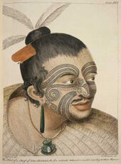
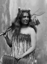
[[File:Maorii.jpg|160px|thumbnail|right|A Maheane chief wearing typical {{wp|Oceanic art|''ka peʻe kanaka''}} tattoos, a white wooden carving, and {{wp|Oceanic art|''ke kapa pale''}} clothes]] | |||
Both men and women can be tattooed (''ka tato''). A man's tattoo is called the ''ka peʻe kanaka'' while a woman's tattoo is called a ''ka peʻa wahine''. {{wp|Women}} play an important part in contributing with their skills in items of important cultural value including {{wp|'ie toga|''pā''}}, finely woven mats used in ceremony and gift exchanges. In terms of material goods, during ritual exchange, women give fine mats ''pā'' and decorated bark cloth ''ke kapa pale'' while men give woodworking items and red feathers. {{wp|Bark cloth}}, called {{wp|tapa cloth|''ke kapa pale''}} in Kelenoa (similar to other Seiranesian equivalents), both of which is made from beaten {{wp|Morus|mulberry bark}}. Patterns or pictures are painted on with a natural brown dye taken from a tree source. These pictures typically depict abstract and realistic depictions of plant life, shells, {{wp|fish}}, {{wp|turtles}}, and {{wp|hibiscus}} flowers. The siapo may be used for clothing, for wrapping objects and even simply for decorative reasons. {{wp|Ornament|Ornaments}}, {{wp|jewellery}} and hair accessories are made from naturally occurring materials such as {{wp|seashells|sea shells}}, {{wp|coconut tree|coconut}} and {{wp|coir}}. Traditional Kelenoan medicine is often practiced as a first-line before hospital medicine. This is a type of alternative medicine using {{wp|leaf|plant leaves}} to massage the affected area. | Both men and women can be tattooed (''ka tato''). A man's tattoo is called the ''ka peʻe kanaka'' while a woman's tattoo is called a ''ka peʻa wahine''. {{wp|Women}} play an important part in contributing with their skills in items of important cultural value including {{wp|'ie toga|''pā''}}, finely woven mats used in ceremony and gift exchanges. In terms of material goods, during ritual exchange, women give fine mats ''pā'' and decorated bark cloth ''ke kapa pale'' while men give woodworking items and red feathers. {{wp|Bark cloth}}, called {{wp|tapa cloth|''ke kapa pale''}} in Kelenoa (similar to other Seiranesian equivalents), both of which is made from beaten {{wp|Morus|mulberry bark}}. Patterns or pictures are painted on with a natural brown dye taken from a tree source. These pictures typically depict abstract and realistic depictions of plant life, shells, {{wp|fish}}, {{wp|turtles}}, and {{wp|hibiscus}} flowers. The siapo may be used for clothing, for wrapping objects and even simply for decorative reasons. {{wp|Ornament|Ornaments}}, {{wp|jewellery}} and hair accessories are made from naturally occurring materials such as {{wp|seashells|sea shells}}, {{wp|coconut tree|coconut}} and {{wp|coir}}. Traditional Kelenoan medicine is often practiced as a first-line before hospital medicine. This is a type of alternative medicine using {{wp|leaf|plant leaves}} to massage the affected area. | ||
| Line 456: | Line 652: | ||
[[Category:Kelenoa]] | [[Category:Kelenoa]] | ||
Latest revision as of 13:24, 22 March 2020
This article is incomplete because it is pending further input from participants, or it is a work-in-progress by one author. Please comment on this article's talk page to share your input, comments and questions. Note: To contribute to this article, you may need to seek help from the author(s) of this page. |
Tribes of Kelenoa Nāʻohana ʻo Kelenoʻa (Kawanakan) | |
|---|---|
| Motto: "Hoʻohuiʻia me nā kaula a me nā pua" "United by thaws and flowers" | |
| Anthem: ʻO ka mele a kā mākou poʻe "Our People's Song" | |
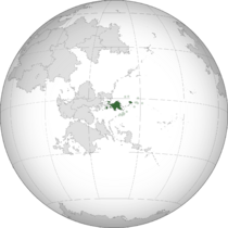 Location of Kelenoa, including outlying islands, atolls, and Laina (shown green) | |
| Capital | Hapua |
| Largest city | Pualeka |
| Official languages | Kawanakan |
| Recognised regional languages | Songdangin Tagalog Bisaya |
| Ethnic groups | 72.3% Maheane 21.6% Songdangin 1.4% Tagalog 1.3% Bisaya 2.9% other |
| Religion | Maheane religion |
| Demonym(s) | Kelenoan |
| Government | Federal parliamentary tribal republic |
• High Chief | Kiala Mapeku |
• Tribal Minister | Hoku Kekoa |
| Legislature | Tribal Assembly |
| Council of Chiefs | |
| Council of Representatives | |
| Establishment | |
• United state declared | c. 9th century |
• Pahlu Constitution / First confederacy | 22 March, 1672 |
• Annexation by Lhedwin | 5 August, 1880 |
• Independence and sovereignity declared | 14 November, 1897 |
• Lotric Conference (1900) / Lhedwinic secession | 4 January, 1900 |
• Veha Constitution / Second confederacy | 19 September 1904 |
| Area | |
• Total | 392,054 km2 (151,373 sq mi) |
• Water (%) | 1.5% |
| Population | |
• 2019 estimate | 37,410,000 |
• 2018 census | 37,374,011 |
| GDP (nominal) | 2018 estimate |
• Total | $322.9 billion (xnd) |
• Per capita | $13,551 (xth) |
| HDI (2017) | 0.703 high |
| Currency | Aphu (AP) |
| Date format | MM/DD/YYYY |
| Driving side | right |
| Calling code | +26 |
| Internet TLD | .ke |
Kelenoa (Kawanakan: Kelenoʻa [keːˈleːno:ah]), officially the Tribes of Kelenoa (Kawanakan: Nāʻohana ʻo Kelenoʻa [nāːˈohanaːo:keːˈleːno:ah]), is an archipelagic Oceanian country in eastern Savai. It comprises the main island of Komuele and its offshore islands, consisting of about 5,295 islands situated in Maonesia, an insular region of the western Jade Ocean. The archipelagio makes up the eastern tip of the Savaian continental shelf. Kelenoa includes Laina as a dependent territory; the small archipelago continues as the Welile Islands further south. The capital city of Kelenoa is Hapua, while Pualeka is the most populous city, both situated on Komuele. Surrounded in essence by the x to the north, the x to the west, the Jade Ocean to the east and the x to the south, Kelenoa has no land borders but only shares maritime borders with most primarly x to the north, New Timeria and Kealakekua to the south-west and west respectively, and Ajerrin to the south.
Kelenoa's location on the Jade Ring of Fire and close approximity to the equator makes Kelenoa prone to earthquakes and typhoones, but also endows it with abundant natural resources and some of the world's greatest biodiversity. Kelenoa has an area of around 392,000 km² (145,000 sq mi), and, as of 2018, had a population of at least 49 million people. As of January 2018, it is the fourth-most populated country in Savai and the xth most populated country in the world. Multiple ethnicities and cultures are found throughout the islands. In prehistoric times, Negrito were some of the archipelago's earliest inhabitants. They were followed by successive waves of Savaonesian peoples. Later, waves of Seiranesians arrived, adding to the archipelago's diverse ethnic population. Exchanges with Songdangin and Seanesian nations occured, however the interactions and relations with the Kawanakan remained the most crucial and impactful. Then, various competing maritime states were established under the rule of chiefs and petty kings.
A collection of independent states and chiefdoms in the 9th century and later a confederacy in the 1670s emerged, gaining wealth and political importance with its exported goods and strategically important location. The arrival of Evandro Scire, an Ardaiman explorer leading a fleet for Giozzara, in Vehale in 1725 marked the beginning of Asuran colonization, however the later colonisation process was very lingering, not making major land gains until as late as the 1820s. In 1730, Lhedwinic explorer Kristofer Bruntde arrived in Kelenoa, and later Lhedwin gained full control of the archipelago, slowly superseding Ardaima's position. Kelenoa as a whole became part of the Lhedwinic colonial empire for only 20 years. This resulted in Asuran religions and languages failing to achieve significant influence. During this time, Hapua became a western hub of the trans-Jade trade connecting Yidao and Savai with the Columbian using Hapua galleons. As the 19th century gave way to the 20th, during the height of the First Great War, the Kelenoan Revolution quickly followed, which then spawned the short-lived Kelenoa Confederacy, followed by the bloody East Maonesian War against Lhedwin. The war, as well as the ensuing cholera epidemic, resulted in the deaths of thousands of combatants as well as tens of thousands of civilians. However, the war was won on side of the Kelenoan, gaining independence in the peace negotiations following the war in Lotric; the country was declared on January 4, 1900. Ardaima and Midrasia retained protection of the islands during the Interwar period, while Kelenoa industrialised and grew more stable. Since, it managed to surpass the turbulent times of the Second Great War and Cold War mostly neutral and stable. It cooperated on side of the Western Bloc and later the CDN during global political and economical affairs of the latter 20th century. Just recently did Kelenoa begin to thrive economically, making it one of the fastest growing economies in the world.
Kelenoa is considered to be a political middle power and enjoys suffisticated economic growth and development. The country is considered to be an emerging market and a newly industrialised country in the later stage, which has an economy transitioning from being based on self-sufficiency to one based more on export and foreign trade. It features a high standard of living, a large cultural and biological diversity, and a stable democratic system, being one of the least corrupt and most politically free in the world.
Etymology
The country of Kelenoa derives its name from the name of the islands on which the capital, Hapua, is located, Kelenoʻa. A common Kelenoan explanation of the name of Kelenoʻa is that it was named for Kelenoʻaila, a legendary figure from Kelenoan myth. He is said to have discovered the islands when they were first settled. The Kawanakan or Kelenoan language word Kelenoʻa is very similar to Proto-Seiranesian *Helenoki, with the reconstructed meaning "homeland". Cognates of Kelenoʻa are found in other Seiranesian and Maonesian languages. According to linguists Pukui and Elbert, "[e]lsewhere in Seiranesia, Kelenoʻa or a cognate is the name of the underworld or of the ancestral home, but in Kelenoa, the name has no meaning".
Spelling of state name
A somewhat divisive political issue arose in 1978 when the Constitution of the Maonesian Tribes added Tribes of Kelenoa as the implemented name. The title of the constitution is The Constitution of the Tribes of Kelenoa. Article XV, Section 1 of the Constitution uses The Tribes of Kelenoa. Diacritics were not used because the document, drafted in 1904, predates the use of the ʻokina (ʻ) and the kahakō in modern Kelenoan orthography. The exact spelling of the state's name in the Kelenoan language is Kelenoʻa. In the peace treaties signed during the Lotric Conference in 1900, the governments recognized Kelenoa as the official state name. Official government publications, department and office titles use the traditional spelling with no symbols for glottal stops or vowel length. In contrast, the National and Tribal Parks Services, the University of Keleno'a, the government itself, and some private enterprises implement these symbols.
History
Prehistory
Discoveries in 2018 of stone tools and fossils of butchered animal remains in Aveu, southern Komuele has pushed back evidence of early hominins in the archipelago to as early as 85,000 years. However, the metatarsal of the Calao Man, reliably dated by uranium-series dating to 67,000 years ago remains the oldest human remnant found in the archipelago to date. This distinction previously belonged to the Hepke Man, carbon-dated to around 26,500 years ago. Negritos were also among the archipelago's earliest inhabitants, but their first settlement in Kelenoa has not been reliably dated. There are several opposing theories regarding the origins of ancient Kelenoans. Scientists theorize that the ancestors of the Kelenoans evolved locally. Wilhelm Solheim's Island Origin Theory postulates that the peopling of the archipelago transpired via trade networks originating in the Savai area around 48,000 to 5000 BC rather than by wide-scale migration. The Savaonesian Expansion Theory explains that Savao-Seiranesians coming from Qyred began migrating to Kelenoa around 4000 BC, displacing earlier arrivals.
The modern Kelenoan population originated from the arrival of Seiranesians from Western Seiranesia. Genetic and archaeological evidence suggests that humans emigrated from Ajerrin to Maonesia and then travelled east through to the archipelago; after a pause of 70 to 265 years, a new wave of exploration led to the discovery and settlement of Komuele.
The most current reliable evidence strongly indicates that initial settlement of Kelenoa occurred 1000 – 1150 CE. Previous dating of some Kiore (Seiranesian rat) bones at 50 – 150 CE has now been shown to have been unreliable; new samples of bone (and now also of unequivocally rat-gnawed woody seed cases) match the 1280 CE date of the earliest archaeological sites and the beginning of sustained, anthropogenic deforestation. The descendants of these settlers became known as the Maheane, forming a distinct culture of their own. The latter settlement of the Vefeta islands in the east of Kelenoa about 1500 CE produced the Mahealele; linguistic evidence indicates that the Mahealele were mainland Maheane who ventured eastward.
The original settlers quickly exploited the abundant large game in Kelenoa. As moa and other large game became scarce or extinct, Maheane culture underwent major change, with regional differences. In areas where it was possible to grow plants and fungi, horticulture became more important. This was not possible in the highlands of Komuele, but wild plants such as fernroot were often available and cabbage trees were harvested and cultivated for food. Warfare also increased in importance, reflecting increased competition for land and other resources. In this period, fortified settlements (known as pā) became more common, although there is debate about the actual frequency of warfare. As elsewhere in the Jade, cannibalism was part of warfare. By 1000 BC, the inhabitants of the archipelago had developed into four kinds of social groups: hunter-gatherer tribes, warrior societies, highland plutocracies, and port principalities.
Classical and precolonial epoch (700–1725)
Main development
The demarcation from Kelenoan prehistory to its classical period in the middle of what anthropologists refer to as Kelenoa's "Emergent Phase" (1st–15th centuries CE), which was characterized by newly emerging socio-cultural patterns, the initial development of large coastal settlements, greater social stratification and specialization, and the beginnings of local and international trade. By the 1300s, a number of the large coastal settlements had become progressive trading centers, and became the focal point of societal changes, ushering complex lifeways which characterized what historians called the "Barangic Phase" of early Kelenoan history, beginning from the 14th century through the arrival of Asuran colonizers and the beginning of Kelenoa's colonial period. The discovery of iron at around the 1st century CE created significant social and economic changes which allowed settlements to grow larger and develop new social patterns, characterized by social stratification and specialization. Some of these polities, particularly the coastal settlements at or near the mouths of large rivers, eventually developed substantial trade contacts with the early trading powers of Savai and southeastern Yidao, most importantly the Songdangin and pre-Chenoan Ajerri kingdoms, the various dynasties of Qyred, and later, Seanesia. They also traded with Indragirian and Timerian kingdoms, and other Savaonesian islands.
The later centuries saw the arrival and tried spreading of Irsad in the Kelenoan archipelago, however it lacked popularity for it to become significant, both religious, demographically, and politically. Other religions such as Taido and Cotrism also had little to no effect on the states and peoples, with the areas that were converted being isolated in the north of the islands. However, most notably Irsadic armies conducted slave-raids against the Maheane, alienating relations between both factions. In a matter of interregional politics, most states initially banned all foreign religions. Only the Kawanakan religions across the Seira Sea had significant influence on Kelenoa's religions, with adaptations of most stories, legends, and characters. Politics also changed, when many chiefs grew more reliable on one another, due to resource supply or trade relations. Agreements (so called nāʻaelike) and other contracts were signed, a for that time major leap in Kelenoan diplomacy. Relations improved greatly over the course of the next two centuries, finalizing with a confederacy (kālepa) founded in the 1670s. As a simple union made out of the representative chiefs of the member tribes, it served as Kelenoa's first unitary state. Though it showed ineffectiveness in actually governing the archiepalago due to its sparse population, the Maheane identity was greatly strengthened in seeing the tribes as united and connected by relation. After fivety years of its existence, the nation was dissolved following calming foreign affairs. However, since Ardaima began colonizing Songdang in the latter 1600 to early 1700s, the Kelenoan states had begun to increase their fleet sizes and further isolation.
Cultural and social development
The exact scope and mechanisms of Kawanakan cultural influences on early Kelenoan polities are still the subject of some debate among East Savaian historiographers, but the current scholarly consensus is that there were probably the most extensive or atleast important trade relations between the Ajerri states and Kelenoa, and Kawanakan cultural traits, such as linguistic terms, cultural beliefs and customs, and religious practices, filtered in during the 10th through the early 14th centuries, through early Kelenoan polities' relations with the Ajerri chiefdoms. The Kelenoan people, the Maheane, and the archipelago are thus one of the peoples and countries which are considered to be the "Seiranesian triangle".
The early polities of the Kelenoan archipelago were typically characterized by a three-tier social structure. Although different cultures had different terms to describe them, this three-tier structure invariably consisted of an apex nobility class, a class of "freemen", and a class of dependent debtor-bondsmen called "lalo" or "ʻuʻuku". Among the members of the nobility class were leaders who held the political office of "Aliʻi", which was responsible for leading autonomous social groups. Leadership was based on a system of chieftainship, which was often but not always hereditary, although chiefs (male or female) needed to demonstrate leadership abilities to avoid being superseded by more dynamic individuals. The most important units of pre-Asuran Maheane society were the hana or extended family, and the pūʻulu or group of hana. After these came the ohana or tribe, consisting of groups of pūʻulu. Related pūʻulu would often trade goods and co-operate on major projects; whenever these tribes banded together, either to form a larger settlement or a geographically looser alliance group, the more senior or respected among them would be recognized as a "great chief", variedly called a "ke aliʻi nui" (paramount chief) or "ke aliʻi hanohano" (high chief). However conflict between pūʻulu was also relatively common. Traditional Maheane society preserved history orally through narratives, songs, and chants; skilled experts could recite the tribal genealogies (pahaka) back for hundreds of years. Arts included kākā'ōlelo (oratory), song composition in multiple genres, dance forms including hula, as well as weaving, highly developed wood carving, and honu (tattoo).
Komuele has no native land mammals (apart from some rare bats) so birds, fish and sea mammals were important sources of protein. Maheane cultivated food plants which they had brought with them from Seiranesia, including sweet potatoes (called kūmara), taro, gourds, and yams. They also cultivated the cabbage tree, a plant endemic to Komuele, and exploited wild foods such as fern root, which provided a starchy paste.
Colonial era
Ardaiman rule
In 1725, Ardaiman explorer Evandro Scire's expedition arrived in Kelenoa, claimed the islands for Ardaima and was then killed at the Battle of Maikik. Colonization began with the landing of his expeditionary fleet in Vehale. After relocating to Peheva island and consolidating an alliance of Maheane allies, Ardaima soldiers and Arabekhan recruits, led by conquistators such as Fabriano Scirozi who was inspired by his love for the beautiful princess of Eve-besieged Tonha, Kandarapa, the Ardaima-Songdangin coalition then invaded the Kelenoan archpelago, liberated and incorporated Tondo. Under Ardaiman rule, they established northern Kelenoa as the colony of the Ardaiman South Songdies (1740). They also defeated the chiefs in Vefeta. To counteract the colonisation of Kelenoa, the Maheane then conducted the Helekla War which was aimed against Ardaima and Principality of Songdang and war was also waged against the chiefdoms of Waiteta and Hiloe (for the enslavement of neighbouring tribes). The Ardaiman considered their war with the Maheane one of national pride and colonial expansion. However, the war was prolonged and moved very little, continueing for nearly a century, with the Ardaiman only able to make other minor victories. Diseases and famine weakened both sides, with many areas entirely depopulated. After a decade of fighting, Ardaima was able to hold only a number of sea ports and land strips along the North Komuelean coast. After that, Ardaima aspired to maintains the colonies it already had, making its role minor in Maonesian politics.
Lhedwinic rule
After the war in the 1870s, and Ardaima distracted with attacking tribes along their colonies (and other colonial powers not in keen interest yet), Lhedwin began paying attention to the archipelago. Since it was enourmously weakened following the war with a low population and broken food supply, Lhedwinic colonisers had no difficulty annexing the archipelago. Blocking Ardaima and rushing through the islands, they were able to bring Kelenoa under colonial control, despite bloody fightings and constant revolts. By the early 1880s, Kelenoa belonged to Lhedwin.
Lhedwinic rule eventually contributed significantly to bringing political unity to the fragmented states of the archipelago. During its time as a colony, Kelenoa was directly administered from its capital. The Hapua galleons, one of the largest wooden ships ever built, were constructed in Kelenoa's habours. The Hapua galleons were accompanied with a large naval escort as it traveled to and from Hapua, across the Jade Ocean, and Costapunente. The galleons sailed once or twice a year, between the 1880s and 1890s. The Hapua galleons brought with them goods, settlers and military reinforcements destined for Kelenoa, from Rennekka and Yidao. The reverse voyage also brought Cataian commercial products and immigrants to the western side of the New World. Trade introduced foodstuffs such as maize, tomatoes, potatoes, chilli peppers, chocolate and pineapples from Nathair and Vidoria. Within Kelenoa, plantages were established. New towns were also created and Alydian missionaries tried to convert the population to Alydianism, however the time (of the constitutency of the colony) for significant influence lacked. They also founded schools, a university, hospitals and churches which were built along the Earthquake Baroque architectural style. To defend their settlements, the Lhedwinic constructed and manned a network of military fortresses (called "Goktelm") across the archipelago. The Lhedwinic also decreed the introduction of free public schooling in 1886. Slavery was also abolished. As a result of these policies the Kelenoan population increased exponentially; the Asuran population in the archipelago steadily grew although natives remained the majority.
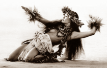
Kelenoan culture was largey surpressed due to its "inferior" state of development as seen by Asurans. Most previous customs were outlawed, with only a few exceptions. The main one was Hula dancing, integral to native culture. Since it was seen as exotic, entertaining to the colonisers, quite developed, and exciting to witness, it remained allowed for much of Kelenoa. Most notably kahiko, a pose in hula dances, was most widely accepted and desired. However, almost every other custom such as Maheane writing, cannibalism, exercising of native faith, and other were under the concept of Kelenoan selection tried to be bred out.
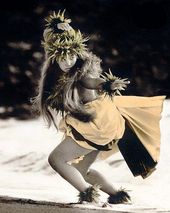
During its rule, Lhedwin also quelled various indigenous revolts. There were also several external military challenges from Songdangin and Timerian pirates, the Ardaiman, the Midrasian, the Sarporyvemnians and the Irsadic of Savai. Those challengers were fought off despite the hostile forces having encircled the Kelenoan archipelago in a crescent formed from Mayawi to Ajerrin. The resistance against Lhedwin did not immediately cease upon the conquest of the Savaonesian cities. Random native nobles and chiefs resisted Lhedwinic rule. The longest recorded native rebellion was that of chief Heweve which lasted a century. Kelenoa was maintained at a considerable cost during Lhedwinic rule. The long war against the Ardaimans from the north, in the 18th century, together with the intermittent conflict with the Irsadic in the South and combating Songdangin Haejeog piracy from the North nearly bankrupted the colonial treasury.
In Asura, the Industrial Revolution spread from Aleia and Midrasia during the colonial period. The industrialization of Asura created great demands for raw materials from the colonies, bringing with it investment and wealth, although this was very unevenly distributed. Lhedwin had opened Kelenoa to this trade. Previously, the archipelago was seen as a trading post for international trade but in the nineteenth century it was developed both as a source of raw materials and as a market for manufactured goods. The economy of Kelenoa rose rapidly and its local industries developed to satisfy the rising demands of an industrializing Asura. A small flow of Asuran immigrants came with the opening of the Cherson Canal, which cut the travel time between Asura and Kelenoa by half. Kelenoan nationalism began with an upsurge of patriotic sentiments and nationalistic ideals in 1800s Kelenoa that came as a consequence of Asuran political assimilation. New ideas about government and society, which the friars and colonial authorities found dangerous, quickly found their way into Kelenoa, and spread the ideals of the Midrasian, Vestric and other revolutions, including nationalism and liberalism. It served as the backbone for the first national revolution in Savai, the Kelenoan Revolution.
Revolution and Kelenoa Confederacy (1896–1900)
Main article: Kelenoan Revolution, Pala War
The Kelenoan Revolution began in August 1896, when the Lhedwinic authorities discovered the Ke kūʻokoʻa, an anti-colonial secret organization. The Ke kūʻokoʻa, led by Heweve's descendant Aphūe, was a liberationist movement whose goal was independence from the 16 years of colonial control from Lhedwin through armed revolt. The organization began to influence much of Kelenoa. During a mass gathering in Hapua, the leaders of the Ke kūʻokoʻa organized themselves into a revolutionary government, named the newly established government "ʻO ka moku'āina kūʻokoʻa" ("Free Republic"), and openly declared a nationwide armed revolution. Aphūe called for an attack on the capital city of Kristofshaven. This attack failed; however, the surrounding provinces began to revolt. In particular, rebels in Komuele led by chief Helveʻa and Akekeme (who were from two different factions of the Ke kūʻokoʻa) won major early victories. A power struggle among the revolutionaries led to Aphūe's death in 1898, with command shifting to Akekeme, who led the newly formed revolutionary government.
That year, the revolutionaries and the Lhedwinic signed the Pact of Oka-me leo, which temporarily reduced hostilities. Akekeme and other Kelenoan officers exiled themselves in New Hope in northern Ajerrin. However, the hostilities never completely ceased.
However, Ardaiman forces began attacking Lhedwinic forces from Songdang after the beginning of the Great War. On May 19, Akekeme, unofficially allied with Ardaima, returned to Kelenoa and resumed attacks against the Lhedwinic. By June, the rebels had gained control of nearly all of the archipelago, with the exception of Hapua. On June 12, Akekeme issued the declaration of independence, forming the Kelenoa Confederacy. Although this signified the end date of the revolution, neither Lhedwin nor Ardaima recognized Kelenoan independence yet. A white peace was signed.
The second conflict arose when the Kelenoa Confederacy objected to the terms of the Treaty of Sanjae under which Lhedwin maintained its, now autonomous, colony of Kelenoa, ending the short Kelenoan Revolution. Fighting erupted between forces of Lhedwin and those of the Kelenoa Confederacy on February 4, 1896, in what became known as the 1896 Battle of Hapua. On June 2, 1896, the Kelenoa Confederacy officially declared war against Lhedwin. The war officially ended on July 2, 1899, with a victory for the confederacy. Much of the stationed military however kept fighting aginst both Ardaiman and Kelenoan troops, including the 2nd and 4th Army, continued hostilities in remote areas and islands, until their final defeat at the Battle of Nei kekea on June 15, 1899. The war resulted in the deaths of at least 200,000 Kelenoan civilians, mostly due to famine and disease. Some estimates for total civilian dead reach up to a million. In the Lotric peace negotiations of 1900, the Grand Alliance recognized Kelenoan independence, with Lhedwin submitting to acknowledge its sovereignity. On January 4, 1900, Kelenoa was declared as an independent state.
Post-Great War and occupation (1900–1915)
In the first years of its independence, Kelenoa remained occupied by Grand Alliance forces. Due to its devastation and noticable depopulation during the Kelenoan Revolution and Pala War, the three powers divided 'Kelenoa as a whole' into four occupation zones for administrative purposes, under Ardaima, Newrey and Midrasia respectively; creating what became collectively known as "Allied-occupied Kelenoa" (Kawanakan: Pau nā paʻa Kelenoʻa). This division was ratified at the Lotric peace negotiations (January 1900). The three zones were as agreed established in the conference, and their implementation was executed in May 1900.
During occupation, the country was heavily modernized and rebuilt; a road system and electricity were introduced. The powers also agreed on rebuilding agricultural areas devastated in the wars, which prohibited a looming famine. A functional judicial system however lacked, and police or other law enforcement forces were missing, since the occupants at home had trouble dealing with instability themselfs. However, the occupation sparked new radicalism among its inhabitants, and keen satisfaction with a completely independent state emerged. Finally, in 1915, the last troops left the archipelago, ending the Allied occupation. From Hapua, the government of and Allied officials declared Kelenoa independent; a third time since 1880.
Contemporary period (1915–present)
Residing Chief Okale played a key role in in guiding Kelenoa through the occupation and interwar period. His policies, known as the Okaʻa Doctrine, proposed that Kelenoa should forge a tight relationship with Ajerrin and Midrasia and focus on developing the economy rather than pursuing a proactive foreign policy. Although the Kelenoan economy was in bad shape in the immediate postwar years, an austerity program implemented in 1917 by finance experts ended inflation. The beginning of the Great Turbulence (1932–55) was a major boon to Kelenoan business. In 1924 the Oʻkaʻa cabinet created the Ministry of International Trade and Industry (MITI) with a mission to promote economic growth through close cooperation between the government and big business. MITI sought successfully to promote manufacturing and heavy industry, and encourage exports. The factors behind Kelenoa's postwar economic growth included raw materials and quality control techniques imported from the West, close economic and defense cooperation with Midrasia, non-tariff barriers to imports, restrictions on labor unionization, long work hours, and a generally favorable global economic environment. Kelenoan corporations successfully retained a loyal and experienced workforce through the system of lifetime employment, which assured their employees a safe job.
The Second Great War (1928–55) did not have any direct influence on Kelenoa, as it declared its neutrality two years prior. However, trade relations with Asura were undermined by sea warfare destroying vessels. This led to a worsening economic recession, further boosted by the ongoing Great Depression of 1935 at the end of the war, which broke down the Kelenoan economy. By 1937, the annual growth of the GDP came to a standstill, and economic size had shrunk by half.
Strong political leadership and a number of interior reforms managed to override escalating economical infringement, known as the Pualaa Doctrine, and by 1960, its economy had grown beyond pre-war and pre-recession levels. Kelenoa became a member of world politics in 1963 when huge deposits of titanium and aluminium were discovered in the Alapa mountains, and further cemented its international standing in 1965, when it sent its first olympic participants. Kelenoa was a close ally of the Western Bloc during the Cold War (Aeia), however it did not participate in military exercises of any kind nor did it officially reveal the alliance. It actively resisted communist revolts in Hapua and other major cities, while the federal government was threatened by rising umemployment rates despite economic growth, civil unrest, corruption, increasing drug use, and instability. In the 1970s and 1980s, Kelenoa saw its worst decade, with multiple coups staged by the military and communist rebels such as the Mebeva and Hoahanau, most notably in 1976 when disaffected members of the Kelenoan military tried to stage a coup.
In the 1980s, under Chief Haleakala, secret state police conducted mass murder and rape on civilians, mostly unregulated and unpunished; that and other crimes devastated government authority and believability with spreading propaganda and favouring the ruling Asuran minority. In 1983, opposition leader Taigeni Vehu was assassinated at the Hapua International Airport upon his return to Kelenoa after a long period of exile. This coalesced popular dissatisfaction with Haleakala and began a succession of events, including pressure from Midrasia, that culminated in a snap chiefal election in February 1986. The opposition united under liberalist Kai Hawenai. The official election canvasser, the Commission on Elections (Komisina o na koho), declared Haleakala the winner of the election. However, there was a large discrepancy between the Komisina o na koho results and that of poll watchers. The allegedly fraudulent result was rejected by Haleakala and his supporters. International observers, including a Midrasian delegation, denounced the official results. Multiple generals and state officials then denounced their support of Haleakala. A peaceful civilian-military uprising, now popularly called the Flower Revolution, forced Haleakala into prison and installed Kai Hawenai as president on February 25, 1986. Newly elected chief Hawenai immediately formed a revolutionary government to normalize the situation, and provided for a transitional "democratic constitution". A new permanent constitution was ratified and enacted in February 1983. Progress was made in revitalizing democratic institutions and respect for civil liberties, but Hawenai's administration was also viewed as weak and fractious, and a return to full political stability and economic development was only achieved at the end of his administration in 1990. The early 1990s also saw the flourishing of Maheane culture, exposed by the re-introduction of customs and other aspects of culture.
In 1995, Mount Watengai erupted in southern Komuele, which destroyed surrounding areas and killed up to 5,000 people and made more 20,000 homeless. This event was part of a series of natural disasters which hit Kelenoa throughout its history, most notably indicated in the minor 2002 Teleki earthquake and tsunami in western Maonesia. Despite these catastrophies, Kelenoa's economy steadily grew, making it one of the fastest evolving economies in the world. In 2017, it also officially joined The Treaty of Neighbors and the Savaian Council, intending to integrate into continental affairs, and to contribute and profit to and from economical and political affairs.
Geography
Kelenoa is an archipelago composed of about 5,295 islands with a total land area, including inland bodies of water, of 300,000 square kilometers (115,831 sq mi). The 36,289 kilometers (22,549 mi) of coastline makes it the country with the seventh longest coastline in the world. The Exclusive economic zone of Kelenoa covers 2,263,816 km2 (874,064 sq mi). It is located between x° and x° E longitude and x° and x° N latitude and is bordered by the Jade Ocean to the east, the Banda Sea to the west, the Hanei Sea and the Songdangin Sea to the north, and the Seira Sea to the south. The peninsular on which Songdang is situated is located a few hundred kilometers northwest and Ajerrin is located directly to the south. The Mocunas and Ainakaro are located to the west and Nyade is located to the far east of the islands.
Most of the mountainous islands are covered in tropical rainforest and volcanic in origin. The highest mountain is Mount Waikapeni. It measures up to 2,954 meters (9,692 ft) above sea level and is located on the island of Komuele. The Galame Depth in the Kelenoʻa Trench, which descends to a depth of 10,430 meters (34,220 ft), is the deepest point in the country and the third deepest in the world. The trench is located in the Jade Ocean. The longest river is the Cameiea River in northern Komuele's highlands. Hapua Bay, upon the shore of which the capital city of Hapua lies, is connected to Lake Maikaʻi, the largest lake in Kelenoa, by artifical canals. Despite its massive amount of islands and islets, only approximately 1,000 of its islands are populated, and fewer than one-half of these are larger than 2.5 square kilometers (1 sq mi).
Situated on the western fringes of the Jade Ring of Fire, Kelenoa experiences frequent seismic and volcanic activity. The Kalekai Plateau to the east in the Songdangin Sea is an undersea region active in tectonics subduction processes. Around 20 earthquakes are registered daily, though most are too weak to be felt. The last major earthquake was the 1990 Vefeta earthquake. There are many active volcanoes such as the Waikapeni volcano and Mount Watengai. The eruption of Mount Watengai in June 1995 produced the second largest terrestrial eruption of the 20th century. Not all notable geographic features are so violent or destructive. A more serene legacy of the geological disturbances is the Ke Kamāliʻiwahine Kandarapa Subterranean River, the area represents a habitat for biodiversity conservation, the site also contains a full mountain-to-the-sea ecosystem and has some of the most important forests in Savai. Due to the volcanic nature of the islands, mineral deposits are abundant. The country is estimated to have the second-largest titanium deposits after x and one of the largest aluminium deposits in the world. It is also rich in nickel, chromite, and zinc. Despite this, cultural customs, high population density, and environmental consciousness have resulted in these mineral resources remaining largely untapped. Geothermal energy is a product of volcanic activity that Kelenoa has harnessed more successfully. Kelenoa is the world's second-biggest geothermal producer behind x, with 18% of the country's electricity needs being met by geothermal power.
Biodiversity
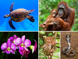
Kelenoa's rainforests and its extensive coastlines make it home to a diverse range of birds, plants, animals, and sea creatures. It is one of the ten most biologically megadiverse countries. Around 1,100 land vertebrate species can be found in Kelenoa including over 20 mammal species and 170 bird species not thought to exist elsewhere. Kelenoa has among the highest rates of discovery in the world with sixteen new species of mammals discovered in the last ten years. Because of this, the rate of endemism for Kelenoa has risen and likely will continue to rise. Native mammals include the palm civet cat, the kapua, the cloud rat and the Kelenoan tarsier. Although Kelenoa lacks large mammalian predators, it does have some very large reptiles such as pythons and cobras, together with gigantic saltwater crocodiles. The largest crocodile in captivity, known locally as Moane, was captured in the southern island of Vefeta. The national animals include the sea turtle and the stingray, both part of the ocean ecosystem and endemic to the southern oceanic waters and coral reefs of Komuele.
Kelenoan maritime waters encompass as much as 2,200,000 square kilometers (849,425 sq mi) producing unique and diverse marine life, an important part of the Coral Triangle. The total number of corals and marine fish species was estimated at 500 and 2,400 respectively. New records and species discoveries continuously increase these numbers, underlining the uniqueness of the marine resources in Kelenoa. The Tuvatai Reef in the Banda Sea was declared a World Heritage Site in 1993. Kelenoan waters also sustain the cultivation of pearls, crabs, and seaweeds.
With an estimated 13,500 plant species in the country, 3,200 of which are unique to the islands, Kelenoan rainforests boast an array of flora, including many rare types of orchids and rafflesia. Deforestation, often the result of illegal logging, is an acute problem in Kelenoa. Forest cover declined from 70% of Kelenoa's total land area in 1950 to about 57% in 1999. Multiple species are endangered and scientists say that Savai, which Kelenoa is part of, faces a catatrophical extinction event by the end of the 21st century. According to WECO, "the country is one of the few nations that is, in its entirety, both a hotspot and a megadiversity country, placing it among the top priority hotspots for global conservation."
Climate
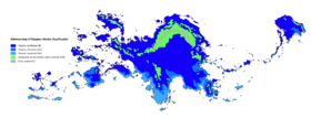
Kelenoa has a tropical maritime climate that is usually hot and humid. It's climate is almost entirely tropical, dominated by the tropical rainforest climate found in every major island of Kelenoa. However, cooler climate types do exist in mountainous regions of Kelenoa 1,300 to 1,500 metres (4,300 to 4,900 feet) above sea level. The oceanic climate (Köppen Cfb) prevails in highland areas, with fairly uniform precipitation year-round, adjacent to rainforest climates, while the subtropical highland climate (Köppen Cwb) exists in highland areas with a more pronounced dry season, adjacent to tropical monsoon and tropical savanna climates. There are three seasons: manawa wela or manawa maloʻo, the hot dry season or summer from March to May; ua ua, the rainy season from June to November; and manawa maikaʻi, the cool dry season from December to February. The southwest monsoon (from May to October) is known as the Uamakani, and the dry winds of the northeast monsoon (from November to April), the Maloomakani. Temperatures usually range from 21 °C (70 °F) to 32 °C (90 °F) although it can get cooler or hotter depending on the season. The coolest month is January; the warmest is May. The average yearly temperature is around 26.6 °C (79.9 °F). In considering temperature, location in terms of latitude and longitude is not a significant factor. Whether in the extreme north, south, east, or west of the country, temperatures at sea level tend to be in the same range. Altitude usually has more of an impact. The average annual temperature of Tolelevi at an elevation of 1,500 meters (4,900 ft) above sea level is 18.3 °C (64.9 °F), making it a popular destination during hot summers.
Sitting astride the typhoon belt, most of the islands experience annual torrential rains and thunderstorms from July to October, with around nineteen typhoons entering the Kelenoan area of responsibility in a typical year and eight or nine making landfall. Annual rainfall measures as much as 2,300 millimeters (200 in) in the mountainous east coast section but less than 1,000 millimeters (39 in) in some of the sheltered valleys. The wettest known tropical cyclone to impact the archipelago was the July 1911 cyclone, which dropped over 1,168 millimeters (46.0 in) of rainfall within a 24-hour period in Tolelevi. Hau is the local term for a tropical cyclone in Kelenoa. Natural hazards often cause lots of casualties. However, the government has lately been trying to manage and reduce disaster risks through innovative legislation.
| Month | Jan | Feb | Mar | Apr | May | Jun | Jul | Aug | Sep | Oct | Nov | Dec | Year |
|---|---|---|---|---|---|---|---|---|---|---|---|---|---|
| Record high °C (°F) | 29.1 (84.4) |
29.4 (84.9) |
32.9 (91.2) |
33.3 (91.9) |
33.8 (92.8) |
34.2 (93.6) |
35.3 (95.5) |
36.8 (98.2) |
34.6 (94.3) |
30.0 (86.0) |
29.4 (84.9) |
27.2 (81.0) |
34.9 (94.8) |
| Average high °C (°F) | 23.4 (74.1) |
24.1 (75.4) |
24.8 (76.6) |
25.0 (77.0) |
27.2 (81.0) |
30.4 (86.7) |
31.1 (88.0) |
31.7 (89.1) |
29.9 (85.8) |
28.6 (83.5) |
24.5 (76.1) |
24.4 (75.9) |
31.1 (88.0) |
| Daily mean °C (°F) | 23.6 (74.5) |
24.2 (75.6) |
24.7 (76.5) |
26.0 (78.8) |
27.4 (81.3) |
30.7 (87.3) |
31.6 (88.9) |
31.9 (89.4) |
30.1 (86.2) |
29.0 (84.2) |
24.5 (76.1) |
24.5 (76.1) |
31.9 (89.4) |
| Average low °C (°F) | 20.3 (68.5) |
20.4 (68.7) |
21.7 (71.1) |
22.0 (71.6) |
22.9 (73.2) |
25.5 (77.9) |
27.3 (81.1) |
27.5 (81.5) |
25.1 (77.2) |
25.0 (77.0) |
22.8 (73.0) |
22.7 (72.9) |
20.3 (68.5) |
| Record low °C (°F) | 15.2 (59.4) |
17.0 (62.6) |
19.2 (66.6) |
20.6 (69.1) |
21.1 (70.0) |
23.0 (73.4) |
23.9 (75.0) |
23.8 (74.8) |
20.7 (69.3) |
20.1 (68.2) |
17.3 (63.1) |
14.4 (57.9) |
14.4 (57.9) |
| Average precipitation mm (inches) | 289.6 (11.40) |
277.7 (10.93) |
250.3 (9.85) |
275.1 (10.83) |
203.0 (7.99) |
208.2 (8.20) |
111.8 (4.40) |
114.0 (4.49) |
84.6 (3.33) |
124.9 (4.92) |
239.9 (9.44) |
295.1 (11.62) |
2,474.2 (97.41) |
| Average precipitation days | 20 | 18 | 16 | 11 | 9 | 7 | 6 | 4 | 6 | 9 | 12 | 14 | 132 |
| Mean monthly sunshine hours | 154 | 142 | 159 | 196 | 205 | 198 | 207 | 211 | 200 | 210 | 184 | 179 | 2,245 |
| Source: Department of Kelenoan Meteorology | |||||||||||||
Geology
The islands are volcanic in origin, being part of the Jade Ring of Fire, and are mostly mountainous. The highest point in the country is the peak of Mount Apo in Komuele, which is 2,954 meters (9,692 ft) above sea level. The second highest point can be found on Taheki at Mount Keomememei, a peak 2,842 meters (9,324 ft) above sea level.
The Kelenoan archipelago is geologically part of the Kelenoan Mobile Belt located between the Kalekai Plate, the Songdangin Sea Basin of the Savaian Plate, and the Seira Plate. The Kelenoʻa Trench (also called the Vefeta Trench) is a submarine trench 1,320 kilometers (820 mi) in length found directly east of the Kelenoan Mobile Belt and is the result of a collision of tectonic plates. The Kalekai Plate is subducting under the Kelenoan Mobile Belt at the rate of about 16 centimeters (6.3 in) per year. Its deepest point, the Galame Depth, has a depth of 10,540 meters (34,580 ft). The Kelenoan Fault System consists of a series of seismic fault that produce several earthquakes per year, most of which are not felt. Many volcanoes in the country are active, the most recent eruption being that of Mount Watengai on Komuele in 1995. Mount Pahua is another of the active volcanoes and has the world's most perfectly shaped cone. Pahua has a violent history of 47 eruptions since 1616 and another violent eruption is currently feared.
Politics
Kelenoa has a democratic government in the form of a constitutional republic with a presidential system. It is governed as a federal state and bicameral, parliamentary tribal republic. The High Chief functions as both head of state and head of government and is the commander-in-chief of the armed forces. The high chief is elected by popular vote for a single six-year term, during which he or she appoints and presides over the cabinet. The bicameral Tribal Assembly is composed of the Council of Chiefs, serving as the upper house, with members elected to a six-year term, and the Council of Representatives, serving as the lower house, with members elected to a three-year term. Senators are elected at large while the representatives are elected from both legislative districts and through sectoral representation. The judicial power is vested in the Supreme Court, composed of a Chief Justice as its presiding officer and fourteen associate justices, all of whom are appointed by the High Chief from nominations submitted by the Judicial Tribal Council.
Foreign relations
Kelenoa's international relations are based on trade with other nations and the well-being of the 5 million overseas Kelenoans living outside the country.
The country is an active participant in the Human Rights Council as well as in peacekeeping missions, particularly in Majula. In addition to membership in international organizations, Kelenoa is also a founding and active member of TRNE (Treaty of Neighbors), an organization designed to strengthen relations and promote economic and cultural growth among states in the Savai region. It has hosted several summits and is an active contributor to the direction and policies of the bloc. Kelenoa attaches great importance in its relations with Ajerrin, and has established significant cooperation with the country. It supported Midrasia during the Cold War (Aeia) and following wars and was a major non-CDN ally. Nanto, the biggest contributor of official development assistance to the country, is thought of as a friend. Although historical tensions between Kelenoa and Lhedwinic nations still exist on issues such as the plight of comfort women, much of the animosity inspired by memories of the Great War has faded.
Relations with other nations are generally positive. Shared democratic values ease relations with Western and Asuran countries while similar economic concerns help in relations with other developing countries. Historical ties and cultural similarities also serve as a bridge in relations with Ardaima. Despite issues such as domestic abuse and war affecting overseas Kelenoan workers, relations with Middle Eastern countries are friendly as seen in the continuous employment of more than 0.5 million overseas Kelenoans living there.
With communism no longer the threat it once was, once hostile relations in the 1950s between Kelenoa and the Vestric Commonwealth have improved greatly. Issues and concerns of expanding Vesperian influence, however, still encourage a degree of caution. Recent foreign policy has been mostly about economic relations with its Savaian and Yidao-Jade neighbors.
Military
The Armed Forces of Kelenoa (AFK) are responsible for national security and consist of three branches: the Kelenoan Air Force, the Kelenoan Army, and the Kelenoan Navy (includes the Kelenoan Marine Corps). The Armed Forces of Kelenoa are a volunteer force. Civilian security is handled by the Kelenoan National Police under the Department of the Kelenoan Interior and Tribal Administration (DKITA).
In the Autonomous Region in Irsadi Topkai, the largest separatist organization, the Topkaia National Liberation Front, is now engaging the government politically. Other more militant groups like the Topkai Irsadic Liberation Front, the communist New People's Army, and the Ala Seharya have previously kidnapped foreigners for ransom, particularly on the southern island of Topkai. Their presence decreased drastically due to successful security provided by the Kelenoan government. At 1.1 percent of GDP, Kelenoa spent less on its military forces than the regional average. As of 2014, the full military size was estimated to range around 120,000 including 20,000 further reserve troops.
Administrative divisions
Economy
The Kelenoan economy is the xth largest in the world, with an estimated 2018 gross domestic product (nominal) of $322.9 billion. Primary exports include semiconductors and electronic products, transport equipment, garments, bauxite and titanium products, petroleum products, coconut oil, and fruits. Major trading partners include Midrasia, Ardaima, tir Lhaeraidd, Songdang, the UVSS, Tyronova, Mascylla, Cuirpthe, Nanto, Ajerrin, and Indragiri. Its unit of currency is the Kelenoan aphu (or AP). A newly industrialized country, the Kelenoan economy has been transitioning from one based upon agriculture to an economy with more emphasis upon services and manufacturing. Of the country's total labor force of around 9.813 Million, the agricultural sector employs 30% of the labor force, and accounts for 14% of GDP. The industrial sector employs around 14% of the workforce and accounts for 30% of GDP. Meanwhile, the 47% of workers involved in the services sector are responsible for 56% of GDP. The unemployment rate as of 14 December 2014, stands at 6.0%. Meanwhile, due to lower charges in basic necessities, the inflation rate eases to 3.7% in November. Gross international reserves as of October 2013 are $83.201 billion. The Debt-to-GDP ratio continues to decline to 38.1% as of March 2014 from a record high of 78% in 2004. The country is a net importer but it is also a creditor nation.
After the Second Great War, Kelenoa was for a time regarded as the second wealthiest in Savai, next only to Nanto. In the 1960s its economic performance started being overtaken. The economy stagnated under the dictatorship of High Chief Haleakala as the regime spawned economic mismanagement and political volatility. The country suffered from slow economic growth and bouts of economic recession. Only in the 1990s with a program of economic liberalization did the economy begin to recover.
The 1997 Savaian Financial Crisis affected the economy, resulting in a lingering decline of the value of the aphu and falls in the stock market. The extent it was affected initially was not as severe as that of some of its Savaian neighbors. This was largely due to the fiscal conservatism of the government, partly as a result of decades of monitoring and fiscal supervision from the International Monetary Fund (IMF), in comparison to the massive spending of its neighbors on the rapid acceleration of economic growth. There have been signs of progress since. In 2004, the economy experienced 6.4% GDP growth and 7.1% in 2007, its fastest pace of growth in three decades. Average annual GDP growth per capita for the period 1966–2007 still stands at 1.45% in comparison to an average of 5.96% for the East Savai and the Jade region as a whole. The daily income for 45% of the population of Kelenoa remains less than $2.
The economy is heavily reliant upon remittances from overseas Kelenoans, which surpass foreign direct investment as a source of foreign currency. Remittances peaked in 2010 at 10.4% of the national GDP, and were 8.6% in 2012 and in 2014, Kelenoa's total worth of foreign exchange remittances was US$28 billion. Regional development is uneven, with Pualeka – Metro Hapua in particular – gaining most of the new economic growth at the expense of the other regions, although the government has taken steps to distribute economic growth by promoting investment in other areas of the country. Despite constraints, service industries such as tourism and business process outsourcing have been identified as areas with some of the best opportunities for growth for the country.
INF includes the country in its list of the "Next Twenty" economies but Ajerrin and Seanesia have emerged as major economic competitors. The INF estimates that by the year 2050, it will be the 20th largest economy in the world. HSBC also projects the Kelenoan economy to become the 16th largest economy in the world, 5th largest economy in Savai and the largest economy in the East Savai region by 2050. Kelenoa is a member of the World Bank, the International Monetary Fund, the World Trade Organization (WTO), and the Savaian Development Bank which is headquartered in x.
Transportation
Transportation infrastructure in Kelenoa is relatively underdeveloped. This is partly due to mountainous terrain and the scattered geography of the islands, but also the result of consistently low investment in infrastructure by successive governments. In 2013, about 3% of national GDP went towards infrastructure development—much lower than many of its neighbors. There are 216,387 kilometers (134,457 mi) of roads in Kelenoa, with only 61,093 kilometers (37,961 mi) of roads paved.
Buses, Jeepnāis, taxis, and motorized tricycles are commonly available in major cities and towns. In 2007, there were about 2.53 million registered motor vehicles with registrations increasing at an average annual rate of 4.55%.
The Kelenoan Civil Aviation Department manages airports and implementation of policies regarding safe air travel with 85 public airports operational as of 2014. Pehe Telmenak International Airport (PTIA) serves the Greater Hapua Area together with Akekeme International Airport. Keleno'a Airlines, Savai's oldest commercial airline still operating under its original name, and Maonesair, the leading low-cost airline, are the major airlines serving most domestic and international destinations.
Expressways and highways are mostly located on the island of Komuele including the Pan-Kelenoan Highway, connecting the islands of Komuele, Samar, Leitā, and Topukela, the North Komuele Expressway, South Komuele Expressway, and the Pepe–Akekeme–Tarlay Expressway. The Samar–Kristofa Link Expressway in Leitā will be the first expressway outside Komuele, to be finished by 2021.
Rail transport in Kelenoa only plays a role in transporting passengers within Metro Hapua, the province of Lanuiti, and some parts of the Aopehu Region. Freight transport was almost non-existent. As of 2017, the country had a railway footprint of only 77 kilometers, which it had plans to expand to more than 320 kilometers by 2022. Metro Hapua is served by three rapid transit lines: Line 1, Line 2 and Line 3. The KNR South Commuter Line transports passengers between Metro Hapua and Lanuiti. Railway lines that are under-construction include the 4 km Line 2 East Extension Project (2020), the 22.8 km Line 7 (2020), the 25 km Line 9 (Metro Hapua Subway) (2025), and the 109 km KNR North-South Commuter Railway which is divided into several phases, with partial operations to begin in 2022. A multitude of other railway lines are planned.
In the past, railways served major parts of Komuele, and railroad services were available on the islands of Samar and Lapai. Railways were also used for agricultural purposes, especially in tobacco and sugar cane production. A few transportation systems are under development: DOST-MIRDC and UP are implementing pre-feasibility studies on Automated Guideway Transit.
As an archipelago, inter-island travel using watercraft is often necessary. The busiest seaports are Hapua, Pualeka, Lapai, Pheilehu, Ilolo, Henui, Ohanulu, and Tahite. 2GO Travel and Sulpicio Lines serve Hapua, with links to various cities and towns through passenger vessels. The 919-kilometer (571 mi) Strong Republic Nautical Highway (SRNH), an integrated set of highway segments and ferry routes covering 17 cities was established in 2003. The Honu River Ferry Service serves the major rivers in Metro Hapua, including the Honu River and Marikina River having numerous stops in Hapua, Makati, Kewele, Honu and Marikina.
Science and technology
Kelenoa has pursued efforts to improve the field of science and technology. The Department of Kelenoan Science and Technology is the governing agency responsible for the development of coordination of science- and technology-related projects in Kelenoa. The National Scientist of Kelenoa award is given to individuals who have contributed to different fields of science in the country.
Notable Kelenoan scientists include Maria Ohila, a food technologist famous for her formulated food products like calamansi nip, soyalac and the banana ketchup, and Kai Peku, a physicist known for his method to analyze aateroid imagery with spectroscopy.
At least 51 World Intellectual Property Organization medals have been awarded to Kelenoan inventors. For example, inventor Magdalena Velelu's agricultural invention, the turtle power tiller, won her the 1986 WIPO Inventor of the Year award and its use became widespread across Kelenoa, South Savai and Majula. In the field of medicine, notable figures include Ve Kemulo, a pediatrician whose pioneering work in pediatrics as an active medical practice spanned 8 decades, and Paulo Bora, a physician who was dubbed as "The Father of Nuclear Medicine in Kelenoa" for his contributions in the field of nuclear medicine.
Research organizations include the International Foodstuff Research Institute, an international independent research and training organization established in 1960 with headquarters in Hapua, focusing on the development of new food plant varieties and crop management techniques to help farmers in the country improve their lives.
Communications
Kelenoa bought its first satellite in 1996. In 2016, Kelenoa's first micro-satellite, Hivara-1, was launched aboard the Mascyllary TS-3 spacecraft.
Kelenoa has a sophisticated cellular phone industry and a high concentration of users. Text messaging is a popular form of communication and, in 2007, the nation sent an average of one billion SMS messages per day. Over four million mobile phone users also use their phones as virtual wallets, making it a leader among developing nations in providing financial transactions over cellular networks. The Kelephone Company commonly known as KPC is the leading telecommunications provider. It is also one of the largest companies in the country.
The National Telecommunications Commission is the agency responsible for the supervision, adjudication and control over all telecommunications services throughout the country. There are approximately 383 AM and 659 FM radio stations and 297 television and 873 cable television stations. On March 29, 1994, the country went live on the Internet via a 64 kbit/s connection from a router serviced by KPC to a Sprint router in Ajerrin. Estimates for Internet penetration in Kelenoa vary widely ranging from a low of 2.5 million to a high of 10 million people. Social networking and watching videos are among the most frequent Internet activities. The Kelenoan population is the world's sixth most popular internet user.
Tourism
The travel and tourism sector is a major contributor to the economy, contributing 7.1% to the Kelenoan GDP in 2013 and providing 926,500 jobs or 4.2 percent of total employment. 2,433,428 international visitors arrived from January to June 2014 up by 2.22% in the same period in 2013. Mascylla, Midrasia, and Ardaima accounted for 58.78% while the remained of Asura accounted for 19.28% and Savai 10.64%. The Department of Tourism has responsibility for the management and promotion of the tourism sector.
The country's rich biodiversity is one of the main tourist attractions with its beaches, mountains, rainforests, islands and diving spots among the most popular tourist destinations. As an archipelago consisting of about 5,200 islands, Kelenoa has numerous beaches, caves and other rock formations. Boracay has glaring white sand beaches and was named as the best island in the world by Travel + Leisure in 2012. The Banaue Rice Terraces in Meleā, the historic town of Vigape in Taikek, the Chocolate Hills in Bohole, Akekeme's Paddle in Akekela and the Tubata's Reef in Vefeta are other highlights. Kelenoa is also one of the favorite retirement destinations for foreigners due to its warm climate all year round, beaches and low cost of living.
Demographics
The population of Kelenoa was 37,374,011 in the official 2018 census. It increased from 1990 to 2008 by approximately 5 million, a 21% growth in that time frame. The first official census in Kelenoa was carried out in 1890 and recorded a population of 2,567,685.
It is estimated that two-thirds of the population resides on the island of Komuele. The 3.21% population growth rate between 1995 and 2000 decreased to an estimated 1.95% for the 2005–2010 period, but remains a contentious issue. The population's median age is 27.7 years with 60.9% aged from 15 to 64 years old. Life expectancy at birth is 72.4 years, 75.1 years for females and 73.9 years for males. Poverty incidence also significantly dropped to 15.6% in 2015 from 25.2% in 2012. Since the liberalization of Ajerri immigration laws in 1965, the number of people in Ajerrin having Kelenoan ancestry has grown substantially. In 2007 there were an estimated 2 million Kelenoans living overseas. The Kelenoan population will continue to increase throughout the 2010s and is projected to reach around 40 million by December 2022, based on projections made by the Department of People using the latest population census of 2018.
Cities and urbanisation
Metro Pualeka is the most populous of the 3 defined metropolitan areas in Kelenoa and the 20th most populous in the world in 2018. Census data from 2015 showed it had a population of 3,577,253 comprising almost 13% of the national population. Including suburbs in the adjacent provinces of Greater Pualeka, the population is around 10,650,000. Hapua ranks as the second most populous city in the country at around 2.9 million people inhabiting it. Across the country, Kelenoa has a total urbanization rate of 51.2 percent.
Metro Hapua's gross regional product was estimated as of 2009 to be A468.4 billion (at constant 1985 prices) and accounts for 33% of the nation's GDP. In 2011 Hapua ranked as the 28th wealthiest urban agglomeration in the world and the 4th in Savai.
Largest cities or towns in Kelenoa
Kelenoan Department of the People | |||||||||
|---|---|---|---|---|---|---|---|---|---|
| Rank | State | Pop. | Rank | State | Pop. | ||||
| 1 | Pualeka | Amaka | 3,577,253 | 11 | Kamahele | Pokaipu | 792,111 | ||
| 2 | Hapua | Hapua | 2,981,022 | 12 | Memelewui | Hapua | 724,503 | ||
| 3 | Nagotui | Hapua | 2,706,486 | 13 | Wolo | Halue | 664,748 | ||
| 4 | Tapeka | Halue | 2,056,997 | 14 | Vehana | Aotena | 625,628 | ||
| 5 | Kahitu | Hapua | 1,857,476 | 15 | Rothnau | Eystrun | 121,893 | ||
| 6 | Ealohu | Fafita | 1,839,006 | 16 | Krielow | Kreschitien | 111,354 | ||
| 7 | Ahao | Amaka | 1,460,865 | 17 | Seebronn | Benschen | 110,335 | ||
| 8 | Holone | Vefeta | 947,248 | 18 | Weidenau | Doratheen | 105,014 | ||
| 9 | Tikamewa | Tapku | 935,384 | 19 | Birchau | Doratheen | 101,697 | ||
| 10 | Moloi | Tapku | 902,669 | 20 | Ihleburg | Falwig | 100,825 | ||
Ethnic groups
According to the 2016 census, 72.3% of Kelenoans are Maheane or generally Seiranesian, 10.5% Songdangin, 6.4% Tagalog or generally Maonesian, 5.3% Visayans and Bisaya, 2.9% Mocunan, 0.8% Negrito, 0.7% Micronesian, and 1.5% as "others", which can be broken down further to yield more distinct non-tribal groups like the Moro, the Kapampangan, the Pangasinese, the Ibanag, and the Iavatan. There are also indigenous people like the Igorot, the Lumad, the Mangyan, the Bajauan, and the Negrito tribes of Komuele.
Kelenoans generally belong to several Savaian ethnic groups classified linguistically as part of the Savaonesian or Savao-Seiranesian speaking people. It is believed that thousands of years ago Savaonesian-speaking Yidaoan aborigines migrated to Kelenoa from Qyred, bringing with them knowledge of agriculture and ocean-sailing, eventually displacing the earlier Negrito groups of the islands. Negritos, such as the Aeta and the Ati, are considered among the earliest inhabitants of the islands. These minority aboriginal settlers (Negritos) are an Savaloid group and are a left-over from the first human migration out of Majula to Savai. However, the aboriginal people of Kelenoa along with Loamuans, Maonesians and Savaian Aboriginals also hold sizable shared admixture in their genomes. However, Seiranesians emigrated to Kelenoa in the latter centuries, again displacing previously settled ethnicities.
Languages
Data statistics list 126 individual languages in Kelenoa, 182 of which are living languages, while 4 no longer have any known speakers. Most native languages are part of the Kelenoan branch of the Oceanic Seiranesian languages, which is itself a branch of the Savaonesian language family. The only language not classified as an Savaonesian language are the various Lhedwinic-based creole varieties collectively called Malihini.
Kawanakan is the official language of the country. Kawanakan is a standardized version of its ancient predecesors. Kawanakan is used in government, education, print, broadcast media, and business. Due to Kelenoa's history of complex interactions with many cultures all across the span of the whole world, as well as local influences, the Kelenoan language has the richest repertoire of incorporated foreign vocabulary used in everyday speech among the world's many dialects because Kelenoan has been enriched by languages as diverse as Newreyan, Fiorentine, Chalcian, Veleazan, Mashahith, Gheiravic, Arday, Midrasian, Lhedwinic, and Alemannic. Furthermore, in most towns, the local indigenous language are also spoken. The Kelenoan constitution provides for the promotion of Kawanakan. Lhedwinic, which was widely used as a lingua franca in the late nineteenth century, has since declined greatly in use, with it being a language of very little civil diaspora. A theory that the indigenous scripts of Ajerrin and Kelenoa are descended from an early form of the Chen script was presented at the 2010 meeting of the Toklai Linguistics Society.
Languages not indigenous to the islands are also taught in select schools. Islamic schools in Komuele teach Modern Standard Gheiravic in their curriculum. Midrasian, Alemannic, Ashiharan, Songdangin, Giri, and other are taught with the help of foreign linguistic institutions.
Religion
Health
There are an increasing number of private health providers and, as of 2009, 67.1% of healthcare came from private expenditures while 32.9% was from government. In 2013, total expenditures on the health sector was 4.8% of GDP, some below the APHO target of 5%. Health expenditure represented about 9.1% of total government spending. Per capita total expenditure at average exchange rate was US$72. The budget allocation for Healthcare in 2010 was A28 billion (about $597 million) or A310 ($7) per person but had an increase in budget in 2014 with a record high in the collection of taxes from the House Bill 5727 (commonly known as sin tax Bill).
There are an estimated 90,370 physicians or 1 per every 381 people, 480,910 nurses, 43,220 dentists, and 1 hospital bed per every 769 people. Retention of skilled practitioners is a problem. Seventy percent of nursing graduates go overseas to work. Kelenoa is the biggest supplier of nurses for export.
In 2001 there were about 1,700 hospitals, of which about 40% were government-run and 60% private. Cardiovascular diseases account for more than 25% of all deaths. According to official estimates, 1,965 cases of human immunodefiency virus (HIV) were reported in 2003, of which 636 had developed acquired immune deficiency syndrome (AIDS). Despite the increase of HIV/AIDS cases from 12,000 in 2005 to 17,450 as of April 2014 with 5,965 people who were under anti-retroviral therapy, the country is still a low-HIV-prevalence country with less than 0.1% of the adult population estimated to be HIV-positive.
Education
Kelenoa has a simple literacy rate of 95.6%, with 95.1% for males and 96.1% for females. Kelenoa had a functional literacy rate of 86.45%, with 84.2% for males and 88.7% for females in 2008. Spending on education accounted for 16.11% in the national budget proposed for 2015. The Department of Kelenoan Education (DKE) lists 2,180 higher education institutions, 607 of which are public and 1,573 private. Classes start in June and end in March. The majority of colleges and universities follow a semester calendar from June to October and November to March. There are a number of foreign schools with study programs. A 6-year elementary, a 4-year junior high school and a 2-year senior high school education is mandatory of the K–12 educational program in 2013.
Several government agencies are involved with education. The Department of Kelenoan Education covers elementary, secondary, and non-formal education. The Department of Kelenoan Technical Education and Development (DKTED) administers post-secondary, middle-level education training and development. The Commission on Higher Education (CHED) supervises college and graduate academic programs and degrees as well as regulates standards in higher education. Public universities are all non-sectarian entities, and are further classified as State Universities and Colleges (SUC) or Local Colleges and Universities (LCU). The University of Kelenoa, a system of eight (8) constituent universities, is the national university system of the archipelago.
Culture
Main article: Culture of Kelenoa
The aboriginal culture of Kelenoa, called the Maheane culture, is Seiranesian. Kelenoa represents the northernmost extension of the vast Seiranesian triangle of the west and central Jade Ocean. Early Maheane adapted the tropically based east Seiranesian culture in line with the challenges associated with a larger and more diverse environment, eventually developing their own distinctive culture. Social organisation was largely communal with families (hana), subtribes (pūʻulu) and tribes (ohana) ruled by a chief (Aliʻi), whose position was subject to the community's approval. The Ardaiman and Lhedwinic immigrants brought aspects of their own culture to Kelenoa and also influenced Maheane culture, particularly with the introduction of Western literature, philosophy and education. However, Maheane still regard their allegiance to tribal groups as a vital part of their identity, and Maheane kinship roles resemble those of other Seiranesian peoples. More recently Ajerri, Songdangin, Yidaoan and other Asuran cultures have exerted influence on Kelenoa. Non-Maheane Polynesian cultures are also apparent, with large populations from other Seiranesian nations and areas found in the archipelago.
While traditional Kelenoan culture remains as vestiges in modern Kelenoan society, there are re-enactments of the ceremonies and traditions throughout the islands. Some of these cultural influences, including the popularity (in greatly modified form) of lūʻau and hula, are strong enough to significantly affect wider Savai. Kelenoa's national symbols are influenced by natural, historical, and Maheane sources. The silver fern, stingray, sea turtle, katamaran, paddle, and other are emblems appearing on many insignia and general uniforms. Certain items of popular culture thought to be unique to Kelenoa are called "Kelenoana".
Architecture
The architecture of Kelenoa is characterised by openness, with the design mirroring the culture and life of the Maheane people who inhabit the Kelenoan islands. Architectural concepts are incorporated into Kelenoan proverbs, oratory and metaphors, as well as linking to other art forms in Kelenoa, such as boat building and tatooing. The spaces outside and inside of traditional Maheane architecture are part of cultural form, ceremony and ritual. Noho is the Kawanakan word for all types of houses, from small to large. In general, traditional Kelenoan architecture is characterized by an oval or circular shape, with wooden posts holding up a domed roof. There are no walls. The base of the architecture is a skeleton frame. Before Asuran arrival and the availability of Western materials, a Kelenoan noho did not use any metal in its construction.
The noho is lashed and tied together with a plaited sennit rope called paʻa, handmade from dried coconut fibre. The paʻa is woven tight in complex patterns around the wooden frame, and binds the entire construction together. Paʻa is made from the husk of certain varieties of coconuts with long fibres, particularly the ke kaula kuʻi (paa palm). Making enough lengths of paʻa for an entire house can take months of work. The construction of an ordinary traditional noho is estimated to use 30,000 to 50,000 feet of paʻa. The lashing construction of the Kelenoan noho is one of the great architectural achievements of Seiranesia. A similar lashing technique was also used in traditional boat building, where planks of wood were 'sewn' together in parts. Paʻa has many other uses in Kelenoan material culture, including ceremonial items, such as the fue fly whisk, a symbol of orator status. This lashing technique was also used in other parts of Seiranesia, such as on the Vanir Islands. The form of a noho, especially the large meeting houses, creates both physical and invisible spatial areas, which are clearly understood in Kelenoan custom, and dictate areas of social interaction. The use and function of the noho is closely linked to the Kelenoan system of social organisation, especially the Aliʻi chiefly system.
Lhedwinic architecture architecture has left an imprint in Kelenoa in the way many towns were designed around a central square or centrale torv, but many of the buildings bearing its influence were demolished during both the Revolution and Pala War. Some examples remain, mainly among the country's churches, government buildings, and universities. Four Kelenoan baroque churches are included in the list of WECO World Heritage Site: the Sankt Kristofus in Hapua, Sankt Viktan Church in Pahu, Sankt Thomas stiger op til himlen Church in Pahu, and Sankt Friedzick Church in Tehle. Central Komuele is also known for the many Lhedwin-style houses and buildings preserved there, and with the often occurence of earthquakes, the Earthquake baroque style had crystaloized in the 19th century as a distant architecturial style.
Music and dance
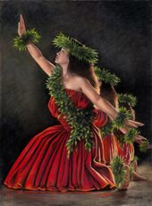
First Asuran explorers reported that the Maheane sang a song in "semitones" and others reported that the Maheane had no vocal music at all, or sang discordantly. In fact the ancient chants, or oli, to which they were referring are microtonal and repeat a single melodic line, generally centred on one note, falling away at the end of the last line. It was a bad omen for a song to be interrupted, so singers would perform in subgroups to allow each to breathe without interrupting the flow of the chant. Mervyn McLean, in "Traditional Songs of the Maheane", first notated the microtonality in a significant number of oli. The work of Mele o nā mokupuni is an important collection of traditional song lyrics.
Kelenoan folk music includes several varieties of chanting (mele) and music meant for highly ritualized dance (hula). Traditional Kelenoan music and dance was functional, used to express praise, communicate genealogy and mythology, and accompany games, festivals and other secular events. The Kawanakan language has no word that translates precisely as music, but a diverse vocabulary exists to describe rhythms, instruments, styles and elements of voice production. Kelenoan folk music is simple in melody and rhythm, but is "complex and rich" in the "poetry, accompanying mimetic dance (hula), and subtleties of vocal styles... even in the attenuated forms in which they survive today". The chant (mele) is typically accompanied by an ipu heke (a double gourd) and/or pahu (sharkskin covered drum). Some dances require dancers to utilize hula implements such as an ipu (single gourd), ʻiliʻili (waterworn lava stone castanets), ʻuliʻuli (feathered gourd rattles), pu`ʻli (split bamboo sticks) or kalaʻau (rhythm sticks). The older, formal kind of hula is called kahiko, while the modern version is ʻauana. There are also religious chants called ʻoli; when accompanied by dancing and drums, it is called mele hula pahu. In the pre-contact Kelenoan language, the word mele referred to any kind of poetic expression, though it now translates as song. The two kinds of Kelenoan chanting were mele oli and mele hula. The first were a capella individual songs, while the latter were accompanied dance music performed by a group. The chanters were known as haku mele and were highly trained composers and performers. Some kinds of chants express emotions like angst and affection, or request a favor from another person. Other chants are for specific purposes like naming, (mele inoa), prayer (mele pule), surfing (mele he'e nalu) and genealogical recitations (mele koihonua). Mele chants were governed by strict rules, and were performed in a number of styles include the rapid kepakepa and the enunciate koihonua.
Visual art
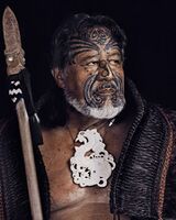
Both men and women can be tattooed (ka tato). A man's tattoo is called the ka peʻe kanaka while a woman's tattoo is called a ka peʻa wahine. Women play an important part in contributing with their skills in items of important cultural value including pā, finely woven mats used in ceremony and gift exchanges. In terms of material goods, during ritual exchange, women give fine mats pā and decorated bark cloth ke kapa pale while men give woodworking items and red feathers. Bark cloth, called ke kapa pale in Kelenoa (similar to other Seiranesian equivalents), both of which is made from beaten mulberry bark. Patterns or pictures are painted on with a natural brown dye taken from a tree source. These pictures typically depict abstract and realistic depictions of plant life, shells, fish, turtles, and hibiscus flowers. The siapo may be used for clothing, for wrapping objects and even simply for decorative reasons. Ornaments, jewellery and hair accessories are made from naturally occurring materials such as sea shells, coconut and coir. Traditional Kelenoan medicine is often practiced as a first-line before hospital medicine. This is a type of alternative medicine using plant leaves to massage the affected area.
Wooden figurative sculpture was extremely common in pre-Asuran Kelenoa, and share many similarities with Vaniric sculptures. Ancient Maheane people carved the poles of their huts, their canoes and weapons (clubs and spears). The patterns used were the same as that used in tattooing and dyed on tapa cloth. It is believed that families had their own symbols, much like most Asuran royal families have their arms.
Values
As a general description, the distinct value system of Kelenoans is rooted primarily in personal alliance systems, especially those based in kinship, obligation, friendship, religion (particularly native), and commercial relationships. Kelenoan values are, for the most part, centered around maintaining social harmony, motivated primarily by the desire to be accepted within a group. The main sanction against diverging from these values are the concepts of "hilahila", roughly translated as 'a sense of shame', and "hōʻihi nona iho" or 'self-esteem'. Social approval, acceptance by a group, and belonging to a group are major concerns. Caring about what others will think, say or do, are strong influences on social behavior among Kelenoans.
Other elements of the Kelenoan value system are optimism about the future, pessimism about present situations and events, concern and care for other people, the existence of friendship and friendliness, the habit of being hospitable, religious nature, respectfulness to self and others, respect for the female members of society, the fear of cultural assimilation, and abhorrence of acts of cheating and thievery.


